|
Baelo Claudia
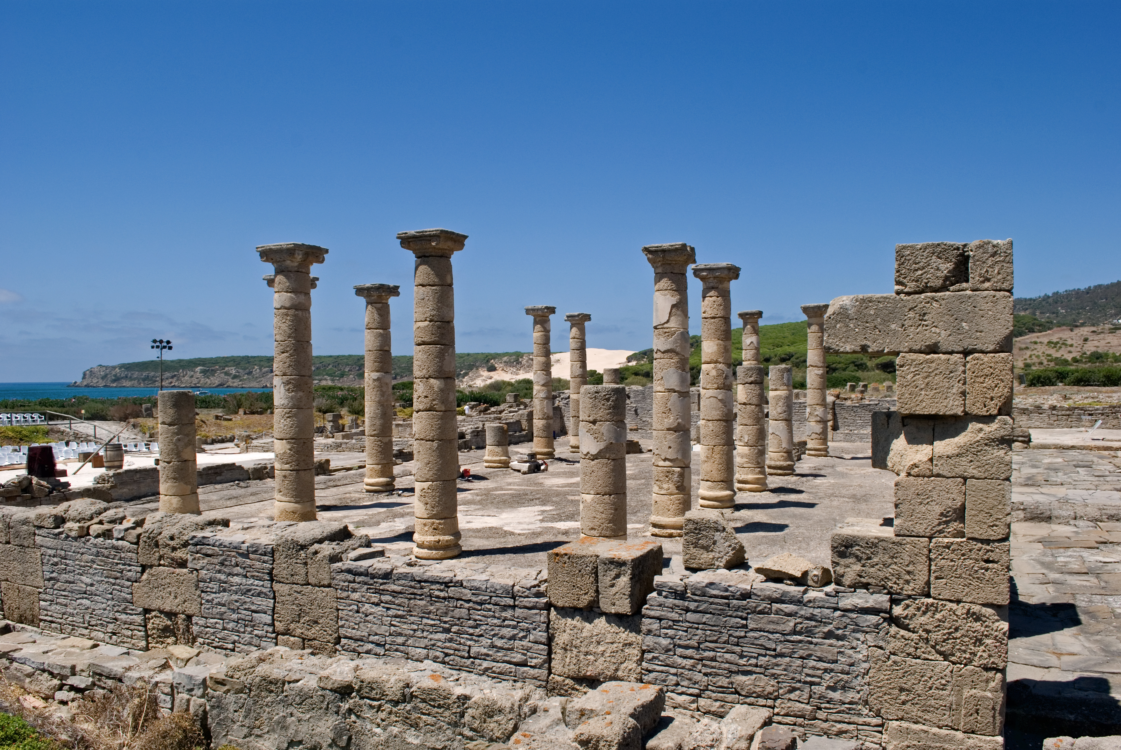
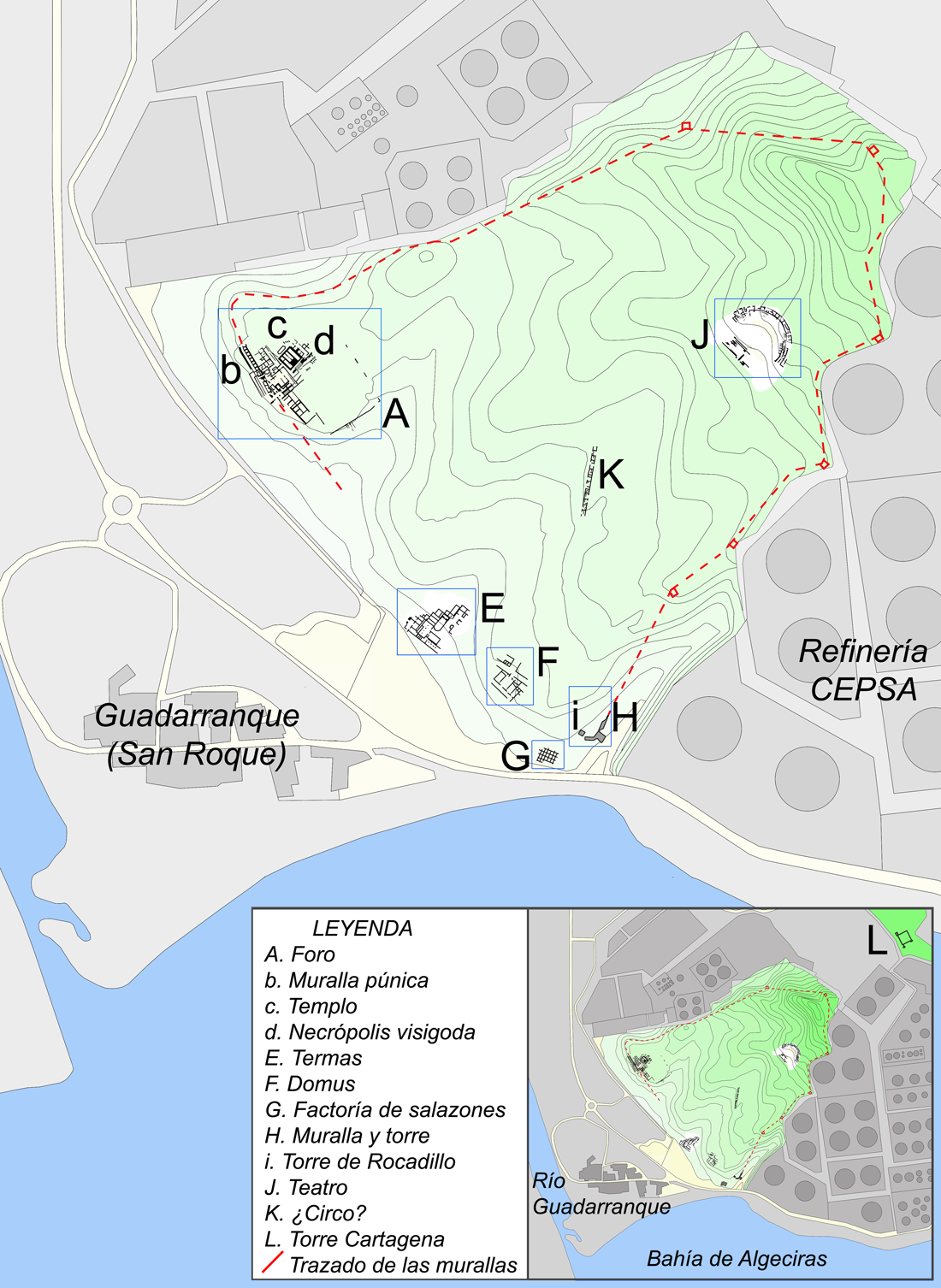
Baelo Claudia was an ancient Roman town of Hispania, located outside of Tarifa, near the village of Bolonia, in southern Spain. Lying on the shores of the Strait of Gibraltar, the town was originally a fishing village and trade link when it was settled some 2,000 years ago. Although prosperous at the time of Emperor Claudius, it went into a decline hastened by earthquakes and was abandoned by the 6th century. The study of its architectural remains shows its Roman origin at the end of the 2nd century BC, already observed since that time a great wealth that makes it an important economic center in the Mediterranean area. History Baelo Claudia is situated on the northern shore of the Strait of Gibraltar. The town was founded in the end of the 2nd century BC as a result of trade with North Africa (it was a major port for Tangier, in Mauretania Tingitana, for example). It is possible that Baelo Claudia had some functions of governmental administration, but tuna fishing, saltin ... [...More Info...] [...Related Items...] OR: [Wikipedia] [Google] [Baidu] |
Municipium
In ancient Rome, the Latin term (pl. ) referred to a town or city. Etymologically, the was a social contract among ("duty holders"), or citizens of the town. The duties () were a communal obligation assumed by the in exchange for the privileges and protections of citizenship. Every citizen was a . The distinction of was not made in the Roman Kingdom; instead, the immediate neighbours of the city were invited or compelled to transfer their populations to the urban structure of Rome, where they took up residence in neighbourhoods and became Romans ''per se''. Under the Roman Republic the practical considerations of incorporating communities into the city-state of Rome forced the Romans to devise the concept of , a distinct state under the jurisdiction of Rome. It was necessary to distinguish various types of and other settlements, such as the colony. In the early Roman Empire these distinctions began to disappear; for example, when Pliny the Elder served in the Roman army, ... [...More Info...] [...Related Items...] OR: [Wikipedia] [Google] [Baidu] |
San Roque, Cádiz
San Roque is a municipality of Spain belonging to the province of Cádiz, which in turn is part of the autonomous community of Andalusia. It is also part of the of Campo de Gibraltar. Located in the southern end of the Iberian Peninsula, San Roque is a short way inland of the north side of the Bay of Gibraltar, to the north of the Gibraltar peninsula. The municipality has a total surface of 145 km2 with a population of approximately 25,500 people, as of 2005. The foundation of San Roque as a city owes to the creation of a sort of Gibraltar-in-exile by refugees fleeing from the Rock in the wake of its seizure by Anglo-Dutch forces in 1704. In addition of the main nucleus of San Roque, the municipality also includes settlements such as Puente Mayorga, , Sotogrande or Guadiaro. Placename San Roque is Spanish for Saint Roch, a Christian saint who was revered in a shrine dating back to 1508 that predates the foundation of the town. Geography San Roque lies in the ''comarca' ... [...More Info...] [...Related Items...] OR: [Wikipedia] [Google] [Baidu] |
Carteia
Carteia ( grc, Καρτηίᾳ) was a Phoenician and Roman town at the head of the Bay of Gibraltar in Spain. It was established at the most northerly point of the bay, next to the town of San Roque, about halfway between the modern cities of Algeciras and Gibraltar, overlooking the sea on elevated ground at the confluence of two rivers, nowadays called Guadarranque and Cachon. According to Strabo, it was founded around 940 BC as the trading settlement of ''Kʿrt'' (meaning "city" in the Phoenician language; compare Carthage and Cartagena). The area had much to offer a trader; the hinterland behind Carteia, in the modern south of Andalusia, was rich in wood, cereals, oranges, lemons, lead, iron, copper and silver. Dyes were another much sought-after commodity, especially those from the murex shellfish, used to make the prized Tyrian purple. Strabo and Pomponius Mela, mention that some believe that Carteia used to be the Tartessos. Pliny the Elder writes that Carteia was called ... [...More Info...] [...Related Items...] OR: [Wikipedia] [Google] [Baidu] |
Cádiz
Cádiz (, , ) is a city and port in southwestern Spain. It is the capital of the Province of Cádiz, one of eight that make up the autonomous community of Andalusia. Cádiz, one of the oldest continuously inhabited cities in Western Europe, was founded by the Phoenicians.Strabo, '' Geographica'' 3.5.5 In the 18th century, the Port in the Bay of Cádiz consolidated as the main harbor of mainland Spain, enjoying the virtual monopoly of trade with the Americas until 1778. It is also the site of the University of Cádiz. Situated on a narrow slice of land surrounded by the sea‚ Cádiz is, in most respects, a typically Andalusian city with well-preserved historical landmarks. The older part of Cádiz, within the remnants of the city walls, is commonly referred to as the Old Town (Spanish: ''Casco Antiguo''). It is characterized by the antiquity of its various quarters (''barrios''), among them ''El Pópulo'', ''La Viña'', and ''Santa María'', which present a marked contr ... [...More Info...] [...Related Items...] OR: [Wikipedia] [Google] [Baidu] |
Tabernae
A ''taberna'' (plural ''tabernae'') was a type of shop or stall in Ancient Rome. Originally meaning a single-room shop for the sale of goods and services, ''tabernae'' were often incorporated into domestic dwellings on the ground level flanking the fauces, the main entrance to a home, but with one side open to the street. As the Roman Empire became more prosperous, tabernae were established within great indoor markets and were often covered by a barrel vault. Each taberna within a market had a window above it to let light into a wooden attic for storage and had a wide doorway. A famous example of such an indoor market is the Markets of Trajan in Rome, built in the early 1st century by Apollodorus of Damascus. According to the ''Cambridge Ancient History'', a taberna was a "retail unit" within the Roman Empire and was where many economic activities and many service industries were provided, including the sale of cooked food, wine, and bread. The plural form ''tabernae'' was also ... [...More Info...] [...Related Items...] OR: [Wikipedia] [Google] [Baidu] |
Forum (Roman)
A forum (Latin ''forum'' "public place outdoors", plural ''fora''; English plural either ''fora'' or ''forums'') was a public square in a Roman municipium, or any civitas, reserved primarily for the vending of goods; i.e., a marketplace, along with the buildings used for shops and the stoas used for open stalls. Many fora were constructed at remote locations along a road by the magistrate responsible for the road, in which case the forum was the only settlement at the site and had its own name, such as Forum Popili or Forum Livi. The functions of a forum In addition to its standard function as a marketplace, a forum was a gathering place of great social significance, and often the scene of diverse activities, including political discussions and debates, rendezvous, meetings, et cetera. In that case, it supplemented the function of a ''conciliabulum''. Every ''municipium'' had a forum. Fora were the first of any civitas synoecized whether Latin, Italic, Etruscan, Greek, C ... [...More Info...] [...Related Items...] OR: [Wikipedia] [Google] [Baidu] |
Cardo Maximus
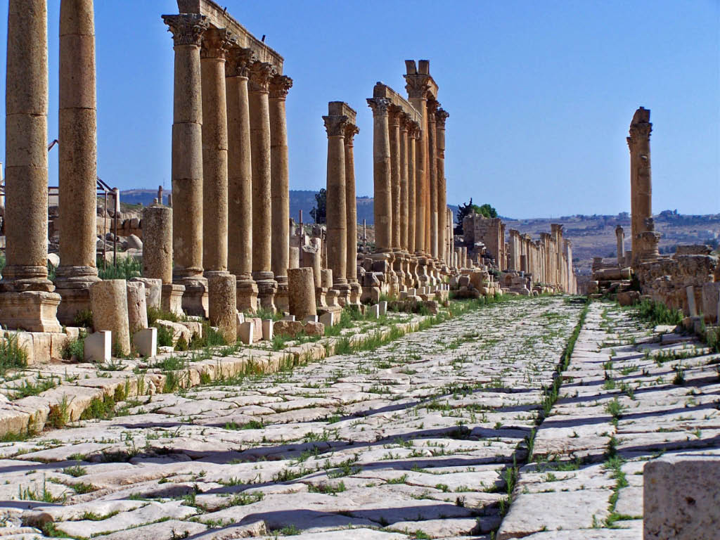
A cardo (plural ''cardines'') was a north–south street in Ancient Roman cities and military castra, camps as an integral component of city planning. The cardo maximus, or most often the ''cardo'', was the main or central north–south-oriented street. Etymology The ''cardo maximus'' was the "hinge" or axis of the city, derived from Greek καρδίᾱ, kardia ("heart") and as such was generally lined with shops and vendors, and served as a hub of economic life. Most Roman cities also had a Decumanus Maximus, an east–west street that served as a secondary main street. Due to varying geography, in some cities the Decumanus is the main street and the Cardo is secondary, but in general the Cardo maximus served as the primary street. The Forum (Roman), Forum was normally located at, or close to, the intersection of the Decumanus and the Cardo. Examples Apamea, Syria The Cardo Maximus of Apamea (Syria), Apamea, Syria ran through the centre of the city directly from North to S ... [...More Info...] [...Related Items...] OR: [Wikipedia] [Google] [Baidu] |
Decumanus Maximus
In Roman urban planning, a decumanus was an east–west-oriented road in a Roman city or castrum (military camp). The main decumanus of a particular city was the Decumanus Maximus, or most often simply "the Decumanus". In the rectangular street grid of the typical Roman city plan, the decumanus was crossed by the perpendicular cardo, a north–south street. In a military camp, the decumanus connected the Porta Praetoria (closest to the enemy) to the Porta Decumana (away from the enemy). In the center – called '' groma'' – of a city or castrum, the Decumanus Maximus crossed the perpendicular ''Cardo Maximus'', the primary north–south road. The Forum was normally located close to this intersection of the Decumanus Maximus and the Cardo Maximus. Etymology ''Decumanus'' or ''decimanus'' was the Latin word for 'tenth'. This name is said to come from the fact that the ''via decumana'' or ''decimana'' (the ''tenth'') separated the Tenth Cohort from the Ninth in the legionary enc ... [...More Info...] [...Related Items...] OR: [Wikipedia] [Google] [Baidu] |
Jorge Bonsor
Jorge is a Spanish and Portuguese given name. It is derived from the Greek name Γεώργιος (''Georgios'') via Latin ''Georgius''; the former is derived from (''georgos''), meaning "farmer" or "earth-worker". The Latin form ''Georgius'' had been rarely given in Western Christendom since at least the 6th century. The popularity of the name however develops from around the 12th century, in Occitan in the form ''Jordi'', and it becomes popular at European courts after the publication of the ''Golden Legend'' in the 1260s. The West Iberian form ''Jorge'' is on record as the name of Jorge de Lencastre, Duke of Coimbra (1481–1550). List of people with the given name Jorge * Jorge (footballer, born 1946), Brazilian footballer * Jorge (Brazilian singer), Brazilian musician and singer, Jorge & Mateus * Jorge (Romanian singer), real name George Papagheorghe, Romanian singer, actor, TV host * Jorge Betancourt, Cuban diver * Jorge Campos, Mexican football player * Jorge Cantú, b ... [...More Info...] [...Related Items...] OR: [Wikipedia] [Google] [Baidu] |
European Economic Area
The European Economic Area (EEA) was established via the ''Agreement on the European Economic Area'', an international agreement which enables the extension of the European Union's single market to member states of the European Free Trade Association. The EEA links the EU member states and three EFTA states (Iceland, Liechtenstein, and Norway) into an internal market governed by the same basic rules. These rules aim to enable free movement of persons, goods, services, and capital within the European single market, including the freedom to choose residence in any country within this area. The EEA was established on 1 January 1994 upon entry into force of the EEA Agreement. The contracting parties are the EU, its member states, and Iceland, Liechtenstein, and Norway. The EEA Treaty is a commercial treaty and differs from the EU Treaties in certain key respects. According to Article 1 its purpose is to "promote a continuous and balanced strengthening of trade and economic relati ... [...More Info...] [...Related Items...] OR: [Wikipedia] [Google] [Baidu] |
El Estrecho Natural Park
El Estrecho (The Strait) Natural Park (Spanish: ''Parque Natural del Estrecho'') is a natural park in Spain, located on the northern side of the Strait of Gibraltar. Comprising 189.1 square kilometres, it was declared a natural park in 2003. The park is located at the southernmost point of mainland Spain, and of mainland Europe, making it the southernmost park of Europe. The location at the point where the Atlantic Ocean and the Mediterranean Sea meet in the Strait of Gibraltar places it on the migratory route for many birds. Description Estrecho Natural Park is located on the southern tip of the Iberian peninsula and protects the area of the coast from the Bay of Getares (Algeciras) to Cape Grace (Tarifa). It was declared a nature reserve in the year 2003 and is a protected area of 18,910 hectares. It is the most southerly protected area of the European continent and unites ecological, scenic, historical and cultural themes. It is part of the Transcontinental Biosphere Reserve ... [...More Info...] [...Related Items...] OR: [Wikipedia] [Google] [Baidu] |


