|
Badogai Pass
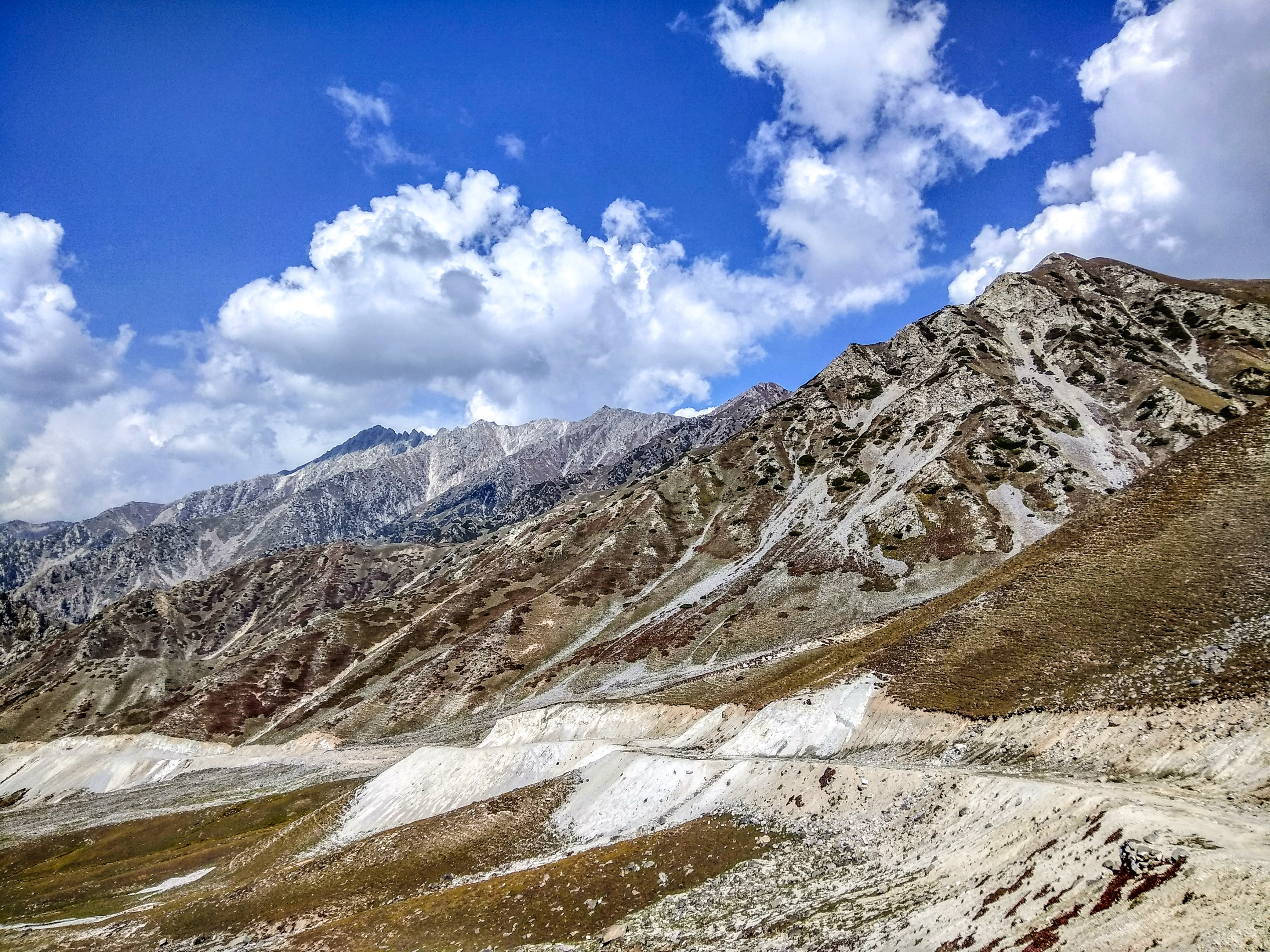
Badgoi Pass or Badawi Pass is a pass that connects Upper Dir District with Utror and Kalam in Khyber Pakhtunkhwa, Pakistan. The high mountain pass is elevated 3.523m above sea level. Badgoi Pass is the border of Kumrat Valley and Kalam Valley Kalam ( Kalami, Pashto, & ur, ) is a valley located from Mingora in the northern upper section of Swat valley along the banks of the Swat River in the Khyber Pakhtunkhwa province of Pakistan. The Swat River was formed as a result of the co .... This pass remains closed from November to the start of June due to snow. Mountain passes of Khyber Pakhtunkhwa Upper Dir District {{Asia-mountain-stub ... [...More Info...] [...Related Items...] OR: [Wikipedia] [Google] [Baidu] |
Mountain Pass
A mountain pass is a navigable route through a mountain range or over a ridge. Since many of the world's mountain ranges have presented formidable barriers to travel, passes have played a key role in trade, war, and both Human migration, human and animal migration throughout history. At lower elevations it may be called a hill pass. A mountain pass is typically formed between two volcanic peaks or created by erosion from water or wind. Overview Mountain passes make use of a gap (landform), gap, saddle (landform), saddle, col or notch (landform), notch. A topographic saddle is analogous to the mathematical concept of a saddle surface, with a saddle point marking the highest point between two valleys and the lowest point along a ridge. On a topographic map, passes are characterized by contour lines with an hourglass shape, which indicates a low spot between two higher points. In the high mountains, a difference of between the summit and the mountain is defined as a mountain pas ... [...More Info...] [...Related Items...] OR: [Wikipedia] [Google] [Baidu] |
Upper Dir District
Upper Dir District ( ps, بر دير ولسوالۍ, ur, ) is a district in Malakand Division of Khyber Pakhtunkhwa province in Pakistan. The city of Dir is the district headquarters. Badogai Pass connects it to Utror. At the time of independence, Dir was a princely state ruled by Nawab Shah Jehan Khan. It was merged with Pakistan in 1969 and later on declared as a district in 1970. In 1996, the Dir District was divided into Upper and Lower Dir districts. This district is situated in the northern part of Pakistan. It borders Chitral district and Afghanistan on the north and northwest and Swat district to the east, and on the south by Lower Dir District.People of Dir are very hospitable. Dir is also called The Land of Hospitality and Brave People. History The British Raj honored Muhammad sharif Khan as Nawab of Dir in 1898 . By declaring his allegiance to the British Raj, Khan/Nawab, once exiled to Afghanistan by Umara Khan Mastkhel was seated as Nawab of Dir. He was succeed ... [...More Info...] [...Related Items...] OR: [Wikipedia] [Google] [Baidu] |
Utror
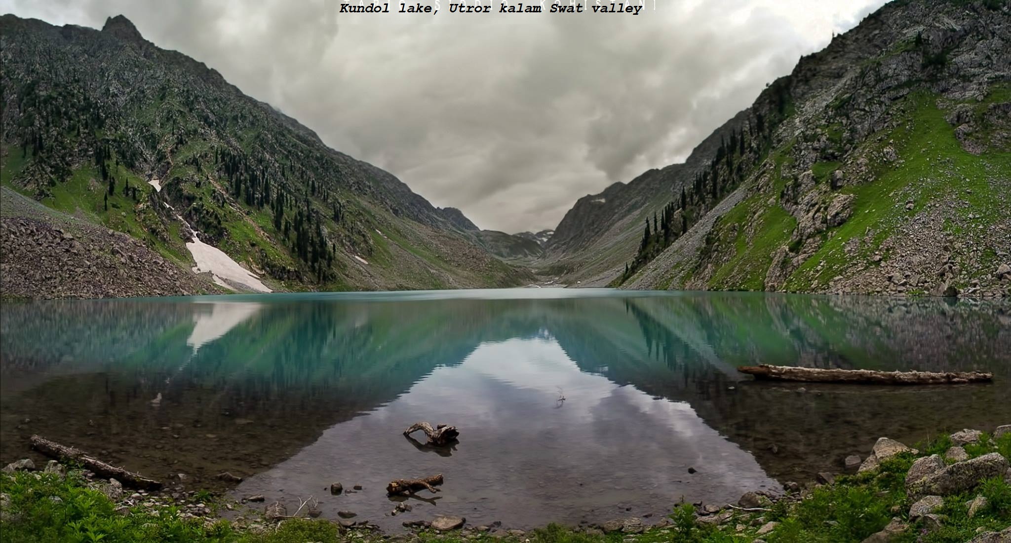
Utror, also spelt Atror, is a valley located in the Swat District of Khyber Pakhtunkhwa, Pakistan. It is surrounded by snow clad mountains, green pastures and waterfalls. The area of the valley is about . Utror is away from Kalam Valley and from Saidu Sharif. Utror is surrounded by Bhan valley on the east, Upper Dir District on the west, Kalam on the south and Gabral on the north. The altitude of the valley at Utror proper is and reaches to 2900 at Kundol Lake.Aesthetic sense of Swat, A case study of valley utror, 20000. Badogai Pass connects it to Upper Dir District. See also *Usho *Matiltan *Gabral *Mahodand Mahodand Lake ( ur, ; ps, د ماهو ډنډ - "Lake of Fishes") is a lake located in the upper Usho, Usho Valley at a distance of about from Kalam, Swat, Kalam in Swat District of Khyber Pakhtunkhwa province of Pakistan. The lake is accessible ... References {{coord, 35, 29, 30, N, 72, 28, 10, E, type:city_region:PK, display=title Tourist attractions in Sw ... [...More Info...] [...Related Items...] OR: [Wikipedia] [Google] [Baidu] |
Khyber Pakhtunkhwa
Khyber Pakhtunkhwa (; ps, خېبر پښتونخوا; Urdu, Hindko: خیبر پختونخوا) commonly abbreviated as KP or KPK, is one of the Administrative units of Pakistan, four provinces of Pakistan. Located in the Geography of Pakistan, northwestern region of the country, Khyber Pakhtunkhwa is the smallest province of Pakistan by land area and the Demographics of Pakistan, third-largest province by population after Punjab, Pakistan, Punjab and Sindh. It shares land borders with the Pakistani provinces of Balochistan, Pakistan, Balochistan to the south, Punjab, Pakistan, Punjab to the south-east and province of Gilgit-Baltistan to the north and north-east, as well as Islamabad Capital Territory to the east, Azad Jammu and Kashmir, Autonomous Territory of Azad Jammu and Kashmir to the north-east. It shares an Durand Line, international border with Afghanistan to the west. Khyber Pakhtunkhwa is known as a tourist hot spot for adventurers and explorers and has a varied landsca ... [...More Info...] [...Related Items...] OR: [Wikipedia] [Google] [Baidu] |
Kumrat Valley
Kumrat ( ur, ) is a valley in the Upper Dir District of Khyber Pakhtunkhwa province of Pakistan. Kumrat Valley is located about 45 minutes away from the town of Thal on the banks of the Panjkora River, and is among the most popular tourist spots in Khyber Pakhtunkhwa. Every summer season, around a million tourists from different areas of the country visit Kumrat Valley for its greenery and cool weather. Around Eid al-Fitr holidays, around 2,000 vehicles enter the region on a daily basis. It can only be accessed using 4x4 vehicles, as the road leading to it is unmetalled. Features Kumrat is covered with green pastures, snow clad mountains, the river Panjkora, foggy mounds and forests are attractions of the region, which serve as habitats for variety of flora and fauna. It is located in the Upper Dir Kohistan region at the back side of which Swat Kohistan area of Gabral is located. Another feature of Kumrat Valley is its towering Deodar forest trees located on level ground adj ... [...More Info...] [...Related Items...] OR: [Wikipedia] [Google] [Baidu] |
Kalam Valley
Kalam ( Kalami, Pashto, & ur, ) is a valley located from Mingora in the northern upper section of Swat valley along the banks of the Swat River in the Khyber Pakhtunkhwa province of Pakistan. The Swat River was formed as a result of the confluence of two major tributaries, the Gabral and Ushu river. At an elevation of about above sea level, the valley itself provides room for a plateau that is located above the river and used for farming. There are mountains that are also visible from Matiltan, a valley close to Kalam Valley, including Mount Falaksar , and another unnamed peak high.Archived aGhostarchiveand thWayback Machine Climate With a mild and generally warm and temperate climate, Kalam features a humid subtropical climate (''Cfa'') under the Köppen climate classification. The average temperature in Kalam is , while the annual precipitation averages . November is the driest month with of precipitation, while April, the wettest month, has an average precipitation ... [...More Info...] [...Related Items...] OR: [Wikipedia] [Google] [Baidu] |
Badogai Pass
Badgoi Pass or Badawi Pass is a pass that connects Upper Dir District with Utror and Kalam in Khyber Pakhtunkhwa, Pakistan. The high mountain pass is elevated 3.523m above sea level. Badgoi Pass is the border of Kumrat Valley and Kalam Valley Kalam ( Kalami, Pashto, & ur, ) is a valley located from Mingora in the northern upper section of Swat valley along the banks of the Swat River in the Khyber Pakhtunkhwa province of Pakistan. The Swat River was formed as a result of the co .... This pass remains closed from November to the start of June due to snow. Mountain passes of Khyber Pakhtunkhwa Upper Dir District {{Asia-mountain-stub ... [...More Info...] [...Related Items...] OR: [Wikipedia] [Google] [Baidu] |
Mountain Passes Of Khyber Pakhtunkhwa
A mountain is an elevated portion of the Earth's crust, generally with steep sides that show significant exposed bedrock. Although definitions vary, a mountain may differ from a plateau in having a limited summit area, and is usually higher than a hill, typically rising at least 300 metres (1,000 feet) above the surrounding land. A few mountains are isolated summits, but most occur in mountain ranges. Mountains are formed through tectonic forces, erosion, or volcanism, which act on time scales of up to tens of millions of years. Once mountain building ceases, mountains are slowly leveled through the action of weathering, through slumping and other forms of mass wasting, as well as through erosion by rivers and glaciers. High elevations on mountains produce colder climates than at sea level at similar latitude. These colder climates strongly affect the ecosystems of mountains: different elevations have different plants and animals. Because of the less hospitable terrain and ... [...More Info...] [...Related Items...] OR: [Wikipedia] [Google] [Baidu] |


