|
Búrfell (Þjórsárdal)
Búrfell () is a basalt tuya located in Iceland. It is situated in the south of the country along the western boundary of the Þjórsárdalur valley. Name There are many different mountains in Iceland by the name of Búrfell, f. ex. Búrfell (Grímsnes), Búrfell (Þingvellir) and Búrfell (Mývatn). The Icelandic word ''búr'' means ''cage'' or ''pantry'' in English. Búrfellsvirkjun In 1918 the power company Fossafélagið Títan published plans that included a large hydroelectric plant on the mountain. However, due to lack of funding this came to nothing at the time. Today Búrfellsvirkjun, at the foot of the mountain as well as in the mountain itself, is one of the biggest hydroelectric power stations of Iceland. It started working in 1972 after being erected mainly to produce energy for the aluminium factory (Alcan) in Straumsvík in the vicinity of Reykjavík. It is producing at the moment 270 MW.seeE.B. Hreinsson: Climate change and its impact, p.3 (PDF) download: 23 ... [...More Info...] [...Related Items...] OR: [Wikipedia] [Google] [Baidu] |
Þjórsá
Þjórsá () is Iceland's longest river at 230 kilometers (about 143 miles). It is in the south of the island. Þjórsá is a glacier river and has its source on the glacier Hofsjökull. It flows out through narrow gorges in the highlands of Iceland. Further downstream, another river, the Tungnaá, flows into it (see also Háifoss), before it enters the lowlands. There it passes the valley of Þjórsárdalur (Thjorsardalur) where the historical farm of Stöng is located. In the lowlands it flows along the eastern border of the Great Þjórsá Lava. In the middle of the now rather wide river, there is a big island called ''Árnes'', where there used to be a '' Þing''. The administrative unit of Árnessýsla was named after it. The ''hringvegur'' (Road No.1) traverses the river via a bridge between Selfoss and Hella. Some kilometers to the southwest the river flows into the Atlantic Ocean. 'Á' signifies river while 'þjór' means bull and is cognate to Danish - tyr, Swedish ... [...More Info...] [...Related Items...] OR: [Wikipedia] [Google] [Baidu] |
Tuyas Of Iceland
A tuya is a flat-topped, steep-sided volcano formed when lava erupts through a thick glacier or ice sheet. They are rare worldwide, being confined to regions which were covered by glaciers and had active volcanism during the same period. As lava that erupts under a glacier cools very quickly and cannot travel far, it piles up into a steep-sided hill. If the eruption continues long enough, it either melts all the ice or emerges through the top of the ice and then creates normal-looking lava flows that make a flat cap on top of the hill. Discovering and dating the lava flows in a tuya has proven useful in reconstructing past glacial ice extents and thicknesses. Formation Tuyas are a type of subglacial volcano that consists of nearly horizontal beds of lava capping outward-dipping beds of fragmental volcanic rocks, and they often rise in isolation above a surrounding plateau. Tuyas are found in Iceland, British Columbia, the Santiam Pass region in Oregon, the Tyva Republic in east ... [...More Info...] [...Related Items...] OR: [Wikipedia] [Google] [Baidu] |
Volcanism Of Iceland
:''The volcano system in Iceland that started activity on August 17, 2014, and ended on February 27, 2015, is Bárðarbunga.'' :''The volcano in Iceland that erupted in May 2011 is Grímsvötn.'' Iceland experiences frequent volcanic activity, due to its location both on the Mid-Atlantic Ridge, a divergent tectonic plate boundary, and over a hot spot. Nearly thirty volcanoes are known to have erupted in the Holocene epoch; these include Eldgjá, source of the largest lava eruption in human history. Volcanic systems and volcanic zones of Iceland Holocene volcanism in Iceland is mostly to be found in the ''Neovolcanic Zone'', comprising the Reykjanes Volcanic Belt (RVB), the West Volcanic Zone (WVZ), the Mid-Iceland Belt (MIB), the East Volcanic Zone (EVZ) and the North Volcanic Zone (NVZ). Two lateral volcanic zones play a minor role: Öræfi Volcanic Belt (ÖVB) and Snæfellsnes Volcanic Belt (SVB). Outside of the main island are the Reykjanes Ridge (RR), as part of the Mid-At ... [...More Info...] [...Related Items...] OR: [Wikipedia] [Google] [Baidu] |
Geology Of Iceland
The geology of Iceland is unique and of particular interest to geologists. Iceland lies on the divergent boundary between the Eurasian plate and the North American plate. It also lies above a hotspot, the Iceland plume. The plume is believed to have caused the formation of Iceland itself, the island first appearing over the ocean surface about 16 to 18 million years ago. The result is an island characterized by repeated volcanism and geothermal phenomena such as geysers. The eruption of Laki in 1783 caused much devastation and loss of life, leading to a famine that killed about 25% of the island's population and resulted in a drop in global temperatures, as sulfur dioxide was spewed into the Northern Hemisphere. This caused crop failures in Europe and may have caused droughts in India. The eruption has been estimated to have killed over six million people globally. Between 1963 and 1967, the new island of Surtsey was created off the southwest coast by a volcanic eruption. Geol ... [...More Info...] [...Related Items...] OR: [Wikipedia] [Google] [Baidu] |
Þjóðveldisbærinn Stöng
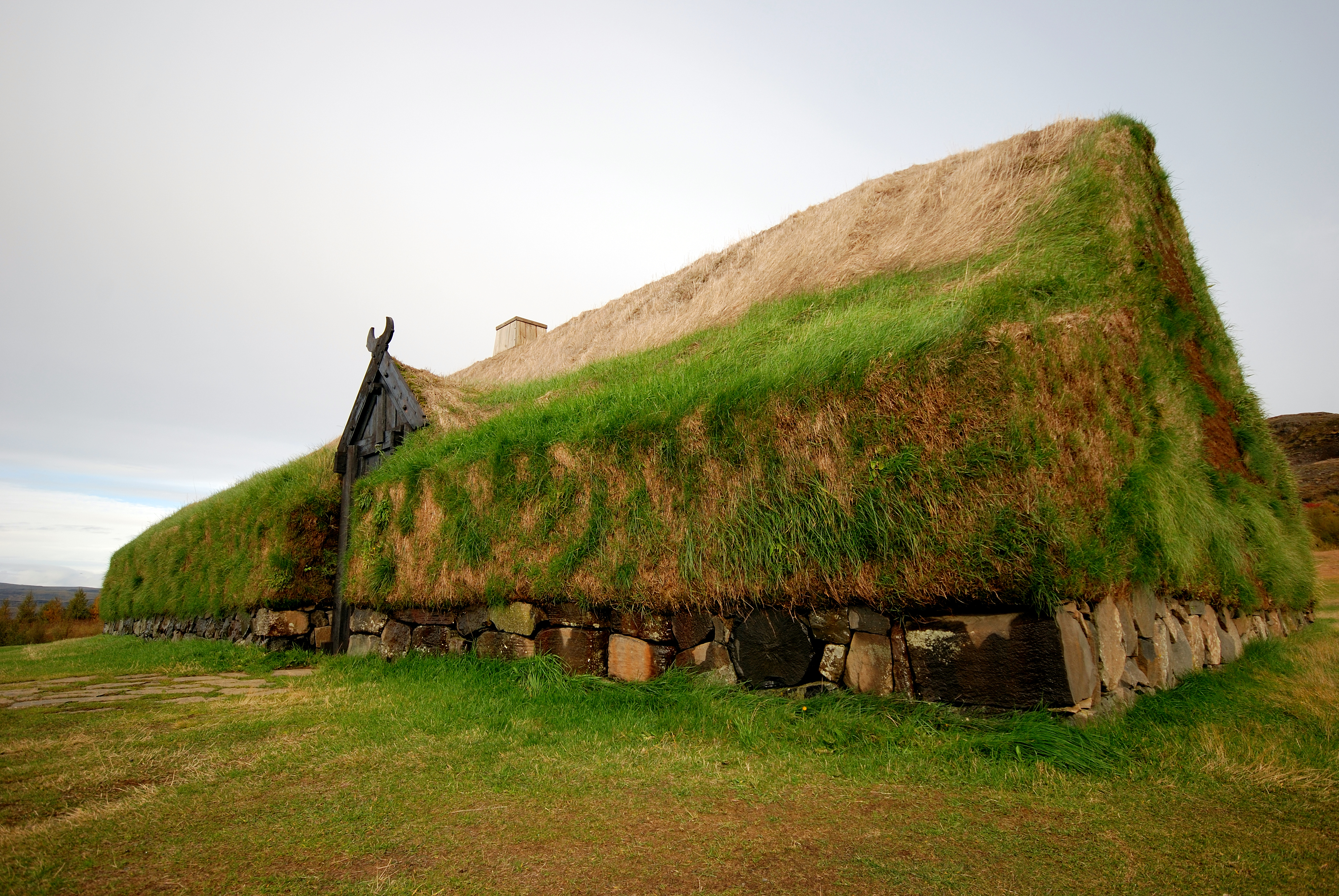
Þjóðveldisbærinn Stöng (, ''Stöng Commonwealth Farm'') is a reconstructed viking-era farmstead in Iceland, located in the Þjórsárdalur valley near road 32 in Árnessýsla county. It is a historically accurate reconstruction of the three buildings, including a longhouse, which stood 7 km to the north at Stöng; the farm is believed to have been buried under volcanic ash in 1104 following the eruption of the volcano Hekla Hekla (), or Hecla, is a stratovolcano in the south of Iceland with a height of . Hekla is one of Iceland's most active volcanoes; over 20 eruptions have occurred in and around the volcano since 874. During the Middle Ages, the Icelandic Norse .... The reconstruction was built in 1974 as a part of the national celebrations of the 1100th anniversary of the settlement of Iceland in 874. External links * Museums in Iceland Archaeological sites in Iceland Former populated places in Iceland History museums in Iceland {{Iceland-geo-stu ... [...More Info...] [...Related Items...] OR: [Wikipedia] [Google] [Baidu] |
Reykjavík
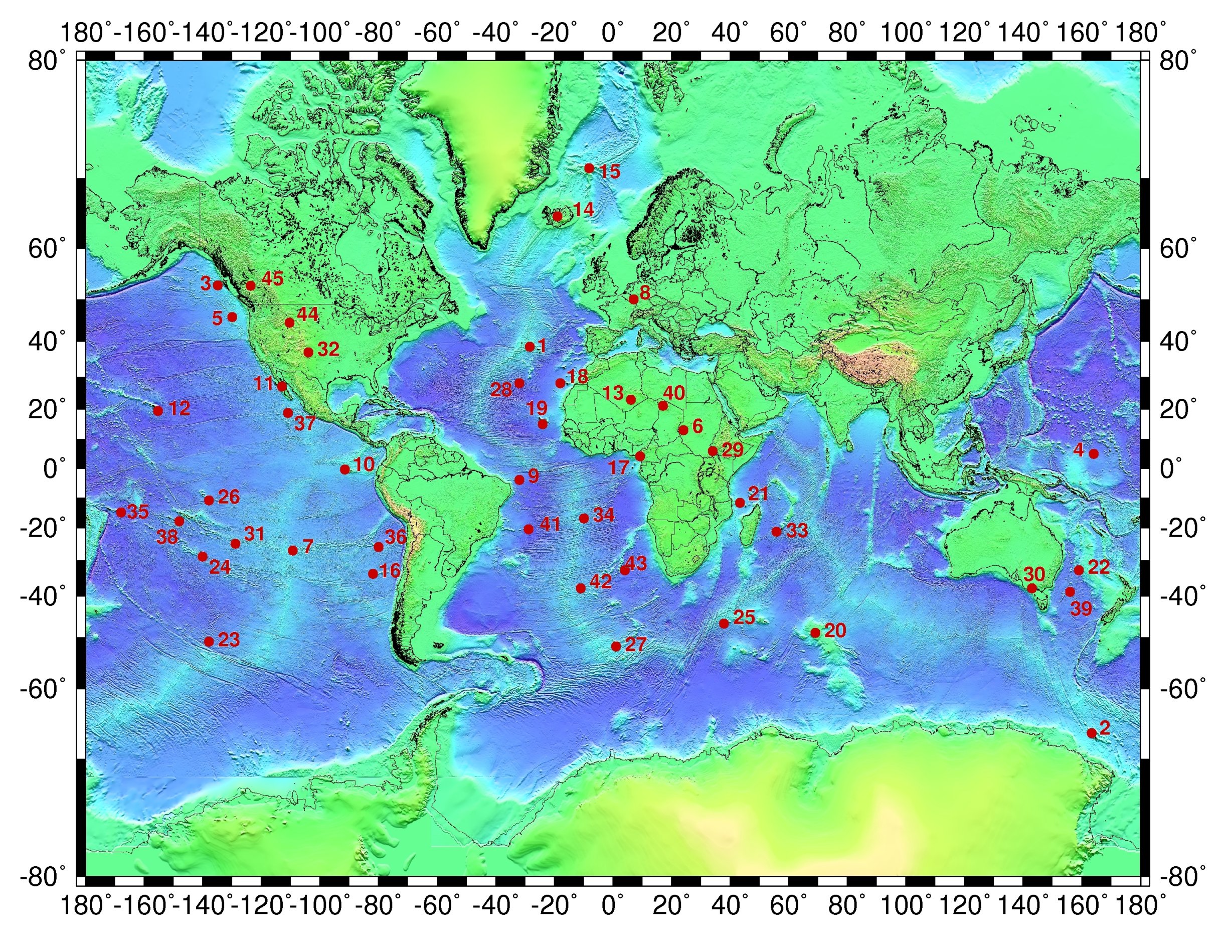
Reykjavík ( ; ) is the capital and largest city of Iceland. It is located in southwestern Iceland, on the southern shore of Faxaflói bay. Its latitude is 64°08' N, making it the world's northernmost capital of a sovereign state. With a population of around 131,136 (and 233,034 in the Capital Region), it is the centre of Iceland's cultural, economic, and governmental activity, and is a popular tourist destination. Reykjavík is believed to be the location of the first permanent settlement in Iceland, which, according to Landnámabók, was established by Ingólfr Arnarson in 874 CE. Until the 18th century, there was no urban development in the city location. The city was officially founded in 1786 as a trading town and grew steadily over the following decades, as it transformed into a regional and later national centre of commerce, population, and governmental activities. It is among the cleanest, greenest, and safest cities in the world. History According to lege ... [...More Info...] [...Related Items...] OR: [Wikipedia] [Google] [Baidu] |
Straumsvík
Straumsvík (, "stream cove") is a harbour on the northern shore of the Reykjanes Peninsula in Iceland Iceland ( is, Ísland; ) is a Nordic island country in the North Atlantic Ocean and in the Arctic Ocean. Iceland is the most sparsely populated country in Europe. Iceland's capital and largest city is Reykjavík, which (along with its s .... References Southern Peninsula (Iceland) Ports and harbours in Europe {{iceland-fjord-stub ... [...More Info...] [...Related Items...] OR: [Wikipedia] [Google] [Baidu] |
Alcan
Alcan was a Canadian mining company and aluminum manufacturer. It was founded in 1902 as the Northern Aluminum Company, renamed Aluminum Company of Canada in 1925, and Alcan Aluminum in 1966. It took the name Alcan Incorporated in 2001. During that time, it grew to become one of the world's largest aluminum manufacturers. Alcan was purchased by Australian-British multinational Rio Tinto for $38 billion in 2007, becoming Rio Tinto Alcan Inc. in 2008. It was headquartered in Montreal, in its Maison Alcan complex. History The Northern Aluminum Company Limited was founded in 1902, in Shawinigan, Quebec, as part of the Pittsburgh Reduction Company. In 1913, the company opened a kitchen utensil production plant and foundry in Toronto. It opened a rolling mill in the plant a few years later. During World War I (1914–18), aluminum production increased to 131,000 tonnes from 69,000. In 1925, the company was renamed the Aluminum Company of Canada. The Aluminum Company of Canada was ... [...More Info...] [...Related Items...] OR: [Wikipedia] [Google] [Baidu] |
Fossafélagið Títan
Fossafélagið Títan (Titan Waterfall Company) was an Icelandic company founded in 1914 to develop hydroelectric power plants. From 1914 to 1919 the company acquired shares of water rights and contracts with mine owners in Iceland. In 1927 the company received permission to build a power station at Urriðafoss but was unable to raise capital for construction. The company became dormant and was wound up in 1951. Origins Frímann B. Arngrímsson came to Iceland in 1894 with proposals to mobilize water power to illuminate streets and buildings, but did not obtain backing. He met the poet and entrepreneur Einar Benediktsson, who encouraged him. Einar became fascinated by the potential of hydroelectric power, and his poetry discusses the power of waterfalls. In 1906 he began to engage in power generation enterprises, joining the boards of two companies, Skjálfanda and Gigant. These were formed to build and operate hydroelectric power plants, particularly the northern waterfalls of ... [...More Info...] [...Related Items...] OR: [Wikipedia] [Google] [Baidu] |
Iceland
Iceland ( is, Ísland; ) is a Nordic island country in the North Atlantic Ocean and in the Arctic Ocean. Iceland is the most sparsely populated country in Europe. Iceland's capital and largest city is Reykjavík, which (along with its surrounding areas) is home to over 65% of the population. Iceland is the biggest part of the Mid-Atlantic Ridge that rises above sea level, and its central volcanic plateau is erupting almost constantly. The interior consists of a plateau characterised by sand and lava fields, mountains, and glaciers, and many glacial rivers flow to the sea through the lowlands. Iceland is warmed by the Gulf Stream and has a temperate climate, despite a high latitude just outside the Arctic Circle. Its high latitude and marine influence keep summers chilly, and most of its islands have a polar climate. According to the ancient manuscript , the settlement of Iceland began in 874 AD when the Norwegian chieftain Ingólfr Arnarson became the first p ... [...More Info...] [...Related Items...] OR: [Wikipedia] [Google] [Baidu] |


