|
Bruce's Cave
Bruce's Cave or the Dunskellie Grotto is a relatively small and mainly artificial cave created in the red sandstone cliffs about 9 metres above the Kirtle Water at Cove, Kirkpatrick-Fleming, Dumfries and Galloway, Scotland. It has been associated with Robert the Bruce and the famous incident with the spider struggling to build its web.Mercer (1997), Page 27 The cave and access Bruce's cave is located in a red sandstone cliff above the Kirtle Water on the south side of the water course. Access is via steps cut into the rock and a platform supported by timbers slotted into the cave via square holes cut into the rock. The pathway was built by the local council in 1927 as previously visitors were lowered on a rope over the overhang, from which they would swing into the cave, resulting in many accidents. Bruce's Cave Caravan Park charge a small fee for parking and access to the cave. Tool markings are distinct in a number of areas and the cave is roughly circular with an alcove or ... [...More Info...] [...Related Items...] OR: [Wikipedia] [Google] [Baidu] |
Kirtle Water
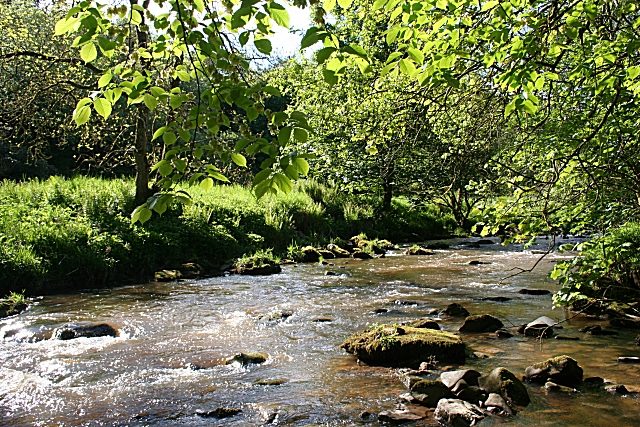
The Kirtle Water is a river in Dumfries and Galloway in southern Scotland. It rises on the southern slopes of Haggy Hill where its headwaters are impounded to form Winterhope Reservoir. Below the dam it flows in a generally southerly direction passing Waterbeck and Eaglesfield to the village of Kirtlebridge along which stretch it is closely followed both by the A74(M) motorway and the mainline railway between Carlisle and Glasgow. From Kirtlebridge it turns southeastwards to flow by Kirkpatrick-Fleming and on, to the west of Gretna, to empty into the estuary of the Border Esk at the eastern limit of the Solway Firth The Solway Firth ( gd, Tràchd Romhra) is a firth that forms part of the border between England and Scotland, between Cumbria (including the Solway Plain) and Dumfries and Galloway. It stretches from St Bees Head, just south of Whitehaven in ....Ordnance Survey 1:50,000 scale Landranger map sheet 85 Carlisle and Solway Firth References External links ... [...More Info...] [...Related Items...] OR: [Wikipedia] [Google] [Baidu] |
Loch Doon Castle
Loch Doon Castle was a castle that was located on an island within Loch Doon, Scotland. The original site and the relocated remains are designated as scheduled ancient monuments. History Loch Doon Castle was built in the late 13th century on an island within Loch Doon. The castle consists of an eleven-sided curtain wall. The castle was in the hands of the Earls of Carrick in the 12th century. During the Scottish Wars of Independence it was held by the governor Sir Gilbert de Carrick (Gille Brighde) who surrendered it to the English. It was soon recovered by the forces of King Robert I of Scotland. In 1206 the Corrie family were the hereditary keepers of Castle Loch Doon, and 57 years later, owing to the marriage of Sir Robert Corrie to Lady Susanna Carlisle, added greatly to their possessions in Dumfriesshire. The castle later fell to the English and was re-captured in 1214. The castle was besieged in 1335. During the 14th century the castle was in the hands of the Kennedy fami ... [...More Info...] [...Related Items...] OR: [Wikipedia] [Google] [Baidu] |
14th Century In Scotland
14 (fourteen) is a natural number following 13 and preceding 15. In relation to the word "four" ( 4), 14 is spelled "fourteen". In mathematics * 14 is a composite number. * 14 is a square pyramidal number. * 14 is a stella octangula number. * In hexadecimal, fourteen is represented as E * Fourteen is the lowest even ''n'' for which the equation φ(''x'') = ''n'' has no solution, making it the first even nontotient (see Euler's totient function). * Take a set of real numbers and apply the closure and complement operations to it in any possible sequence. At most 14 distinct sets can be generated in this way. ** This holds even if the reals are replaced by a more general topological space. See Kuratowski's closure-complement problem * 14 is a Catalan number. * Fourteen is a Companion Pell number. * According to the Shapiro inequality 14 is the least number ''n'' such that there exist ''x'', ''x'', ..., ''x'' such that :\sum_^ \frac < \frac where ''x'' = ''x'', ''x'' = ... [...More Info...] [...Related Items...] OR: [Wikipedia] [Google] [Baidu] |
Landforms Of Dumfries And Galloway
A landform is a natural or anthropogenic land feature on the solid surface of the Earth or other planetary body. Landforms together make up a given terrain, and their arrangement in the landscape is known as topography. Landforms include hills, mountains, canyons, and valleys, as well as shoreline features such as bays, peninsulas, and seas, including submerged features such as mid-ocean ridges, volcanoes, and the great ocean basins. Physical characteristics Landforms are categorized by characteristic physical attributes such as elevation, slope, orientation, stratification, rock exposure and soil type. Gross physical features or landforms include intuitive elements such as berms, mounds, hills, ridges, cliffs, valleys, rivers, peninsulas, volcanoes, and numerous other structural and size-scaled (e.g. ponds vs. lakes, hills vs. mountains) elements including various kinds of inland and oceanic waterbodies and sub-surface features. Mountains, hills, plateaux, and plains are the fou ... [...More Info...] [...Related Items...] OR: [Wikipedia] [Google] [Baidu] |
Protected Areas Of Dumfries And Galloway
Protection is any measure taken to guard a thing against damage caused by outside forces. Protection can be provided to physical objects, including organisms, to systems, and to intangible things like civil and political rights. Although the mechanisms for providing protection vary widely, the basic meaning of the term remains the same. This is illustrated by an explanation found in a manual on electrical wiring: Some kind of protection is a characteristic of all life, as living things have evolved at least some protective mechanisms to counter damaging environmental phenomena, such as ultraviolet light. Biological membranes such as bark on trees and skin on animals offer protection from various threats, with skin playing a key role in protecting organisms against pathogens and excessive water loss. Additional structures like scales and hair offer further protection from the elements and from predators, with some animals having features such as spines or camouflage servin ... [...More Info...] [...Related Items...] OR: [Wikipedia] [Google] [Baidu] |
Caves Of Scotland
A cave or cavern is a natural void in the ground, specifically a space large enough for a human to enter. Caves often form by the weathering of rock and often extend deep underground. The word ''cave'' can refer to smaller openings such as sea caves, rock shelters, and grottos, that extend a relatively short distance into the rock and they are called ''exogene'' caves. Caves which extend further underground than the opening is wide are called ''endogene'' caves. Speleology is the science of exploration and study of all aspects of caves and the cave environment. Visiting or exploring caves for recreation may be called ''caving'', ''potholing'', or ''spelunking''. Formation types The formation and development of caves is known as ''speleogenesis''; it can occur over the course of millions of years. Caves can range widely in size, and are formed by various geological processes. These may involve a combination of chemical processes, erosion by water, tectonic forces, microorgani ... [...More Info...] [...Related Items...] OR: [Wikipedia] [Google] [Baidu] |
Peden's Cave (Auchinbay)
Peden's Cave is at least partly artificial and is set into a craggy outcrop of red sandstone rocks overlooking the River Lugar just below the farm of Auchinbay in East Ayrshire, Scotland, close to the town of Ochiltree. Traditionally it is said that this cave was used as a hiding place for Covenanters, including the famous Covenanter minister Alexander Peden in the 17th century, mainly during the so-called 'Killing Times' of the 1680s. Cave and access Peden's Cave is located near the top of a much eroded red sandstone cliff, the cave floor being around above the River Lugar on the south-western side of this water course, just off the old road that ran from Stair past Auchinbay Farm and over the old Slatehole Ford, later replaced by the now ruined Slatehole Bridge and its associated lodge, running into the Auchinleck Estate. The cave is well camouflaged from directly above. The well known Wallace's Cave' is located at the junction of the River Lugar and the Dippol Burn, a short ... [...More Info...] [...Related Items...] OR: [Wikipedia] [Google] [Baidu] |
Cleeves Cove
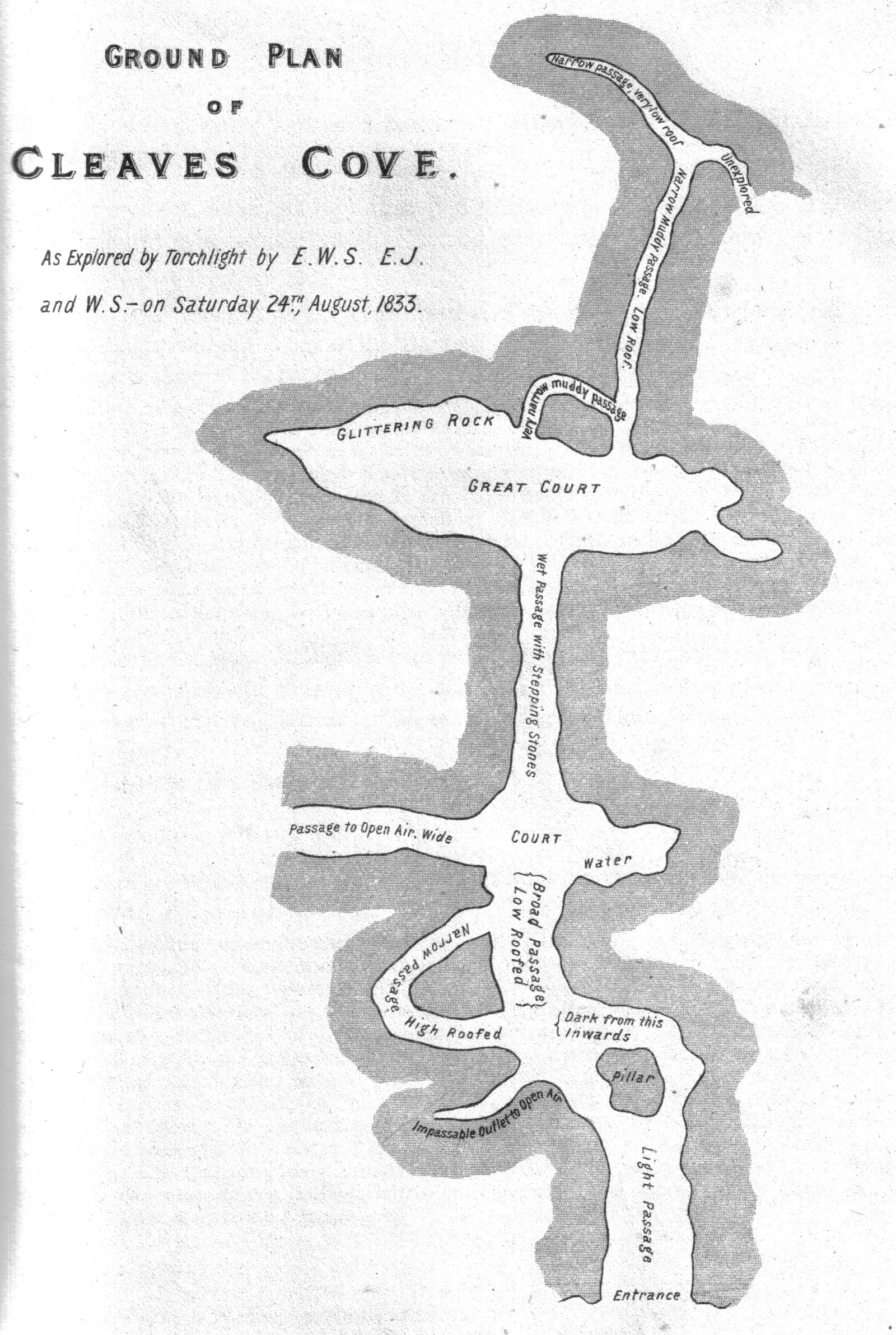
Cleeves Cove or Blair Cove is a solutional cave system on the Dusk Water in North Ayrshire, Scotland, close to the town of Dalry. Cave system The Cleeves, or Cleaves Cove (Scots) cave system is situated in the lower beds of Carboniferous limestone. It has a total passage length of around . The caves are now well above the level of the Dusk Water and lie close to Cleeves Farm and Blair Mill on the Blair Estate. Many of the stalactites and stalagmites have been damaged by visitors. The cave has three practical entrances facing onto the Dusk Water. A number of older books refer to ''the romantic sylvan dell of Auchenskeigh,'' now Auchenskeith, derived from ''Achadh-na-sgitheach'' - the field of thorns.Dobie, James D. (ed Dobie, J.S.) (1876). ''Cunninghame, Topographized by Timothy Pont'' 1604–1608, with continuations and illustrative notices. Pub. Glasgow : John Tweed. p. 49. The calcareous incrustations in these caves were compared with Gothic fretwork. A number of old limesto ... [...More Info...] [...Related Items...] OR: [Wikipedia] [Google] [Baidu] |
Knaresborough
Knaresborough ( ) is a market and spa town and civil parish in the Borough of Harrogate, in North Yorkshire, England, on the River Nidd. It is east of Harrogate. History Knaresborough is mentioned in the Domesday Book of 1086 as ''Chenaresburg'', meaning "Cenheard's fortress", in the wapentake of Burghshire, renamed Claro Wapentake in the 12th century. Knaresborough Castle is Norman; around 1100, the town began to grow. It provided a market and attracted traders to service the castle. The parish church, St John's, was established around this time. The earliest identified Lord of Knaresborough is around 1115 when Serlo de Burgh held the Honour of Knaresborough from the King. Hugh de Morville was granted the Honour of Knaresborough in 1158. He was constable of Knaresborough and leader of the group of four knights who murdered Archbishop Thomas Becket at Canterbury Cathedral on 29 December 1170. The four knights fled to Knaresborough and hid at the castle. Hugh de Morvil ... [...More Info...] [...Related Items...] OR: [Wikipedia] [Google] [Baidu] |
St Robert's Cave And Chapel Of The Holy Cross
The early 13th century St Robert's Cave and Chapel of the Holy Cross also known with variants such as St Robert's Chapel and Chapel of the Holy Rood are located on Abbey Road beside the River Nidd in its gorge at Knaresborough. The cave is a rare example of a medieval hermitage, cut out of the magnesian limestone river gorge with a domestic area externally and the chapel of the Holy Cross which originally housed the saint's grave. The trustees of the site are the monks of Ampleforth Abbey and in 1989 the Harrogate Museums Service carried out excavations after clearing the site. Robert of Knaresborough Robert of Knaresborough was born Robert Flower or Floure in York to a wealthy family. From childhood he was intent on pursuing a religious vocation and after a short time in a formal abbey setting he became a hermit and lived for much of his life in a cave beside the River Nidd in Knaresborough. Never officially canonized, in 1252 Robert was implicitly recognised as a saint b ... [...More Info...] [...Related Items...] OR: [Wikipedia] [Google] [Baidu] |
Lockerbie
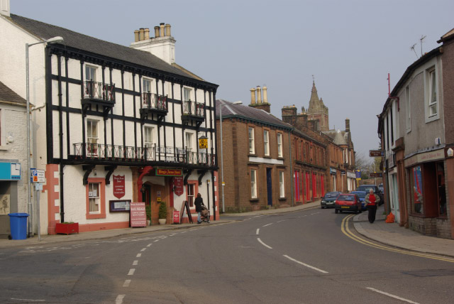
Lockerbie (, gd, Locarbaidh) is a small town in Dumfries and Galloway, south-western Scotland. It is about from Glasgow, and from the border with England. The United Kingdom Census 2001, 2001 Census recorded its population as 4,009. The town came to international attention in December 1988 when the wreckage of Pan Am Flight 103 crashed there following a terrorism, terrorist bomb attack aboard the flight. Prehistory and archaeology In 2006, ahead of the construction of a new primary and secondary school archaeologists from CFA Archaeology under took excavations. They discovered the remains of a large (27 x 8m) Neolithic British Isles, Neolithic timber hall that dated to somewhere between 3950 BC to 3700 BC. The archaeologists found it was in use for some time as some of the posts had been replaced. Flax seeds were found in the timber hall showing the people were processing flax. This is an extremely rare find with only one other site in Scotland showing evidence of flax produc ... [...More Info...] [...Related Items...] OR: [Wikipedia] [Google] [Baidu] |

.jpg)
.jpg)


