|
Black And Yellow Trail
The Black and Yellow Trail was the promotional name for the portion of U.S. Route 14 (US 14) nominally linking the Black Hills of South Dakota to Yellowstone National Park. The signed auto trail route was extended by promoters to Chicago in the east. In 1919, it was proposed as a brand for a continuous route from Boston, Massachusetts to Seattle, Washington The headquarters for the promotional association were established in Huron, South Dakota with the aim of diverting traffic from the better-known Yellowstone Trail to the north. The Black and Yellow Trail also included portions of US 16, US 20, and US 41. The Black and Yellow Trail is notable for a 1924 speech by South Dakota state historian Doane Robinson given to the route's organizers, where he first mentioned his proposal to carve figures of historical figures at Mount Rushmore. See also *Good Roads Movement *Lincoln Highway The Lincoln Highway is the first transcontinental highway in the United ... [...More Info...] [...Related Items...] OR: [Wikipedia] [Google] [Baidu] |
Black Hills
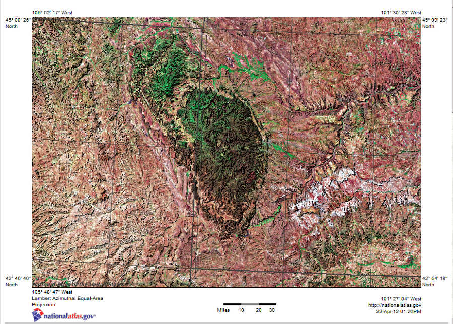
The Black Hills ( lkt, Ȟe Sápa; chy, Moʼȯhta-voʼhonáaeva; hid, awaxaawi shiibisha) is an isolated mountain range rising from the Great Plains of North America in western South Dakota and extending into Wyoming, United States. Black Elk Peak (formerly known as Harney Peak), which rises to , is the range's highest summit. The Black Hills encompass the Black Hills National Forest. The name of the hills in Lakota is ', meaning “the heart of everything that is." The Black Hills are considered a holy site. The hills are so called because of their dark appearance from a distance, as they are covered in evergreen trees. Native Americans have a long history in the Black Hills and consider it a sacred site. After conquering the Cheyenne in 1776, the Lakota took the territory of the Black Hills, which became central to their culture. In 1868, the U.S. government signed the Fort Laramie Treaty of 1868, establishing the Great Sioux Reservation west of the Missouri River, and exempt ... [...More Info...] [...Related Items...] OR: [Wikipedia] [Google] [Baidu] |
Huron, South Dakota
Huron is a city in Beadle County, South Dakota, United States. It is the county seat of Beadle County. The '' Huron Daily Plainsman'', also referred to as the ''Plainsman'', is the newspaper. The first settlement at Huron was made in 1880. The city was named after the Huron Indians. It is currently the eighth largest city in South Dakota, but it once was the fourth. In recent years, Huron's population has once again started to grow after nearly 20 years of stagnation. A welcoming immigration policy coupled with an economic revival in the area has sparked development. A Walmart Supercenter opened in the mid 2000s. Since Walmart's opening more commercial and residential development has occurred with the completion of a new Runnings store (retailer specializing in farm and fleet products), and many new apartments, twin homes and houses. The greater Huron area is home to approximately 30,000 people. The population within the city limits was 14,263 at the 2020 census. Huron was once ... [...More Info...] [...Related Items...] OR: [Wikipedia] [Google] [Baidu] |
Lincoln Highway
The Lincoln Highway is the first transcontinental highway in the United States and one of the first highways designed expressly for automobiles. Conceived in 1912 by Indiana entrepreneur Carl G. Fisher, and formally dedicated October 31, 1913, the Lincoln Highway runs coast-to-coast from Times Square in New York City west to Lincoln Park in San Francisco, originally through 13 states: New York, New Jersey, Pennsylvania, Ohio, Indiana, Illinois, Iowa, Nebraska, Colorado, Wyoming, Utah, Nevada, and California. In 1915, the "Colorado Loop" was removed, and in 1928, a realignment relocated the Lincoln Highway through the northern tip of West Virginia. Thus, there are a total of 14 states, 128 counties, and more than 700 cities, towns and villages through which the highway passed at some time in its history. The first officially recorded length of the entire Lincoln Highway in 1913 was . Over the years, the road was improved and numerous realignments were made, See throughout, bu ... [...More Info...] [...Related Items...] OR: [Wikipedia] [Google] [Baidu] |
Good Roads Movement
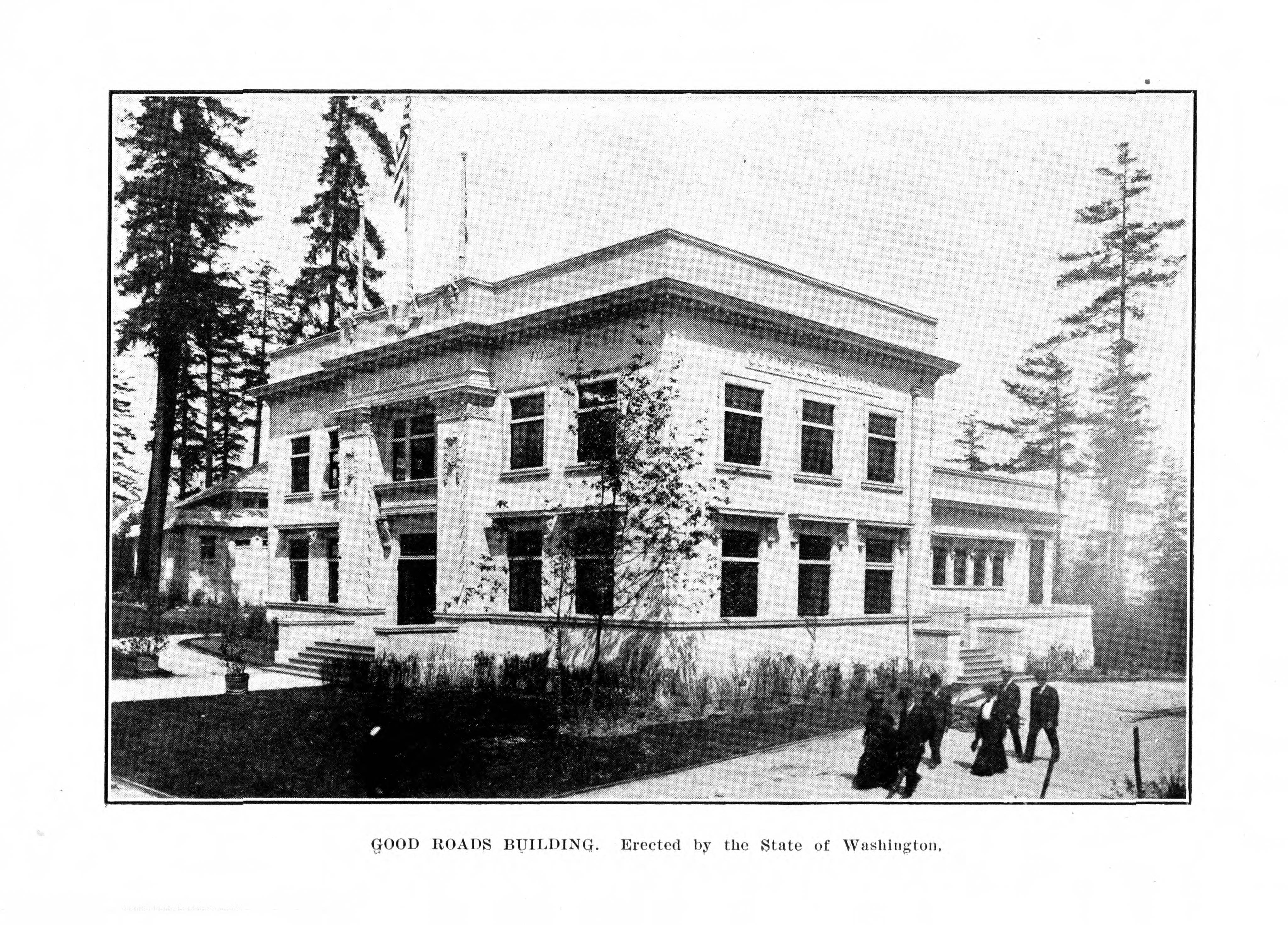
The Good Roads Movement occurred in the United States between the late 1870s and the 1920s. It was the rural dimension of the Progressive movement. A key player was the United States Post Office Department. Once a commitment was made for Rural Free Delivery of the mail, the Post Office had to determine which local roads were suitable and which were not. Farmers living on officially unusable roads now had motivation to get them upgraded. Advocates for improved roads turned local agitation into a national political movement. It started as a coalition between farmers' organizations groups and bicyclists' organizations, such as the League of American Wheelmen. The goal was state and federal spending to improve rural roads. By 1910, automobile lobbies such as the American Automobile Association joined the campaign, coordinated by the National Good Roads Association. Outside cities, roads were dirt or gravel; mud in the winter and dust in the summer. Travel was slow and expensive. Earl ... [...More Info...] [...Related Items...] OR: [Wikipedia] [Google] [Baidu] |
Mount Rushmore
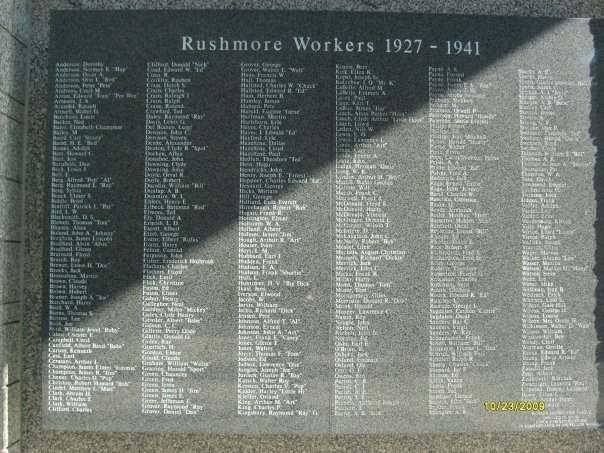
Mount Rushmore National Memorial is a national memorial centered on a colossal sculpture carved into the granite face of Mount Rushmore (Lakota: ''Tȟuŋkášila Šákpe'', or Six Grandfathers) in the Black Hills near Keystone, South Dakota, United States. Sculptor Gutzon Borglum created the sculpture's design and oversaw the project's execution from 1927 to 1941 with the help of his son, Lincoln Borglum. The sculpture features the heads of four United States Presidents recommended by Borglum: George Washington (1732–1799), Thomas Jefferson (1743–1826), Theodore Roosevelt (1858–1919) and Abraham Lincoln (1809–1865). The four presidents were chosen to represent the nation's birth, growth, development and preservation, respectively. The memorial park covers and the mountain itself has an elevation of above sea level. ... [...More Info...] [...Related Items...] OR: [Wikipedia] [Google] [Baidu] |
Doane Robinson
Jonah LeRoy "Doane" Robinson (October 19, 1856 – November 27, 1946Hoover, Herbert T., & Larry J. Zimmerman (eds.). 1989. ''South Dakota Leaders: From Pierre Chouteau, Jr., to Oscar Howe''. Vermillion: University of South Dakota Press, p. 439.) was an American historian who was the state historian of South Dakota. He is known for conceiving of the idea for the Mount Rushmore National Memorial in the Black Hills, which he believed would stimulate tourism to the area. Doane Robinson had introduced a bill to the South Dakota State legislature asking for permission and funds to scout a location for a massive carvings project; the sculpture was to include the Sioux Nation chief as well as local famous South Dakotans. While denied funding, he was granted permission to look for an area. He had initially suggested a well known area of the Black Hills, Needles, named after large distinct eroded granite pillars. Early on, Robinson originally wrote Lorado Taft about the project idea ... [...More Info...] [...Related Items...] OR: [Wikipedia] [Google] [Baidu] |
Black And Yellow Trail Marker
Black is a color which results from the absence or complete absorption of visible light. It is an achromatic color, without hue, like white and grey. It is often used symbolically or figuratively to represent darkness. Black and white have often been used to describe opposites such as good and evil, the Dark Ages versus Age of Enlightenment, and night versus day. Since the Middle Ages, black has been the symbolic color of solemnity and authority, and for this reason it is still commonly worn by judges and magistrates. Black was one of the first colors used by artists in Neolithic cave paintings. It was used in ancient Egypt and Greece as the color of the underworld. In the Roman Empire, it became the color of mourning, and over the centuries it was frequently associated with death, evil, witches, and magic. In the 14th century, it was worn by royalty, clergy, judges, and government officials in much of Europe. It became the color worn by English romantic poets, businessmen an ... [...More Info...] [...Related Items...] OR: [Wikipedia] [Google] [Baidu] |
Yellowstone Trail
The Yellowstone Trail was the first transcontinental automobile highway through the upper tier of states in the United States, established on May 23, 1912. It was an Auto Trail that ran from the Atlantic Ocean in Plymouth, Massachusetts, through Montana to Yellowstone National Park in Wyoming, to the Pacific Ocean in Seattle, Washington. The road slogan was "A Good Road from Plymouth Rock to Puget Sound". History The Yellowstone Trail was conceived by Joseph William Parmley of Ipswich, South Dakota. In April 1912, the first step he and his local influential colleagues wanted was a good road from Ipswich over to Aberdeen, also in South Dakota. By May, the intent had expanded to get a transcontinental route built, including to the popular tourist destination to the west, Yellowstone National Park. The automobile was just becoming popular, but there were few good all weather roads, no useful long distance roads, and no government marked routes. The federal government had not buil ... [...More Info...] [...Related Items...] OR: [Wikipedia] [Google] [Baidu] |
Washington (state)
Washington (), officially the State of Washington, is a state in the Pacific Northwest region of the Western United States. Named for George Washington—the first U.S. president—the state was formed from the western part of the Washington Territory, which was ceded by the British Empire in 1846, by the Oregon Treaty in the settlement of the Oregon boundary dispute. The state is bordered on the west by the Pacific Ocean, Oregon to the south, Idaho to the east, and the Canadian province of British Columbia to the north. It was admitted to the Union as the 42nd state in 1889. Olympia is the state capital; the state's largest city is Seattle. Washington is often referred to as Washington state to distinguish it from the nation's capital, Washington, D.C. Washington is the 18th-largest state, with an area of , and the 13th-most populous state, with more than 7.7 million people. The majority of Washington's residents live in the Seattle metropolitan area, the center of trans ... [...More Info...] [...Related Items...] OR: [Wikipedia] [Google] [Baidu] |
South Dakota
South Dakota (; Sioux language, Sioux: , ) is a U.S. state in the West North Central states, North Central region of the United States. It is also part of the Great Plains. South Dakota is named after the Lakota people, Lakota and Dakota people, Dakota Sioux Native Americans in the United States, Native American tribes, who comprise a large portion of the population with nine Indian reservation, reservations currently in the state and have historically dominated the territory. South Dakota is the List of U.S. states and territories by area, seventeenth largest by area, but the List of U.S. states and territories by population, 5th least populous, and the List of U.S. states and territories by population density, 5th least densely populated of the List of U.S. states, 50 United States. As the southern part of the former Dakota Territory, South Dakota became a state on November 2, 1889, simultaneously with North Dakota. They are the 39th and 40th states admitted to the union; Pr ... [...More Info...] [...Related Items...] OR: [Wikipedia] [Google] [Baidu] |
Seattle
Seattle ( ) is a seaport city on the West Coast of the United States. It is the seat of King County, Washington. With a 2020 population of 737,015, it is the largest city in both the state of Washington and the Pacific Northwest region of North America. The Seattle metropolitan area's population is 4.02 million, making it the 15th-largest in the United States. Its growth rate of 21.1% between 2010 and 2020 makes it one of the nation's fastest-growing large cities. Seattle is situated on an isthmus between Puget Sound (an inlet of the Pacific Ocean) and Lake Washington. It is the northernmost major city in the United States, located about south of the Canadian border. A major gateway for trade with East Asia, Seattle is the fourth-largest port in North America in terms of container handling . The Seattle area was inhabited by Native Americans for at least 4,000 years before the first permanent European settlers. Arthur A. Denny and his group of travelers, subsequ ... [...More Info...] [...Related Items...] OR: [Wikipedia] [Google] [Baidu] |
Massachusetts
Massachusetts (Massachusett language, Massachusett: ''Muhsachuweesut [Massachusett writing systems, məhswatʃəwiːsət],'' English: , ), officially the Commonwealth of Massachusetts, is the most populous U.S. state, state in the New England region of the Northeastern United States. It borders on the Atlantic Ocean and Gulf of Maine to the east, Connecticut and Rhode Island to the south, New Hampshire and Vermont to the north, and New York (state), New York to the west. The state's capital and List of municipalities in Massachusetts, most populous city, as well as its cultural and financial center, is Boston. Massachusetts is also home to the urban area, urban core of Greater Boston, the largest metropolitan area in New England and a region profoundly influential upon American History of the United States, history, academia, and the Economy of the United States, research economy. Originally dependent on agriculture, fishing, and trade. Massachusetts was transformed into a manuf ... [...More Info...] [...Related Items...] OR: [Wikipedia] [Google] [Baidu] |


