|
Bay Of Bohai
Bohai Bay () is one of the three major bays of the Bohai Sea, the northwestern and innermost gulf of the Yellow Sea. It is bounded by the coastlines of eastern Hebei province (Tangshan and Cangzhou), Tianjin municipality and northern Shandong province (Binzhou and Dongying) south of the Daqing River estuary (which is an old mouth of Luan River in Laoting County) and north of the Yellow River estuary. It is the most southerly water in the northern hemisphere where sea ice can form. The Bohai Bay is the drainage destination of the Hai River and 15 other rivers. Due to these rivers' muddy runoff, the bay used to be a highly silty water body, but extensive damming of the various river systems has greatly diminished siltage. Nevertheless, the Bohai Bay in effect concentrates the runoff of the whole eastern North China Plain, and the Bay is an intensely polluted body of water. Reduced silt deposition and sea level rise are causing problems with sea encroachment in some coasta ... [...More Info...] [...Related Items...] OR: [Wikipedia] [Google] [Baidu] |
Sea Ice
Sea ice arises as seawater freezes. Because ice is less dense than water, it floats on the ocean's surface (as does fresh water ice, which has an even lower density). Sea ice covers about 7% of the Earth's surface and about 12% of the world's oceans. Much of the world's sea ice is enclosed within the polar ice packs in the Earth's polar regions: the Arctic ice pack of the Arctic Ocean and the Antarctic ice pack of the Southern Ocean. Polar packs undergo a significant yearly cycling in surface extent, a natural process upon which depends the Arctic ecology, including the ocean's ecosystems. Due to the action of winds, currents and temperature fluctuations, sea ice is very dynamic, leading to a wide variety of ice types and features. Sea ice may be contrasted with icebergs, which are chunks of ice shelves or glaciers that calve into the ocean. Depending on location, sea ice expanses may also incorporate icebergs. General features and dynamics Sea ice does not simply grow and ... [...More Info...] [...Related Items...] OR: [Wikipedia] [Google] [Baidu] |
Port Of Jingtang
A port is a maritime law, maritime facility comprising one or more Wharf, wharves or loading areas, where ships load and discharge Affreightment, cargo and passengers. Although usually situated on a sea coast or estuary, ports can also be found far inland, such as Port of Hamburg, Hamburg, Port of Manchester, Manchester and Duluth; these access the sea via rivers or canals. Because of their roles as port of entry, ports of entry for immigrants as well as soldiers in wartime, many port cities have experienced dramatic multi-ethnic and multicultural changes throughout their histories. Ports are extremely important to the global economy; 70% of global merchandise trade by value passes through a port. For this reason, ports are also often densely populated settlements that provide the labor for processing and handling goods and related services for the ports. Today by far the greatest growth in port development is in Asia, the continent with some of the World's busiest ... [...More Info...] [...Related Items...] OR: [Wikipedia] [Google] [Baidu] |
Caofeidian
Caofeidian () is a land reclamation-converted economic development zone in Bohai Bay located in the eponymous district of Tangshan, Hebei Province, China. China's new development zone to takes shape near Beijing (2009-01-28) It hosts a large coal and ore discharging port, which forms one of the prime ports of Northern China, namely (from South to North) - Jingtang port - Caofeidian - - |
Port Of Tangshan
The Port of Tangshan () is an artificial deep-water international seaport on the coast of Tangshan Municipality, Hebei, in Northern China. It is the 9th largest port in China and is composed of three separate port areas: Jingtang, Caofeidian and Fennan, administered separately but considered to be the same port for statistical purposes. The Port of Tangshan is one of the fastest-growing ports in the world and is counted among the ten largest ports of China. History Layout The port of Tangshan consists of three separate port areas: Jingtang (), Caofeidian and Fennan. These are administered separately and have different UNLocodes, but are often considered to be the same port for statistical purposes. The closest airport to the port is Tianjin Tianjin (; ; Mandarin: ), alternately romanized as Tientsin (), is a municipality and a coastal metropolis in Northern China on the shore of the Bohai Sea. It is one of the nine national central cities in Mainland China, with ... [...More Info...] [...Related Items...] OR: [Wikipedia] [Google] [Baidu] |
Port Of Tianjin
The Port of Tianjin (''Tianjin Gang'', ), formerly known as the Port of Tanggu, is the largest port in Northern China and the main maritime gateway to Beijing. The name "Tianjin Xingang" (), which strictly speaking refers only to the main seaport area, is sometimes used to refer to the whole port. The port is on the western shore of the Bohai Bay, centred on the estuary of the Haihe River, 170 km southeast of Beijing and 60 km east of Tianjin city. It is the largest man-made port in mainland China, and one of the largest in the world. It covers 121 square kilometers of land surface, with over 31.9 km of quay shoreline and 151 production berths at the end of 2010. Tianjin Port handled 500 million tonnes of cargo and 13 million TEU of containers in 2013, making it the world's fourth largest port by throughput tonnage and the ninth in container throughput. The port trades with more than 600 ports in 180 countries and territories around the world. It is served by over ... [...More Info...] [...Related Items...] OR: [Wikipedia] [Google] [Baidu] |
Overfishing
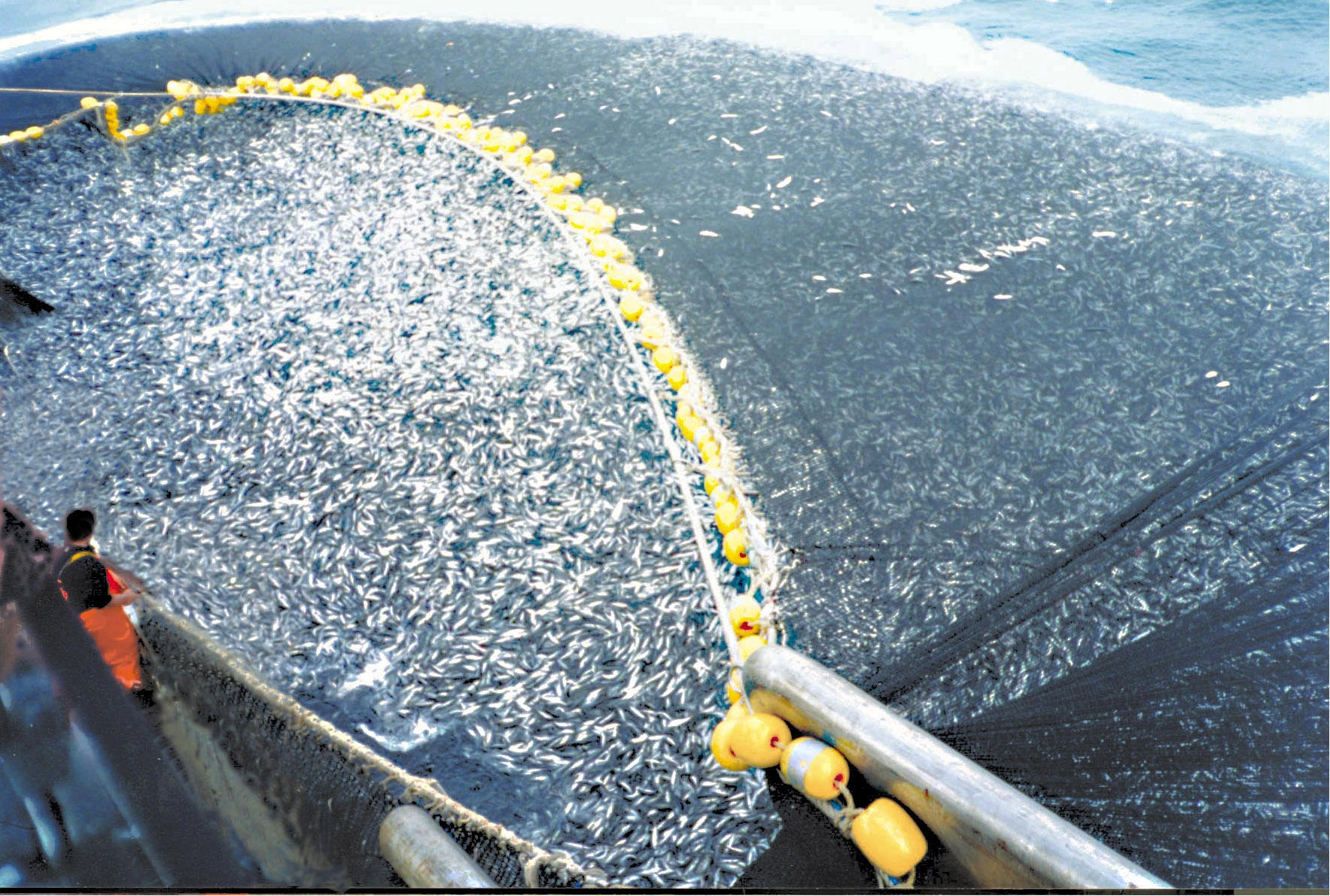
Overfishing is the removal of a species of fish (i.e. fishing) from a body of water at a rate greater than that the species can replenish its population naturally (i.e. the overexploitation of the fishery's existing fish stock), resulting in the species becoming increasingly underpopulated in that area. Overfishing can occur in water bodies of any sizes, such as ponds, wetlands, rivers, lakes or oceans, and can result in resource depletion, reduced biological growth rates and low biomass levels. Sustained overfishing can lead to critical depensation, where the fish population is no longer able to sustain itself. Some forms of overfishing, such as the overfishing of sharks, has led to the upset of entire marine ecosystems. Types of overfishing include: growth overfishing, recruitment overfishing, ecosystem overfishing. The ability of a fishery to recover from overfishing depends on whether its overall carrying capacity and the variety of ecological conditions are suitable for t ... [...More Info...] [...Related Items...] OR: [Wikipedia] [Google] [Baidu] |
Habitat Destruction
Habitat destruction (also termed habitat loss and habitat reduction) is the process by which a natural habitat becomes incapable of supporting its native species. The organisms that previously inhabited the site are displaced or dead, thereby reducing biodiversity and species abundance. Habitat destruction is the leading cause of biodiversity loss. Fragmentation and loss of habitat have become one of the most important topics of research in ecology as they are major threats to the survival of endangered species. Activities such as harvesting natural resources, industrial production and urbanization are human contributions to habitat destruction. Pressure from agriculture is the principal human cause. Some others include mining, logging, trawling, and urban sprawl. Habitat destruction is currently considered the primary cause of species extinction worldwide. Environmental factors can contribute to habitat destruction more indirectly. Geological processes, climate change, introdu ... [...More Info...] [...Related Items...] OR: [Wikipedia] [Google] [Baidu] |
Eutrophication
Eutrophication is the process by which an entire body of water, or parts of it, becomes progressively enriched with minerals and nutrients, particularly nitrogen and phosphorus. It has also been defined as "nutrient-induced increase in phytoplankton productivity". Water bodies with very low nutrient levels are termed oligotrophic and those with moderate nutrient levels are termed mesotrophic. Advanced eutrophication may also be referred to as dystrophic and hypertrophic conditions. Eutrophication can affect freshwater or salt water systems. In freshwater ecosystems it is almost always caused by excess phosphorus. In coastal waters on the other hand, the main contributing nutrient is more likely to be nitrogen, or nitrogen and phosphorus together. This depends on the location and other factors. When occurring naturally, eutrophication is a very slow process in which nutrients, especially phosphorus compounds and organic matter, accumulate in water bodies. These nutrients deriv ... [...More Info...] [...Related Items...] OR: [Wikipedia] [Google] [Baidu] |
Hatcheries
A hatchery is a facility where eggs are hatched under artificial conditions, especially those of fish, poultry or even turtles. It may be used for ex-situ conservation purposes, i.e. to breed rare or endangered species under controlled conditions; alternatively, it may be for economic reasons (i.e. to enhance food supplies or fishery resources). Fish hatcheries Fish hatcheries are used to cultivate and breed a large number of fish in an enclosed environment. Fish farms use hatcheries to cultivate fish to sell for food, or ornamental purposes, eliminating the need to find the fish in the wild and even providing some species outside their natural season. They raise the fish until they are ready to be eaten or sold to aquarium stores. Other hatcheries release the juvenile fish into a river, lake or the ocean to support commercial, tribal, or recreational fishing or to supplement the natural numbers of threatened or endangered species, a practice known as fish stocking. Resear ... [...More Info...] [...Related Items...] OR: [Wikipedia] [Google] [Baidu] |
Bohai Bay, China ESA213619
Bohai may refer to: *Bohai Sea, or Bo Hai, the innermost gulf of the Yellow Sea *Balhae, known as Bohai in Chinese, a former mixed Mohe-Goguryeo empire which existed from 698 to 926 in Manchuria Locations or areas in China *Bohai Bay, one of three bays surrounding Bohai Sea, immediately east of Tianjin *Bohai Strait, a water channel between Shandong Peninsula and Liaodong Peninsula *Bohai Commandery, a historical commandery in imperial China *Bohai Economic Rim, economic region around the Bohai Sea and the Yellow River Delta *Bohai Township ( zh; ), subdivision of Shanhaiguan District, Qinhuangdao, Hebei ;Subdistricts () *Bohai Subdistrict, Dunhua ( zh), in Dunhua City, Jilin *Bohai Subdistrict, Huludao ( zh), in Lianshan District, Huludao, Liaoning * Bohai Subdistrict, Panjin ( zh), in Xinglongtai District, Panjin, Liaoning ;Towns () *Bohai, Beijing ( zh), in Huairou District, Beijing * Bohai, Heilongjiang ( zh), in Ning'an, Heilongjiang * Bohai, Zhejiang ( zh), in Jingning She ... [...More Info...] [...Related Items...] OR: [Wikipedia] [Google] [Baidu] |
Sea Level Rise
Globally, sea levels are rising due to human-caused climate change. Between 1901 and 2018, the globally averaged sea level rose by , or 1–2 mm per year on average.IPCC, 2019Summary for Policymakers InIPCC Special Report on the Ocean and Cryosphere in a Changing Climate .-O. Pörtner, D.C. Roberts, V. Masson-Delmotte, P. Zhai, M. Tignor, E. Poloczanska, K. Mintenbeck, A. Alegría, M. Nicolai, A. Okem, J. Petzold, B. Rama, N.M. Weyer (eds.) Cambridge University Press, Cambridge, UK and New York, NY, USA. https://doi.org/10.1017/9781009157964.001. This rate is accelerating, with sea levels now rising by 3.7 mm per year. Climate scientists expect further acceleration during the 21st century. Climate change heats (and therefore expands) the ocean and melts land-based ice sheets and glaciers. Between 1993 and 2018, the thermal expansion of water contributed 42% to sea level rise; melting of temperate glaciers, 21%; Greenland, 15%; and Antarctica, 8%. Over the next 2 ... [...More Info...] [...Related Items...] OR: [Wikipedia] [Google] [Baidu] |


