|
Battle Of Canyon Creek
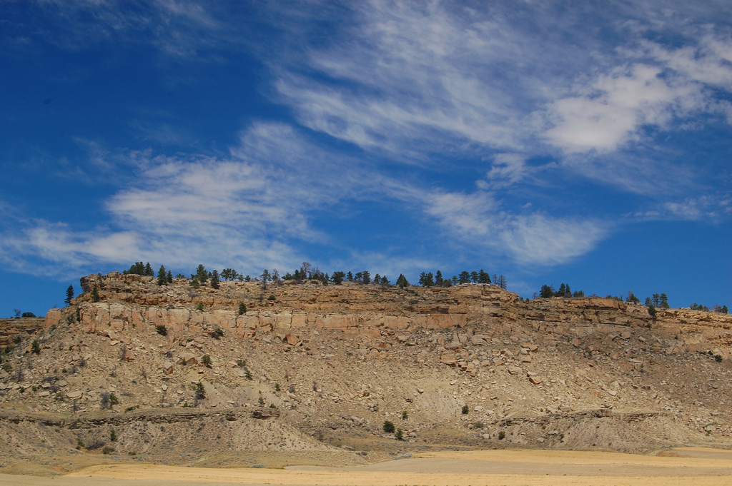
The Battle of Canyon Creek was a military engagement in Montana Territory between the Nez Perce Indians and the United States Army's 7th Cavalry. The battle was part of the larger Indian Wars of the latter 19th century and the immediate Nez Perce War. It took place on September 13, 1877, west of present-day Billings in Yellowstone County, in the canyons and benches around Canyon Creek. Background In June 1877, several bands of the Nez Perce, resisting relocation from their native lands on the Wallowa River in northeast Oregon to a reservation in north-central Idaho Territory on the Clearwater River, attempted to escape to the east through Idaho, Montana, and Wyoming territories, over the Rocky Mountains into the Great Plains. By September, the Nez Perce had traveled nearly and fought several battles in which they defeated or held off the U.S. Army forces pursuing them. The Nez Perce had the mistaken notion that after crossing the next mountain range or defeating the latest ... [...More Info...] [...Related Items...] OR: [Wikipedia] [Google] [Baidu] |
Nez Perce War
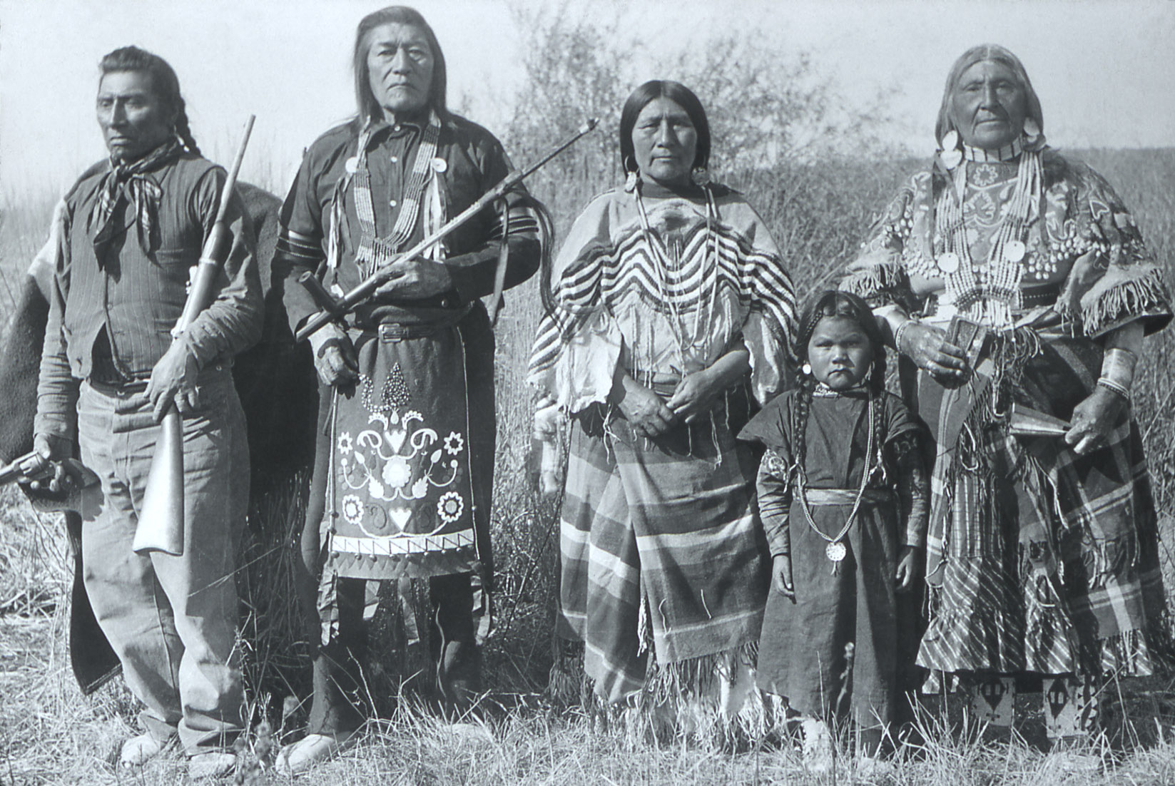
The Nez Perce War was an armed conflict in 1877 in the Western United States that pitted several bands of the Nez Perce tribe of Indigenous peoples of the Americas, Native Americans and their allies, a small band of the ''Palus people, Palouse'' tribe led by Red Echo (''Hahtalekin'') and Bald Head (''Husishusis Kute''), against the United States Army. Fought between June and October, the conflict stemmed from the refusal of several bands of the Nez Perce, dubbed "non-treaty Indians," to give up their ancestral lands in the Pacific Northwest and move to an Indian reservation in Idaho Territory. This forced removal was in violation of the 1855 Treaty of Walla Walla, which granted the tribe 7.5 million acres of their ancestral lands and the right to hunt and fish on lands ceded to the U.S. government. After the first armed engagements in June, the Nez Perce embarked on an arduous trek north initially to seek help with the Crow tribe. After the Crows' refusal of aid, they sought ... [...More Info...] [...Related Items...] OR: [Wikipedia] [Google] [Baidu] |
Wallowa River
The Wallowa River is a tributary of the Grande Ronde River, approximately long, in northeastern Oregon in the United States. It drains a valley on the Columbia Plateau in the northeast corner of the state north of Wallowa Mountains. The Wallowa Valley was home to Chief Joseph's band of the Nez Perce Tribe. Chief Joseph asked the first white settlers to leave when they arrived in 1871. The U.S. government expelled the tribe and seized their property and livestock in 1877, when non-Indian farmers and ranchers wanted to settle the fertile Wallowa valley. The tribe was barred from returning to their homeland by the government after repeated petitions. The tribal members were shipped in unheated box cars to Indian Territory (now Oklahoma) to be placed in a prisoner-of-war camp never to see their home again. Course The river begins at the confluence of its east and west forks, which rise in southern Wallowa County, in the Eagle Cap Wilderness of the Wallowa–Whitman National Fores ... [...More Info...] [...Related Items...] OR: [Wikipedia] [Google] [Baidu] |
Bannock People
The Bannock tribe were originally Northern Paiute but are more culturally affiliated with the Northern Shoshone. They are in the Great Basin classification of Indigenous People. Their traditional lands include northern Nevada, southeastern Oregon, southern Idaho, and western Wyoming. Today they are enrolled in the federally recognized Shoshone-Bannock Tribes of the Fort Hall Reservation of Idaho, located on the Fort Hall Indian Reservation. History The Northern Paiute have a history of trade with surrounding tribes. In the 1700s, the bands in eastern Oregon traded with the tribes to the north, who by 1730 had acquired the horse. In the mid-18th century, some bands developed a horse culture and split off to become the Bannock tribe. The horse gave the tribe a greater range, from Oregon to northern Nevada, southern Idaho, and western Wyoming. They forayed from there on the Bannock Trail to Montana and Canada to hunt buffalo. The Bannock have traditionally made pottery, utensi ... [...More Info...] [...Related Items...] OR: [Wikipedia] [Google] [Baidu] |
Oliver Otis Howard
Oliver Otis Howard (November 8, 1830 – October 26, 1909) was a career United States Army officer and a Union general in the Civil War. As a brigade commander in the Army of the Potomac, Howard lost his right arm while leading his men against Confederate forces at the Battle of Fair Oaks/Seven Pines in June 1862, an action which later earned him the Medal of Honor. As a corps commander, he suffered two major defeats at Chancellorsville and Gettysburg in May and July 1863, but recovered from the setbacks as a successful corps and later army commander in the Western Theater. Known as the "Christian General" because he tried to base his policy decisions on his deep, evangelical piety, he was given charge of the Freedmen's Bureau in mid-1865, with the mission of integrating the former slaves into Southern society and politics during the second phase of the Reconstruction Era. Howard took charge of labor policy, setting up a system that required freed people to work on former ... [...More Info...] [...Related Items...] OR: [Wikipedia] [Google] [Baidu] |
Yellowstone River
The Yellowstone River is a tributary of the Missouri River, approximately long, in the Western United States. Considered the principal tributary of upper Missouri, via its own tributaries it drains an area with headwaters across the mountains and Great Plains, high plains of southern Montana and northern Wyoming, and stretching east from the Rocky Mountains in the vicinity of Yellowstone National Park. It flows northeast to its confluence with the Missouri River on the North Dakota side of the border, about 25 miles west of present-day Williston, North Dakota, Williston. Yellowstone watershed The Yellowstone River watershed is a river basin spanning across Montana, with minor extensions into Wyoming and North Dakota, toward headwaters and terminus, respectively. The Yellowstone Basin watershed contains a system of rivers, including the Yellowstone River, and four tributary basins: the Clarks Fork Yellowstone, Wind River (Wyoming), Wind River and Bighorn River, Tongue River (Mon ... [...More Info...] [...Related Items...] OR: [Wikipedia] [Google] [Baidu] |
Clarks Fork Yellowstone River
The Clarks Fork of the Yellowstone River (sometimes called the Clark's Fork River) is a tributary of the Yellowstone River, 150 mi (241 km) long in the U.S. states of Montana and Wyoming. It rises in southern Montana, in the Gallatin National Forest in the Beartooth Mountains, approximately 4 mi (6 km) northeast of Cooke City and southwest of Granite Peak. It flows southeast into the Shoshone National Forest in northwest Wyoming, east of Yellowstone National Park, then northeast back into Montana. It passes Belfry, Bridger, Fromberg, and Edgar, and joins the Yellowstone approximately 2 mi (3 km) southeast of Laurel. The Clarks Fork of the Yellowstone River should not be confused with the Clark Fork River, which is located in Montana and Idaho. See also *Montana Stream Access Law *List of rivers of Montana *List of Wyoming rivers The following is a list of rivers in Wyoming, United States. East of the continental divide Missouri River ... [...More Info...] [...Related Items...] OR: [Wikipedia] [Google] [Baidu] |
Yellowstone National Park
Yellowstone National Park is an American national park located in the western United States, largely in the northwest corner of Wyoming and extending into Montana and Idaho. It was established by the 42nd U.S. Congress with the Yellowstone National Park Protection Act and signed into law by President Ulysses S. Grant on March 1, 1872. Yellowstone was the first national park in the U.S. and is also widely held to be the first national park in the world. The park is known for its wildlife and its many geothermal features, especially the Old Faithful geyser, one of its most popular. While it represents many types of biomes, the subalpine forest is the most abundant. It is part of the South Central Rockies forests ecoregion. While Native Americans have lived in the Yellowstone region for at least 11,000 years, aside from visits by mountain men during the early-to-mid-19th century, organized exploration did not begin until the late 1860s. Management and control of the park ... [...More Info...] [...Related Items...] OR: [Wikipedia] [Google] [Baidu] |
Nez Perce In Yellowstone Park
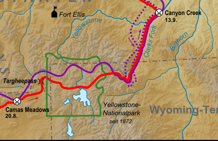
The Nez Perce native Americans fled through Yellowstone National Park between August 20 and Sept 7, during the Nez Perce War in 1877. As the U.S. army pursued the Nez Perce through the park, a number of hostile and sometimes deadly encounters between park visitors and the Indians occurred. Eventually, the army's pursuit forced the Nez Perce off the Yellowstone plateau and into forces arrayed to capture or destroy them when they emerged from the mountains of Yellowstone onto the valley of Clark's Fork of the Yellowstone River. Background In June 1877, several bands of the Nez Perce, numbering about 750 men, women, and children and resisting relocation from their native lands on the Wallowa River in northeast Oregon to a reservation in west-central Idaho on the Clearwater river, attempted to escape to the east through Idaho, Montana and Wyoming over the Rocky Mountains into the Great Plains. By late August, the Nez Perce had travelled hundreds of miles and fought several battles ... [...More Info...] [...Related Items...] OR: [Wikipedia] [Google] [Baidu] |
Great Plains
The Great Plains (french: Grandes Plaines), sometimes simply "the Plains", is a broad expanse of flatland in North America. It is located west of the Mississippi River and east of the Rocky Mountains, much of it covered in prairie, steppe, and grassland. It is the southern and main part of the Interior Plains, which also include the tallgrass prairie between the Great Lakes and Appalachian Plateau, and the Taiga Plains and Boreal Plains ecozones in Northern Canada. The term Western Plains is used to describe the ecoregion of the Great Plains, or alternatively the western portion of the Great Plains. The Great Plains lies across both Central United States and Western Canada, encompassing: * The entirety of the U.S. states of Kansas, Nebraska, North Dakota and South Dakota; * Parts of the U.S. states of Colorado, Iowa, Minnesota, Missouri, Montana, New Mexico, Oklahoma, Texas and Wyoming; * The southern portions of the Canadian provinces of Alberta, Saskatchewan and Manitoba. ... [...More Info...] [...Related Items...] OR: [Wikipedia] [Google] [Baidu] |
Rocky Mountains
The Rocky Mountains, also known as the Rockies, are a major mountain range and the largest mountain system in North America. The Rocky Mountains stretch in straight-line distance from the northernmost part of western Canada, to New Mexico in the southwestern United States. Depending on differing definitions between Canada and the U.S., its northern terminus is located either in northern British Columbia's Terminal Range south of the Liard River and east of the Trench, or in the northeastern foothills of the Brooks Range/ British Mountains that face the Beaufort Sea coasts between the Canning River and the Firth River across the Alaska-Yukon border. Its southernmost point is near the Albuquerque area adjacent to the Rio Grande rift and north of the Sandia–Manzano Mountain Range. Being the easternmost portion of the North American Cordillera, the Rockies are distinct from the tectonically younger Cascade Range and Sierra Nevada, which both lie farther to its west. The ... [...More Info...] [...Related Items...] OR: [Wikipedia] [Google] [Baidu] |
Wyoming Territory
The Territory of Wyoming was an organized incorporated territory of the United States that existed from July 25, 1868, until July 10, 1890, when it was admitted to the Union as the State of Wyoming. Cheyenne was the territorial capital. The boundaries of the Wyoming Territory were identical to those of the modern State of Wyoming. Background Because of Wyoming's location as part of the Louisiana Purchase, the Oregon Country, and the Mexican Cession, the land which became Wyoming has a complicated history of territorial relationships. Portions of the territory, which eventually fell under Wyoming's jurisdiction, were at various points associated with the territories of Washington, Oregon, Idaho, Dakota, Nebraska, and Utah, and had previously belonged to the independent states of Great Britain, France, Spain, Mexico, and Texas. The portion of the Wyoming Territory east of the continental divide was acquired by the U.S. in the 1803 Louisiana Purchase and organized into the Nebras ... [...More Info...] [...Related Items...] OR: [Wikipedia] [Google] [Baidu] |
Clearwater River (Idaho)
The Clearwater River is in the northwestern United States, in north central Idaho. Its length is ,U.S. Geological Survey. National Hydrography Dataset high-resolution flowline data. , accessed May 3, 2011 westward from the Bitterroot Mountains along the Idaho-Montana border, and joins the Snake River at Lewiston. the Lewis and Clark Expedition descended the Clearwater River in dugout canoes, putting in at downstream from Orofino; they reached the Columbia Bar and the Pacific Ocean about six weeks later. By average discharge, the Clearwater River is the largest tributary of the Snake River. The River got its name for the Niimiipuutímt naming as ''Koos-Koos-Kia'' - "clear water". The drainage basin of the Clearwater River is . Its mean annual discharge is , Northwest Power and Conservation Council Course In the small town of Kooskia, the Middle Fork and South Fork of the Clearwater River join their waters to form the main stem of the Clearwater. The larger Middle Fork i ... [...More Info...] [...Related Items...] OR: [Wikipedia] [Google] [Baidu] |


.jpg)
