|
B1149 Road
The B1149 is the most direct route between the town of Holt and the city of Norwich in the county of Norfolk, England. There is no direct A-road alternative. The road joins the A140 north of Norwich at a traffic island close to Norwich International Airport. From north to south the road passes through: * Edgefield * Saxthorpe * Corpusty * Horsford History The route of the B1149 can be seen clearly on Faden's large-scale map (at one inch to the mile) of the county of Norfolk of 1779, which shows that this road's route has changed very little over the years, even after the Parliamentary Enclosure of the early 19th century. On this early map the road is labeled as the Norwich–to–Cley next the Sea road, indicating the road's importance farther back to the 13th century, when Cley was a busy seaport. The road would have been used by the wealthy merchants of Norwich to transport their goods to the port, where a healthy trade was carried out between Norfolk and the Low Countries ... [...More Info...] [...Related Items...] OR: [Wikipedia] [Google] [Baidu] |
Corpusty
Corpusty is a village and former civil parish, now in the parish of Corpusty and Saxthorpe, in the North Norfolk district, in the county of Norfolk, England, situated on the River Bure. Corpusty is about sixteen miles from Norwich and six miles (10 km) from Holt. History Corpusty's name is of Viking origin and derives from the Old Norse for raven's path. In the Domesday Book, Corpusty is recorded as a settlement of 6 households in the hundred of South Erpingham. In 1086, the village was divided between the estates of William de Warenne. William de Beaufeu and William d'Ecouis. The village was once home to Corpusty and Saxthorpe railway station which opened in 1883 as part of the Midland and Great Northern Joint Railway. The station closed in 1959 yet the infrastructure still remains. Geography According to the 2011 Census, Corpusty has a population of 2,322 residents living in 1,193 households. Corpusty falls within the constituency of North Norfolk and is rep ... [...More Info...] [...Related Items...] OR: [Wikipedia] [Google] [Baidu] |
Horsford
Horsford is a village six miles north of Norwich, England which is surrounded by the Horsford Forest and is named after the dried up section of the River Hor. Its population has seen a steady increase since the Second World War, growing from 750 in 1945 to 4,163 at the 2011 Census. There are various explanations of the village name. It is usually said to derive from 'horse ford', but it has also been suggested that it comes from the River Hor on which the village stands (more usually known to locals as 'the Beck'). A third explanation is that it comes from Horsa, the name of a Saxon chief. The surrounding Horsford Forest has been designated a County Wildlife Site. The rare silver-studded blue butterfly has a colony in this forest. The motte of the demolished Horsford Castle lies to the east of the village. Sport The village has produced three footballers of note: Barry Bridges, who returned to Horsford to manage the village team Horsford United, [...More Info...] [...Related Items...] OR: [Wikipedia] [Google] [Baidu] |
Norwich Northern Distributor Road
The Norwich Northern Distributor Road, now officially named the Broadland Northway (but also known as the NDR) is a dual-carriageway linking the A47 to the south east of the city to the proposed Rackheath Eco-town and Norwich International Airport to the north of Norwich before finishing at the A1067 Fakenham Road to the north west of the city. The road is designated the A1270, and in Spring 2018 was named the Broadland Northway. It was given 'Programme Entry' status by the Department for Transport in December 2009. On 2 June 2015 the scheme was given the final go ahead, the road was completed on 17 April 2018, the western section having opened in late 2017. The project was initially for a road from the A47 to the west of Norwich at Easton passing to the north of the city and linking to the A47 to the east near Postwick. The project was later scaled back to start at the A1067 road. Norfolk County Council has announced that it is committed to providing the final section from ... [...More Info...] [...Related Items...] OR: [Wikipedia] [Google] [Baidu] |
Mundesley
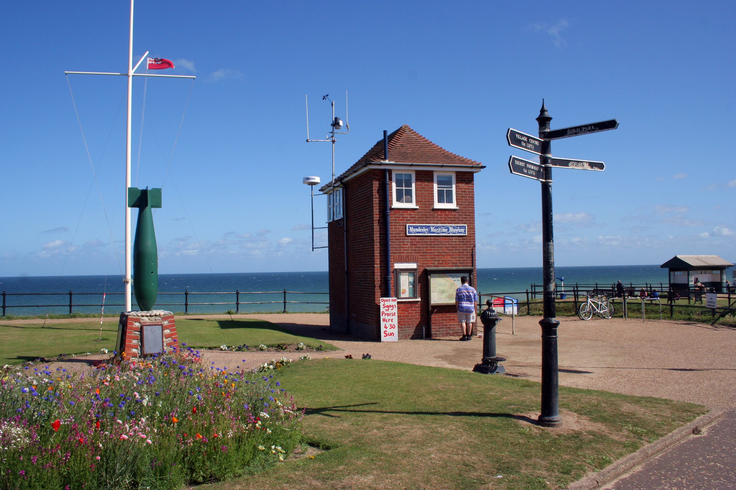
Mundesley /ˈmʌndz.li/ is a coastal village and a civil parish in the English county of Norfolk. The village is north-north east of Norwich, south east of Cromer and north east of London. The village lies north-north east of the town of North Walsham. The nearest railway station is at North Walsham, for the Bittern Line which runs between Sheringham and Norwich. The nearest airport is Norwich Airport. The village sits astride the B1159 coast road that links Cromer and Caister-on-Sea, and is at the eastern end of the B1145 a route which runs between King's Lynn and Mundesley. Mundesley is within the Norfolk Coast AONB. It has a resident population of around 2,695 (parish, 2001 census), measured at 2,758 in the 2011 Census. The River Mun or Mundesley Beck flows into the sea here. On 5 September 2022 Mundesley beach won the North Norfolk District Council Battle of the Beaches to be recognised as the top beach in North Norfolk in a close run off against West Runton beach. Hist ... [...More Info...] [...Related Items...] OR: [Wikipedia] [Google] [Baidu] |
Kings Lynn
King's Lynn, known until 1537 as Bishop's Lynn and colloquially as Lynn, is a port and market town in the borough of King's Lynn and West Norfolk in the county of Norfolk, England. It is located north of London, north-east of Peterborough, north-north-east of Cambridge and west of Norwich. History Toponymy The etymology of King's Lynn is uncertain. The name ''Lynn'' may signify a body of water near the town – the Welsh word means a lake; but the name is plausibly of Anglo-Saxon origin, from ''lean'' meaning a tenure in fee or farm. As the 1085 Domesday Book mentions saltings at Lena (Lynn), an area of partitioned pools may have existed there at the time. Other places with Lynn in the name include Dublin, Ireland. An Dubh Linn....the Black Pool. The presence of salt, which was relatively rare and expensive in the early medieval period, may have added to the interest of Herbert de Losinga and other prominent Normans in the modest parish. The town was named ''Len '' (Bi ... [...More Info...] [...Related Items...] OR: [Wikipedia] [Google] [Baidu] |
Thursford
Thursford is a village and civil parish in the county of Norfolk, eastern England. The village is 16.3 miles southwest of Cromer, 24.5 miles northwest of Norwich and 121 miles north-east of London. The village lies 6.9 miles northwest of the nearby town of Fakenham. The nearest railway station is at Sheringham for the Bittern Line which runs between Sheringham, Cromer and Norwich. The nearest airport is Norwich International Airport. The village once had its own Thursford railway station which is now closed. It is a proposed stop on the Norfolk Orbital Railway. The villages name means 'Giant ford' or ' demon ford'. Thursford parish church is dedicated to St Andrew and has some fine examples of Victorian stained glass windows.Norfolk 1: Norwich and North-East, by Nikolaus Pevsner and Bill Wilson The church was rebuilt in the early 1860s with money given by the Chadd family who lived in the nearby Thursford Hall. Thursford Collection Thursford is the home of the Thursford C ... [...More Info...] [...Related Items...] OR: [Wikipedia] [Google] [Baidu] |
Roundabout
A roundabout is a type of circular intersection or junction in which road traffic is permitted to flow in one direction around a central island, and priority is typically given to traffic already in the junction.''The New Shorter Oxford English Dictionary,'' Volume 2, Clarendon Press, Oxford (1993), page 2632 Engineers use the term modern roundabout to refer to junctions installed after 1960 that incorporate various design rules to increase safety. Both modern and non-modern roundabouts, however, may bear street names or be identified colloquially by local names such as rotary or traffic circle. Compared to stop signs, traffic signals, and earlier forms of roundabouts, modern roundabouts reduce the likelihood and severity of collisions greatly by reducing traffic speeds and minimizing T-bone and head-on collisions. Variations on the basic concept include integration with tram or train lines, two-way flow, higher speeds and many others. For pedestrians, traffic exiting th ... [...More Info...] [...Related Items...] OR: [Wikipedia] [Google] [Baidu] |
River Bure
The River Bure is a river in the county of Norfolk, England, most of it in the Broads.Ordnance Survey (2005). ''OS Explorer Map OL40 - The Broads''. . The Bure rises near Melton Constable, upstream of Aylsham, which was the original head of navigation. Nowadays, the head of navigation is downstream at Coltishall Bridge. After Aylsham Lock and Burgh Bridge, the Bure passes through Buxton Lammas, Coltishall, Belaugh, Wroxham, Horning, past St. Benet's Abbey, through Oby, Acle, Stokesby, along the northern border of the Halvergate Marshes, through Runham and Great Yarmouth where it meets Breydon Water and flows into the sea at Gorleston. It has two major tributaries, the River Thurne and the River Ant. There is also Muck Fleet which connects the Trinity Broads (Ormesby, Rollesby and Filby Broad) to the main network. Other minor tributaries include the River Hor, which joins the Bure just upstream of Hoveton, The Mermaid which merges at Burgh-next-Aylsham and Scarrow Bec ... [...More Info...] [...Related Items...] OR: [Wikipedia] [Google] [Baidu] |
Low Countries
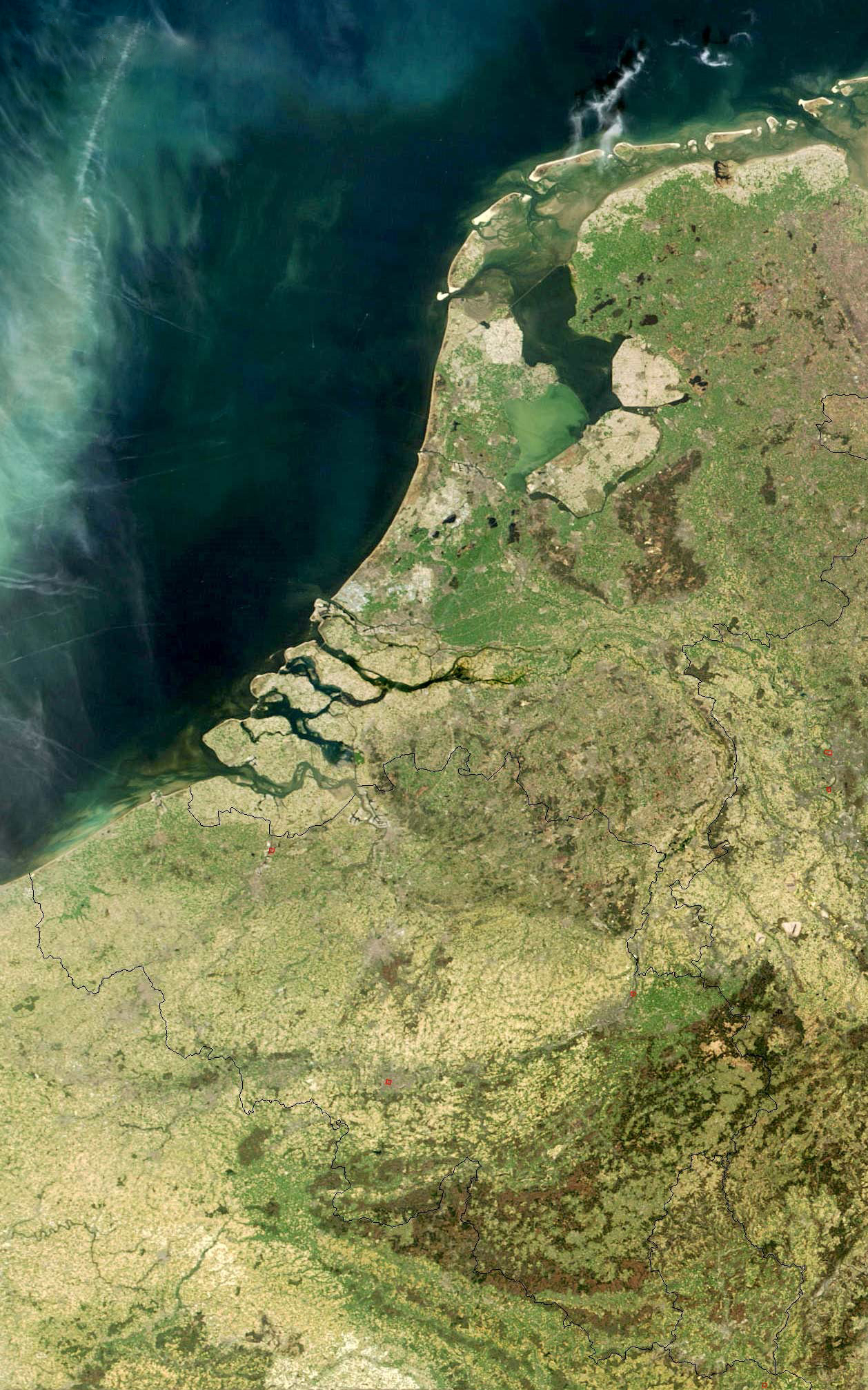
The term Low Countries, also known as the Low Lands ( nl, de Lage Landen, french: les Pays-Bas, lb, déi Niddereg Lännereien) and historically called the Netherlands ( nl, de Nederlanden), Flanders, or Belgica, is a coastal lowland region in Northwestern Europe forming the lower basin of the Rhine–Meuse–Scheldt delta and consisting of three countries: Belgium, the Netherlands and Luxembourg. Geographically and historically, the area also includes parts of France and Germany such as the French Flanders and the German regions of East Frisia and Cleves. During the Middle Ages, the Low Countries were divided into numerous semi-independent principalities. Historically, the regions without access to the sea linked themselves politically and economically to those with access to form various unions of ports and hinterland, stretching inland as far as parts of the German Rhineland. Because of this, nowadays not only physically low-altitude areas, but also some hilly or elevated regi ... [...More Info...] [...Related Items...] OR: [Wikipedia] [Google] [Baidu] |
Cley Next The Sea
Cley next the Sea (, , is a village and civil parish on the River Glaven in England, English county of Norfolk, England, Norfolk, north-west of Holt, Norfolk, Holt and east of Blakeney, Norfolk, Blakeney. The main A149 road, A149 coast road runs through the centre of the village, causing congestion in the summer months due to the tight, narrow streets. It lies within the Norfolk Coast AONB (Area of Outstanding Natural Beauty) and the North Norfolk Heritage Coast. History The village's name is of Anglo-Saxon origin and derives from the Old English for a settlement close to the sea with an abundance of clay. In the Domesday Book, Cley is recorded as a settlement of 38 households located in the Hundred (county division), hundred of Holt. The village formed parts of the East Anglia, East Anglian estates of William the Conqueror, King William I. A ruined building on the marshes is known as Blakeney Chapel; despite its name, it is in Cley parish, and probably never had a religiou ... [...More Info...] [...Related Items...] OR: [Wikipedia] [Google] [Baidu] |
Saxthorpe
Saxthorpe is a village in Norfolk, England. The village is west south west of Cromer and north north west of Norwich. The village lies south west of the town of Holt. It is in the civil parish of Corpusty and Saxthorpe. The village is passed to the north and east by the B1149 between Holt and Norwich. The nearest railway station is at Sheringham for the Bittern Line which runs between Sheringham, Cromer and Norwich. The Corpusty and Saxthorpe railway station closed in 1959 but still exists, though the track has been lifted. History The villages name means 'Saxi's outlying settlement'. Saxthorpe has an entry in the Domesday Book of 1086. In the great book Saxthorpe is recorded with the spellings ''Sastorp'', ''Saxiorp'' and ''Saxthorp'', and is said to be in the ownership of the King and in the custody of Godric, Count Alan and Ribralt from him. The survey also notes that there are 50 goats, 20 cattle and 4 cobs (draught horses). For more details about Saxthorpe and its si ... [...More Info...] [...Related Items...] OR: [Wikipedia] [Google] [Baidu] |


