|
Avonside
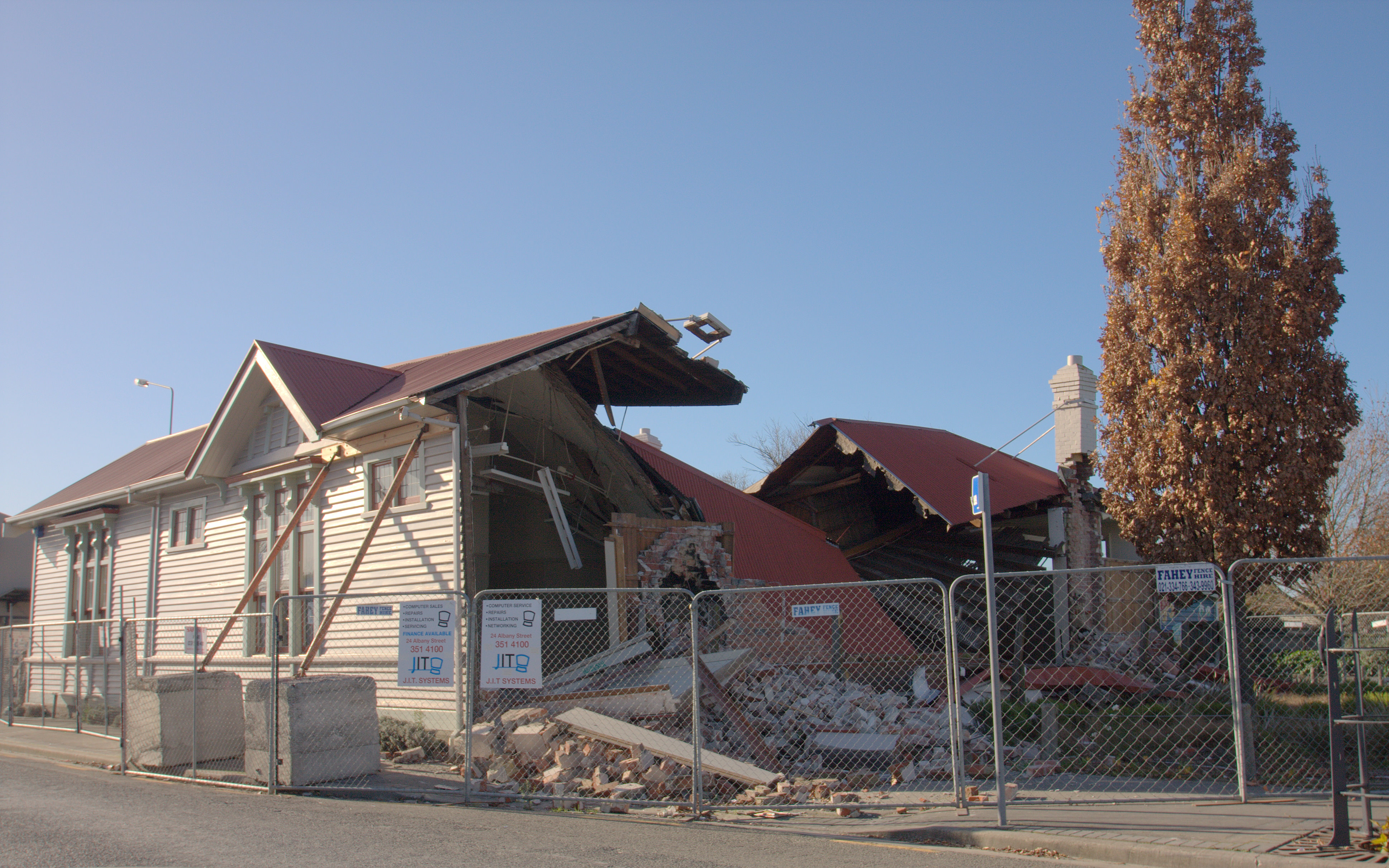
Avonside is an eastern suburb in Christchurch, New Zealand. It is one of the oldest suburbs of the city, with only Heathcote being older. History The suburb was named after Holy Trinity Avonside, which was built beside the Avon River in 1855. The 1874 part of the church was designed by the eminent architect Benjamin Mountfort who is buried in the churchyard. The church was damaged in the 2010 Canterbury earthquake and whilst under repair, was damaged beyond repair in the February 2011 Christchurch earthquake and demolished later that year. Avonside is home to Avonside Girls' High School. It also has the Avon River flowing through it. The boundaries of the original Anglican parish of Avonside were fixed in 1859 and covered much of what is now suburbs such as Aranui, Burwood, Linwood, Marshland, New Brighton, North New Brighton, Parklands and part of Phillipstown. The area once covered the whole of north east Christchurch as far as the River Styx. The area borders th ... [...More Info...] [...Related Items...] OR: [Wikipedia] [Google] [Baidu] |
Holy Trinity Avonside
Holy Trinity Avonside was a heritage-listed Anglican church located in Linwood, Christchurch, New Zealand. It was registered as a "Historic Place – Category I" by the New Zealand Historic Places Trust. It was "damaged beyond the point of repair" in the February 2011 Christchurch earthquake and was demolished the following September. History The Parish of the Most Holy Trinity Avonside was established in 1855, with the first service held in the Rev. Charles Mackie's home "Stricklands". The first service was held in a church building designed by Charles Edward Fooks and made of cob at Christmas Day 1855, but the church was only consecrated on 24 February 1857; it was the first Anglican church in Canterbury consecrated by Bishop Harper. The land for the church had been provided by John and Elizabeth Stace, who had arrived in Lyttelton on the ''Nugent'' in 1851. Architect Benjamin Mountfort, a parishioner, designed additions to the church including a bell tower and timber ves ... [...More Info...] [...Related Items...] OR: [Wikipedia] [Google] [Baidu] |
Avonside Girls' High School
Avonside Girls' High School is a large urban high school in Christchurch, New Zealand, with more than 1,000 girls from Year 9 to Year 13. It was formerly in the suburb of Avonside but moved in 2019, along with Shirley Boys' High School, to the former QEII Park site in the east of Christchurch. History The school originally opened in January 1919 on the Avonside Drive site as a satellite campus of Christchurch Girls' High School. It became a separate school in its own right in 1928. Earthquake Following the 22 February 2011 Christchurch earthquake, the school site closed, with classes operating at Burnside High School in the afternoons. Two school blocks, including the Main Block, were condemned following the earthquake and were demolished. Students returned to the Avonside site at the beginning of 2012, with relocatable and prefabricated classrooms filling gaps left by the condemned buildings, but due to significant land damage adjacent to the school site, it was clear that the ... [...More Info...] [...Related Items...] OR: [Wikipedia] [Google] [Baidu] |
Linwood, New Zealand
Linwood is an inner suburb of the city of Christchurch, New Zealand. It lies to the east of the city centre, mostly between Ferry Road and Linwood Avenue, two of the major arterial roads to the eastern suburbs of Christchurch. History Linwood was given its name by Joseph Brittan, who purchased rural section 300 in Avonside. The adjoining rural section 301 was to be part of the farm, but the right was sold but probably farmed with rural section 300 and was eventually bought back by his son in 1874. To this was added a small part of section 30 to give access in 1855 and 21-year lease for the adjoining sections in 1862 giving a total area of about 380 acres (about 150ha). He called the farm Linwood, as he was from Linwood, Hampshire. Brittan built Linwood House at 30 Linwood Avenue in 1857, which stood there until demolition following the February 2011 Christchurch earthquake. Christchurch lacked an accessible port before the construction of the Lyttelton Rail Tunnel in 1867. Th ... [...More Info...] [...Related Items...] OR: [Wikipedia] [Google] [Baidu] |
North New Brighton
North New Brighton is a suburb on the northern side of Christchurch city. It was originally known as North Beach and was readily accessible from Christchurch city by tram. It was renamed North New Brighton in 1953. Demographics The statistical area of North Beach covers . It had an estimated population of as of with a population density of people per km2. North Beach had a population of 4,071 at the 2018 New Zealand census, an increase of 69 people (1.7%) since the 2013 census, and a decrease of 12 people (-0.3%) since the 2006 census. There were 1,647 households. There were 2,016 males and 2,052 females, giving a sex ratio of 0.98 males per female. The median age was 37.8 years (compared with 37.4 years nationally), with 834 people (20.5%) aged under 15 years, 753 (18.5%) aged 15 to 29, 1,941 (47.7%) aged 30 to 64, and 537 (13.2%) aged 65 or older. Ethnicities were 89.4% European/Pākehā, 15.5% Māori, 3.7% Pacific peoples, 2.4% Asian, and 1.8% other ethnicities (totals ... [...More Info...] [...Related Items...] OR: [Wikipedia] [Google] [Baidu] |
Benjamin Mountfort
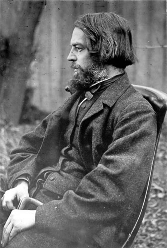
Benjamin Woolfield Mountfort (13 March 1825 – 15 March 1898) was an English emigrant to New Zealand, where he became one of the country's most prominent 19th-century architects. He was instrumental in shaping the city of Christchurch's unique architectural identity and culture, and was appointed the first official Provincial Architect of the developing province of Canterbury, New Zealand, Canterbury. Heavily influenced by the Anglo-Catholicism, Anglo-Catholic philosophy behind early Victorian architecture, he is credited with importing the Gothic revival style to New Zealand. His Gothic designs constructed in both wood and stone in the province are considered unique to New Zealand. Today, he is considered the founding architect of the province of Canterbury. Early life Mountfort was born in Birmingham, an industrial town in the English Midlands, Midlands of England. He was the son of perfume manufacturer and jeweller Thomas Mountfort and his wife Susanna (née Woolfield). As a ... [...More Info...] [...Related Items...] OR: [Wikipedia] [Google] [Baidu] |
2011 Christchurch Earthquake
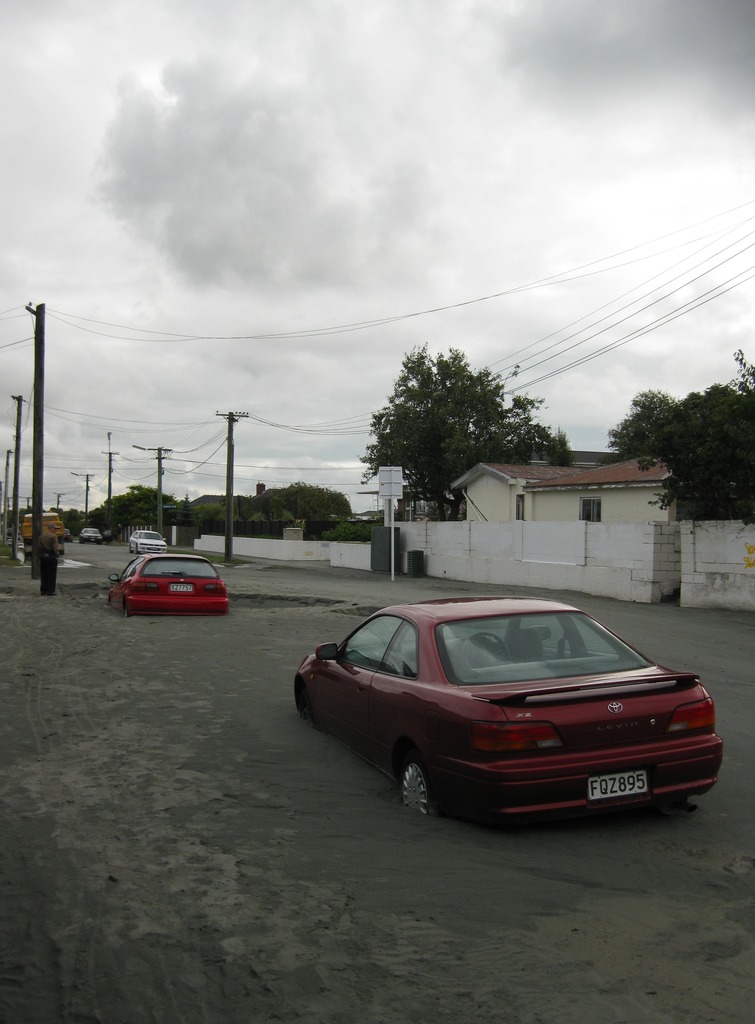
A major earthquake occurred in Christchurch on Tuesday 22 February 2011 at 12:51 p.m. local time (23:51 UTC, 21 February). The () earthquake struck the entire of the Canterbury region in the South Island, centred south-east of the central business district. It caused widespread damage across Christchurch, killing 185 people, in New Zealand's fifth-deadliest disaster. Christchurch's central city and eastern suburbs were badly affected, with damage to buildings and infrastructure already weakened by the magnitude 7.1 Canterbury earthquake of 4 September 2010 and its aftershocks. Significant liquefaction affected the eastern suburbs, producing around 400,000 tonnes of silt. The earthquake was felt across the South Island and parts of the lower and central North Island. While the initial quake only lasted for approximately 10 seconds, the damage was severe because of the location and shallowness of the earthquake's focus in relation to Christchurch as well as ... [...More Info...] [...Related Items...] OR: [Wikipedia] [Google] [Baidu] |
Christchurch
Christchurch ( ; mi, Ōtautahi) is the largest city in the South Island of New Zealand and the seat of the Canterbury Region. Christchurch lies on the South Island's east coast, just north of Banks Peninsula on Pegasus Bay. The Avon River / Ōtākaro flows through the centre of the city, with an urban park along its banks. The city's territorial authority population is people, and includes a number of smaller urban areas as well as rural areas. The population of the urban area is people. Christchurch is the second-largest city by urban area population in New Zealand, after Auckland. It is the major urban area of an emerging sub-region known informally as Greater Christchurch. Notable smaller urban areas within this sub-region include Rangiora and Kaiapoi in Waimakariri District, north of the Waimakariri River, and Rolleston and Lincoln in Selwyn District to the south. The first inhabitants migrated to the area sometime between 1000 and 1250 AD. They hunted moa, which led ... [...More Info...] [...Related Items...] OR: [Wikipedia] [Google] [Baidu] |
New Brighton, New Zealand
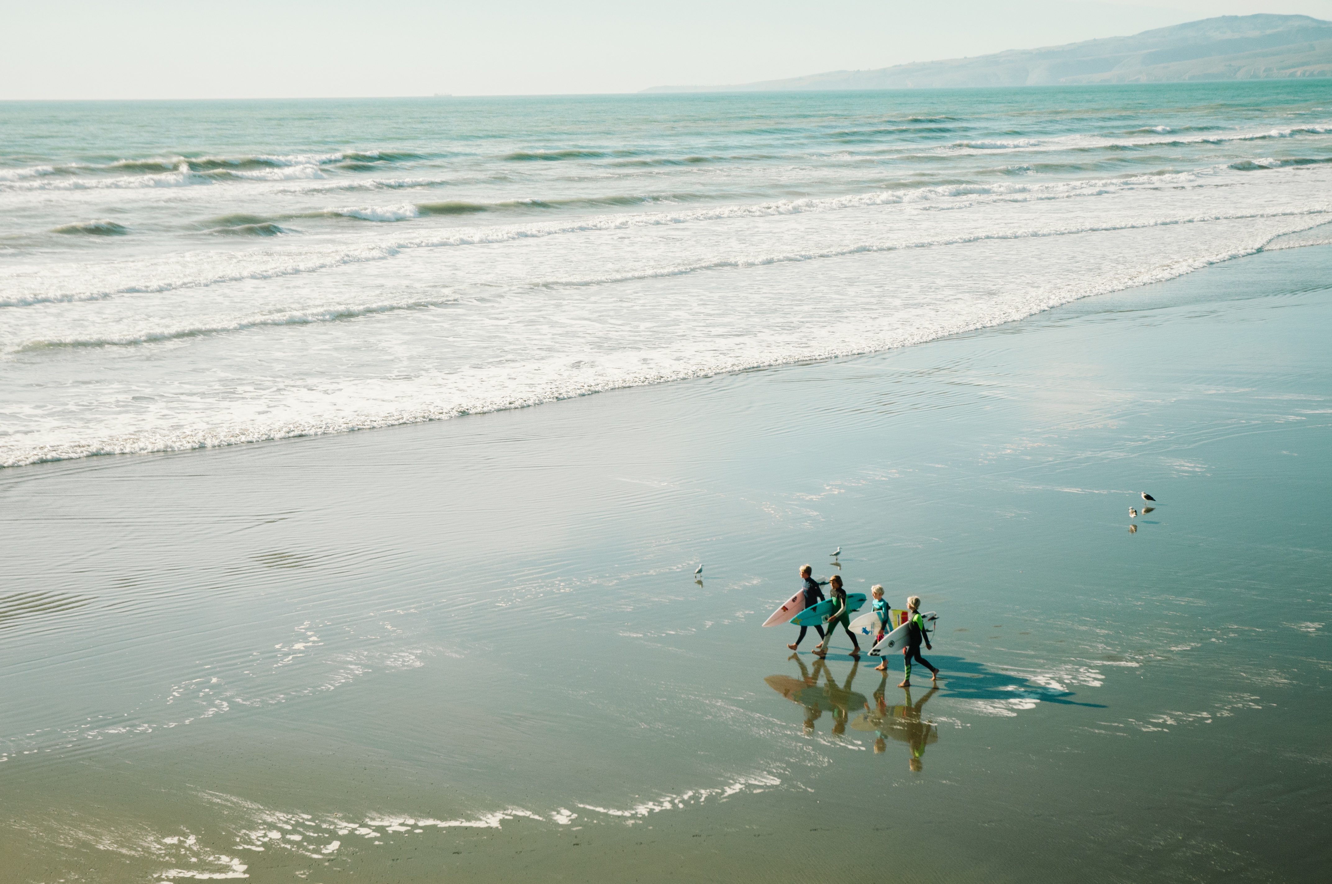
New Brighton is a coastal suburb of Christchurch, New Zealand, east of the city centre. It is one of eastern Christchurch's main entertainment and tourist centres, with its architecturally unique pier and scenic coastline. The 2011 Christchurch earthquakes caused significant damage in the area. History Māori connections New Brighton is of cultural significance for the local iwi or tribe Ngāi Tahu who are the kaitiaki or guardians of this takiwa or area. Ngāi Tūāhuriri hapū, a sub-tribe of Ngāi Tahu, hold manawhenua status (territorial rights) in respect to this area. Te Tai o Mahaanui refers to the coast and surrounding land of which New Brighton is a part. Naming The naming of New Brighton was apparently done on the 'spur of the moment' by William Fee, an early settler of the area. When Guise Brittan, the Waste Lands Commissioner, visited the area in December 1860, he was recognised and Fee chalked 'New Brighton' on a wooden plank, supposedly in reference to his ... [...More Info...] [...Related Items...] OR: [Wikipedia] [Google] [Baidu] |
Residential Red Zone
The residential red zone refers to areas of land in and around Christchurch, New Zealand, that experienced severe damage in the 2010 and 2011 Christchurch earthquakes and were deemed infeasible to rebuild on. Through voluntary buyouts, the Crown acquired and demolished or removed over 8,000 properties. The majority were located in a broad swath of the eastern suburbs along the Avon River / Ōtākaro that had suffered damage from soil liquefaction. Background In the 2010 and 2011 earthquakes, many areas in and around Christchurch were severely affected by soil liquefaction, lateral spreading, and/or rockslides. Many flatland areas were flooded and covered in silt as a result of liquefaction, and houses and utilities were damaged. Such areas were rendered effectively uninhabitable by the quakes. Decision not to rebuild Some land in and around Christchurch was so damaged that the government determined that making the land safe for rebuilding would take years and require the dem ... [...More Info...] [...Related Items...] OR: [Wikipedia] [Google] [Baidu] |
Christchurch Central
Christchurch Central is a New Zealand parliamentary electorate in the South Island city of Christchurch. The electorate was established for the 1946 election and, until 2011 had always been won by the Labour Party. Since 2008, the incumbent was Brendon Burns but the election night results for the resulted in a tie; the special vote results combined with a judicial recount revealed a 47-vote majority for Nicky Wagner, the National list MP based in the electorate. Wagner significantly increased her winning margin in the after having declared the electorate "unwinnable" for National earlier in the year following a boundary review. At the Wagner lost the seat to Labour's Duncan Webb, who retained it at the . Population centres The 1941 New Zealand census had been postponed due to World War II, so the 1946 electoral redistribution had to take ten years of population growth and movements into account. The North Island gained a further two electorates from the South Island due t ... [...More Info...] [...Related Items...] OR: [Wikipedia] [Google] [Baidu] |
Richmond, Christchurch
Richmond is a minor suburb of Christchurch, New Zealand. Situated to the inner north east of the city centre, the suburb is bounded by Shirley Road to the north, Hills Road to the west, and the Avon River to the south and east. In 2018, ongoing earthquake repairs and flood mitigation work were causing disruption within Richmond. Demographics Richmond covers . It had an estimated population of as of with a population density of people per km2. Richmond had a population of 4,311 at the 2018 New Zealand census Eighteen or 18 may refer to: * 18 (number), the natural number following 17 and preceding 19 * one of the years 18 BC, AD 18, 1918, 2018 Film, television and entertainment * ''18'' (film), a 1993 Taiwanese experimental film based on the short ..., unchanged since the 2013 census, and a decrease of 1,095 people (-20.3%) since the 2006 census. There were 1,815 households. There were 2,220 males and 2,085 females, giving a sex ratio of 1.06 males per female, with ... [...More Info...] [...Related Items...] OR: [Wikipedia] [Google] [Baidu] |
2010 Canterbury Earthquake
The 2010 Canterbury earthquake (also known as the Darfield earthquake) struck the South Island of New Zealand with a moment magnitude of 7.1 at on , and had a maximum perceived intensity of X (''Extreme'') on the Mercalli intensity scale. Some damaging aftershocks followed the main event, the strongest of which was a magnitude 6.3 shock known as the Christchurch earthquake that occurred nearly six months later on 22 February 2011. Because this aftershock was centred very close to Christchurch, it was much more destructive and resulted in the deaths of 185 people. The earthquake on 4 September caused widespread damage and several power outages, particularly in the city of Christchurch, New Zealand's second largest city at that time. Two residents were seriously injured, one by a collapsing chimney and a second by flying glass. One person died of a heart attack suffered during the quake. Another person died after a fall during the quake. Mass fatalities were avoided partly due t ... [...More Info...] [...Related Items...] OR: [Wikipedia] [Google] [Baidu] |


