|
Attack At Mocodome
The attack at Mocodome was a battle which occurred during Father Le Loutre's War in present-day Country Harbour, Nova Scotia on February 21, 1753 which saw two British mariners and six Mi'kmaq killed. The battle ended any hope for the survival of the Treaty of 1752 signed by Governor Peregrine Hopson and Mi'kmaq chief Jean-Baptiste Cope. Historical context Despite the British Siege of Port Royal (1710), Conquest of Acadia in 1710, Nova Scotia remained primarily occupied by Catholic Acadians and Mi'kmaq. By the time Cornwallis had arrived in Halifax, there was a long history of the Wabanaki Confederacy (which included the Mi'kmaq) attacking British colonists attempting to establish new settlements along the American frontier, New England frontier in Maine (See the Northeast Coast Campaigns King William's War#Northeast Coast Campaign (1688), 1688, Northeast Coast Campaign (1703), 1703, Northeast Coast Campaign (1723), 1723, Father Rale's War#Northeast Coast Campaign (1724), 1724, ... [...More Info...] [...Related Items...] OR: [Wikipedia] [Google] [Baidu] |
Old Burying Ground (Halifax, Nova Scotia)
The Old Burying Ground (also known as St. Paul's Church Cemetery) is a historic cemetery in Halifax, Nova Scotia, Canada. It is located at the intersection of Barrington Street and Spring Garden Road in Downtown Halifax. History The Old Burying Ground was founded in 1749, the same year as the settlement, as the town's first burial ground. It was originally non-denominational and for several decades was the only burial place for all Haligonians. (The burial ground was also used by St. Matthew's United Church). In 1793 it was turned over to the Anglican St. Paul's Church. The cemetery was closed in 1844 and the Camp Hill Cemetery established for subsequent burials. The site steadily declined until the 1980s when it was restored and refurbished by the Old Burying Ground Foundation, which now maintains the site and employ tour guides to interpret the site in the summer. Ongoing restoration of the rare 18th-century grave markers continues. Over the decades some 12,000 people were ... [...More Info...] [...Related Items...] OR: [Wikipedia] [Google] [Baidu] |
Raid On Dartmouth (1751)
The Raid on Dartmouth (also referred to as the Dartmouth Massacre) occurred during Father Le Loutre's War on May 13, 1751, when a Miꞌkmaq and Acadian militia from Chignecto, under the command of Acadian Joseph Broussard, raided Dartmouth, Nova Scotia, destroying the town and killing twenty British villagers and wounding British regulars. The town was protected by a blockhouse on Blockhouse Hill (close to the corner of King St. and North St.) with William Clapham's Rangers and British regulars from the 45th Regiment of Foot. This raid was one of seven the Natives and Acadians would conduct against the town during the war. Historical context After the British Conquest of Acadia in 1710, the British laid claim to all of peninsular Acadia, renaming it Nova Scotia. Its population was primarily Catholic French Acadians and the Miꞌkmaq indigenous peoples. The Mi’kmaq numbered about 1000 in total, in Nova Scotia at the time. In response to British settlement, the Miꞌkmaq ... [...More Info...] [...Related Items...] OR: [Wikipedia] [Google] [Baidu] |
Lawrencetown, Halifax County, Nova Scotia
Lawrencetown (1986 population: 2,680) is a Canadian rural community in the Halifax Regional Municipality in Nova Scotia, Canada. The settlement was established during the eve of Father Le Loutre's War and at the beginning of the French and Indian War. History Father Le Loutre's War began when Edward Cornwallis arrived to establish Halifax with 13 transports on June 21, 1749. By unilaterally establishing Halifax, the Mi'kmaq believed the British were violating earlier treaties (1726), which were signed after Father Rale's War. The British quickly began to build other settlements. To guard against Mi'kmaq, Acadian and French attacks on the new Protestant settlements, British fortifications were erected in Halifax (1749), Bedford (Fort Sackville) (1749), Dartmouth (1750), Lunenburg (1753) and Lawrencetown (1754). In 1754, Nova Scotia's Lieutenant Governor Charles Lawrence, offered land grants to twenty families, who referred to their settlement as Lawrence's Town, which b ... [...More Info...] [...Related Items...] OR: [Wikipedia] [Google] [Baidu] |
Lunenburg, Nova Scotia
Lunenburg is a port town on the South Shore of Nova Scotia, Canada. Founded in 1753, the town was one of the first British attempts to settle Protestants in Nova Scotia. The economy was traditionally based on the offshore fishery and today Lunenburg is the site of Canada's largest secondary fish-processing plant. The town flourished in the late 1800s, and much of the historic architecture dates from that period. In 1995 UNESCO designated it a World Heritage Site. UNESCO considers the site the best example of planned British colonial settlement in North America, as it retains its original layout and appearance of the 1800s, including local wooden vernacular architecture. UNESCO considers the town in need of protection because the future of its traditional economic underpinnings, the Atlantic fishery, is now very uncertain. The historic core of the town is also a National Historic Site of Canada. Toponymy Lunenburg was named in 1753 after the Duke of Braunschweig-Lüneburg ... [...More Info...] [...Related Items...] OR: [Wikipedia] [Google] [Baidu] |
History Of Dartmouth
Dartmouth founded in 1750, is a Metropolitan Area and former city in the Canadian province of Nova Scotia. Dartmouth and the neighbouring metropolitan area of Halifax form the urban core of the Halifax Regional Municipality (HRM). Both cities, along with the town of Bedford and the Municipality of the County of Halifax were dissolved on April 1, 1996 when they were amalgamated into HRM. Mi'kmaq Prior to European colonization, the region around Dartmouth was inhabited the indigenous Mi'kmaq people, who had occupied the area for roughly a millennia. The Mi'kmaq called the area Ponamogoatitjg (Boonamoogwaddy), which has been varyingly translated as "Tomcod Ground" or "Salmon Place" in reference to the fish which were presumably caught in this part of Halifax Harbour. There is evidence that bands would spend the summer on the shores of the Bedford Basin, moving to points inland before the harsh Atlantic winter set in. From Dartmouth Cove, the Mi'kmaq would have followed an important ... [...More Info...] [...Related Items...] OR: [Wikipedia] [Google] [Baidu] |
Fort Sackville (Nova Scotia)
Fort Sackville was a British fort in present-day Bedford, Nova Scotia. It was built during Father Le Loutre's War by British adjacent to present-day Scott Manor House, on a hill overlooking the Sackville River to help prevent French, Acadian and Mi'kmaq attacks on Halifax. The fort consisted of a blockhouse, a guard house, a barracks that housed 50 soldiers, and outbuildings, all encompassed by a palisade. Not far from the fort was a rifle range. The fort was named after George Germain, 1st Viscount Sackville. Historical context Despite the British Conquest of Acadia in 1710, Nova Scotia remained primarily occupied by Catholic Acadians and Mi'kmaq. Father Le Loutre's War began when Edward Cornwallis arrived to establish Halifax with 13 transports on June 21, 1749. The British remained largely in Halifax, having attempted to establish a settlement east of Halifax near present-day Lawrencetown Beach they quickly abandoned the effort due to the threat of Mi'kmaq attacks. Four ... [...More Info...] [...Related Items...] OR: [Wikipedia] [Google] [Baidu] |
Bedford, Nova Scotia
Bedford is a community of the Halifax Regional Municipality, in Nova Scotia, Canada. History The area of Bedford has evidence of Indigenous peoples dating back thousands of years. Petroglyphs are found at Bedford Petroglyphs National Historic Site. The Bedford area is known as Kwipek to the Mi'kmaq First Nation. 18th century On 21 July 1749, Father Le Loutre's War began when Edward Cornwallis arrived to establish Halifax with 13 transports. The British quickly began to build other settlements. To guard against the Acadians, the French, and the Mi'kmaq, British fortifications were erected in Halifax (1749), Bedford (Fort Sackville) (1749), Dartmouth (1750), Lunenburg (1753) and Lawrencetown (1754). The history of Bedford began when Governor Edward Cornwallis organised his men and began the construction of a road leading to Minas Basin on the Bay of Fundy after establishing the garrison at Halifax. To protect it, he hired John Gorham and his Rangers to erect a fort on the ... [...More Info...] [...Related Items...] OR: [Wikipedia] [Google] [Baidu] |
Halifax Regional Municipality
Halifax is the capital and largest municipality of the Provinces and territories of Canada, Canadian province of Nova Scotia, and the largest municipality in Atlantic Canada. As of the 2021 Census, the municipal population was 439,819, with 348,634 people in its urban area. The regional municipality consists of four former municipalities that were Amalgamation (politics), amalgamated in 1996: History of Halifax (former city), Halifax, Dartmouth, Nova Scotia, Dartmouth, Bedford, Nova Scotia, Bedford, and Halifax County, Nova Scotia, Halifax County. Halifax is a major economic centre in Atlantic Canada, with a large concentration of government services and private sector companies. Major employers and economic generators include the Canadian Armed Forces, Department of National Defence, Dalhousie University, Nova Scotia Health Authority, Saint Mary's University (Halifax), Saint Mary's University, the Halifax Shipyard, various levels of government, and the Port of Halifax. Agricult ... [...More Info...] [...Related Items...] OR: [Wikipedia] [Google] [Baidu] |
Edward Cornwallis
Edward Cornwallis ( – 14 January 1776) was a British career military officer and was a member of the aristocratic Cornwallis family, who reached the rank of Lieutenant General. After Cornwallis fought in Scotland, putting down the Jacobite rebellion of 1745, he was appointed Groom of the Chamber for King George II (a position he held for the next 17 years). He was then made Governor of Nova Scotia (1749–1752), one of the colonies in North America, and assigned to establish the new town of Halifax, Nova Scotia. Later Cornwallis returned to London, where he was elected as MP for Westminster and married the niece of Robert Walpole, Great Britain's first Prime Minister. Cornwallis was next appointed as Governor of Gibraltar. Cornwallis arrived in Nova Scotia during a period of conflict with the local indigenous Miꞌkmaq peoples of peninsular Nova Scotia. The Mi'kmaq opposed the founding of Halifax and conducted war raids on the colony. Cornwallis responded with the ext ... [...More Info...] [...Related Items...] OR: [Wikipedia] [Google] [Baidu] |
Canso, Nova Scotia
Canso is a community in Guysborough County, on the north-eastern tip of mainland Nova Scotia, Canada, next to Chedabucto Bay. In January 2012, it ceased to be a separate town and as of July 2012 was amalgamated into the Municipality of the District of Guysborough. The area was established in 1604, along with the original Port-Royal. The British construction of a fort in the village (1720), was instrumental in contributing to Dummer's War (1722–1725). The town is of national historic importance because it was one of only two British settlements in Nova Scotia prior to the establishment of Halifax (1749). Canso played a key role in the defeat of Louisbourg. Today, the town attracts people internationally for the annual Stan Rogers Folk Festival. Geography The community is located on the southern shore of Chedabucto Bay. The southern limit of the bay is at Cape Canso, a headland approximately southeast of the community. Canso is the southeastern terminus of Trunk 16, an ... [...More Info...] [...Related Items...] OR: [Wikipedia] [Google] [Baidu] |
Shelburne, Nova Scotia
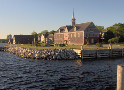
Shelburne is a town located in southwestern Nova Scotia, Canada. History Shelburne lies at the southwest corner of Nova Scotia, at roughly the same latitude as Portland, Maine in the United States. The Mi'kmaq call the large and well-sheltered harbour ''Logumkeegan'' or ''Sogumkeagum.'' The first Europeans to make a settlement on these shores were the French Acadians. They set up a small fishing settlement known as Port Razoir in the late 17th century, named after the harbour's resemblance to an open razor. Early European settlers had small subsistence farms, but most of the inhabitants' income from that time to the present has been derived from the sea. The Acadian fishing settlement was abandoned after repeated raids from New England colonists during Queen Anne's War in 1705, in which five Acadians were taken prisoner, and again in 1708. Raid on Port Roseway (1715) On May 14, 1715, New England naval commander Cyprian Southack attempted to create a permanent fishing station a ... [...More Info...] [...Related Items...] OR: [Wikipedia] [Google] [Baidu] |

.png)


_by_Dominic_Serres%2C_c._1765.jpg)

