|
Atsumi Peninsula
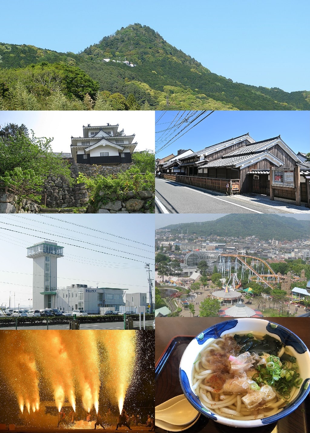
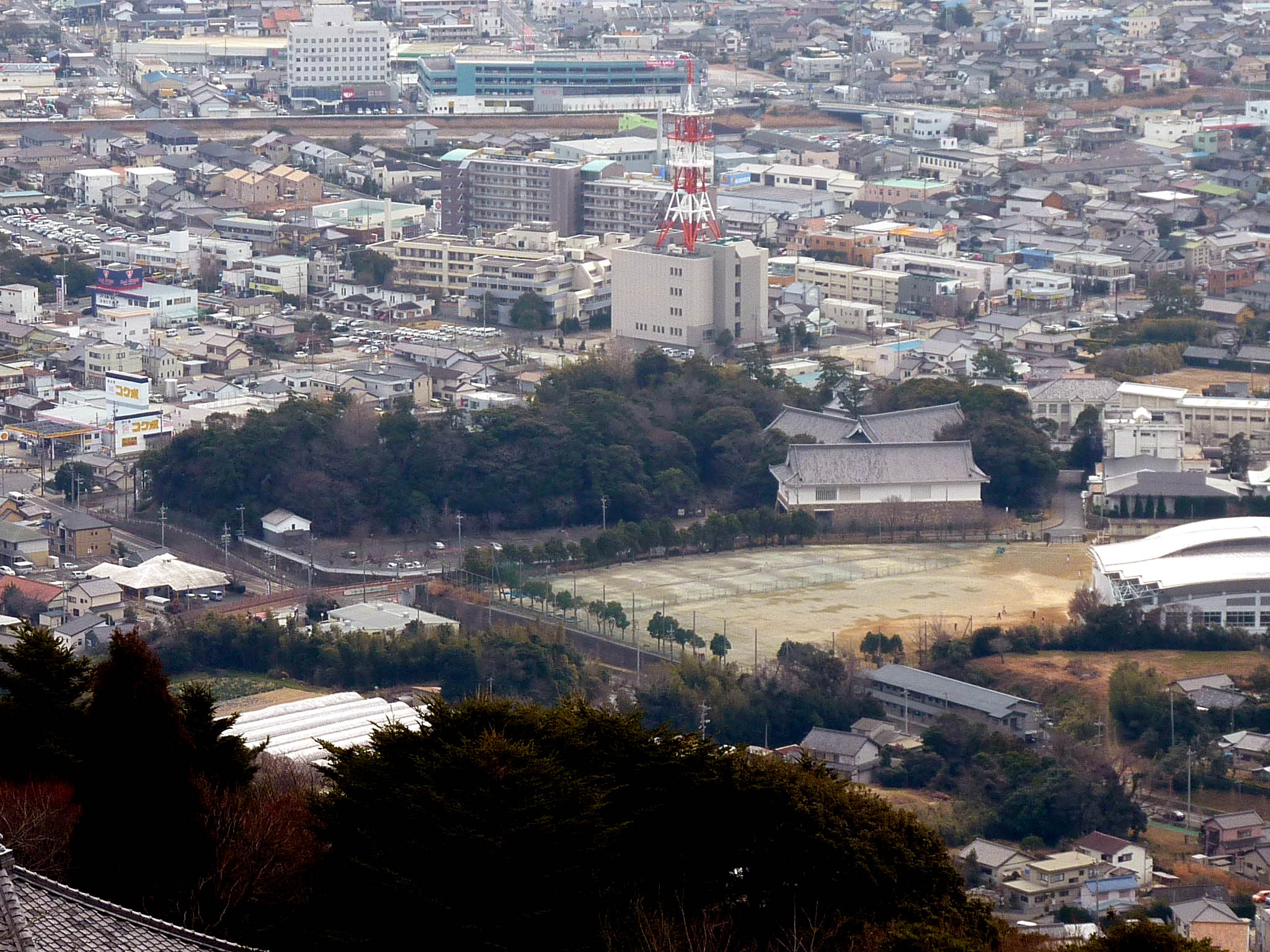
is a peninsula in southern Aichi Prefecture, central Honshū, Japan. It has an approximate length of east-west, separating Mikawa Bay (to the north) from the Philippine Sea to the south, with Ise Bay lying to its west. It faces the Chita Peninsula, to the northwest, across the entrance to Mikawa Bay. It has a width ranging from to , and its highest point is . Its total area is approximately 200 square kilometers. Atsumi Peninsula is noted for its temperate climate, due to the warm Kuroshio Current offshore. The rock formations at Cape Irago, its western tip, and its beaches are part of the Mikawa Wan Quasi-National Park. Administratively, almost all of the peninsula falls within the city of Tahara, with its eastern "neck" within the city of Toyohashi is a city in Aichi Prefecture, Japan. , the city had an estimated population of 377,453 in 160,516 households and a population density of 1,400 persons per km2. The total area of the city was . By area, Toyohashi was Aich ... [...More Info...] [...Related Items...] OR: [Wikipedia] [Google] [Baidu] |
Mikawa Bay Aichi Japan SRTM
Mikawa may refer to: ;Places in Japan * Mikawa Province, an old province of Japan * Mikawa, Yamagata, a town in Yamagata Prefecture * Mikawa, Ishikawa, former town in Ishikawa Prefecture * Mikawa, Kumamoto, former town in Kumamoto Prefecture * Mikawa, Yamaguchi, former town in Yamaguchi Prefecture * Mikawa, Ehime, former village in Ehime Prefecture * Mikawa, Niigata, former village in Niigata Prefecture ;Surname * Gunichi Mikawa, admiral in the Imperial Japanese Navy during World War II * Kenichi Mikawa, Japanese TV star, comedian and singer ;Other uses *Mikawa dialect, dialect of Japanese spoken in Mikawa Province in eastern Aichi Prefecture. It is also known as "Mikawa-ben" See also *Mikawa Station (other) {{disambiguation, geo, surname Japanese-language surnames ... [...More Info...] [...Related Items...] OR: [Wikipedia] [Google] [Baidu] |
Philippine Sea
The Philippine Sea is a marginal sea of the Western Pacific Ocean east of the Philippine archipelago (hence the name), the largest in the world, occupying an estimated surface area of . The Philippine Sea Plate forms the floor of the sea. Its western border is the first island chain to the west, comprising the Ryukyu Islands in the northwest and Taiwan in the west. Its southwestern border comprises the Philippine islands of Luzon, Catanduanes, Samar, Leyte, and Mindanao. Its northern border comprises the Japanese islands of Honshu, Shikoku and Kyūshū. Its eastern border is the second island chain to the east, comprising the Bonin Islands and Iwo Jima in the northeast, the Mariana Islands (including Guam, Saipan, and Tinian) in the due east, and Halmahera, Palau, Yap and Ulithi (of the Caroline Islands) in the southeast. Its southern border is Indonesia's Morotai Island. The sea has a complex and diverse undersea relief. The floor is formed into a structural basin by a s ... [...More Info...] [...Related Items...] OR: [Wikipedia] [Google] [Baidu] |
Peninsulas Of Japan
{{unreferenced, date=March 2020 Peninsulas of Japan include: Hokkaido *Nemuro Peninsula *Notsuke Peninsula (a sand spit) * Oshima Peninsula to the south ** Kameda Peninsula southeast fork of Oshima Peninsula ** Matumae Peninsula southwest fork of Oshima Peninsula * Shakotan Peninsula on the most eastern coast *Shiretoko Peninsula on the east coast Honshu * Atsumi Peninsula * Bōsō Peninsula * Chita Peninsula * Ise-Shima * Izu Peninsula * Kii Peninsula * Miura Peninsula * Natsudomari Peninsula * Noto Peninsula * Oga Peninsula * Oshika (Ojika) Peninsula * Shimokita Peninsula * Tsugaru Peninsula Shikoku * Sadamisaki Peninsula * Takanawa Peninsula Kyushu * Kitamatsuura Peninsula * Kunisaki Peninsula * Nagasaki Peninsula * Nishisonogi Peninsula * Ōsumi Peninsula * Satsuma Peninsula * Shimabara Peninsula * Uto Peninsula Okinawa * Chinen Peninsula * Henoko Peninsula * Katsuren Peninsula * Motobu Peninsula * Yomitan peninsula * Japan Peninsulas A peninsula (; ) i ... [...More Info...] [...Related Items...] OR: [Wikipedia] [Google] [Baidu] |
Toyohashi, Aichi
is a city in Aichi Prefecture, Japan. , the city had an estimated population of 377,453 in 160,516 households and a population density of 1,400 persons per km2. The total area of the city was . By area, Toyohashi was Aichi Prefecture's second-largest city until March 31, 2005 when it was surpassed by the city of Toyota, which had merged with six peripheral municipalities. Geography Toyohashi is located in southeastern Aichi Prefecture, and is the capital of the informal "Higashi-Mikawa Region" of the prefecture. It is bordered by Shizuoka Prefecture to the east, and by Mikawa Bay and the headlands of the Atsumi Peninsula to the west. To the south is the Enshu Bay of the Pacific Ocean. The presence of the warm Kuroshio Current offshore gives the city a temperate climate. The in Toyohashi is a sea turtle nesting spot. Climate The city has a climate characterized by hot and humid summers, and relatively mild winters (Köppen climate classification ''Cfa''). The average annual tempe ... [...More Info...] [...Related Items...] OR: [Wikipedia] [Google] [Baidu] |
Tahara, Aichi
is a city in Aichi Prefecture, Japan. , the city had an estimated population of 60,206 in 22,576 households, and a population density of 315 persons per km2. The total area of the city is . Geography Tahara is situated in southern Aichi Prefecture, and occupies most of the hilly Atsumi Peninsula. The peninsula is bounded on the north by Mikawa Bay and to the south lies the Philippine Sea. Situated as it is between those two bodies of water, Tahara has a warm maritime climate. Climate The city has a climate characterized by hot and humid summers, and relatively mild winters (Köppen climate classification ''Cfa''). The average annual temperature in Tahara is . The average annual rainfall is with September as the wettest month. The temperatures are highest on average in August, at around , and lowest in January, at around . Demographics Per Japanese census data, the population of Tahara has been relatively steady over the past 60 years. Neighboring municipalities ;Aichi Prefect ... [...More Info...] [...Related Items...] OR: [Wikipedia] [Google] [Baidu] |
Mikawa Wan Quasi-National Park
is a Quasi-National Park in Aichi Prefecture, Japan. It is rated a protected landscape (category V) according to the IUCN. The park includes the coastal areas of Atsumi Peninsula, the Pacific shoreline of Chita Peninsula as well as islands and portion of the northern shoreline of Mikawa Bay. It was founded on 10 April 1958 and has an area of 94.4 km². Like all Quasi-National Parks in Japan, the park is managed by the local prefectural governments. See also *List of national parks of Japan and in Japan are places of scenic beauty designated for protection and sustainable usage by the Minister of the Environment under the of 1957. National Parks are designated and in principle managed by the Ministry of the Environment. Quasi-Nat ... References *Southerland, Mary and Britton, Dorothy. ''The National Parks of Japan''. Kodansha International (1995). National parks of Japan Parks in Aichi Prefecture Protected areas established in 1958 {{Japan-protecte ... [...More Info...] [...Related Items...] OR: [Wikipedia] [Google] [Baidu] |
Kuroshio Current
The , also known as the Black or or the is a north-flowing, warm ocean current on the west side of the North Pacific Ocean basin. It was named for the deep blue appearance of its waters. Similar to the Gulf Stream in the North Atlantic, the Kuroshio is a powerful western boundary current that transports warm equatorial water poleward and forms the western limb of the North Pacific Gyre, North Pacific Subtropical Gyre. Off the East Coast of Japan, it merges with the Oyashio Current to form the North Pacific Current. The Kuroshio Current has significant effects on both physical and biological processes of the North Pacific Ocean, including nutrient and sediment transport, major pacific storm tracks and regional climate, and Pacific mode water formation.Terazaki, Makoto (1989) "Recent Large-Scale Changes in the Biomass of the Kuroshio Current Ecosystem" in Kenneth Sherman and Lewis M. Alexander (eds.), Biomass Yields and Geography of Large Marine Ecosystems (Boulder: Westview) AAA ... [...More Info...] [...Related Items...] OR: [Wikipedia] [Google] [Baidu] |
Chita Peninsula
Chita Peninsula (知多半島 ''Chita Hantō'') is a peninsula to the south of Aichi Prefecture, central Honshū, Japan. It runs approximately north-south. To the west is Ise Bay, while to the east it encloses Mikawa Bay. It faces the Atsumi Peninsula southeast across Mikawa Bay. Chūbu Centrair International Airport is an international airport on an artificial island in Ise Bay, Tokoname City in Aichi Prefecture, south of Nagoya in central Japan. Centrair is classified as a first class airport and is the main international gateway for the Chubu ("ce ... is located off the west coast of the peninsula. External links (Hazumisaki:Southernmost point) Peninsulas of Japan Landforms of Aichi Prefecture {{Aichi-geo-stub ... [...More Info...] [...Related Items...] OR: [Wikipedia] [Google] [Baidu] |
Ise Bay
is a bay located at the mouth of the Kiso Three Rivers between Mie and Aichi Prefectures in Japan. Ise Bay has an average depth of and a maximum depth of . The mouth of the bay is and is connected to the smaller Mikawa Bay by two channels: the Nakayama Channel and the Morosaki Channel. Mikawa Bay is subsequently joined to the Pacific Ocean by the Irako Channel, which ranges from in depth. History and environment Ise Bay derives its name from the region surrounding Ise Grand Shrine and the city of Ise, where the shrine stands. The flat coastal plain that stretches from Kuwana in northern Mie Prefecture to Ise is called the Ise Plain and this plain lies on the western shore of Ise Bay. Prior to the Meiji Period, Ise Province consisted of most of modern Mie Prefecture. From ancient times, Ise Bay has provided the people of the surrounding regions with a rich abundance of natural resources as well as providing easy transport. As a result, unique communities developed around the ... [...More Info...] [...Related Items...] OR: [Wikipedia] [Google] [Baidu] |
Mikawa Bay
Mikawa Bay (Landsat photo) Mikawa Bay (三河湾 ''Mikawa-wan'') is a bay to the south of Aichi Prefecture, Japan, surrounded by Chita Peninsula to the west and Atsumi Peninsula to the east and south. Its area is approximately 604 km2. Pollution of the shallow, enclosed waters of the bay has become a concern in recent years. Islands * Shinojima :ja:篠島 * Himakajima :ja:日間賀島 * Sakushima :ja:佐久島 * Tsukumijima * Nezujima * Takeshima :ja:竹島 (愛知県) * Kajishima :ja:梶島 * Butsu * Mikawa Oshima Mikawa may refer to: ;Places in Japan * Mikawa Province, an old province of Japan * Mikawa, Yamagata, a town in Yamagata Prefecture * Mikawa, Ishikawa, former town in Ishikawa Prefecture * Mikawa, Kumamoto, former town in Kumamoto Prefecture * Mik ... :ja:三河大島 * Mikawa Kojima * Maeshima :ja:前島 (愛知県) * Okishima :ja:沖島 (愛知県) * Himeshima :ja:姫島 (愛知県田原市) * Nojima Bays of Japan Landforms of Aichi Prefectu ... [...More Info...] [...Related Items...] OR: [Wikipedia] [Google] [Baidu] |
Japan
Japan ( ja, 日本, or , and formally , ''Nihonkoku'') is an island country in East Asia. It is situated in the northwest Pacific Ocean, and is bordered on the west by the Sea of Japan, while extending from the Sea of Okhotsk in the north toward the East China Sea, Philippine Sea, and Taiwan in the south. Japan is a part of the Ring of Fire, and spans Japanese archipelago, an archipelago of List of islands of Japan, 6852 islands covering ; the five main islands are Hokkaido, Honshu (the "mainland"), Shikoku, Kyushu, and Okinawa Island, Okinawa. Tokyo is the Capital of Japan, nation's capital and largest city, followed by Yokohama, Osaka, Nagoya, Sapporo, Fukuoka, Kobe, and Kyoto. Japan is the List of countries and dependencies by population, eleventh most populous country in the world, as well as one of the List of countries and dependencies by population density, most densely populated and Urbanization by country, urbanized. About three-fourths of Geography of Japan, the c ... [...More Info...] [...Related Items...] OR: [Wikipedia] [Google] [Baidu] |


