|
Atlantis Basin
Atlantis basin is an eroded impact crater in the southern hemisphere of Mars, in the Phaethontis quadrangle, Sirenum Terrae region, centered at 177° West, 35° South. It was formed during the early Noachian period. Atlantis basin contains Atlantis Chaos, a region of chaos terrain. It also contains an ancient dry lakebed (possibly part of Eridania Lake), as well as structures that appear to be volcanic dikes and recently formed gullies, which suggests the possibility of long-term hydrothermal activity. Image:Atlantis Chaos.JPG, Atlantis Chaos, within the Atlantis basin, as seen by HiRISE. Click on image to see mantle covering and possible gullies. The two images are different parts of the original image. They have different scales. See also * Geography of Mars * Areas of chaos terrain on Mars This is a list of areas of chaos terrain officially named by the International Astronomical Union on the planet Mars. Chaos terrain (or chaotic terrain) is an astrogeologica ... [...More Info...] [...Related Items...] OR: [Wikipedia] [Google] [Baidu] |
Mars
Mars is the fourth planet from the Sun and the second-smallest planet in the Solar System, only being larger than Mercury (planet), Mercury. In the English language, Mars is named for the Mars (mythology), Roman god of war. Mars is a terrestrial planet with a thin atmosphere (less than 1% that of Earth's), and has a crust primarily composed of elements similar to Earth's crust, as well as a core made of iron and nickel. Mars has surface features such as impact craters, valleys, dunes and polar ice caps. It has two small and irregularly shaped moons, Phobos (moon), Phobos and Deimos (moon), Deimos. Some of the most notable surface features on Mars include Olympus Mons, the largest volcano and List of tallest mountains in the Solar System, highest known mountain in the Solar System and Valles Marineris, one of the largest canyons in the Solar System. The North Polar Basin (Mars), Borealis basin in the Northern Hemisphere covers approximately 40% of the planet and may be a la ... [...More Info...] [...Related Items...] OR: [Wikipedia] [Google] [Baidu] |
Phaethontis Quadrangle
The Phaethontis quadrangle is one of a series of 30 quadrangle maps of Mars used by the United States Geological Survey (USGS) Astrogeology Research Program. The Phaethontis quadrangle is also referred to as MC-24 (Mars Chart-24). The name comes from Phaethon, the son of Helios. The Phaethontis quadrangle lies between 30° and 65 ° south latitude and 120° and 180 ° west longitude on Mars. This latitude range is where numerous gullies have been discovered. An old feature in this area, called Terra Sirenum lies in this quadrangle; Mars Reconnaissance Orbiter discovered iron/magnesium smectites there. Part of this quadrangle contains what is called the Electris deposits, a deposit that is thick. It is light-toned and appears to be weak because of few boulders. Among a group of large craters is Mariner Crater, first observed by the Mariner IV spacecraft in the summer of 1965. It was named after that spacecraft. A low area in Terra Sirenum is believed to have once held a ... [...More Info...] [...Related Items...] OR: [Wikipedia] [Google] [Baidu] |
Sirenum Terra
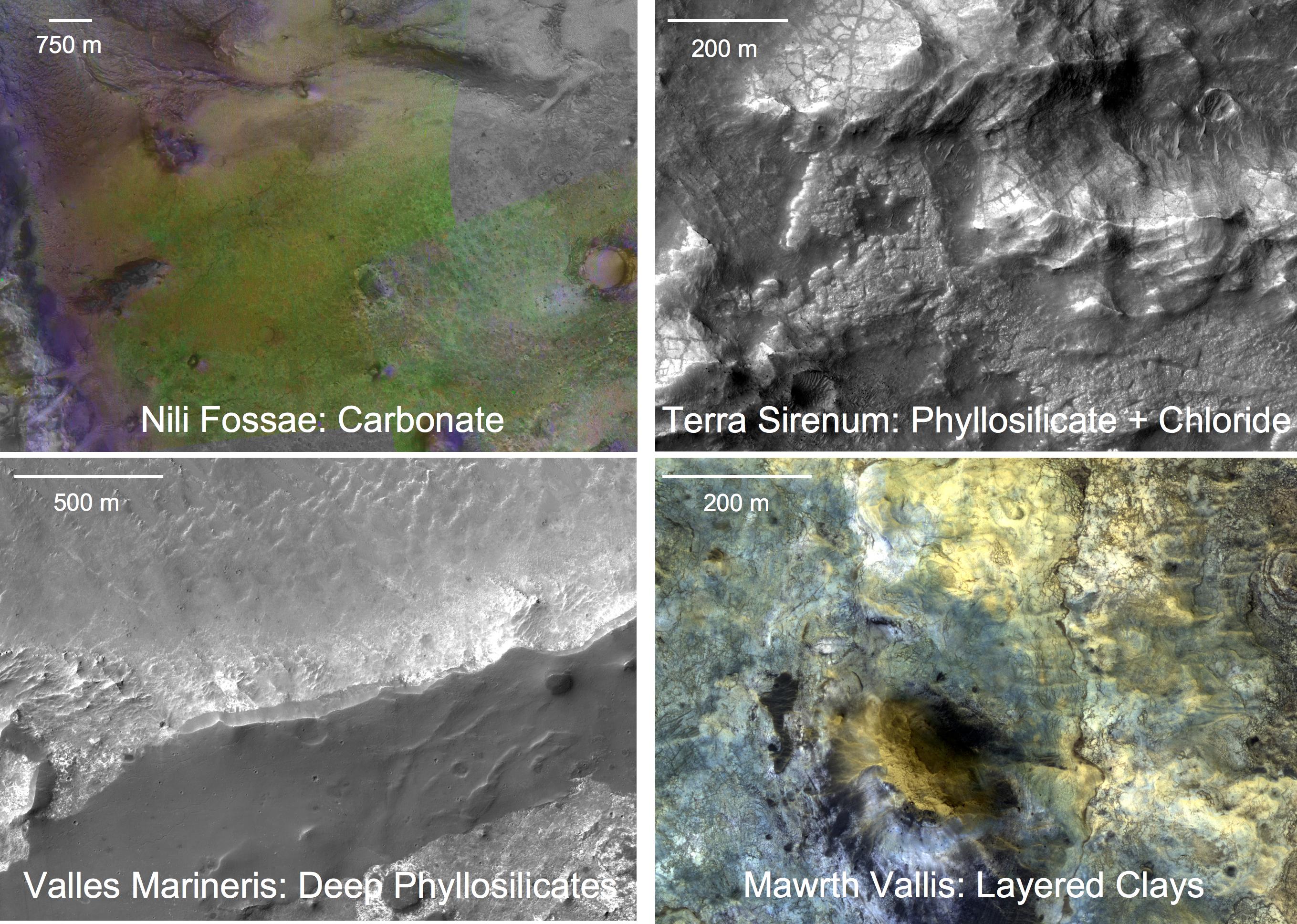
Terra Sirenum is a large region in the southern hemisphere of the planet Mars. It is centered at and covers 3900 km at its broadest extent. It covers latitudes 10 to 70 South and longitudes 110 to 180 W. Terra Sirenum is an upland area notable for massive cratering including the large Newton Crater. Terra Sirenum is in the Phaethontis quadrangle and the Memnonia quadrangle of Mars. A low area in Terra Sirenum is believed to have once held a lake that eventually drained through Ma'adim Vallis. Terra Sirenum is named after the Sirens, who were birds with the heads of girls. In the ''Odyssey'' these girls captured passing seamen and killed them. Chloride deposits Evidence of deposits of chloride based minerals in Terra Sirenum was discovered by the 2001 Mars Odyssey orbiter's Thermal Emission Imaging System in March 2008. The deposits are approximately 3.5 to 3.9 billion years old. This suggests that near-surface water was widespread in early Martian history, which h ... [...More Info...] [...Related Items...] OR: [Wikipedia] [Google] [Baidu] |
Noachian Period
The Noachian is a geologic system and early time period on the planet Mars characterized by high rates of meteorite and asteroid impacts and the possible presence of abundant surface water. The absolute age of the Noachian period is uncertain but probably corresponds to the lunar Pre-Nectarian to Early Imbrian periods of 4100 to 3700 million years ago, during the interval known as the Late Heavy Bombardment. Many of the large impact basins on the Moon and Mars formed at this time. The Noachian Period is roughly equivalent to the Earth's Hadean and early Archean eons when the first life forms likely arose. Noachian-aged terrains on Mars are prime spacecraft landing sites to search for fossil evidence of life. During the Noachian, the atmosphere of Mars was denser than it is today, and the climate possibly warm enough to allow rainfall. Large lakes and rivers were present in the southern hemisphere, and an ocean may have covered the low-lying northern plains. Extensive volcanism o ... [...More Info...] [...Related Items...] OR: [Wikipedia] [Google] [Baidu] |
Atlantis Chaos
Atlantis Chaos is a region of chaos terrain in the Phaethontis quadrangle of Mars. It is located around 34.7° south latitude, and 177.6° west longitude. It is encompassed by the Atlantis basin. The region is across, and was named after an albedo feature at 30° S, 173° W. Mapmariner.jpg, Map showing relative positions of Atlantis Chaos, Gorgonum Chaos, Magelhaens Crater and Simois Colles See also * List of areas of chaos terrain on Mars This is a list of areas of chaos terrain officially named by the International Astronomical Union on the planet Mars. Chaos terrain (or chaotic terrain) is an astrogeological term used to denote planetary surface areas where features such as ridg ... References External links Phaethontis quadrangle Chaotic terrains on Mars {{Mars-stub ... [...More Info...] [...Related Items...] OR: [Wikipedia] [Google] [Baidu] |
Chaos Terrain
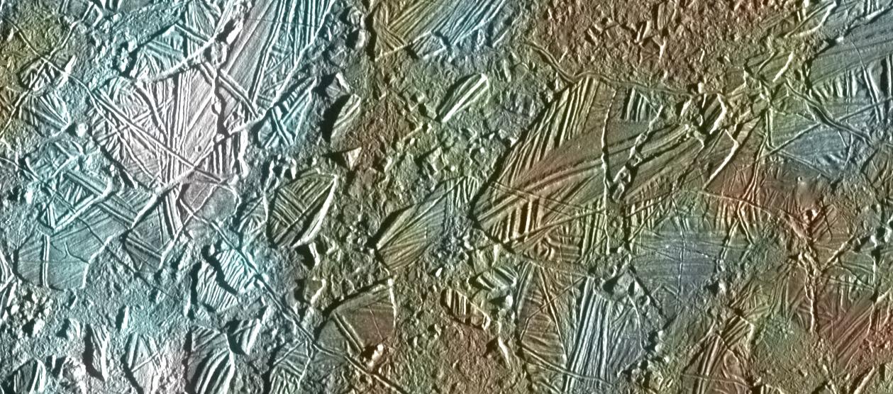
In astrogeology, chaos terrain, or chaotic terrain, is a planetary surface area where features such as ridges, cracks, and plains appear jumbled and enmeshed with one another. Chaos terrain is a notable feature of the planets Mars and Mercury, Jupiter's moon Europa, and the dwarf planet Pluto. In scientific nomenclature, "chaos" is used as a component of proper nouns (e.g., "Aureum Chaos" on Mars). On Mars Wikichaosmap.jpg, Tography map of Oxia Palus region of Mars showing the location of a number of chaos regions Mapbeer.jpg, Map showing location of Arsinoes Chaos (far left), Iani Chaos, Aureum Chaos, Margaritifer Chaos, and other nearby features Image:Margaritifer Sinus Map.JPG, Map of Margaritifer Sinus quadrangle with major features labeled. Aureum Chaos is near the top of the map. Image:Canyons and Mesas of Aureum Chaos in Oxia Palus.JPG, Huge canyons in Aureum Chaos, as seen by THEMIS. Gullies are rare at this latitude. Image from Margaritifer Sinus quadrangle. Im ... [...More Info...] [...Related Items...] OR: [Wikipedia] [Google] [Baidu] |
Eridania Lake
Eridania Lake is a theorized ancient lake on Mars with a surface area of roughly 1.1 million square kilometers. It is located at the source of the Ma'adim Vallis outflow channel and extends into Eridania quadrangle and the Phaethontis quadrangle. As Eridania Lake dried out in the late Noachian epoch it divided into a series of smaller lakes. PIA22059 fig1eridaniadepths.jpg, Map showing estimated water depth in different parts of Eridania Sea This map is about 850 km (530 miles) across. PIA22059 fig1eridaniadepthslabeled.jpg, Features around Eridania Sea labeled Later research with CRISM found thick deposits, greater than 400 meters thick, that contained the minerals saponite, talc-saponite, Fe-rich mica (for example, glauconite-nontronite), Fe- and Mg-serpentine, Mg-Fe-Ca-carbonate and probable Fe- sulphide. The Fe-sulphide probably formed in deep water from water heated by volcanoes. Such a process, classified as hydrothermal may have been a place where life be ... [...More Info...] [...Related Items...] OR: [Wikipedia] [Google] [Baidu] |
Dike (geology)
A dike or dyke, in Geology, geological usage, is a sheet of rock that is formed in a Fracture (geology), fracture of a pre-existing rock body. Dikes can be either Intrusive rock, magmatic or Sedimentary rock, sedimentary in origin. Magmatic dikes form when magma flows into a crack then solidifies as a sheet intrusion, either cutting across layers of rock or through a contiguous mass of rock. Clastic dikes are formed when sediment fills a pre-existing crack.Essentials of Geology, 3rd Ed, Stephen Marshak Magmatic dikes A magmatic dike is a sheet of igneous rock that cuts across older rock beds. It is formed when magma fills a fracture in the older beds and then cools and solidifies. The dike rock is usually more resistant to weathering than the surrounding rock, so that erosion exposes the dike as a natural wall or ridge. It is from these natural walls that dikes get their name. Dikes preserve a record of the fissures through which most mafic magma (fluid magma low in silica) reac ... [...More Info...] [...Related Items...] OR: [Wikipedia] [Google] [Baidu] |
Gullies
A gully is a landform created by running water, mass movement, or commonly a combination of both eroding sharply into soil or other relatively erodible material, typically on a hillside or in river floodplains or terraces. Gullies resemble large ditches or small valleys, but are metres to tens of metres in depth and width and are characterised by a distinct 'headscarp' or 'headwall' and progress by headward (i.e. upstream) erosion. Gullies are commonly related to intermittent or ephemeral water flow usually associated with localised intense or protracted rainfall events, or snowmelt. Gullies can be formed and accelerated by cultivation practices on hillslopes (often gentle gradient) in farmland, and they can develop rapidly in rangelands from existing natural erosion forms subject to vegetative cover removal and livestock activity. Etymology The earliest known usage of the term is from 1657. It originates from the French word ''goulet'', a diminutive form of ''goule'' which m ... [...More Info...] [...Related Items...] OR: [Wikipedia] [Google] [Baidu] |
Hydrothermal Activity
Hydrothermal circulation in its most general sense is the circulation of hot water (Ancient Greek ὕδωρ, ''water'',Liddell, H.G. & Scott, R. (1940). ''A Greek-English Lexicon. revised and augmented throughout by Sir Henry Stuart Jones. with the assistance of. Roderick McKenzie.'' Oxford: Clarendon Press. and θέρμη, ''heat'' ). Hydrothermal circulation occurs most often in the vicinity of sources of heat within the Earth's crust. In general, this occurs near volcanic activity, but can occur in the shallow to mid crust along deeply penetrating fault irregularities or in the deep crust related to the intrusion of granite, or as the result of orogeny or metamorphism. Seafloor hydrothermal circulation Hydrothermal circulation in the oceans is the passage of the water through mid-oceanic ridge systems. The term includes both the circulation of the well-known, high-temperature vent waters near the ridge crests, and the much-lower-temperature, diffuse flow of water through sedim ... [...More Info...] [...Related Items...] OR: [Wikipedia] [Google] [Baidu] |
Geography Of Mars
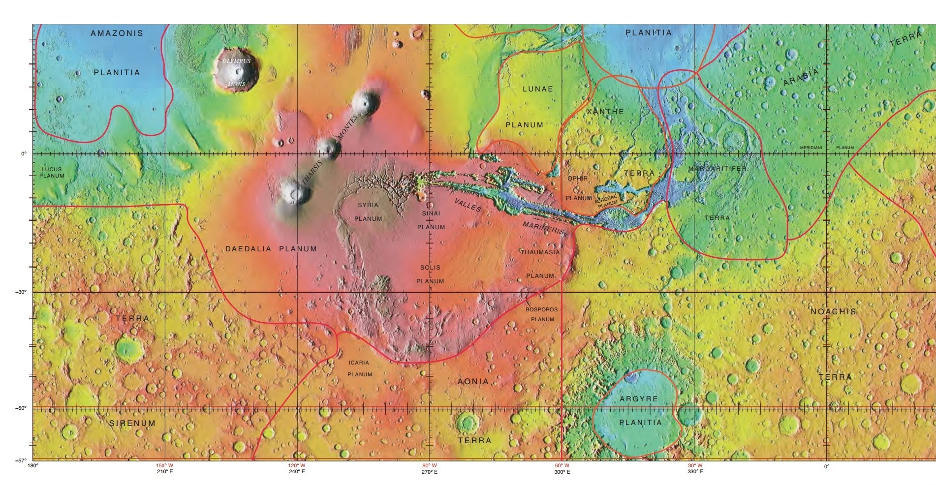
Areography, also known as the geography of Mars, is a subfield of planetary science that entails the delineation and characterization of regions on Mars. Areography is mainly focused on what is called physical geography on Earth; that is the distribution of physical features across Mars and their cartographic representations. History The first detailed observations of Mars were from ground-based telescopes. The history of these observations are marked by the oppositions of Mars, when the planet is closest to Earth and hence is most easily visible, which occur every couple of years. Even more notable are the perihelic oppositions of Mars which occur approximately every 16 years, and are distinguished because Mars is closest to earth and Jupiter perihelion making it even closer to Earth. In September 1877, (a perihelic opposition of Mars occurred on September 5), Italian astronomer Giovanni Schiaparelli published the first detailed map of Mars. These maps notably contained feat ... [...More Info...] [...Related Items...] OR: [Wikipedia] [Google] [Baidu] |
Areas Of Chaos Terrain On Mars
This is a list of areas of chaos terrain officially named by the International Astronomical Union on the planet Mars. Chaos terrain (or chaotic terrain) is an astrogeological term used to denote planetary surface areas where features such as ridges, cracks, and plains appear jumbled and enmeshed with one another. Coordinates are in planetocentric latitude with east longitude. Areas of chaos terrain are usually named after a nearby albedo feature as in line with the IAU's rules on planetary nomenclature. Such an albedo feature must feature on the maps of Mars made by either Giovanni Schiaparelli or Eugène Michel Antoniadi and are listed at Classical albedo features on Mars. References This list was adapted from the public domaiGazetteer of Planetary Nomenclature courtesy of the United States Geological Survey The United States Geological Survey (USGS), formerly simply known as the Geological Survey, is a scientific agency of the United States government. The scientis ... [...More Info...] [...Related Items...] OR: [Wikipedia] [Google] [Baidu] |


.jpg)
