|
At-Bashy
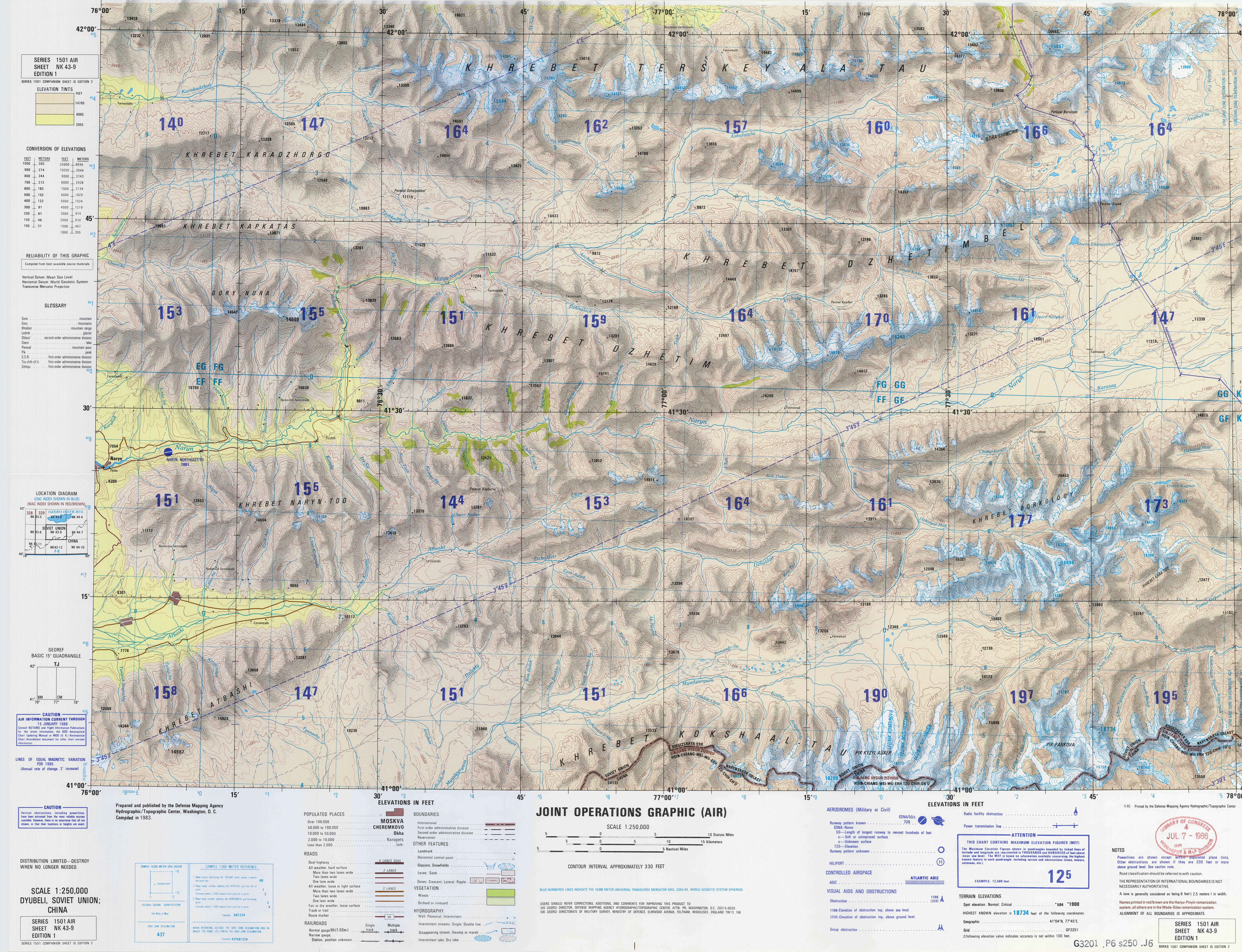
At-Bashy ( Kyrgyz: Ат-Башы) is a village in the Naryn Region of Kyrgyzstan, about 35km southwest of Naryn on the main highway to the Torugart Pass. It is the seat of At-Bashy District. The At-Bashy Range to the south extends to Lake Chatyr-Kul. The river At-Bashy comes in from the east and then runs northwest through a gorge in the Baybiche-Too range to join the Naryn near Dostuk Dostuk ( ky, Достук) is a village in Naryn District of Naryn Region of Kyrgyzstan on the river Naryn and highway A361 about 35 km west of Naryn. Its population was 750 in 2021. Until 2012 it was an urban-type settlement Urban-type .... It is the last considerable settlement before the Chinese border. The highway, built in 1906, runs southwest between the Baybiche-Too and At-Bashy ranges before turning south and then east to reach the pass. Its population was 14,655 in 2021. Population References Populated places in Naryn Region {{Naryn-geo-stub ... [...More Info...] [...Related Items...] OR: [Wikipedia] [Google] [Baidu] |
At-Bashy District
At-Bashy () is a district of Naryn Region in Kyrgyzstan. The administrative center is at At-Bashy. Its area is , and its resident population was 55,771 in 2021. The mountain lake Chatyr-Kul lies in the southwestern part of the district. Population Rural communities and villages In total, At-Bashy District includes 19 settlements in 11 rural communities (). Each rural community includes one or several villages. The rural communities and settlements in the At-Bashy District are as follows: # Acha-Kayyngdy (seat: Acha-Kayyngdy) # Ak-Jar (seat: Ak-Jar) # Ak-Moyun (seat: Ak-Moyun; incl. Birdik) # Ak-Muz (sea ... [...More Info...] [...Related Items...] OR: [Wikipedia] [Google] [Baidu] |
At-Bashy (river)
The At-Bashy ( ky, Ат-Башы) is a left tributary of the Naryn in Naryn Region of Kyrgyzstan. The river is formed at the north slope of Jangy-Jer Range by confluence of the rivers Ulan and Jangy-Jer. It flows into the Naryn near Dostuk Dostuk ( ky, Достук) is a village in Naryn District of Naryn Region of Kyrgyzstan on the river Naryn and highway A361 about 35 km west of Naryn. Its population was 750 in 2021. Until 2012 it was an urban-type settlement Urban-type .... It is long, and has a drainage basin of . Average altitude - 3,060 m, annual average flow rate - 33.1 m³/s, and average specific discharge - 5.98 L/s•km2. Settlements located along the banks of the At-Bashy include: At-Bashy, Bash-Kayyngdy, Birinchi May and Taldy-Suu. References Rivers of Kyrgyzstan {{Kyrgyzstan-river-stub ... [...More Info...] [...Related Items...] OR: [Wikipedia] [Google] [Baidu] |
Naryn (river)
The Naryn ( ky, Нарын, uz, Norin) rises in the Tian Shan mountains in Kyrgyzstan, Central Asia, flowing west through the Fergana Valley into Uzbekistan. Here it merges with the Kara Darya (near Namangan) to form the Syr Darya. It is long (together with its upper course Chong-Naryn) and its basin area is . It has an annual flow of . The river contains many reservoirs which are important in the generation of hydroelectricity. The largest of these is the Toktogul Reservoir in Kyrgyzstan containing of water. Dams downstream of the Toktogul in Kyrgyzstan include: Kürpsay, Tash-Kömür, Shamaldy-Say and Üch-Korgon. Upstream of Toktogul in Kyrgyzstan is the Kambar-Ata-2 and At-Bashy Dams while the Kambar-Ata-1 Dam is in planning stages. Some places along the river: Kyrgyzstan: Kara-Say (see Barskoon), Naryn Region, Naryn, Dostuk, Jalal-Abad Region, Kazarman, Toktogul Reservoir, Kara-Köl, Tash-Kömür. Tributaries The main tributaries of the Naryn are, from source to mo ... [...More Info...] [...Related Items...] OR: [Wikipedia] [Google] [Baidu] |
Naryn Region
Naryn Region ( ky, Нарын облусу, Naryn oblusu; russian: Нарынская область, Narynskaya oblast) is the largest region ('' oblus'') of Kyrgyzstan. It is located in the east of the country and borders with Chüy Region in the north, Issyk-Kul Region in the northeast, Xinjiang Uyghur Autonomous Region of China in the southeast, Osh Region in the southwest, and Jalal-Abad Region in the west. Its capital is Naryn. Its total area is . The resident population of the region was 292,140 as of January 2021. The main highway runs from the Chinese border at Torugart Pass north to Balykchy on Issyk-Kul Lake. It is known as the location of Song Köl Lake and Chatyr-Kul Lake and Tash Rabat. The population of Naryn oblast is 99% Kyrgyz. The economy is dominated by animal herding (sheep, horses, yaks), with wool and meat as the main products. Mining of various minerals developed during the Soviet era has largely been abandoned as uneconomical. Today the oblast is co ... [...More Info...] [...Related Items...] OR: [Wikipedia] [Google] [Baidu] |
Kyrgyzstan
Kyrgyzstan,, pronounced or the Kyrgyz Republic, is a landlocked country in Central Asia. Kyrgyzstan is bordered by Kazakhstan to the north, Uzbekistan to the west, Tajikistan to the south, and the People's Republic of China to the east. Its capital and largest city is Bishkek. Ethnic Kyrgyz make up the majority of the country's seven million people, followed by significant minorities of Uzbeks and Russians. The Kyrgyz language is closely related to other Turkic languages. Kyrgyzstan's history spans a variety of cultures and empires. Although geographically isolated by its highly mountainous terrain, Kyrgyzstan has been at the crossroads of several great civilizations as part of the Silk Road along with other commercial routes. Inhabited by a succession of tribes and clans, Kyrgyzstan has periodically fallen under larger domination. Turkic nomads, who trace their ancestry to many Turkic states. It was first established as the Yenisei Kyrgyz Khaganate later in the ... [...More Info...] [...Related Items...] OR: [Wikipedia] [Google] [Baidu] |
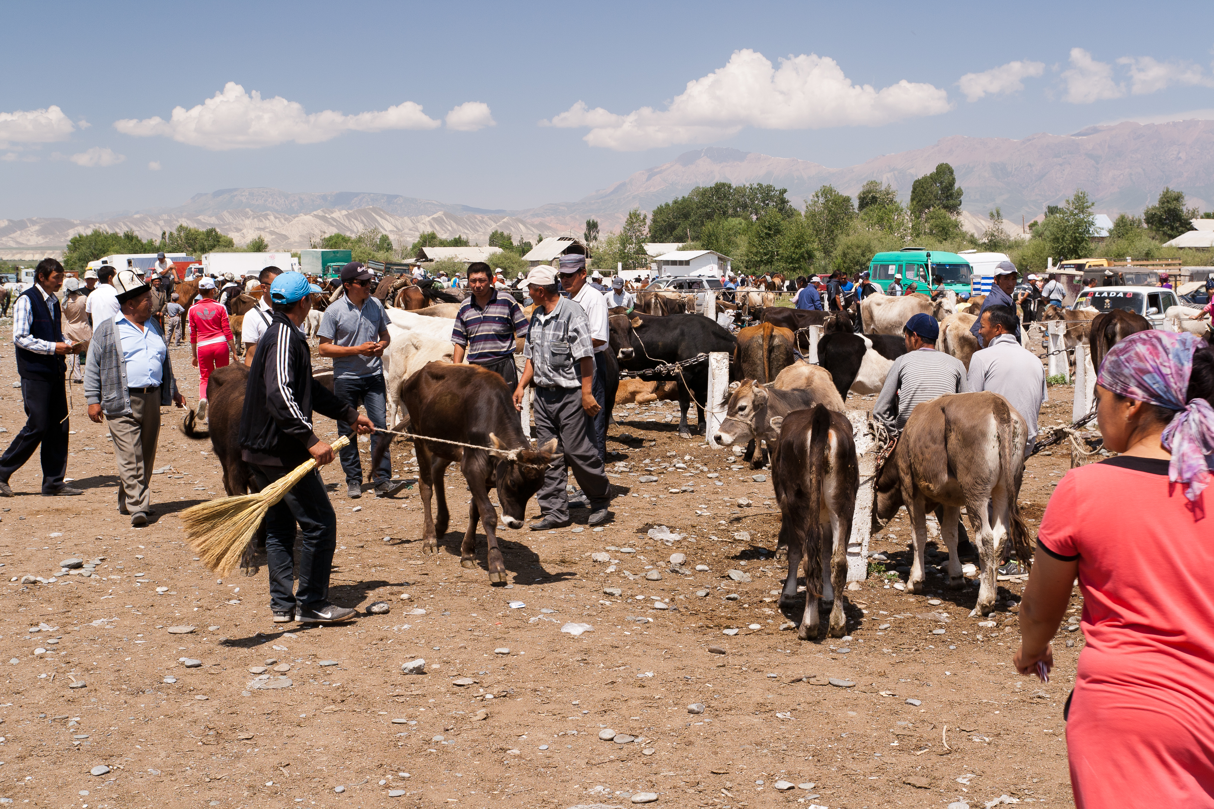
Livestock Market At-Bashi
Livestock are the domesticated animals raised in an agricultural setting to provide labor and produce diversified products for consumption such as meat, eggs, milk, fur, leather, and wool. The term is sometimes used to refer solely to animals who are raised for consumption, and sometimes used to refer solely to farmed ruminants, such as cattle, sheep, goats and pigs. Horses are considered livestock in the United States. The USDA classifies pork, veal, beef, and lamb (mutton) as livestock, and all livestock as red meat. Poultry and fish are not included in the category. The breeding, maintenance, slaughter and general subjugation of livestock, called ''animal husbandry'', is a part of modern agriculture and has been practiced in many cultures since humanity's transition to farming from hunter-gatherer lifestyles. Animal husbandry practices have varied widely across cultures and time periods. It continues to play a major economic and cultural role in numerous communities. Livestoc ... [...More Info...] [...Related Items...] OR: [Wikipedia] [Google] [Baidu] |
Kyrgyz Language
Kyrgyz (; autonym: , tr. ''Kyrgyz tili'', ) is a Turkic language of the Kipchak branch spoken in Central Asia. Kyrgyz is the official language of Kyrgyzstan and a significant minority language in the Kizilsu Kyrgyz Autonomous Prefecture in Xinjiang, China and in the Gorno-Badakhshan Autonomous Region of Tajikistan. There is a very high level of mutual intelligibility between Kyrgyz, Kazakh, and Altay. A dialect of Kyrgyz known as Pamiri Kyrgyz is spoken in Afghanistan and Pakistan. Kyrgyz is also spoken by many ethnic Kyrgyz through the former Soviet Union, Afghanistan, Turkey, parts of northern Pakistan, and Russia. Kyrgyz was originally written in Göktürk script, gradually replaced by the Perso-Arabic alphabet (in use until 1928 in the USSR, still in use in China). Between 1928 and 1940 a Latin-script alphabet, the Uniform Turkic Alphabet, was used. In 1940, Soviet authorities replaced the Latin script with the Cyrillic alphabet for all Turkic countries. When Kyrgy ... [...More Info...] [...Related Items...] OR: [Wikipedia] [Google] [Baidu] |
Naryn
Naryn ( ky, Нарын, translit=Naryn, Mongolian : Нарийн, Nariin, Traditional Mongolian ᠨᠠᠷᠢᠨ) is the regional administrative center of Naryn Region in central Kyrgyzstan. Its area is , and its estimated population was 41,178 as of January 2021. The town was established as a fortress on the caravan route in 1868. It is situated on both banks of the river Naryn (one of the main head waters of the Syr Darya), which cuts a picturesque gorge through the town. The city has two regional museums and some hotels, but is otherwise residential. History Naryn was established as a fortress on the important caravan route between Kashgar and Zhetysu (Semirechye) at the direction of the first Governor-General of Russian Turkestan Konstantin Petrovich von Kaufmann in 1868. Overview From Naryn, the main road (one of the branches of the ancient Silk Road) runs south through the sparsely settled central Kyrgyz highlands to the Torugart Pass and China. At present, this is the ... [...More Info...] [...Related Items...] OR: [Wikipedia] [Google] [Baidu] |
Torugart Pass
Torugart Pass (; ; ) is a mountain pass in the Tian Shan mountain range near the border between the Naryn Region of Kyrgyzstan and the Xinjiang Autonomous Region of China. It is one of two border crossings between Kyrgyzstan and China, the other being Erkeshtam, some 165 km (103 mi) to the southwest. The scenic lake Chatyr-Köl lies near the pass on the Kyrgyz side. The road to Naryn and then to Balykchy and Bishkek—stretching for some —is narrow and in winter often impassable due to heavy snowfall and frequent avalanches. On the Chinese side, the Torugart Port of Entry (吐尔尕特口岸), where travelers must clear for customs, is located about from the pass itself in Ulugqat County of the Kizilsu Kirghiz Autonomous Prefecture. Distances from the pass to major cities are: to Ulugqat, to Kashgar, to Artux and some to Ürümqi. The pass is also terminus of European route E125 and, under the new National Highway plans, the China National Highway ... [...More Info...] [...Related Items...] OR: [Wikipedia] [Google] [Baidu] |
Baybiche Too
The Baybiche Too (or Baybichetoo) ( ky, Байбичетоо) is a mountain range in the central Tien-Shan separating the Middle Naryn and Atbashi valleys. The range runs 140 km along its axis with the highest elevation at 4,337 m. The range is composed of uplifted Paleozoic limestones, schists, and granite Granite () is a coarse-grained (phaneritic) intrusive igneous rock composed mostly of quartz, alkali feldspar, and plagioclase. It forms from magma with a high content of silica and alkali metal oxides that slowly cools and solidifies undergro ...s. References Mountain ranges of Kyrgyzstan {{Kyrgyzstan-geo-stub ... [...More Info...] [...Related Items...] OR: [Wikipedia] [Google] [Baidu] |
Dostuk
Dostuk ( ky, Достук) is a village in Naryn District of Naryn Region of Kyrgyzstan on the river Naryn and highway A361 about 35 km west of Naryn. Its population was 750 in 2021. Until 2012 it was an urban-type settlement Urban-type settlementrussian: посёлок городско́го ти́па, translit=posyolok gorodskogo tipa, abbreviated: russian: п.г.т., translit=p.g.t.; ua, селище міського типу, translit=selyshche mis'koho typu, ab .... Population References External linksDostuk Map– Maplandia.com Populated places in Naryn Region {{Naryn-geo-stub ... [...More Info...] [...Related Items...] OR: [Wikipedia] [Google] [Baidu] |


