|
Assawoman Canal
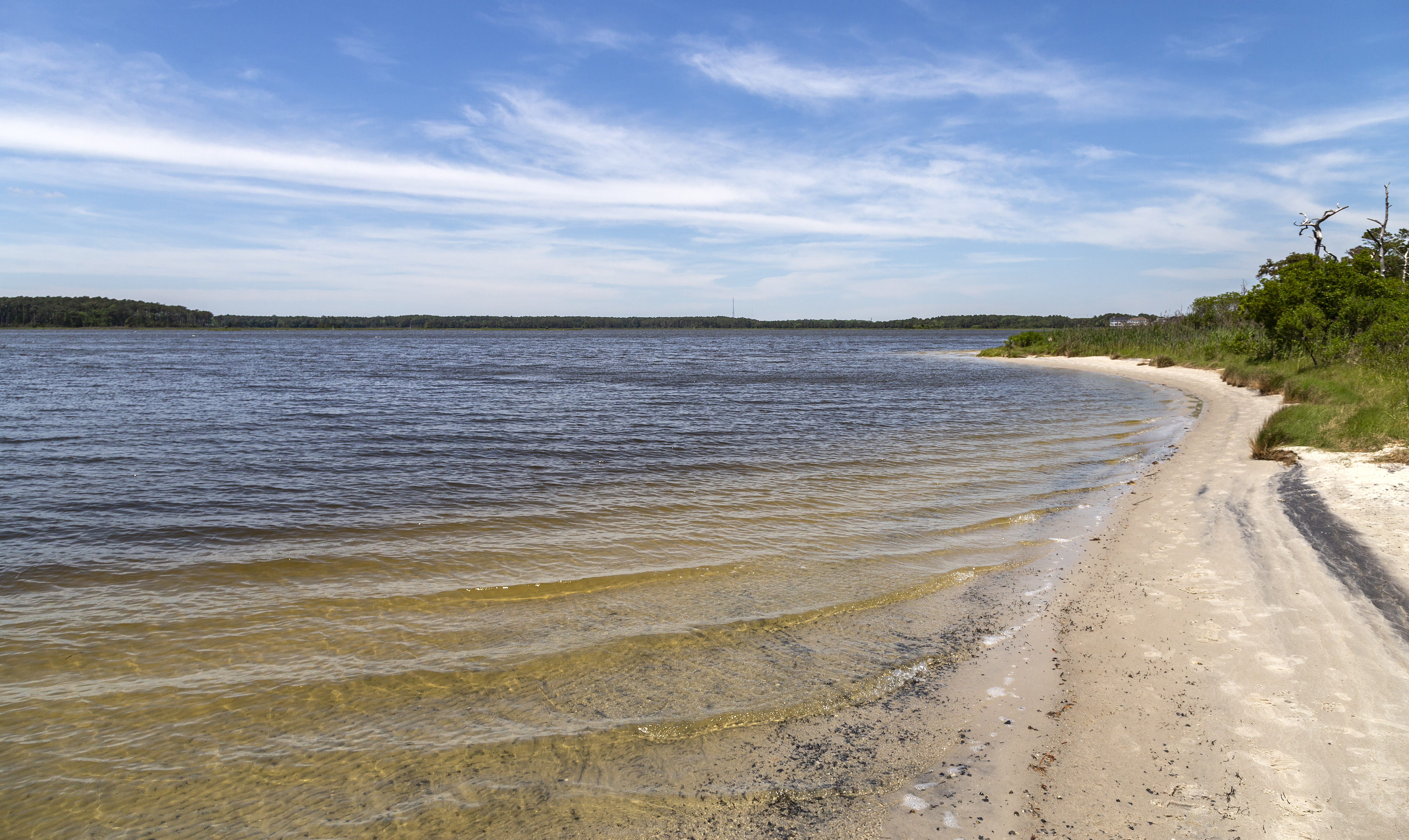
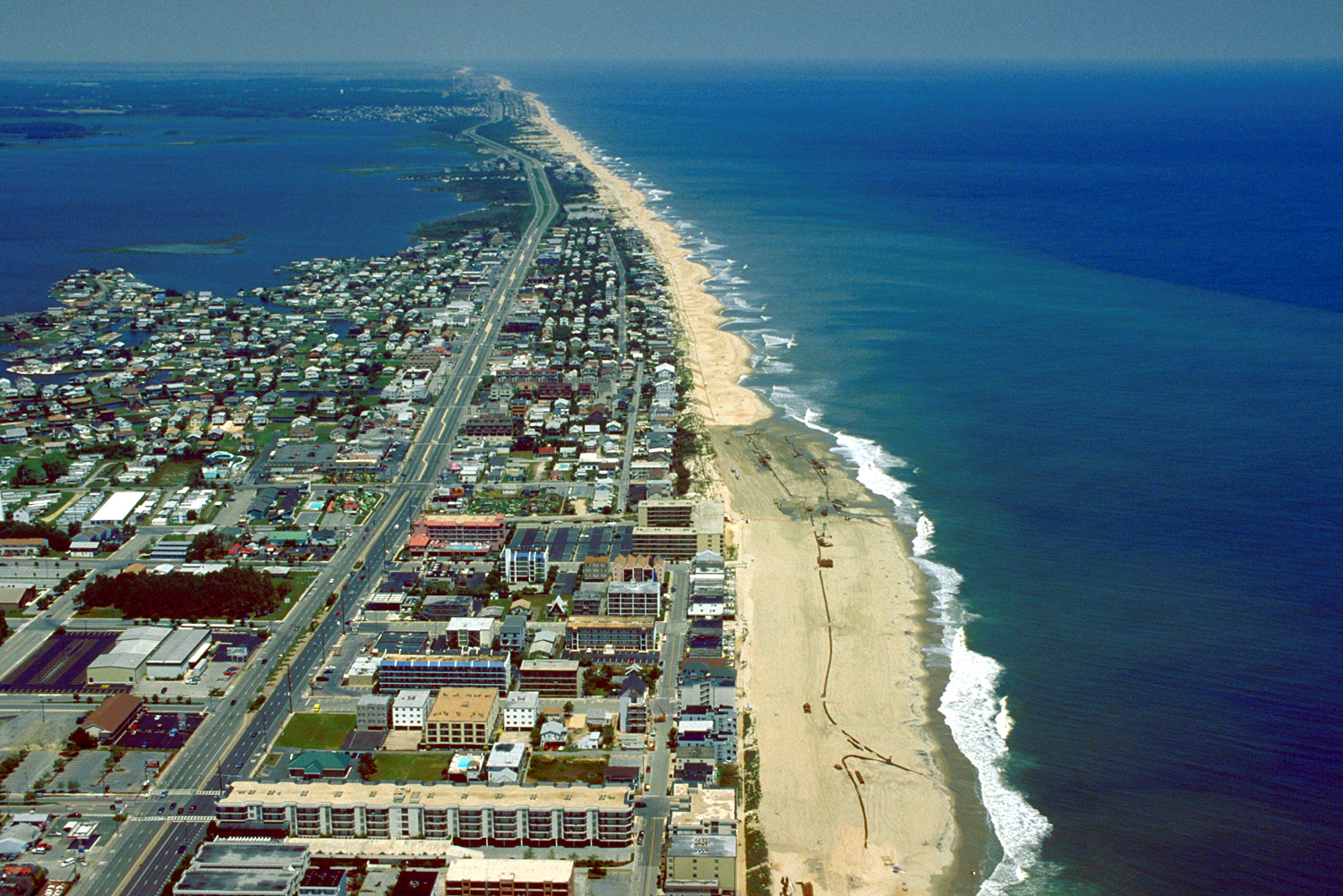
The Assawoman Canal is a canal in Sussex County, Delaware. The canal links the Indian River Bay to the north with the Little Assawoman Bay to the south. It is bordered by Bethany Beach and South Bethany to the east and Ocean View to the west. Because of it, Fenwick Island is detached from the Delaware mainland. First proposed in 1884, the Assawoman Canal was constructed by the U.S. Army Corps of Engineers in 1891 for the purpose of moving goods by boat without having to travel into the Atlantic Ocean. The canal was initially dug by hand in the 1890s by immigrant labor. The canal was not dredged from the 1950s until 2006. By the early 2000s, it was no longer deep enough to handle the boat traffic that once passed through it when it was part of the Intracoastal Waterway The Intracoastal Waterway (ICW) is a inland waterway along the Atlantic and Gulf of Mexico coasts of the United States, running from Massachusetts southward along the Atlantic Seaboard and around the south ... [...More Info...] [...Related Items...] OR: [Wikipedia] [Google] [Baidu] |
Sussex County, Delaware
Sussex County is located in the southern part of the U.S. state of Delaware, on the Delmarva Peninsula. As of the 2020 census, the population was 237,378. The county seat is Georgetown. The first European settlement in the state of Delaware was founded by the Dutch in 1631 near the present-day town of Lewes on the Atlantic Coast. However, Sussex County was not organized until 1683 under English colonial rule. Sussex County is included in the Salisbury, MD-DE Metropolitan Statistical Area which encompasses much of central Delmarva. History Beginnings Archaeologists estimate that the first inhabitants of Sussex County, the southernmost county in Delaware, arrived between 10,000 and 14,000 years ago. Various indigenous cultures occupied the area, especially along the river and the coast, often having seasonal fishing villages. Historic Native Americans in Sussex County were members of Algonquian-speaking tribes, as were most coastal peoples along the Atlantic Coast. By the ... [...More Info...] [...Related Items...] OR: [Wikipedia] [Google] [Baidu] |
United States
The United States of America (U.S.A. or USA), commonly known as the United States (U.S. or US) or America, is a country primarily located in North America. It consists of 50 states, a federal district, five major unincorporated territories, nine Minor Outlying Islands, and 326 Indian reservations. The United States is also in free association with three Pacific Island sovereign states: the Federated States of Micronesia, the Marshall Islands, and the Republic of Palau. It is the world's third-largest country by both land and total area. It shares land borders with Canada to its north and with Mexico to its south and has maritime borders with the Bahamas, Cuba, Russia, and other nations. With a population of over 333 million, it is the most populous country in the Americas and the third most populous in the world. The national capital of the United States is Washington, D.C. and its most populous city and principal financial center is New York City. Paleo-Americ ... [...More Info...] [...Related Items...] OR: [Wikipedia] [Google] [Baidu] |
Intracoastal Waterway
The Intracoastal Waterway (ICW) is a inland waterway along the Atlantic and Gulf of Mexico coasts of the United States, running from Massachusetts southward along the Atlantic Seaboard and around the southern tip of Florida, then following the Gulf Coast to Brownsville, Texas. Some sections of the waterway consist of natural inlets, saltwater rivers, bays, and sounds, while others are artificial canals. It provides a navigable route along its length without many of the hazards of travel on the open sea. Context and early history Since the coastline represented the national border, and commerce of the time was chiefly by water, the fledgling United States government established a degree of national control over it. Inland transportation to supply the coasting trade at the time was less known and virtually undeveloped, but when new lands and their favorable river systems were added with the Northwest Territory in 1787, the Northwest Ordinance established a radically new and f ... [...More Info...] [...Related Items...] OR: [Wikipedia] [Google] [Baidu] |
Indian River Bay
Indian River Bay is a body of water in Sussex County, Delaware. It is part of Delaware's inland bay system, along with Little Assawoman Bay and Rehoboth Bay. Fed by the Indian River at its western end, the bay is connected to the Atlantic Ocean to the east via the Indian River Inlet. A natural waterway that shifted up and down a two-mile (3.2 km) stretch of the coast until 1928, the inlet was kept in its current location by dredging between 1928 and 1937, and in 1938 was fixed in place by the construction of jetties. The Charles W. Cullen Bridge, commonly known as the Indian River Inlet Bridge, spans the inlet. Indian River Bay is unique among Delaware's inland bays in that it is a drowned river valley, whereas Delaware's other bays are estuaries built on sand bars.Delaware Inland Bays Compreh ... [...More Info...] [...Related Items...] OR: [Wikipedia] [Google] [Baidu] |
Little Assawoman Bay
Little Assawoman Bay is a body of water in Sussex County, Delaware, Sussex County, Delaware. It is connected from Assawoman Bay to the south by a narrow canal known locally as "The Ditch," and is connected to Indian River Bay to the north by the Assawoman Canal. It is separated from the Atlantic Ocean by the Fenwick Island (Delaware–Maryland), Fenwick Island barrier spit. References Bays of Delaware Bays of Sussex County, Delaware {{Delaware-geo-stub ... [...More Info...] [...Related Items...] OR: [Wikipedia] [Google] [Baidu] |
Canal
Canals or artificial waterways are waterways or engineered channels built for drainage management (e.g. flood control and irrigation) or for conveyancing water transport vehicles (e.g. water taxi). They carry free, calm surface flow under atmospheric pressure, and can be thought of as artificial rivers. In most cases, a canal has a series of dams and locks that create reservoirs of low speed current flow. These reservoirs are referred to as ''slack water levels'', often just called ''levels''. A canal can be called a ''navigation canal'' when it parallels a natural river and shares part of the latter's discharges and drainage basin, and leverages its resources by building dams and locks to increase and lengthen its stretches of slack water levels while staying in its valley. A canal can cut across a drainage divide atop a ridge, generally requiring an external water source above the highest elevation. The best-known example of such a canal is the Panama Canal. Many ... [...More Info...] [...Related Items...] OR: [Wikipedia] [Google] [Baidu] |
Bethany Beach, Delaware
Bethany Beach is an incorporated town in Sussex County, Delaware, United States. According to the 2010 Census Bureau figures, the population of the town is 1,060; however, during the summer months some 15,000 more populate the town as vacationers. It is part of the Salisbury, MD-DE Metropolitan Statistical Area. Bethany Beach, South Bethany and Fenwick Island are popularly known as "The Quiet Resorts". Contributing to Bethany Beach's reputation as a "quiet" place is the presence of Delaware Seashore State Park immediately to the north of the town. Despite its small size, Bethany Beach contains the usual attractions of a summer seaside resort, including the short Joseph Olson Boardwalk, a broad, sandy beach, motels, restaurants, and vacation homes. Because Bethany Beach does not sit on a barrier island, residential areas continue some distance to the west of the town's limits. Geography Bethany Beach is located at (38.5395564, −75.0551807). The town is bordered to the nort ... [...More Info...] [...Related Items...] OR: [Wikipedia] [Google] [Baidu] |
South Bethany, Delaware
South Bethany is an incorporated town in Sussex County, Delaware, United States. According to the 2010 census, the population of the town is 449, a decrease of 8.7% over the previous decade. It is part of the Salisbury, Maryland-Delaware Metropolitan Statistical Area. South Bethany is popularly considered one of "The Quiet Resorts", along with its direct neighbor to the north, Bethany Beach, and its neighbor to the south, Fenwick Island. This is in contradistinction to the crowded atmosphere of the more popular Dewey Beach and the cosmopolitan bustle of nearby Rehoboth Beach. Assisting South Bethany's reputation as a "quiet" place is the presence of Delaware Seashore State Park – a six-mile-long barrier island providing a substantial buffer from Dewey Beach's noise – to the north of Bethany Beach, as well as the relative quiet provided by a large unincorporated area of private condominiums and multimillion-dollar beach homes between the park and Bethany Beach. To the south, ... [...More Info...] [...Related Items...] OR: [Wikipedia] [Google] [Baidu] |
Ocean View, Delaware
Ocean View is a town in Sussex County, Delaware, United States. The population was 1,882 at the 2010 census, an increase of 87.1% over the previous decade. It is part of the Salisbury, Maryland-Delaware Metropolitan Statistical Area and lies in Baltimore Hundred. Ocean View is fast becoming a bedroom community for the neighboring summer resort of Bethany Beach. Geography Ocean View is located at (38.5451122, –75.0890709). It lies west of the Atlantic Ocean and south of Indian River Bay. The Assawoman Canal borders Ocean View on the east and northeast, and Bethany Beach has a short contiguous border with it on the east. On the northwest and west, White's Creek borders the town, and Millville is contiguous with Ocean View on the west. On the south, Ocean View borders unincorporated portions of Sussex County. According to the United States Census Bureau, the town has a total area of , all of it land. Ocean View contains three churches, a school, and a town park. Histor ... [...More Info...] [...Related Items...] OR: [Wikipedia] [Google] [Baidu] |
Fenwick Island (Delaware–Maryland)
Fenwick Island is a barrier island along the Atlantic Ocean in Delaware and Maryland in the United States. It contains the communities of South Bethany and Fenwick Island in Delaware along with Ocean City, Maryland. Until 1933, it was attached to Assateague Island to the south. That year, a hurricane carved an inlet between the two landforms, which was made permanent. If not for the Assawoman Canal, constructed by the U.S. Army Corps of Engineers , colors = , anniversaries = 16 June (Organization Day) , battles = , battles_label = Wars , website = , commander1 = ... in 1891, the island would be attached to the mainland of Delaware. References Barrier islands of Delaware Barrier islands of Maryland Landforms of Sussex County, Delaware Landforms of Worcester County, Maryland Spits of the United States Islands of Maryland {{Worcest ... [...More Info...] [...Related Items...] OR: [Wikipedia] [Google] [Baidu] |
United States Army Corps Of Engineers
, colors = , anniversaries = 16 June (Organization Day) , battles = , battles_label = Wars , website = , commander1 = LTG Scott A. Spellmon , commander1_label = Chief of Engineers and Commanding General of the U.S. Army Corps of Engineers , commander2 = MGbr>Richard J. Heitkamp, commander2_label = Deputy Chief of Engineers and Deputy Commanding General , commander3 = MGKimberly M. Colloton, commander3_label = Deputy Commanding General for Military and International Operations , commander4 = MGbr>William H. Graham, commander4_label = Deputy Commanding General for Civil and Emergency Operations , commander5 = COLbr>James J. Handura, commander5_label = Chief of Staff for the U.S. Army Corps of Engi ... [...More Info...] [...Related Items...] OR: [Wikipedia] [Google] [Baidu] |
Atlantic Ocean
The Atlantic Ocean is the second-largest of the world's five oceans, with an area of about . It covers approximately 20% of Earth's surface and about 29% of its water surface area. It is known to separate the " Old World" of Africa, Europe and Asia from the "New World" of the Americas in the European perception of the World. The Atlantic Ocean occupies an elongated, S-shaped basin extending longitudinally between Europe and Africa to the east, and North and South America to the west. As one component of the interconnected World Ocean, it is connected in the north to the Arctic Ocean, to the Pacific Ocean in the southwest, the Indian Ocean in the southeast, and the Southern Ocean in the south (other definitions describe the Atlantic as extending southward to Antarctica). The Atlantic Ocean is divided in two parts, by the Equatorial Counter Current, with the North(ern) Atlantic Ocean and the South(ern) Atlantic Ocean split at about 8°N. Scientific explorations of the A ... [...More Info...] [...Related Items...] OR: [Wikipedia] [Google] [Baidu] |


