|
Aspetuck Reservoir
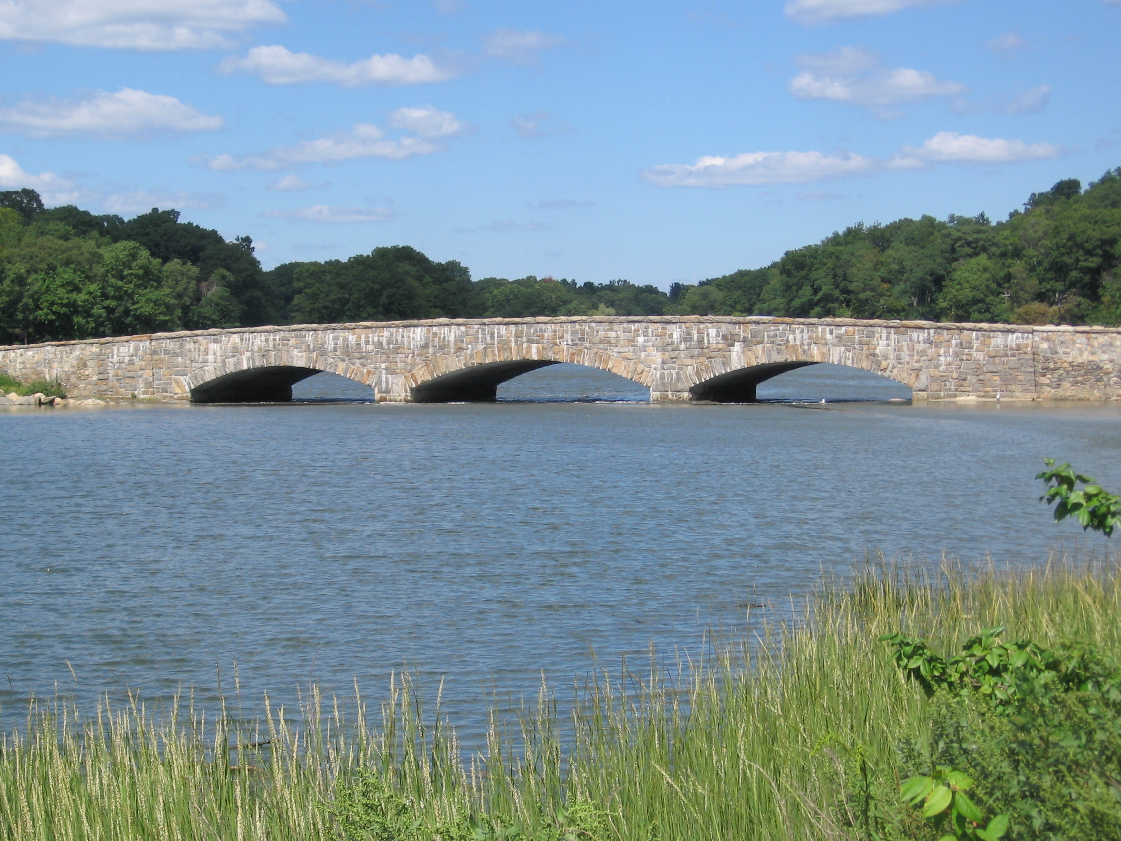
The Aspetuck Reservoir is a large body of water in Fairfield County, Connecticut. It is formed on the Aspetuck River The Aspetuck River is a U.S. Geological Survey. National Hydrography Dataset high-resolution flowline dataThe National Map, accessed April 1, 2011 river in the U.S. state of Connecticut. The river rises in the hills located in Huntington State Par .... All of the Aspetuck River Watershed in Redding, the easternmost quadrant of the Town, drains south to the Aspetuck Reservoir in Easton and Fairfield. References Lakes of Fairfield County, Connecticut Reservoirs in Connecticut Protected areas of Fairfield County, Connecticut {{Connecticut-geo-stub ... [...More Info...] [...Related Items...] OR: [Wikipedia] [Google] [Baidu] |
Fairfield County, Connecticut
Fairfield County is a County (United States), county in the southwestern corner of the U.S. state of Connecticut. It is the List of counties in Connecticut, most populous county in the state and was also its fastest-growing from 2010 to 2020. As of the 2020 United States census, 2020 census, the county's population was 957,419, representing 26.6% of Connecticut's overall population. The closest to the center of the New York metropolitan area, the county contains four of the state's top 7 largest cities—Bridgeport, Connecticut, Bridgeport (1st), Stamford, Connecticut, Stamford (2nd), Norwalk, Connecticut, Norwalk (6th), and Danbury, Connecticut, Danbury (7th)—whose combined population of 433,368 is nearly half the county's total population. The United States Office of Management and Budget has designated Fairfield County as the Greater Bridgeport, Bridgeport-Stamford-Norwalk-Danbury metropolitan statistical area. The United States Census Bureau ranked the metropolitan area a ... [...More Info...] [...Related Items...] OR: [Wikipedia] [Google] [Baidu] |
Reservoir
A reservoir (; from French ''réservoir'' ) is an enlarged lake behind a dam. Such a dam may be either artificial, built to store fresh water or it may be a natural formation. Reservoirs can be created in a number of ways, including controlling a watercourse that drains an existing body of water, interrupting a watercourse to form an embayment within it, through excavation, or building any number of retaining walls or levees. In other contexts, "reservoirs" may refer to storage spaces for various fluids; they may hold liquids or gasses, including hydrocarbons. ''Tank reservoirs'' store these in ground-level, elevated, or buried tanks. Tank reservoirs for water are also called cisterns. Most underground reservoirs are used to store liquids, principally either water or petroleum. Types Dammed valleys Dammed reservoirs are artificial lakes created and controlled by a dam A dam is a barrier that stops or restricts the flow of surface water or underground streams ... [...More Info...] [...Related Items...] OR: [Wikipedia] [Google] [Baidu] |
Aspetuck River
The Aspetuck River is a U.S. Geological Survey. National Hydrography Dataset high-resolution flowline dataThe National Map, accessed April 1, 2011 river in the U.S. state of Connecticut. The river rises in the hills located in Huntington State Park in Bethel, with a watershed of approximately . The river flows generally southerly through Redding, Connecticut, to the Aspetuck Reservoir, the Hemlock Reservoir in Easton and Fairfield and finally into the Saugatuck River in Westport, Connecticut and then into the Long Island Sound. It flows through the village of Aspetuck at an average depth of . The word Aspetuck can be translated as "river originating at the high place" in an Algonquian language. Recreation Hiking The Aspetuck Valley Trail is a Blue-Blazed Trail that follows the general course of the river. Water quality The Aspetuck is one of the cleanest rivers in the state, with an AA rating. See also *List of rivers of Connecticut *East Aspetuck River The East Aspe ... [...More Info...] [...Related Items...] OR: [Wikipedia] [Google] [Baidu] |
Redding, Connecticut
Redding is a town in Fairfield County, Connecticut, United States. The population was 8,765 at the 2020 census. History Early settlement and establishment At the time colonials began receiving grants for land within the boundaries of present-day Redding, Native American trails crossed through portions of the area, including the Berkshire Path running north–south. In 1639, Roger Ludlow (also referenced as Roger Ludlowe in many accounts) purchased land from local Native Americans to establish Fairfield, and in 1668 Fairfield purchased another tract of land then called Northfield, which comprised land that is now part of Redding. "National Register of Historic Places Continuation Sheet, Redding Center Historic District," U.S. Department of the Interior, 1992-10-01. Retrieved 2014-04-30. For settlement purposes, Fairfield authorities divided the newly available land into parcels dubbed "long lots" at the time, which north–south measured no more than a third of a mile wide but ... [...More Info...] [...Related Items...] OR: [Wikipedia] [Google] [Baidu] |
Easton, Connecticut
Easton is a town in Fairfield County, Connecticut, United States. The population was 7,605 at the time of the 2020 census. Easton contains the historic district of Aspetuck and the Plattsville census-designated place. Part of the Greater Bridgeport area, which is in turn a part of the New York metropolitan statistical area, it is bordered by the towns of Fairfield, Connecticut to the south, Redding to the north, Weston to the west, and Monroe and Trumbull to the east. History Easton was first settled in 1757 by men and women from Fairfield. In 1762 a congregation called the North Fairfield Society was established, and it gradually evolved into Easton. In 1787 Weston, then including lands now defined as Easton, was incorporated out of Fairfield. The area was slow to develop because of the rough hills along the Aspetuck River, and so it was not until 1845 that what is now Easton separated from Weston. Today, half of the town's property is owned by the Aquarion Water Company ... [...More Info...] [...Related Items...] OR: [Wikipedia] [Google] [Baidu] |
Fairfield, Connecticut
Fairfield is a town in Fairfield County, Connecticut, United States. It borders the city of Bridgeport and towns of Trumbull, Easton, Weston, and Westport along the Gold Coast of Connecticut. Located within the New York metropolitan area, it is around 43 miles northeast of Midtown Manhattan. As of 2020 the town had a population of 61,512. History Colonial era In 1635, Puritans and Congregationalists in the Massachusetts Bay Colony, were dissatisfied with the rate of Anglican reform, and sought to establish an ecclesiastical society subject to their own rules and regulations. The Massachusetts General Court granted them permission to settle in the towns of Windsor, Wethersfield, and Hartford which is an area now known as Connecticut. On January 14, 1639, a set of legal and administrative regulations called the Fundamental Orders was adopted and established Connecticut as a self-ruling entity. By 1639, these settlers had started new towns in the surrounding areas. ... [...More Info...] [...Related Items...] OR: [Wikipedia] [Google] [Baidu] |
Lakes Of Fairfield County, Connecticut
A lake is an area filled with water, localized in a basin, surrounded by land, and distinct from any river or other outlet that serves to feed or drain the lake. Lakes lie on land and are not part of the ocean, although, like the much larger oceans, they do form part of the Earth's water cycle. Lakes are distinct from lagoons, which are generally coastal parts of the ocean. Lakes are typically larger and deeper than ponds, which also lie on land, though there are no official or scientific definitions. Lakes can be contrasted with rivers or streams, which usually flow in a channel on land. Most lakes are fed and drained by rivers and streams. Natural lakes are generally found in mountainous areas, rift zones, and areas with ongoing glaciation. Other lakes are found in endorheic basins or along the courses of mature rivers, where a river channel has widened into a basin. Some parts of the world have many lakes formed by the chaotic drainage patterns left over from the last ice ... [...More Info...] [...Related Items...] OR: [Wikipedia] [Google] [Baidu] |
Reservoirs In Connecticut
A reservoir (; from French ''réservoir'' ) is an enlarged lake behind a dam. Such a dam may be either artificial, built to store fresh water or it may be a natural formation. Reservoirs can be created in a number of ways, including controlling a watercourse that drains an existing body of water, interrupting a watercourse to form an embayment within it, through excavation, or building any number of retaining walls or levees. In other contexts, "reservoirs" may refer to storage spaces for various fluids; they may hold liquids or gasses, including hydrocarbons. ''Tank reservoirs'' store these in ground-level, elevated, or buried tanks. Tank reservoirs for water are also called cisterns. Most underground reservoirs are used to store liquids, principally either water or petroleum. Types Dammed valleys Dammed reservoirs are artificial lakes created and controlled by a dam constructed across a valley, and rely on the natural topography to provide most of the basin of the re ... [...More Info...] [...Related Items...] OR: [Wikipedia] [Google] [Baidu] |


