|
Asco, Haute-Corse
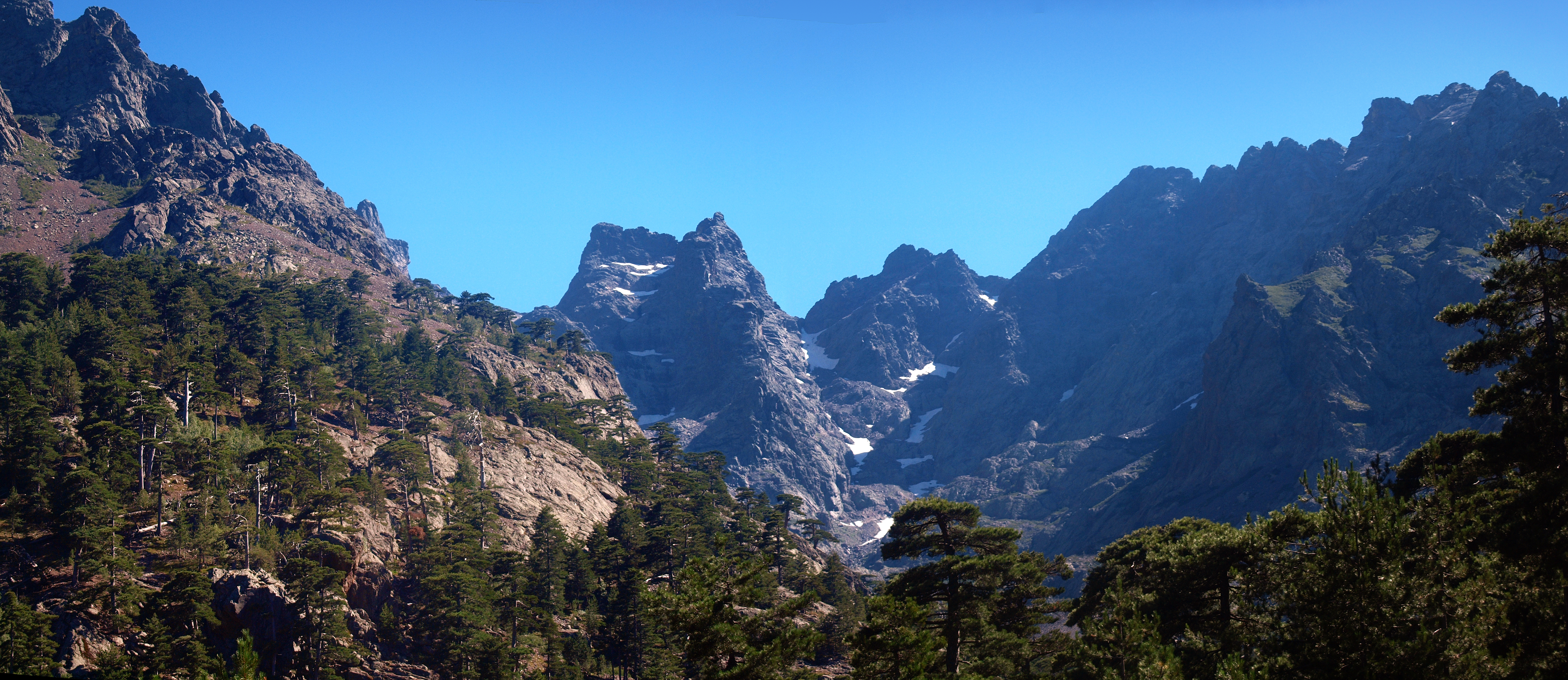
Asco (; co, Ascu, pronounced aËs.ku is a commune in the Haute-Corse department of France on the island of Corsica. The inhabitants of the commune are known as ''Aschesi''. Geography Asco is a remote commune high in the mountains some 20 km in a direct line south-east of Calvi and 15 km north-west of Corte. It is a commune which was part of the former Pieve of Caccia: a historic territory, geographically and culturally, which was made up of Niolo, Giovellina, and the Asco Valley which today is called the High Centre of Corsica. The commune is part of the ten communes in the Canton of Castifao-Morosaglia. It is also located in the ''Parc naturel rĂ©gional de Corse'' (Regional Natural Park of Corsica). Access to the commune The main access to Asco is by the D47 (branches from the N197 at a place called Ponte Rossu 1.5 km north of Ponte-Leccia). The D47 is the road to the villages of Moltifao and Castifao however to get to Asco and the upper valley, th ... [...More Info...] [...Related Items...] OR: [Wikipedia] [Google] [Baidu] |
Communes Of France
The () is a level of administrative division in the French Republic. French are analogous to civil townships and incorporated municipalities in the United States and Canada, ' in Germany, ' in Italy, or ' in Spain. The United Kingdom's equivalent are civil parishes, although some areas, particularly urban areas, are unparished. are based on historical geographic communities or villages and are vested with significant powers to manage the populations and land of the geographic area covered. The are the fourth-level administrative divisions of France. vary widely in size and area, from large sprawling cities with millions of inhabitants like Paris, to small hamlets with only a handful of inhabitants. typically are based on pre-existing villages and facilitate local governance. All have names, but not all named geographic areas or groups of people residing together are ( or ), the difference residing in the lack of administrative powers. Except for the municipal arrondi ... [...More Info...] [...Related Items...] OR: [Wikipedia] [Google] [Baidu] |
Capu A U Verdatu
Capo al Berdato (french: Capu a u Verdatu, co, Capu à u Pardatu) is a mountain in the department of Haute-Corse on the island of Corsica, France. It is in the Monte Cinto massif. Location Capu al Berdato is in the northwest of the island, in the Monte Cinto massif. The commune of Asco is to the north and northeast, Lozzi is to the south and southeast, and Corscia is to the east. The D147 road runs to the north of the mountain down the Asco river valley to the village of Asco. Lac Maggiore is below the peak to the east. Physical Capo al Berdato is at an elevation of and prominence of . It is connected to Monte Cinto to the southwest by the Créte de Sellola, a ridge. Another ridge, the Pianu di Terra Corsica, connects it to the Capu Terra Corsica to the southeast. A third ridge connects it to the Capu Biancu to the northeast. The north and west of the mountain is drained by tributaries of the Asco river The Asco ( co, Ascu) is a small river in the department of Haute-Cor ... [...More Info...] [...Related Items...] OR: [Wikipedia] [Google] [Baidu] |
Olmi-Cappella
Olmi-Cappella (; co, Olmi Ăš Cappella) is a commune in the Haute-Corse department of France on the island of Corsica. Population See also *Communes of the Haute-Corse department The following is a list of the 236 Communes of France, communes of the Haute-Corse Departments of France, department of France. The communes cooperate in the following Communes of France#Intercommunality, intercommunalities (as of 2020): References Communes of Haute-Corse Haute-Corse communes articles needing translation from French Wikipedia {{HauteCorse-geo-stub ...[...More Info...] [...Related Items...] OR: [Wikipedia] [Google] [Baidu] |
Ski Resort
A ski resort is a resort developed for skiing, snowboarding, and other winter sports. In Europe, most ski resorts are towns or villages in or adjacent to a ski area â a mountainous area with pistes (ski trails) and a ski lift system. In North America, it is more common for ski areas to exist well away from towns, so ski resorts usually are destination resorts, often purpose-built and self-contained, where skiing is the main activity. Ski resort Ski resorts are located on both Northern and Southern Hemispheres on all continents except Antarctica. They typically are located on mountains, as they require a large slope. They also need to receive sufficient snow (at least in combination with artificial snowmaking, unless the resort uses dry ski slopes). High concentrations of ski resorts are located in the Alps, Scandinavia, western and eastern North America, and Japan. There are also ski resorts in the Andes, scattered across central Asia, and in Australia and New Zealand. Ext ... [...More Info...] [...Related Items...] OR: [Wikipedia] [Google] [Baidu] |
Corsican Language
Corsican (''corsu'' , ; full name: ''lingua corsa'' , ) is a Romance language constituted by the continuum of the Italo-Romance dialects spoken on the Mediterranean island of Corsica (France) and on the northern end of the island of Sardinia (Italy). Corsican is related to the Tuscan varieties from the Italian peninsula, and therefore also to the Florentine-based standard Italian. Under the long-standing sway of Tuscany's Pisa and Republic of Genoa over Corsica, Corsican used to play the role of a vernacular in combination with Italian functioning as the island's official language. In 1859, Italian was replaced by French, owing to the French acquisition from the Republic of Genoa in 1768. Over the next two centuries, the use of French in the place of Italian grew to the extent that, by the Liberation in 1945, all the islanders had a working knowledge of French. The 20th century saw a language shift, with the islanders changing their language practices to the extent that there ... [...More Info...] [...Related Items...] OR: [Wikipedia] [Google] [Baidu] |
Alder
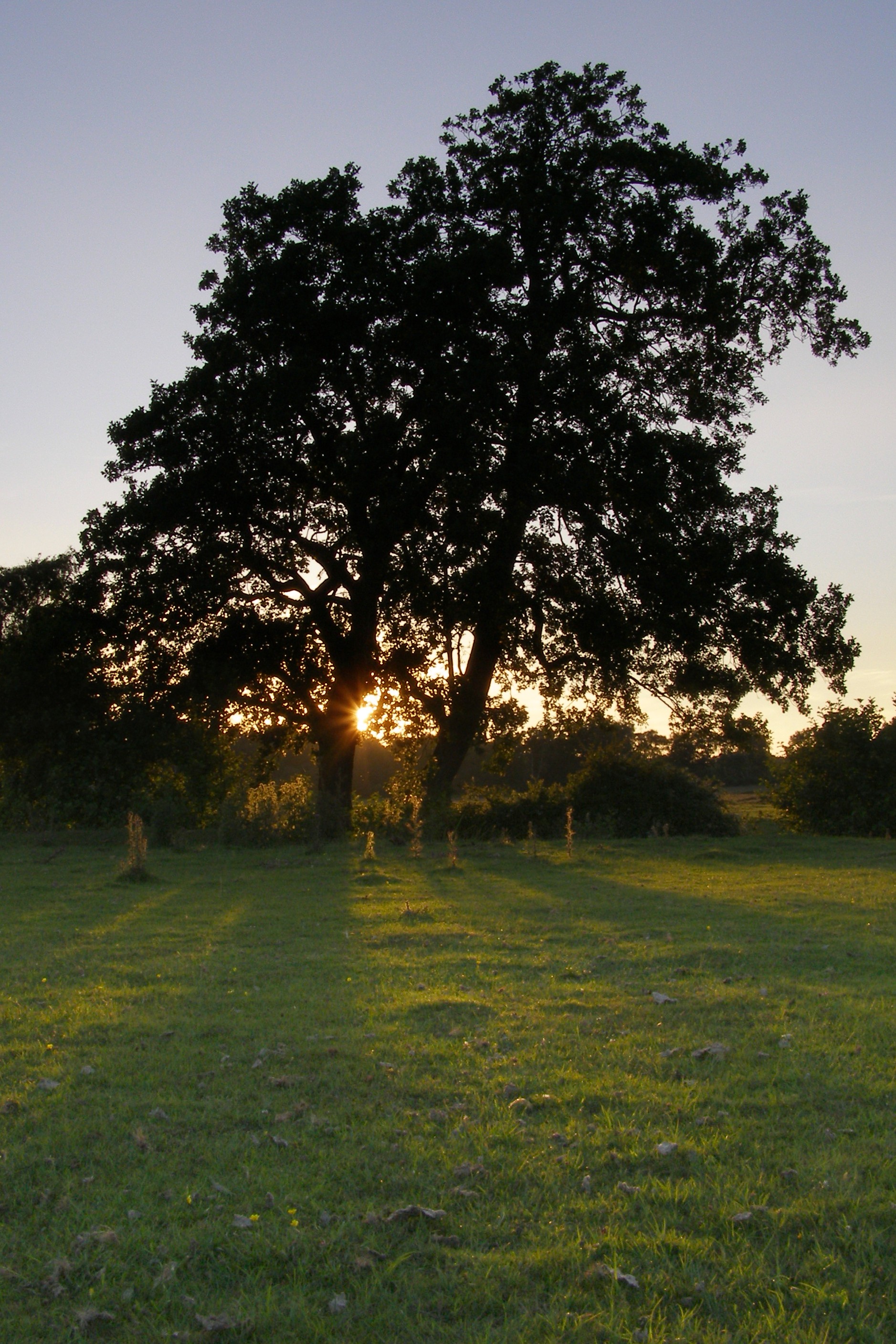
Alders are trees comprising the genus ''Alnus'' in the birch family Betulaceae. The genus comprises about 35 species of monoecious trees and shrubs, a few reaching a large size, distributed throughout the north temperate zone with a few species extending into Central America, as well as the northern and southern Andes. Description With a few exceptions, alders are deciduous, and the leaves are alternate, simple, and serrated. The flowers are catkins with elongate male catkins on the same plant as shorter female catkins, often before leaves appear; they are mainly wind-pollinated, but also visited by bees to a small extent. These trees differ from the birches (''Betula'', another genus in the family) in that the female catkins are woody and do not disintegrate at maturity, opening to release the seeds in a similar manner to many conifer cones. The largest species are red alder (''A. rubra'') on the west coast of North America, and black alder (''A. glutinosa''), native ... [...More Info...] [...Related Items...] OR: [Wikipedia] [Google] [Baidu] |
Pinus Nigra
''Pinus nigra'', the Austrian pine or black pine, is a moderately variable species of pine, occurring across Southern Europe from the Iberian Peninsula to the eastern Mediterranean, on the Anatolian peninsula of Turkey, Corsica and Cyprus, as well as Crimea and in the high mountains of Northwest Africa. Description ''Pinus nigra'' is a large coniferous evergreen tree, growing to high at maturity and spreading to wide. The bark is gray to yellow-brown, and is widely split by flaking fissures into scaly plates, becoming increasingly fissured with age. The leaves ('needles') are thinner and more flexible in western populations. The ovulate and pollen cones appear from May to June. The mature seed cones are (rarely to 11 cm) long, with rounded scales; they ripen from green to pale gray-buff or yellow-buff in September to November, about 18 months after pollination. The seeds are dark gray, long, with a yellow-buff wing long; they are wind-dispersed when the cones open from ... [...More Info...] [...Related Items...] OR: [Wikipedia] [Google] [Baidu] |
Juniperus Oxycedrus
''Juniperus oxycedrus'', vernacularly called Cade, cade juniper, prickly juniper, prickly cedar, or sharp cedar, is a species of juniper, native across the Mediterranean region from Algeria and Portugal, north to southern France, east to westernmost Iran, and south to Lebanon and Israel, growing on a variety of rocky sites from sea level up to in elevation.Farjon, A. (2005). ''Monograph of Cupressaceae and Sciadopitys''. Royal Botanic Gardens, Kew. The specific epithet ''oxycedrus'' means "sharp cedar" and this species may have been the original cedar or ''cedrus'' of the ancient Greeks. Description ''Juniperus oxycedrus'' is very variable in shape, forming a spreading shrub tall to a small erect tree tall. It has needle-like leaves in whorls of three; the leaves are green, long and broad, with a double white stomatal band (split by a green midrib) on the inner surface. It is usually dioecious, with separate male and female plants. The seed cones are berry-like, green ripeni ... [...More Info...] [...Related Items...] OR: [Wikipedia] [Google] [Baidu] |
Republic Of Genoa
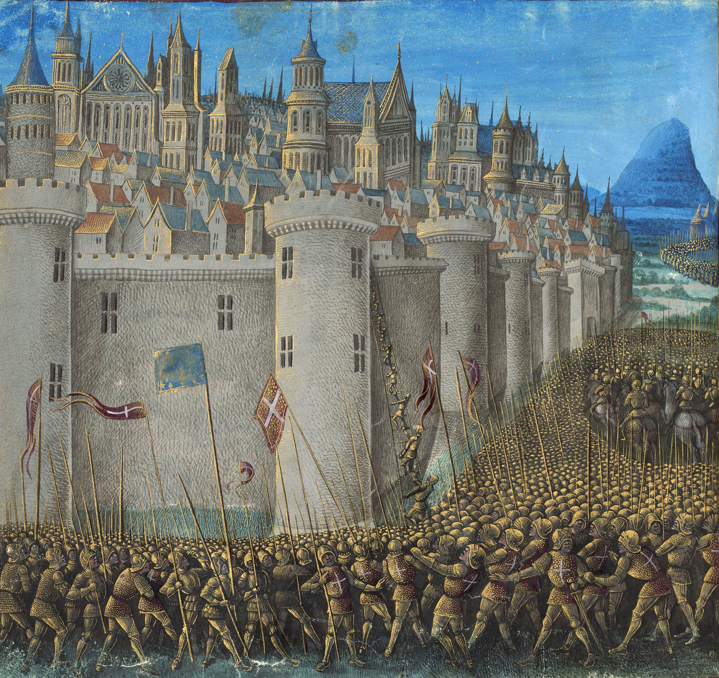
The Republic of Genoa ( lij, RepĂșbrica de ZĂȘna ; it, Repubblica di Genova; la, Res Publica Ianuensis) was a medieval and early modern maritime republic from the 11th century to 1797 in Liguria on the northwestern Italian coast. During the Late Middle Ages, it was a major commercial power in both the Mediterranean Sea and the Black Sea. Between the 16th and 17th centuries it was one of the major financial centers in Europe. Throughout its history, the Genoese Republic established numerous colonies throughout the Mediterranean and the Black Sea, including Corsica from 1347 to 1768, Monaco, Southern Crimea from 1266 to 1475 and the islands of Lesbos and Chios from the 14th century to 1462 and 1566 respectively. With the arrival of the early modern period, the Republic had lost many of its colonies, and had to shift its interests and focus on banking. This decision would prove successful for Genoa, which remained as one of the hubs of capitalism, with highly developed banks ... [...More Info...] [...Related Items...] OR: [Wikipedia] [Google] [Baidu] |
Via Ferrata
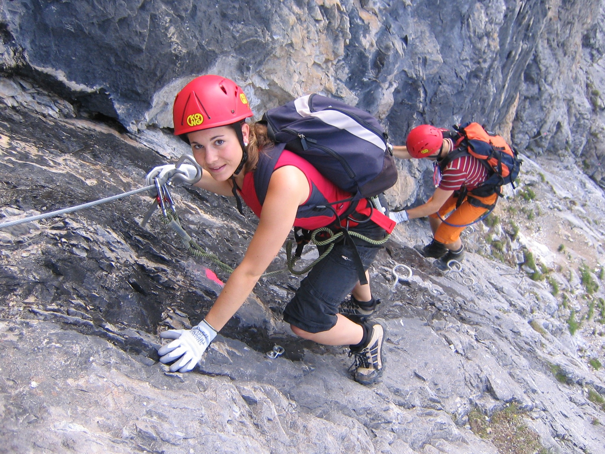
A via ferrata (Italian for "iron path", plural ''vie ferrate'' or in English ''via ferratas'') is a protected climbing route found in the Alps and certain other locations. The term "via ferrata" is used in most countries and languages except notably in German-speaking regions, which use ''Klettersteig''â"climbing path" (plural ''Klettersteige''). Infrastructure A via ferrata is a climbing route that employs steel cables, rungs or ladders, fixed to the rock to which the climbers affix a harness with two leashes, which allows the climbers to secure themselves to the metal fixture and limit any fall. The cable and other fixtures, such as iron rungs (stemples), pegs, carved steps, and ladders and bridges, provide both footings and handholds, as well. This allows climbing on otherwise dangerous routes without the risks of unprotected scrambling and climbing or the need for technical climbing equipment. They expand the opportunities for accessing difficult peaks as an alternative ... [...More Info...] [...Related Items...] OR: [Wikipedia] [Google] [Baidu] |
Golo (river)
The Golo (; ) is the longest river on the island of Corsica, France, at Course The Golo is long. It crosses the communes of Aiti, Albertacce, Bigorno, Bisinchi, Calacuccia, Campile, Campitello, Canavaggia, Casamaccioli, Castello-di-Rostino, Castirla, Corscia, Gavignano, Lento, Lucciana, Monte, Morosaglia, Olmo, Omessa, Piedigriggio, Prato-di-Giovellina, Prunelli-di-Casacconi, Saliceto, Valle-di-Rostino, Venzolasca, Vescovato, Vignale and Volpajola. The Golo's source is in the mountainous middle of the island, south of Monte Cinto. It flows generally northeast, through Calacuccia and Ponte-Leccia, and ends in the Tyrrhenian Sea approximately south of Bastia, near the Bastia â Poretta Airport. Its entire course is in the Haute-Corse ''dĂ©partement''. The river is dammed at Calacuccia to form the Lac de Calacuccia Lac de Calacuccia is a reservoir in the Haute-Corse department of France formed by damming the Golo river. It provides hydroelectric power and water ... [...More Info...] [...Related Items...] OR: [Wikipedia] [Google] [Baidu] |


