|
Aruvappulam
Aruvappulam is a remote village in the south eastern corner of Pathanamthitta district in the state of Kerala Kerala ( ; ) is a state on the Malabar Coast of India. It was formed on 1 November 1956, following the passage of the States Reorganisation Act, by combining Malayalam-speaking regions of the erstwhile regions of Cochin, Malabar, South ..., India. Aruvappulam is a ''grama panchayat'' (village council) within Konni Thaluk. The highest point in the district Devar Mala is situated in the village. A sizeable portion of the village is within Konni Reserve Forest. The village shares a border with Tamil Nadu, but there is no interstate road connecting the village with the neighbouring state. The major streams that flow into the Achankovil river originate in the village. The river forms the border between village and the neighbouring district of Kollam district, Kollam. The major settlements within the village are Kokkathode and Kalleli. Demographics At the 200 ... [...More Info...] [...Related Items...] OR: [Wikipedia] [Google] [Baidu] |
Devar Mala
Devarmala (Malayalam: ദേവര്മല) is a huge peak in the Western Ghats of Kerala. It stands at an altitude of 1,923m. It is located in Pathanamthitta District of Kerala, right next to the border with Thirunelveli District of Tamil Nadu. It is the last of the peaks located just north of the biogeographically important seven kilometers wide "Schencottah Pass" or "Schencottah Gap" or 'Aryankavu Pass'. Devarmala is situated in the watershed region of Pamba- Achenkovil rivers and is the highest peak in both the Pamba river basin and the Achankovil river basin. It is also the highest point in Pathanamthitta district and the Achenkovil range. It is the highest peak in the Western Ghats south of Periyar plateau. To the east, lie the Karuppanadhi Dam and the smaller " Adavinainar Dam" situated west off Puliyankudi and Kadayanallur towns of Tamil Nadu. To the south lies Achankovil village of Kollam district. It is situated in the Konni taluk of Pathnamthitta district ... [...More Info...] [...Related Items...] OR: [Wikipedia] [Google] [Baidu] |
Pathanamthitta District
Pathanamthitta District (), is one of the 14 districts in the Indian state of Kerala. The district headquarters is in the town of Pathanamthitta. There are four municipalities in Pathanamthitta: Adoor, Pandalam, Pathanamthitta and Thiruvalla. According to the 2011 Census of India, the population was 1,197,412, making it the third least populous district in Kerala (out of 14), after Wayanad and Idukki. Pathanamthitta has been declared the first polio-free district in India. The district is 10.03% urbanised. Pathanamthitta is one of the richest districts in India with just 1.17% poverty as of 2013, which places the district among top 5 districts in India with least poverty. Etymology The district's name is a combination of two Malayalam words, and , which together mean 'array of houses on the river side'. The district capital is located on the banks of the river Achankovil. History It is presumed that the regions that form the district were formerly under the rule ... [...More Info...] [...Related Items...] OR: [Wikipedia] [Google] [Baidu] |
States And Territories Of India
India is a federal union comprising 28 states and 8 union territories, with a total of 36 entities. The states and union territories are further subdivided into districts and smaller administrative divisions. History Pre-independence The Indian subcontinent has been ruled by many different ethnic groups throughout its history, each instituting their own policies of administrative division in the region. The British Raj mostly retained the administrative structure of the preceding Mughal Empire. India was divided into provinces (also called Presidencies), directly governed by the British, and princely states, which were nominally controlled by a local prince or raja loyal to the British Empire, which held ''de facto'' sovereignty ( suzerainty) over the princely states. 1947–1950 Between 1947 and 1950 the territories of the princely states were politically integrated into the Indian union. Most were merged into existing provinces; others were organised into ... [...More Info...] [...Related Items...] OR: [Wikipedia] [Google] [Baidu] |
Grama Panchayat
Gram Panchayat () is a basic village-governing institute in Indian villages. It is a democratic structure at the grass-roots level in India. It is a political institute, acting as cabinet of the village. The Gram Sabha work as the general body of the Gram Panchayat. The members of the Gram Panchayat are elected by the Gram Sabha. There are about 250,000+ Gram Panchayats in India. History Established in various states of India, the Panchayat Raj system has three tiers: Zila Parishad, at the district level; Panchayat Samiti, at the block level; and Gram Panchayat, at the village level. Rajasthan was the first state to establish Gram Panchayat, Bagdari Village (Nagaur District) being the first village where Gram Panchayat was established, on 2 October 1959. The failed attempts to deal with local matters at the national level caused, in 1992, the reintroduction of Panchayats for their previously used purpose as an organisation for local self-governance. Structure Gram P ... [...More Info...] [...Related Items...] OR: [Wikipedia] [Google] [Baidu] |
United States Congress
The United States Congress is the legislature of the federal government of the United States. It is bicameral, composed of a lower body, the House of Representatives, and an upper body, the Senate. It meets in the U.S. Capitol in Washington, D.C. Senators and representatives are chosen through direct election, though vacancies in the Senate may be filled by a governor's appointment. Congress has 535 voting members: 100 senators and 435 representatives. The U.S. vice president has a vote in the Senate only when senators are evenly divided. The House of Representatives has six non-voting members. The sitting of a Congress is for a two-year term, at present, beginning every other January. Elections are held every even-numbered year on Election Day. The members of the House of Representatives are elected for the two-year term of a Congress. The Reapportionment Act of 1929 establishes that there be 435 representatives and the Uniform Congressional Redistricting Act requires ... [...More Info...] [...Related Items...] OR: [Wikipedia] [Google] [Baidu] |
United States
The United States of America (U.S.A. or USA), commonly known as the United States (U.S. or US) or America, is a country primarily located in North America. It consists of 50 states, a federal district, five major unincorporated territories, nine Minor Outlying Islands, and 326 Indian reservations. The United States is also in free association with three Pacific Island sovereign states: the Federated States of Micronesia, the Marshall Islands, and the Republic of Palau. It is the world's third-largest country by both land and total area. It shares land borders with Canada to its north and with Mexico to its south and has maritime borders with the Bahamas, Cuba, Russia, and other nations. With a population of over 333 million, it is the most populous country in the Americas and the third most populous in the world. The national capital of the United States is Washington, D.C. and its most populous city and principal financial center is New York City. Paleo-Americ ... [...More Info...] [...Related Items...] OR: [Wikipedia] [Google] [Baidu] |
Gulf Cooperation Council
The Cooperation Council for the Arab States of the Gulf ( ar, مجلس التعاون لدول العربية الخليج ), also known as the Gulf Cooperation Council (GCC; ar, مجلس التعاون الخليجي), is a regional, intergovernmental, political, and economic union comprising Bahrain, Kuwait, Oman, Qatar, Saudi Arabia, and the United Arab Emirates. The council's main headquarters is located in Riyadh, the capital of Saudi Arabia. The Charter of the GCC was signed on 25 May 1981, formally establishing the institution. All current member states are monarchies, including three constitutional monarchies (Qatar, Kuwait, and Bahrain), two absolute monarchies (Saudi Arabia and Oman), and one federal monarchy (the United Arab Emirates, which is composed of seven member states, each of which is an absolute monarchy with its own emir). There have been discussions regarding the future membership of Jordan, Morocco, and Yemen. During the Arab Spring in 2011, Saudi Arab ... [...More Info...] [...Related Items...] OR: [Wikipedia] [Google] [Baidu] |
Census
A census is the procedure of systematically acquiring, recording and calculating information about the members of a given population. This term is used mostly in connection with national population and housing censuses; other common censuses include censuses of agriculture, traditional culture, business, supplies, and traffic censuses. The United Nations (UN) defines the essential features of population and housing censuses as "individual enumeration, universality within a defined territory, simultaneity and defined periodicity", and recommends that population censuses be taken at least every ten years. UN recommendations also cover census topics to be collected, official definitions, classifications and other useful information to co-ordinate international practices. The UN's Food and Agriculture Organization (FAO), in turn, defines the census of agriculture as "a statistical operation for collecting, processing and disseminating data on the structure of agriculture, covering th ... [...More Info...] [...Related Items...] OR: [Wikipedia] [Google] [Baidu] |
Kollam District
Kollam district (), (formerly Quilon district) is one of 14 districts of the state of Kerala, India. The district has a cross-section of Kerala's natural attributes; it is endowed with a long coastline, a major Laccadive Sea seaport and an inland lake (Ashtamudi Lake). The district has many water bodies. Kallada River is one among them, and the east side land of river is East Kallada and the west side land is West Kallada. Overview Kallada Boat race is one of the famous festival events of the district. Even though it is a competition between two land sides of the river, many boat clubs from various places, even beyond the district participate in the event. Kollam is the capital of Kerala's cashew industry. Plains, mountains, lakes, lagoons, and backwaters, forests, farmland and rivers make up the topography of the district. The area had trading relationships with Phoenicia and Ancient Rome. Climate Kollam's temperature is almost steady throughout the year. The average te ... [...More Info...] [...Related Items...] OR: [Wikipedia] [Google] [Baidu] |
Achankovil
Achankovil is a 128 km long west flowing river in Kerala, India, which flows through Kollam, Pathanamthitta, and Alappuzha districts. The river drains vast tract of fertile plains of Upper Kuttanad in the Alappuzha and Pathanamthitta districts. It also sustains numerous urban settlements along its course such as Konni, Pathanamthitta, Pandalam, Mavelikkara etc. Course The river has its origin in the peak '' Devar Mala'' of the Western Ghats situated in the Konni Reserve Forest. Rivers like Rishimala, Pashukidamettu and Ramakkaltheri form the major tributaries of the Achenkovil river. It flows south west from its origin and enters Kollam district near Achencovil village. Then the river switches its course towards north west and flows almost 20 kms through Kollam district before re-entering Pathanamthitta district near Kalleli. Later it flows through the hilly towns of Konni, Kumbazha, Mylapra, Konnithazham, Vettoor, Pathanamthitta, Pramadam, Vallikode and enters into t ... [...More Info...] [...Related Items...] OR: [Wikipedia] [Google] [Baidu] |
Tamil Nadu
Tamil Nadu (; , TN) is a States and union territories of India, state in southern India. It is the List of states and union territories of India by area, tenth largest Indian state by area and the List of states and union territories of India by population, sixth largest by population. Its capital and largest city is Chennai. Tamil Nadu is the home of the Tamil people, whose Tamil language—one of the longest surviving Classical languages of India, classical languages in the world—is widely spoken in the state and serves as its official language. The state lies in the southernmost part of the Indian peninsula, and is bordered by the Indian union territory of Puducherry (union territory), Puducherry and the states of Kerala, Karnataka, and Andhra Pradesh, as well as an international maritime border with Sri Lanka. It is bounded by the Western Ghats in the west, the Eastern Ghats in the north, the Bay of Bengal in the east, the Gulf of Mannar and Palk Strait to the south-eas ... [...More Info...] [...Related Items...] OR: [Wikipedia] [Google] [Baidu] |
Konni Thaluk
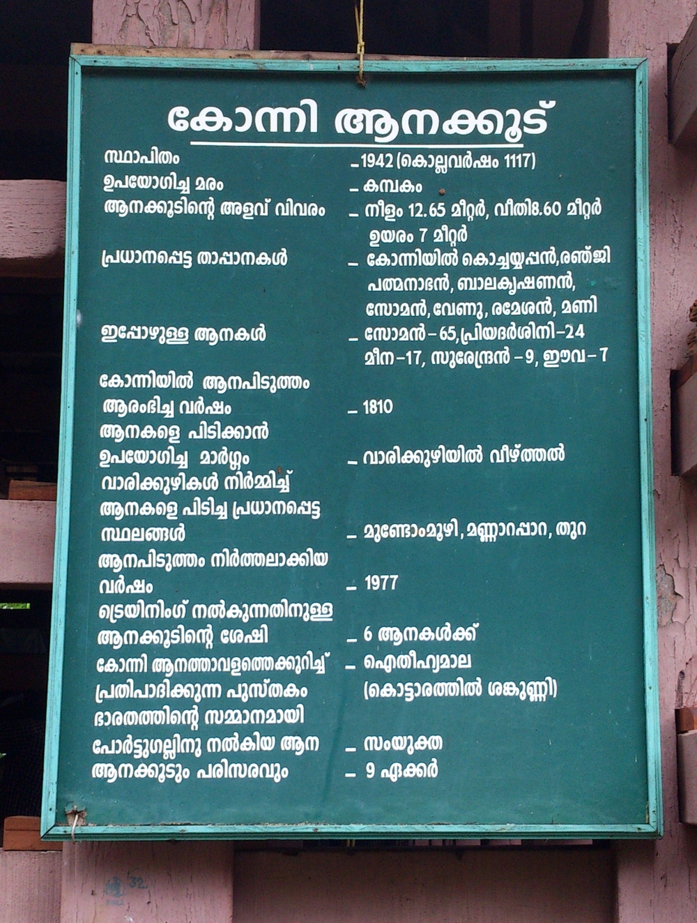
Konni is a town and a Taluk headquarters in Pathanamthitta district, Kerala, India. Konni is known for its elephant cages, forests, and rubber plantations. Konni is also known as "Anakoodinte Nadu".Nearest City Is Thiruvalla.Konni Is Located 40 km Distance From Thiruvalla Railway Station.Well Connected Via Thiruvalla- Kumbazha Highway.Buses Ply Frequently From Thiruvalla KSRTC Bus Station To Konni. Overview Konni is an important town on the Main Eastern Highway (SH 08). Konni is about away from the district headquarters. Konni assembly constituency is part of Pathanamthitta (Lok Sabha constituency). The lush green land has been prominent as a haven of wild elephants and as an elephant training center. The large area of thick forest with wild animals made Konni to emerge as another tourist spot for safaris and trekking. In Kerala there are two elephant training centers, the other located at Kodanad. It is located in the Adoor revenue division and it is one of the major towns s ... [...More Info...] [...Related Items...] OR: [Wikipedia] [Google] [Baidu] |


