|
Arroyo Seco Municipality
Arroyo Seco Municipality is a municipality in Querétaro in central Mexico. The municipality As municipal seat, the town of Arroyo Seco, Querétaro is the local government for forty five communities, which together make up an area of 731.1665km2. The municipality is located in the north of Querétaro, the farthest from the state capital 238 km away. The municipality borders the municipalities of Jalpan de Serra and Pinal de Amoles with the San Luis Potosí to the north and west and the state of Guanajuato to the south and west. The municipality consists of forty five communities divided into the municipal seat, five delegations and forty sub delegations. It has a government consisting of a municipal president and nine officials called "regidors". In 2009, the municipality sponsored the first Guadalupana Race, with prizes for competitors in five different categories. The event attracts runners from various parts of the Sierra Gorda and neighboring states. As of 2005, t ... [...More Info...] [...Related Items...] OR: [Wikipedia] [Google] [Baidu] |
Municipalities Of Mexico
Municipalities (''municipios'' in Spanish language, Spanish) are the second-level administrative divisions of Mexico, where the first-level administrative division is the ''states of Mexico, state'' (Spanish: estado). They should not be confused with cities or towns that may share the same name as they are distinct entities and do not share geographical boundaries. As of January 2021, there are 2,454 municipalities in Mexico, excluding the 16 Boroughs of Mexico City, boroughs of Mexico City. Since the 2015 Intercensal Survey, two municipalities have been created in Campeche, three in Chiapas, three in Morelos, one in Quintana Roo and one in Baja California. The internal political organization and their responsibilities are outlined in the 115th article of the Constitution of Mexico, 1917 Constitution and detailed in the constitutions of the states to which they belong. are distinct from , a form of Mexican Localities of Mexico, locality, and are divided into ''Colonia (Mexico ... [...More Info...] [...Related Items...] OR: [Wikipedia] [Google] [Baidu] |
Guanajuato
Guanajuato (), officially the Free and Sovereign State of Guanajuato ( es, Estado Libre y Soberano de Guanajuato), is one of the 32 states that make up the Federal Entities of Mexico. It is divided into 46 municipalities and its capital city is Guanajuato. Guanajuato is in central Mexico. It is bordered by the states of Jalisco to the west, Zacatecas to the northwest, San Luis Potosí to the north, Querétaro to the east, and Michoacán to the south. It covers an area of . The state is home to several historically important cities, especially those along the "Bicentennial Route", which retraces the path of Miguel Hidalgo y Costilla's insurgent army at the beginning of the Mexican War of Independence. This route begins at Dolores Hidalgo, and passes through the Sanctuary of Atotonilco, San Miguel de Allende, Celaya, and the capital of Guanajuato. Other important cities in the state include León, the state's biggest city, Salamanca, and Irapuato. The first town established ... [...More Info...] [...Related Items...] OR: [Wikipedia] [Google] [Baidu] |
Comisión Nacional Para El Desarrollo De Los Pueblos Indígenas
The National Institute of Indigenous Peoples ( es, Instituto Nacional de los Pueblos Indígenas, INPI) is a decentralized agency of the Mexican Federal Public Administration. It was established on December 4, 2018, though the earliest Mexican government agency for indigenous matters was created in 1948. It is headquartered in Mexico City and headed by Adelfo Regino Montes. History National Indigenist Institute The National Indigenist Institute was established in 1948, with the initial goal of integrating indigenous people into the national culture. The agency carried out health and education campaigns, and it also relocated more than 22,000 people displaced by the construction of the Miguel Alemán Dam in Oaxaca. Three years later, it established the first Indigenous Coordination Center, at San Cristóbal de las Casas, Chiapas. In the 1970s, the focus of the agency shifted to "elevating" the life of indigenous people to help them participate in the national life, and later to ... [...More Info...] [...Related Items...] OR: [Wikipedia] [Google] [Baidu] |
Comal (cookware)
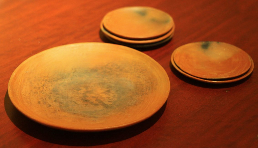
A comal is a smooth, flat griddle typically used in Mexico, Central America, and parts of South America, to cook tortillas and arepas, toast spices and nuts, sear meat, and generally prepare food. Similar cookware is called a budare in South America. Some comals are concave and made of ''barro'' (clay). These are still made and used by the indigenous peoples of Mexico and Central America. Comals are similar to the American griddle or the Indian tawa, and are often used and named interchangeably with these. Comals for home use are generally made from heavy cast iron, and sized to fit over either one burner on the stovetop (round) or two burners front to back (elongated oval). In many indigenous and pre-Hispanic cultures, the comal is handed down from grandmother to mother to daughter, the idea being that a comal tempered over many years of usage will heat faster and cook cleaner. History The history of such cooking methods dates back to the pre-Columbian era, when powdered-homin ... [...More Info...] [...Related Items...] OR: [Wikipedia] [Google] [Baidu] |
Adobe
Adobe ( ; ) is a building material made from earth and organic materials. is Spanish for ''mudbrick''. In some English-speaking regions of Spanish heritage, such as the Southwestern United States, the term is used to refer to any kind of earthen construction, or various architectural styles like Pueblo Revival or Territorial Revival. Most adobe buildings are similar in appearance to cob and rammed earth buildings. Adobe is among the earliest building materials, and is used throughout the world. Adobe architecture has been dated to before 5,100 B.C. Description Adobe bricks are rectangular prisms small enough that they can quickly air dry individually without cracking. They can be subsequently assembled, with the application of adobe mud to bond the individual bricks into a structure. There is no standard size, with substantial variations over the years and in different regions. In some areas a popular size measured weighing about ; in other contexts the size is weighi ... [...More Info...] [...Related Items...] OR: [Wikipedia] [Google] [Baidu] |
Otomi Language
Otomi (; ) is an Oto-Pamean languages, Oto-Pamean language family spoken by approximately 240,000 indigenous Otomi people in the Mexican Plateau, central ''altiplano'' region of Mexico. Otomi consists of several closely related languages, many of which are not mutually intelligible. The word ''Hñähñu'' has been proposed as an endonym, but since it represents the usage of a single dialect, it has not gained wide currency. Linguists have classified the modern dialects into three dialect areas: the Northwestern dialects are spoken in Querétaro, Hidalgo (state), Hidalgo and Guanajuato; the Southwestern dialects are spoken in the Mexico (state), State of Mexico; and the Eastern dialects are spoken in the highlands of Veracruz, Puebla, and eastern Hidalgo and villages in Tlaxcala and Mexico states. Like all other Oto-Manguean languages, Otomi is a tonal language, and most varieties distinguish three tones. Nouns are marked only for possessor; the plural number is marked with a d ... [...More Info...] [...Related Items...] OR: [Wikipedia] [Google] [Baidu] |
Pame People
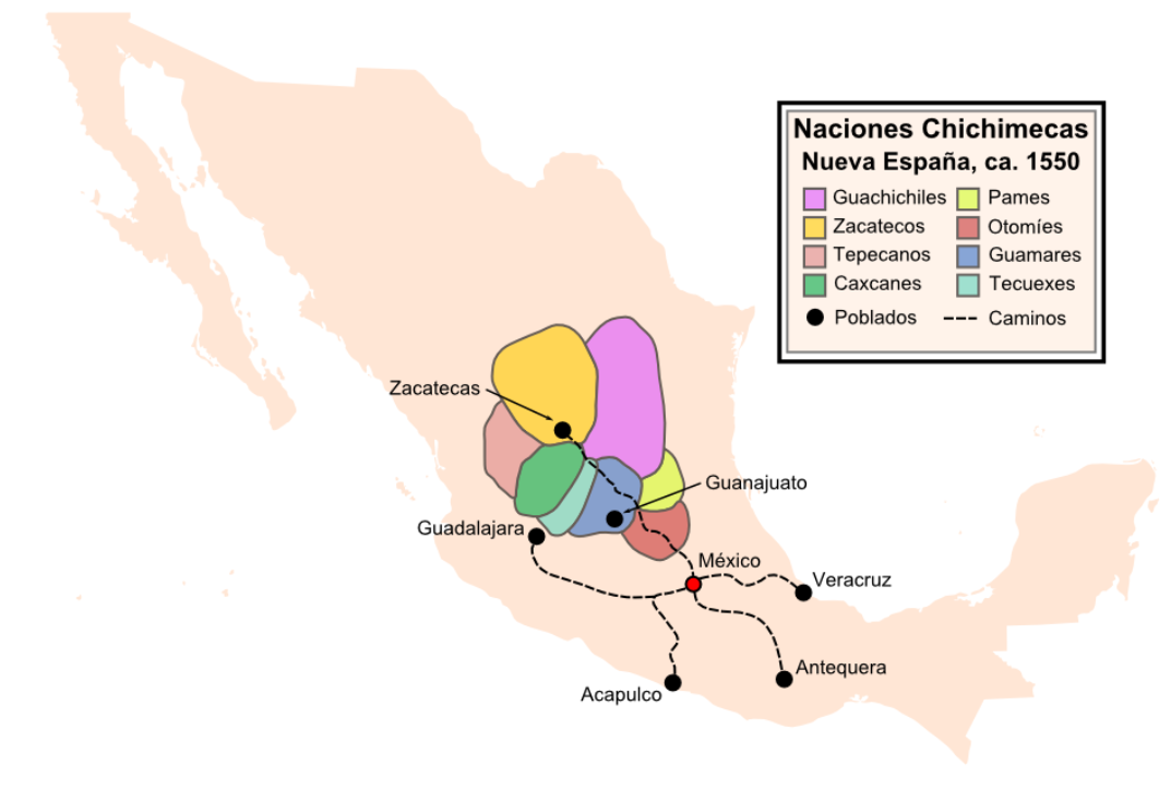
The north Pame, or Xi'iuy (alternate spelling: Xi'úi, Xi'ui, Xi'oi, or Xiyui), as they refer to themselves, the south Pame, or Ñáhu, Nyaxu (in Hidalgo), and the Pame in Querétaro or Re Nuye Eyyä, are an Indigenous people of central Mexico primarily living in the state of San Luis Potosí. When Spanish colonists arrived and conquered their traditional territory in the sixteenth century, which "extended from the modern state of Tamaulipas in the north to Hidalgo and the area around Mexico City in the south along the Sierra Madre," they renamed "the area ''Pamería'', and applied the name Pame to all of the peoples there." Estimates for population of the Pames at the time of contact with Spanish colonists in 1519 range between 40,000 and 70,000. In 1794, the population was estimated at around 25,000. Recent figures for the Pame have estimated the population to be approximately 10,000 people. The Pames, along with the Chichimeca-Jonaz of the Sierra Gorda in eastern Guanajuato, are ... [...More Info...] [...Related Items...] OR: [Wikipedia] [Google] [Baidu] |
Day Of The Dead
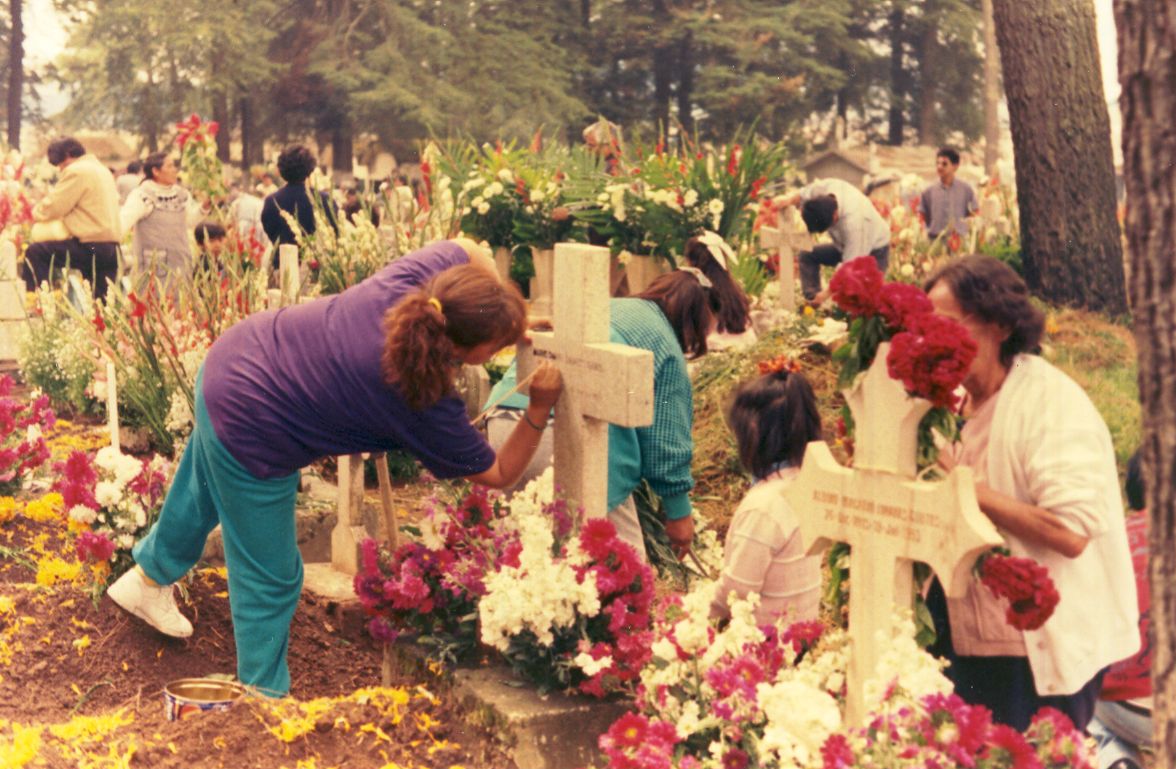
The Day of the Dead ( es, Día de Muertos or ''Día de los Muertos'') is a holiday traditionally celebrated on November 1 and 2, though other days, such as October 31 or November 6, may be included depending on the locality. It is widely observed in Mexico, where it largely developed, and is also observed in other places, especially by people of Mexican heritage. Although related to the simultaneous Christian remembrances for Hallowtide, it has a much less solemn tone and is portrayed as a holiday of joyful celebration rather than mourning. The multi-day holiday involves family and friends gathering to pay respects and to remember friends and family members who have died. These celebrations can take a humorous tone, as celebrants remember funny events and anecdotes about the departed. Traditions connected with the holiday include honoring the deceased using calaveras and marigold flowers known as ''cempazúchitl'', building home altars called '' ofrendas'' with the favorite fo ... [...More Info...] [...Related Items...] OR: [Wikipedia] [Google] [Baidu] |
Santa María River (Querétaro)
Several rivers are named Santa Maria River. Argentina * Two rivers Bolivia * Crivers Brazil * Six rivers, including: ** Santa Maria River (Mato Grosso do Sul) ** Santa Maria River (Rio Grande do Sul) ** Santa Maria River (Sergipe) ** Chile * Two rivers Colombia * Two rivers Cuba * Five rivers Italy * One river Mexico * Seven rivers, including: * Santa Maria River (Chihuahua) * Santa Maria River (San Luis Potosi) Panama * Santa Maria River (Panama) Peru * Two rivers Philippines * Four rivers Spain * Two rivers United States * Santa Maria River (Arizona) * Santa Maria River (California) Santa Maria River on the Central Coast of California, is formed at the confluence of the Sisquoc River and Cuyama River, just east of the city of Santa Maria, and flows U.S. Geological Survey. National Hydrography Dataset high-resolution flowlin ... Venezuela * Santa Maria River (Venezuela) {{geodis ... [...More Info...] [...Related Items...] OR: [Wikipedia] [Google] [Baidu] |
Bamboo
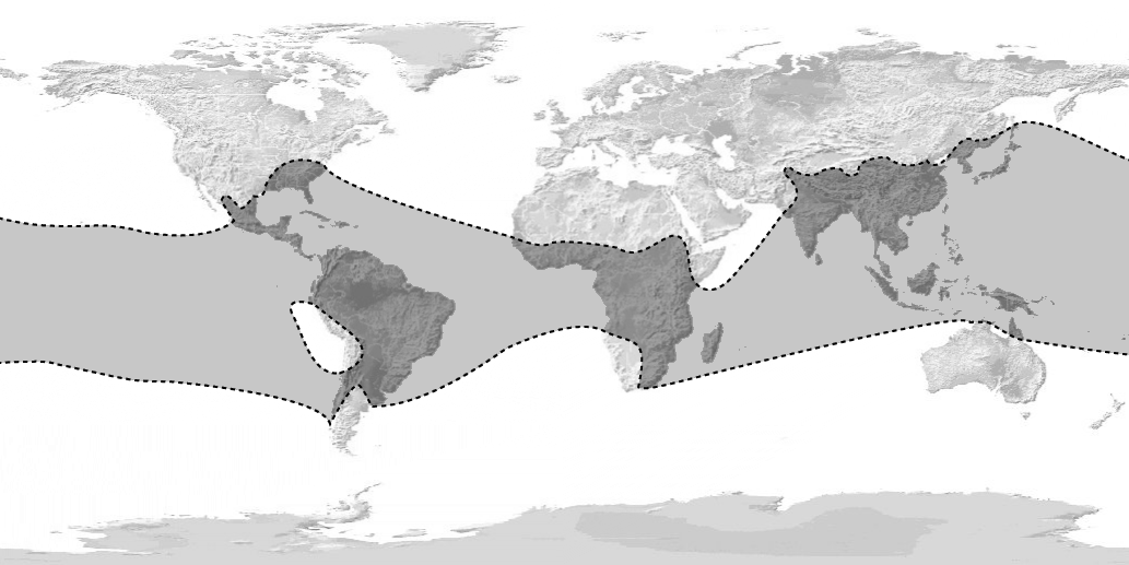
Bamboos are a diverse group of evergreen perennial flowering plants making up the subfamily Bambusoideae of the grass family Poaceae. Giant bamboos are the largest members of the grass family. The origin of the word "bamboo" is uncertain, but it probably comes from the Dutch or Portuguese language, which originally borrowed it from Malay or Kannada. In bamboo, as in other grasses, the internodal regions of the stem are usually hollow and the vascular bundles in the cross-section are scattered throughout the stem instead of in a cylindrical arrangement. The dicotyledonous woody xylem is also absent. The absence of secondary growth wood causes the stems of monocots, including the palms and large bamboos, to be columnar rather than tapering. Bamboos include some of the fastest-growing plants in the world, due to a unique rhizome-dependent system. Certain species of bamboo can grow within a 24-hour period, at a rate of almost an hour (equivalent to 1 mm every 90 seco ... [...More Info...] [...Related Items...] OR: [Wikipedia] [Google] [Baidu] |
Sierra Gorda
The Sierra Gorda () is an ecological region centered on the northern third of the Mexican state of Querétaro and extending into the neighboring states of Guanajuato, Hidalgo and San Luis Potosí. Within Querétaro, the ecosystem extends from the center of the state starting in parts of San Joaquín and Cadereyta de Montes municipalities and covering all of the municipalities of Peñamiller, Pinal de Amoles, Jalpan de Serra, Landa de Matamoros and Arroyo Seco, for a total of 250 km2 of territory. The area is extremely rugged with high steep mountains and deep canyons. As part of the Huasteca Karst, it also contains many formations due to erosion of limestone, especially pit caves known locally as sótanos. The area is valued for its very wide diversity of plant and animal life, which is due to the various microenvironments created by the ruggedness of the terrain and wide variation in rainfall. This is due to the mountains’ blocking of moisture coming in from the Gulf ... [...More Info...] [...Related Items...] OR: [Wikipedia] [Google] [Baidu] |


_1.jpg)


