|
Arroyo Ojito Formation
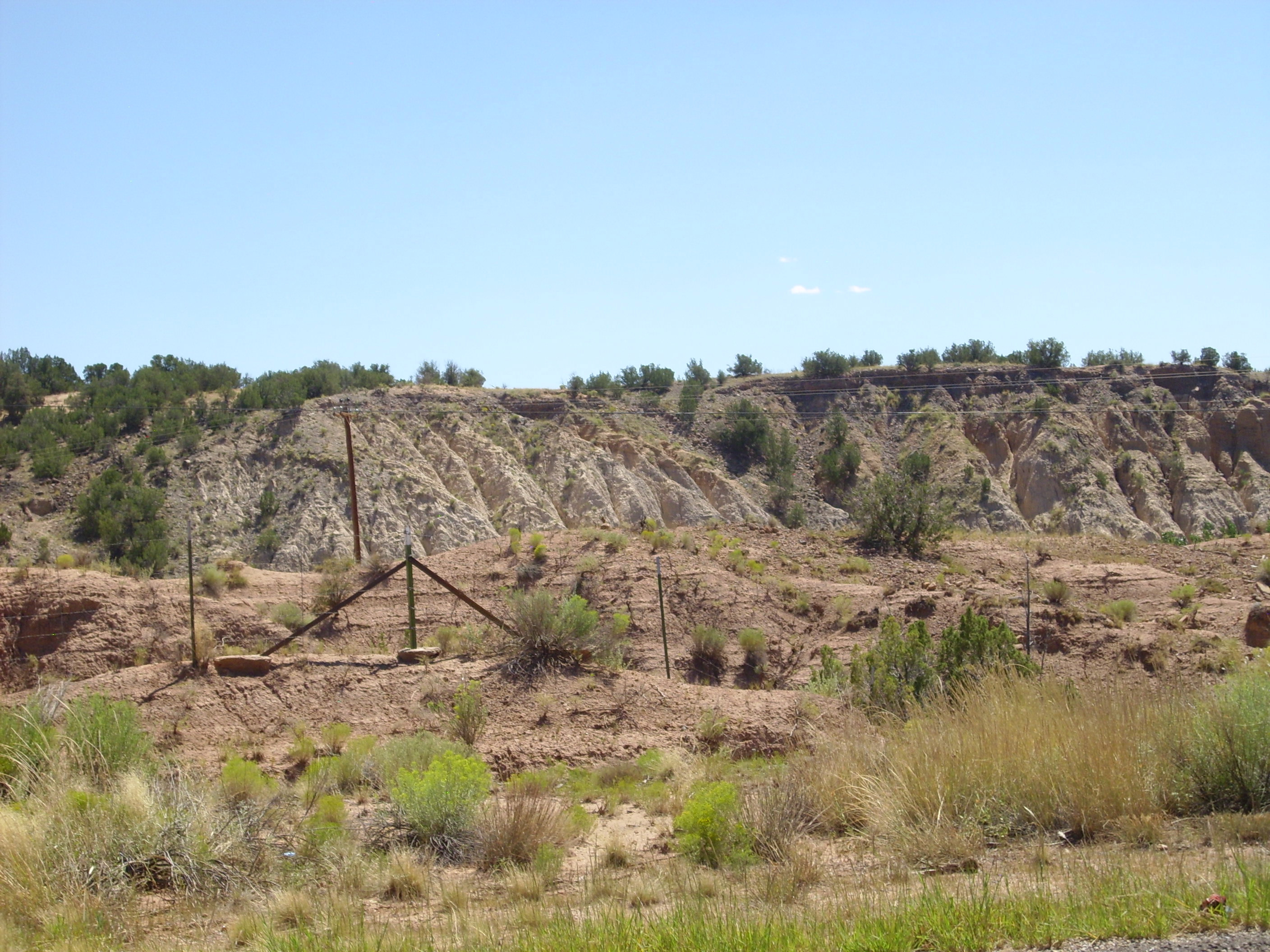
The Arroyo Ojito Formation is a late Miocene geologic formation exposed near Albuquerque, New Mexico. It records deposition of sediments in the Albuquerque Basin of the Rio Grande Rift after full integration of the Rio Grande through the basin. Description The Arroyo Ojito Formation is composed of sediments deposited from streams draining the Sierra Nacimiento, San Juan Basin, and southeastern Colorado Plateau. These are mostly moderately to poorly sorted arkosic sandstone, mudstone, and conglomerate. The upper beds are coarse and more poorly sorted. The formation rests on the Cerro Conejo Formation and is unconformably overlain by the Ceja Formation. The total thickness of the Arroyo Ojito is nearly . The formation is divided into the Navajo Draw, Loma Barbon, and Picuda Peak Member (in ascending stratigraphic order). The Navajo Draw Member consists of pale brown to pale yellow sandstone with some conglomerate lenses and mudstone deposited by numerous southeast-flowing ... [...More Info...] [...Related Items...] OR: [Wikipedia] [Google] [Baidu] |
Formation (stratigraphy)
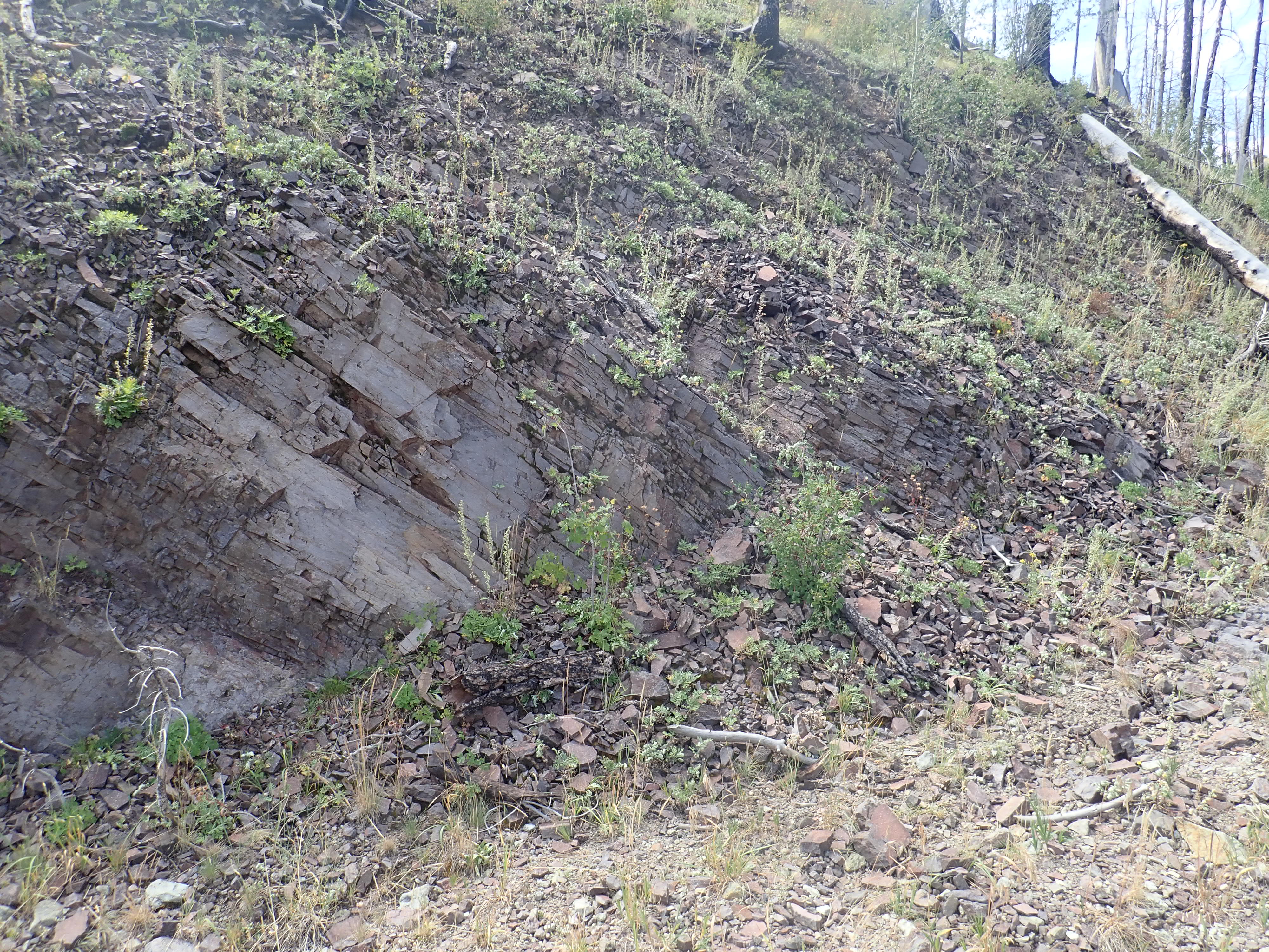
A geological formation, or simply formation, is a body of rock having a consistent set of physical characteristics (lithology) that distinguishes it from adjacent bodies of rock, and which occupies a particular position in the layers of rock exposed in a geographical region (the stratigraphic column). It is the fundamental unit of lithostratigraphy, the study of strata or rock layers. A formation must be large enough that it can be mapped at the surface or traced in the subsurface. Formations are otherwise not defined by the thickness (geology), thickness of their rock strata, which can vary widely. They are usually, but not universally, tabular in form. They may consist of a single lithology (rock type), or of alternating beds of two or more lithologies, or even a heterogeneous mixture of lithologies, so long as this distinguishes them from adjacent bodies of rock. The concept of a geologic formation goes back to the beginnings of modern scientific geology. The term was used by ... [...More Info...] [...Related Items...] OR: [Wikipedia] [Google] [Baidu] |
San Juan Basin
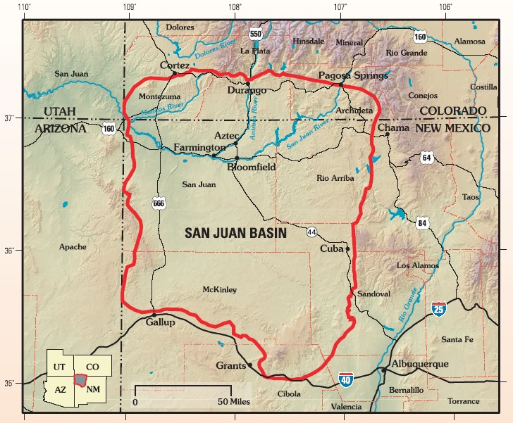
The San Juan Basin is a geologic structural basin located near the Four Corners region of the Southwestern United States. The basin covers 7,500 square miles and resides in northwestern New Mexico, southwestern Colorado, and parts of Utah and Arizona. Specifically, the basin occupies space in the San Juan, Rio Arriba, Sandoval, and McKinley counties in New Mexico, and La Plata and Archuleta counties in Colorado. The basin extends roughly N-S and E-W. The San Juan Basin is an asymmetric structural depression in the Colorado Plateau province, with varying elevation and nearly in topographic relief. Its most striking features include Chaco Canyon (northwestern New Mexico, between Farmington and Santa Fe) and Chacra Mesa. The basin lies west of the Continental Divide, and its main drainage is the southwest- to west-flowing San Juan River, which eventually joins the Colorado River in Utah. Climate of the basin is arid to semiarid, with an annual precipitation of and an a ... [...More Info...] [...Related Items...] OR: [Wikipedia] [Google] [Baidu] |
Paleontology In New Mexico
Paleontology in New Mexico refers to paleontological research occurring within or conducted by people from the U.S. state of New Mexico. The fossil record of New Mexico is exceptionally complete and spans almost the entire stratigraphic column. More than 3,300 different kinds of fossil organisms have been found in the state. Of these more than 700 of these were new to science and more than 100 of those were type species for new genera. During the early Paleozoic, southern and western New Mexico were submerged by a warm shallow sea that would come to be home to creatures including brachiopods, bryozoans, cartilaginous fishes, corals, graptolites, nautiloids, placoderms, and trilobites. During the Ordovician the state was home to algal reefs up to 300 feet high. During the Carboniferous, a richly vegetated island chain emerged from the local sea. Coral reefs formed in the state's seas while terrestrial regions of the state dried and were home to sand dunes. Local wil ... [...More Info...] [...Related Items...] OR: [Wikipedia] [Google] [Baidu] |
List Of Fossiliferous Stratigraphic Units In New Mexico
This article contains a list of fossil-bearing stratigraphic units in the state of New Mexico, U.S. Sites See also * Paleontology in New Mexico References * {{DEFAULTSORT:Fossiliferous stratigraphic units in New Mexico New Mexico Stratigraphic units A stratigraphic unit is a volume of Rock (geology), rock of identifiable origin and relative age range that is defined by the distinctive and dominant, easily mapped and recognizable petrology, petrographic, lithology, lithologic or paleontology, p ... Stratigraphy of New Mexico New Mexico geography-related lists United States geology-related lists ... [...More Info...] [...Related Items...] OR: [Wikipedia] [Google] [Baidu] |
Quaternary
The Quaternary ( ) is the current and most recent of the three periods of the Cenozoic Era in the geologic time scale of the International Commission on Stratigraphy (ICS). It follows the Neogene Period and spans from 2.58 million years ago to the present. The Quaternary Period is divided into two epochs: the Pleistocene (2.58 million years ago to 11.7 thousand years ago) and the Holocene (11.7 thousand years ago to today, although a third epoch, the Anthropocene, has been proposed but is not yet officially recognised by the ICS). The Quaternary Period is typically defined by the cyclic growth and decay of continental ice sheets related to the Milankovitch cycles and the associated climate and environmental changes that they caused. Research history In 1759 Giovanni Arduino proposed that the geological strata of northern Italy could be divided into four successive formations or "orders" ( it, quattro ordini). The term "quaternary" was introduced by Jules Desnoye ... [...More Info...] [...Related Items...] OR: [Wikipedia] [Google] [Baidu] |
Zia Formation
The Zia Formation is a geologic formation in the southwestern Jemez Mountains and northwestern Santo Domingo basin. It contains vertebrate fossils that date it to early to middle Miocene in age. Description The Zia Formation is a very soft quartz sandstone. The type section rests on about of laminated greenish clay beds that in turn rest on the Galisteo Formation. The upper contact is with the Cerro Conejo Formation, with the Cochiti Formation, or with Miocene volcanic rocks of the Jemez volcanic field. The formation is divided (in ascending stratigraphic order) into the Piedra Parada Member, the Chamisa Mesa Member. and the Canada Pilares Member. The formation is interpreted as eolian deposits derived from volcaniclastics of the Jemez volcanic field. These were first transported south by the Jemez River, then transported by wind from the west. Fossils The Piera Parada Member contains fossils mostly of camels (''Stenomylus'', '' Oxydactylus'', and ''Michenia'') and ... [...More Info...] [...Related Items...] OR: [Wikipedia] [Google] [Baidu] |
Bearhead Rhyolite
The Keres Group is a group of geologic formations exposed in and around the Jemez Mountains of northern New Mexico. Radiometric dating gives it an age of 13 to 6 million years, corresponding to the Miocene epoch. Geology The Jemez Mountains lie on the intersection of the western margin of the Rio Grande Rift and the Jemez Lineament. Here magma produced from the fertile rock of an ancient subduction zone has repeatedly found its way to the surface along faults produced by rifting. This has produced a long-lived volcanic field, with the earliest eruptions beginning at least 13 million years ago in both the northern (Polvadera Group) and southern (Keres Group) portions of the volcanic field. High-silica eruptions of the Tewa Group began about 1.85 million years ago and continued almost to the present day. The Keres Group is a sequence of basalt, andesite, dacite, and rhyolite flows that underlie the southern Jemez Mountains. It overlaps the Polvadera Group to the north and has a ... [...More Info...] [...Related Items...] OR: [Wikipedia] [Google] [Baidu] |
Rio Puerco (Rio Grande Tributary)
The Rio Puerco is a tributary of the Rio Grande in the U.S. state of New Mexico. From its source on the west side of the Nacimiento Mountains, it flows about ,Calculated in Google Earth generally south to join the Rio Grande about south of Belen and about south of Albuquerque. Its drainage basin is about large, of which probably about are noncontributing. The Rio Puerco is ephemeral, with no streamflow for part of the year. Its discharge averages . The maximum officially recorded discharge was , in 1941. The greatest flood since about 1880 occurred on September 23, 1929, with an estimated discharge of . Another flood, on August 12, 1929, reached an estimated . Name Although Rio Puerco means ''River of Pigs'' in Spanish, this usage in the southwestern United States is better translated as ''Muddy River''. Course The Rio Puerco arises in the San Pedro Peaks area of the Nacimiento Mountains, in the San Pedro Parks Wilderness area of the Santa Fe National Forest. It flows g ... [...More Info...] [...Related Items...] OR: [Wikipedia] [Google] [Baidu] |
Ma (unit)
A year or annus is the orbital period of a planetary body, for example, the Earth, moving in its orbit around the Sun. Due to the Earth's axial tilt, the course of a year sees the passing of the seasons, marked by change in weather, the hours of daylight, and, consequently, vegetation and soil fertility. In temperate and subpolar regions around the planet, four seasons are generally recognized: spring, summer, autumn and winter. In tropical and subtropical regions, several geographical sectors do not present defined seasons; but in the seasonal tropics, the annual wet and dry seasons are recognized and tracked. A calendar year is an approximation of the number of days of the Earth's orbital period, as counted in a given calendar. The Gregorian calendar, or modern calendar, presents its calendar year to be either a common year of 365 days or a leap year of 366 days, as do the Julian calendars. For the Gregorian calendar, the average length of the calendar year (the mean yea ... [...More Info...] [...Related Items...] OR: [Wikipedia] [Google] [Baidu] |
Argon–argon Dating
Argon–argon (or 40Ar/39Ar) dating is a radiometric dating method invented to supersede potassiumargon (K/Ar) dating in accuracy. The older method required splitting samples into two for separate potassium and argon measurements, while the newer method requires only one rock fragment or mineral grain and uses a single measurement of argon isotopes. 40Ar/39Ar dating relies on neutron irradiation from a nuclear reactor to convert a stable form of potassium (39K) into the radioactive 39Ar. As long as a standard of known age is co-irradiated with unknown samples, it is possible to use a single measurement of argon isotopes to calculate the 40K/40Ar* ratio, and thus to calculate the age of the unknown sample. 40Ar* refers to the radiogenic 40Ar, i.e. the 40Ar produced from radioactive decay of 40K. 40Ar* does not include atmospheric argon adsorbed to the surface or inherited through diffusion and its calculated value is derived from measuring the 36Ar (which is assumed to be of atmosphe ... [...More Info...] [...Related Items...] OR: [Wikipedia] [Google] [Baidu] |
Basalt
Basalt (; ) is an aphanite, aphanitic (fine-grained) extrusive igneous rock formed from the rapid cooling of low-viscosity lava rich in magnesium and iron (mafic lava) exposed at or very near the planetary surface, surface of a terrestrial planet, rocky planet or natural satellite, moon. More than 90% of all volcanic rock on Earth is basalt. Rapid-cooling, fine-grained basalt is chemically equivalent to slow-cooling, coarse-grained gabbro. The eruption of basalt lava is observed by geologists at about 20 volcanoes per year. Basalt is also an important rock type on other planetary bodies in the Solar System. For example, the bulk of the plains of volcanism on Venus, Venus, which cover ~80% of the surface, are basaltic; the lunar mare, lunar maria are plains of flood-basaltic lava flows; and basalt is a common rock on the surface of Mars. Molten basalt lava has a low viscosity due to its relatively low silica content (between 45% and 52%), resulting in rapidly moving lava flo ... [...More Info...] [...Related Items...] OR: [Wikipedia] [Google] [Baidu] |
Unconformably
An unconformity is a buried erosional or non-depositional surface separating two rock masses or strata of different ages, indicating that sediment deposition was not continuous. In general, the older layer was exposed to erosion for an interval of time before deposition of the younger layer, but the term is used to describe any break in the sedimentary geologic record. The significance of angular unconformity (see below) was shown by James Hutton, who found examples of Hutton's Unconformity at Jedburgh in 1787 and at Siccar Point in 1788. The rocks above an unconformity are younger than the rocks beneath (unless the sequence has been overturned). An unconformity represents time during which no sediments were preserved in a region or were subsequently eroded before the next deposition. The local record for that time interval is missing and geologists must use other clues to discover that part of the geologic history of that area. The interval of geologic time not represented is ... [...More Info...] [...Related Items...] OR: [Wikipedia] [Google] [Baidu] |


