|
Armori
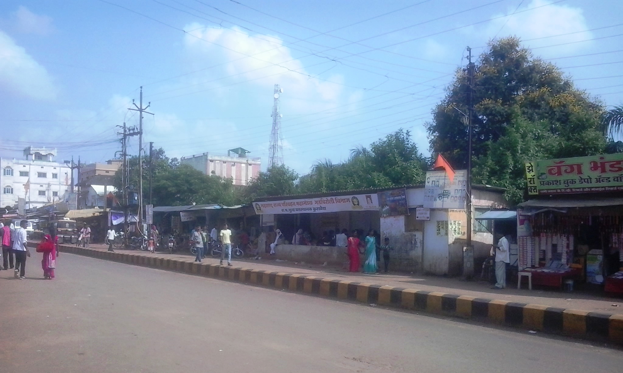
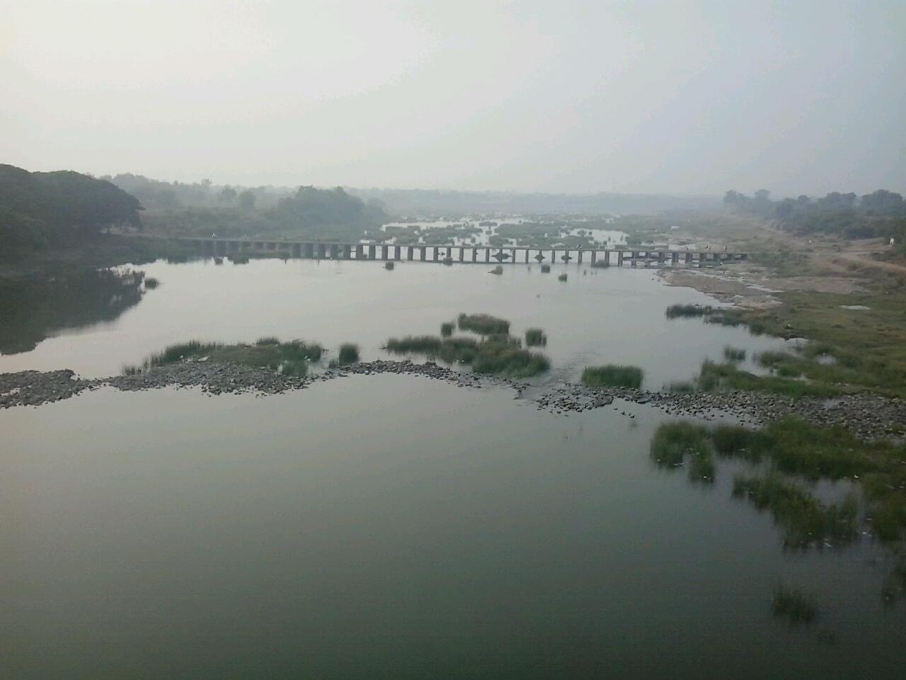
Armori is a town and municipal council in the Gadchiroli district in the Indian state of Maharashtra. It is connected with the National Highway NH-353C. It is located on the left of the Wainganga River, a tributary of the Pranahita River which meets the Godavari River. Geography Armori is located at . It has an average elevation of 199 metres (676 feet). It is part of Desaiganj subdivision of Gadchiroli district along with the tehsils Desaiganj, Kurkheda and Korchi. Demographics As per Indian governmanet census of 2011, the population was 97097. Transport Road Armori is well connected to major industrial and commercial places by road. It is about 140 km from the city of Nagpur and about 36 km from district headquarters, Gadchiroli. The Maharashtra State Road Transport Corporation (MSRTC) runs buses connecting Gadchiroli to Nagpur via Armori, Brahmpuri, Nagbhid, Umrer with a frequency of about 45 min. Rail Nearest railway station is Wadsa ... [...More Info...] [...Related Items...] OR: [Wikipedia] [Google] [Baidu] |
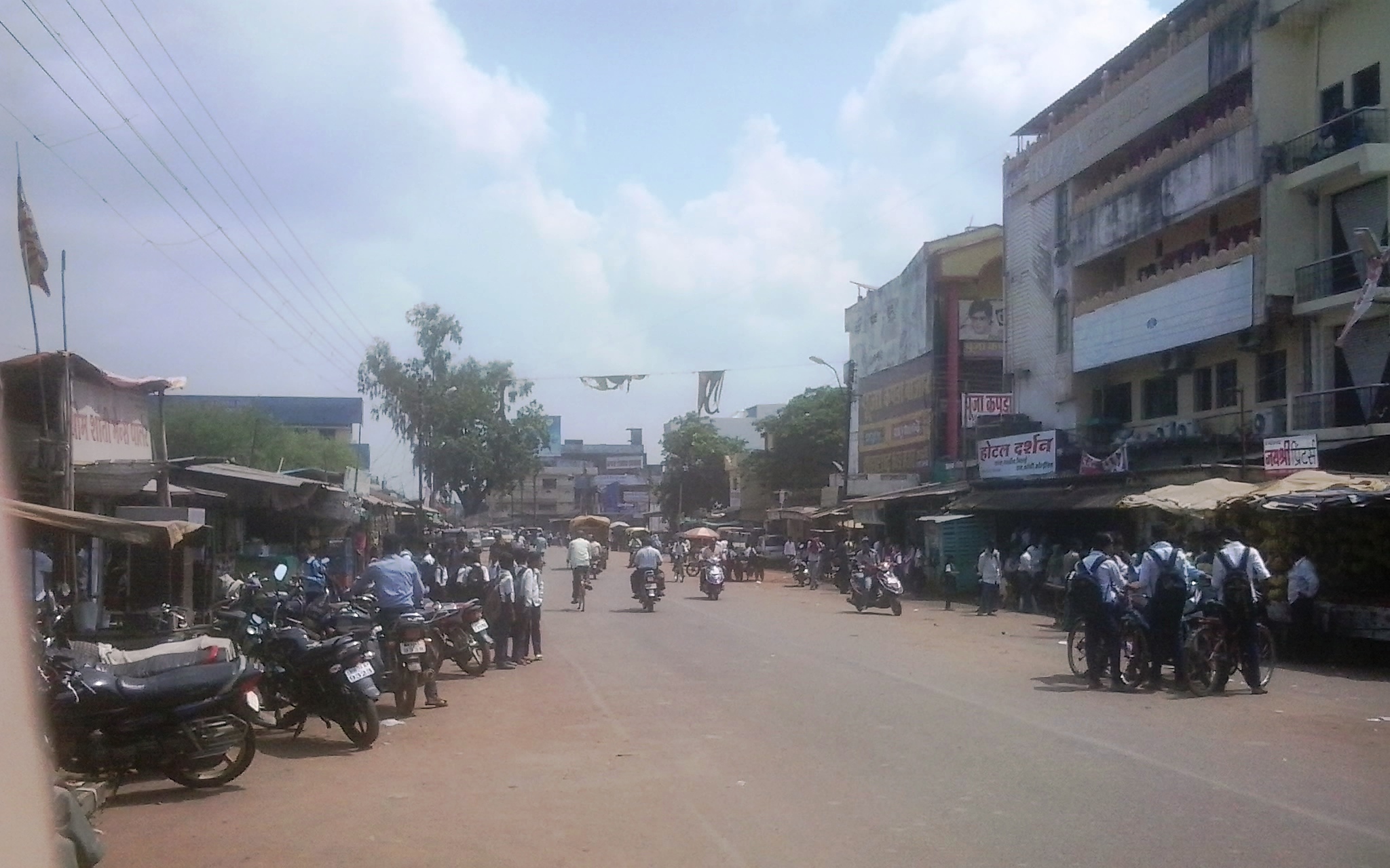
Armori Main Road
Armori is a town and municipal council in the Gadchiroli district in the Indian state of Maharashtra. It is connected with the National Highway NH-353C. It is located on the left of the Wainganga River, a tributary of the Pranahita River which meets the Godavari River. Geography Armori is located at . It has an average elevation of 199 metres (676 feet). It is part of Desaiganj subdivision of Gadchiroli district along with the tehsils Desaiganj, Kurkheda Kurkheda is a Village and a tehsil in the Gadchiroli district in the Indian state State may refer to: Arts, entertainment, and media Literature * ''State Magazine'', a monthly magazine published by the U.S. Department of State * ''The Stat ... and Korchi. Demographics As per Indian governmanet census of 2011, the population was 97097. Transport Road Armori is well connected to major industrial and commercial places by road. It is about 140 km from the city of Nagpur and about 36&nbs ... [...More Info...] [...Related Items...] OR: [Wikipedia] [Google] [Baidu] |
Armori Municipal Council
Armori is the Municipal council in district of Gadchiroli, Maharashtra Maharashtra (; , abbr. MH or Maha) is a states and union territories of India, state in the western India, western peninsular region of India occupying a substantial portion of the Deccan Plateau. Maharashtra is the List of states and union te .... History The Armori municipal council established on 12 September 2017. Municipal Council election Electoral performance 2019 References {{reflist Municipal councils in Maharashtra ... [...More Info...] [...Related Items...] OR: [Wikipedia] [Google] [Baidu] |
Gadchiroli
Gadchiroli ( í╔Ö╔ľt═í╩âi╔żoli╦É is a city and a municipal council in Gadchiroli district in the state of Maharashtra, central India. It is located on eastern side of Maharashtra, and is the administrative headquarters of the district. Gadchiroli is called a lung of Maharashtra as it has almost 35% of this district has forest cover. The main river flowing through city is the Wainganga River. The landscape is lush and green during the monsoon season which is prone to flooding. Gadchiroli is known for its forests. Teak is grown commercially and bamboos are used for various crafts. Notable places and Personalities Some notable places and personalities in the town include: * Chaprala Wildlife Sanctuary"Tourist Places , District Gadchiroli, Government of Maharashtra , India". Retrieved 21 July 2021. *Semana-Hanuman Temple ÔÇô About from center of town (Gandhi Chowk) * Hemalkasa ÔÇô Situated in Bhamragarh Block (east side of district), from Gadchiroli. *Allapalli ÔÇô ... [...More Info...] [...Related Items...] OR: [Wikipedia] [Google] [Baidu] |
Korchi
Korchi is a Village and a tehsil in Gadchiroli district in the Indian state of Maharashtra. It is about 1012 km from the capital city, Mumbai. The town is good for its connectivity and facilities compared to rest of the area around. It is part of Kurkheda Sub-division of Gadchiroli district along with Kurkheda Kurkheda is a Village and a tehsil in the Gadchiroli district in the Indian state State may refer to: Arts, entertainment, and media Literature * ''State Magazine'', a monthly magazine published by the U.S. Department of State * ''The Stat ..., Korchi tehsils. Demographics As per Indian government census of 2011, the population was 42,811. References Cities and towns in Gadchiroli district Talukas in Maharashtra {{Gadchiroli-geo-stub ... [...More Info...] [...Related Items...] OR: [Wikipedia] [Google] [Baidu] |
India
India, officially the Republic of India (Hindi: ), is a country in South Asia. It is the seventh-largest country by area, the second-most populous country, and the most populous democracy in the world. Bounded by the Indian Ocean on the south, the Arabian Sea on the southwest, and the Bay of Bengal on the southeast, it shares land borders with Pakistan to the west; China, Nepal, and Bhutan to the north; and Bangladesh and Myanmar to the east. In the Indian Ocean, India is in the vicinity of Sri Lanka and the Maldives; its Andaman and Nicobar Islands share a maritime border with Thailand, Myanmar, and Indonesia. Modern humans arrived on the Indian subcontinent from Africa no later than 55,000 years ago., "Y-Chromosome and Mt-DNA data support the colonization of South Asia by modern humans originating in Africa. ... Coalescence dates for most non-European populations average to between 73ÔÇô55 ka.", "Modern human beingsÔÇö''Homo sapiens''ÔÇöoriginated in Africa. Then, int ... [...More Info...] [...Related Items...] OR: [Wikipedia] [Google] [Baidu] |
Kurkheda
Kurkheda is a Village and a tehsil in the Gadchiroli district in the Indian state State may refer to: Arts, entertainment, and media Literature * ''State Magazine'', a monthly magazine published by the U.S. Department of State * ''The State'' (newspaper), a daily newspaper in Columbia, South Carolina, United States * ''Our S ... of Maharashtra. According to the 2011 census the village has a population of 379 living in 90 households. Its main agriculture product is paddy growing. Geography Kurkheda is located at . It has an average elevation of 240 metres (790 feet). Kurkheda is a part of the Kurkheda subdivision in the Gadchiroli district. It encompasses a total of 128 villages. Education Among many schools, Shivaji High School and Junior College is the oldest one. Shri Govindrao Munghate Arts and Science Degree and PG College is run by the Dandakaranya Educational, Cultural and Research Institute, Gadchiroli. The college is affiliated to the R.T.M. Nagpur Un ... [...More Info...] [...Related Items...] OR: [Wikipedia] [Google] [Baidu] |
Tehsil
A tehsil (, also known as tahsil, taluka, or taluk) is a local unit of administrative division in some countries of South Asia. It is a subdistrict of the area within a district including the designated populated place that serves as its administrative centre, with possible additional towns, and usually a number of villages. The terms in India have replaced earlier terms, such as '' pargana'' (''pergunnah'') and ''thana''. In Andhra Pradesh and Telangana, a newer unit called mandal (circle) has come to replace the system of tehsils. It is generally smaller than a tehsil, and is meant for facilitating local self-government in the panchayat system. In West Bengal, Bihar, Jharkhand, community development blocks are the empowered grassroots administrative unit, replacing tehsils. As an entity of local government, the tehsil office (panchayat samiti) exercises certain fiscal and administrative power over the villages and municipalities within its jurisdiction. It is the ultimate execu ... [...More Info...] [...Related Items...] OR: [Wikipedia] [Google] [Baidu] |
Desaiganj
Desaiganj also known as Navi Wadsa (lit. New Wadsa) is a Large Village and a municipal council in the Wadsa taluka in Gadchiroli district in the state of Maharashtra, India. The village of Wadsa, now called Juni Wadsa (lit. Old Wadsa) lies 2 km to the south-west. The town is situated on the banks of river Wainganga. Demographics Indian census A census is the procedure of systematically acquiring, recording and calculating information about the members of a given population. This term is used mostly in connection with national population and housing censuses; other common censuses in ..., Desaiganj has a population of 28,781 of which 14,388 are males while 14,393 are females. Literacy rate of Desaiganj is 88.38% higher than state average of 82.34%. In Desaiganj, Male literacy is around 93.58% while female literacy rate is 83.22%. Population of children with age of 0-6 is 3064 which is 10.65% of total population of Desaiganj. Marathi is the most widely spoken languag ... [...More Info...] [...Related Items...] OR: [Wikipedia] [Google] [Baidu] |
Godavari River
The Godavari (IAST: ''God─üvar─ź'' íod╠¬a╦É╩ő╔Ö╔żi╦É is India's second longest river after the Ganga river and drains into the third largest basin in India, covering about 10% of India's total geographical area. Its source is in Trimbakeshwar, Nashik, Maharashtra. It flows east for , draining the states of Maharashtra (48.6%), Telangana (18.8%), Andhra Pradesh (4.5%), Chhattisgarh (10.9%) and Odisha (5.7%). The river ultimately empties into the Bay of Bengal through an extensive network of tributaries. Measuring up to , it forms one of the largest river basins in the Indian subcontinent, with only the Ganga and Indus rivers having a larger drainage basin. In terms of length, catchment area and discharge, the Godavari is the largest in peninsular India, and had been dubbed as the Dakshina Ganga (Ganges of the South). The river has been revered in Hindu scriptures for many millennia and continues to harbour and nourish a rich cultural heritage. In the past few decades, the riv ... [...More Info...] [...Related Items...] OR: [Wikipedia] [Google] [Baidu] |
Pranahita River
The Pranhita River is the largest tributary of Godavari River covering about 34% of its drainage basin conveying the combined waters of the Penganga River, the Wardha River, and the Wainganga River. By virtue of its extensive network of tributaries, the river drains a large part of Vidarbha region in Maharashtra, as well as the southern slopes of the Satpura Range in southeast Madhya Pradesh. It flows along the border of Gadchiroli district in Maharashtra and Komaram Bheem Asifabad district in Telangana. The Pranahita sub-basin is the seventh largest in India, measuring about 109,078 km2, making it larger than the individual basins of significant rivers such as the Narmada River and Kaveri. Origin The Pranhita River begins at the confluence of two extensive rivers: the Wardha River, Wardha (catchment area: 46,237 km2) and the Wainganga River, Wainganga (catchment area: 49,677 km2). This junction lies on the border between the states of Maharashtra and Telangan ... [...More Info...] [...Related Items...] OR: [Wikipedia] [Google] [Baidu] |
Wainganga River
The Wainganga is a river in India originating in the Mahadeo Hills in Mundara near the village Gopalganj in Seoni, Madhya Pradesh. It is a key tributary of the Godavari. The river flows south in a winding course through the states of Madhya Pradesh and Maharashtra, roughly . After joining the Wardha River, the united stream, which is known as the Pranahita River, empties into the Godavari River at Kaleshwaram, Telangana. Course The main stream of the Wainganga originates at Mahadev hills near Gopalganj, Seoni District, on the southern slopes of the Satpura Range of Madhya Pradesh. The river has developed extensive floodplains characterized by sweeping graceful meanders, low alluvial flats, and slip-off slopes. The river has high banks, which measure from to on either side. The northern part is surrounded by the Mahadeo hills and Satpura Range, with an average elevation of 625 m (2,051 ft) above sea level. The valley of the Wainganga River is forested and sparsely p ... [...More Info...] [...Related Items...] OR: [Wikipedia] [Google] [Baidu] |
National Highway (India)
The National highways in India are a network of trunk roads owned by the Ministry of Road Transport and Highways. National highways have flyover access or some controlled-access, where entrance and exit is through the side of the flyover, at each intersection of highways flyovers are provided to bypass the city/town/village traffic and these highways are designed for speed of 100 km/hr. Some national highways have interchanges in between but they don't have total controlled-access throughout the highways. It is constructed and managed by the Central Public Works Department (CPWD), the National Highways and Infrastructure Development Corporation Limited (NHIDCL), and the public works departments (PWD) of state governments. Currently, the longest National Highway in India is National Highway 44 at 4,112 km (2,555 mi). The National Highways Authority of India (NHAI) and the National Highways and Infrastructure Development Corporation Limited (NHIDCL) are the nodal agencies re ... [...More Info...] [...Related Items...] OR: [Wikipedia] [Google] [Baidu] |


.jpg)