|
Arkansas Highway 354
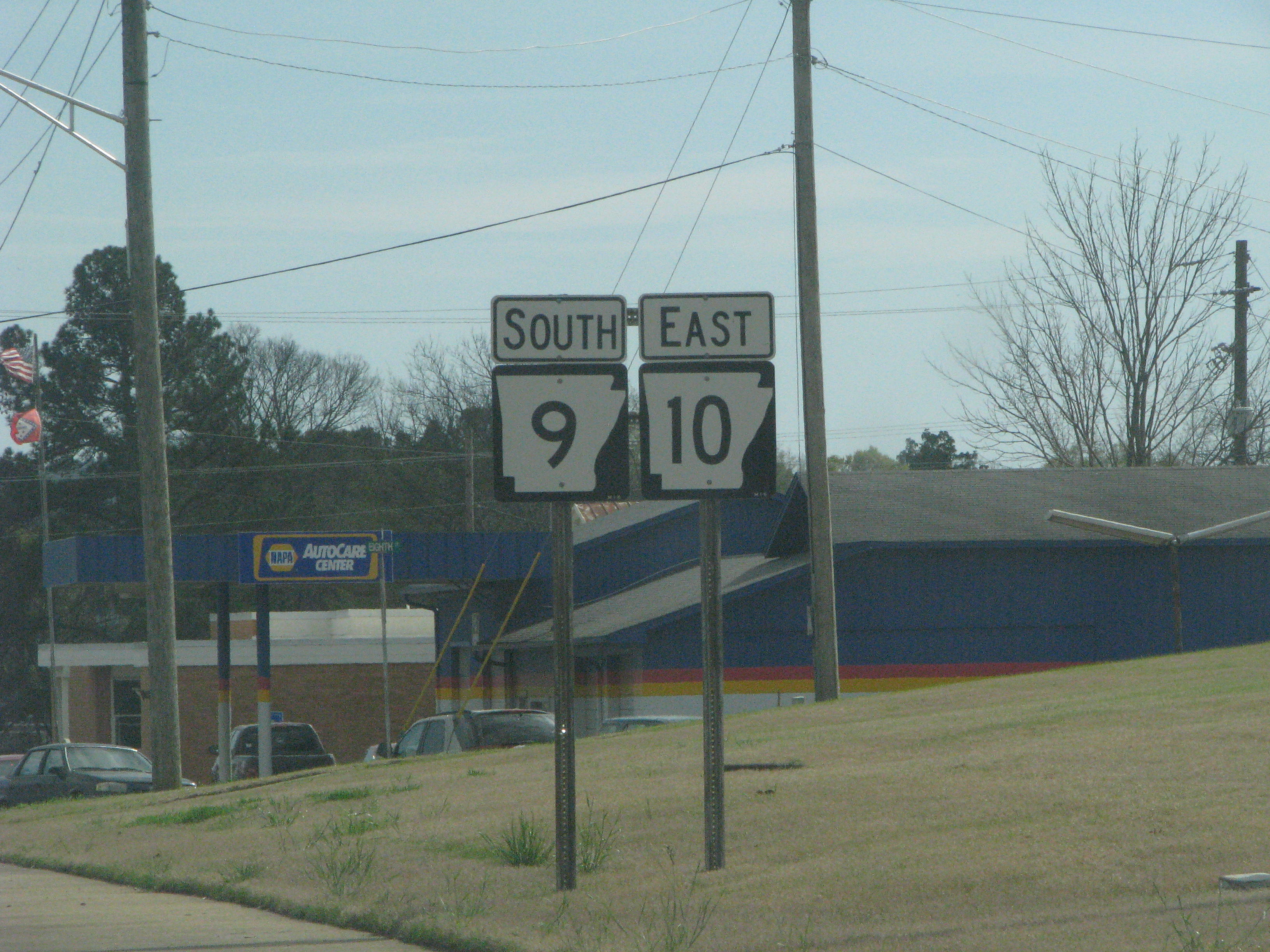
Arkansas Highway 354 is a designation for two east–west state highways in north Arkansas. The western segment of runs from Highway 9 in Oxford to Horseshoe Bend. An eastern segment of runs east from U.S. Route 167 in Ash Flat to Arkansas Highway 58. Route description Oxford to Horseshoe Bend The route begins at AR 9 in Oxford. The route runs east to Horseshoe Bend, where it terminates at AR 289. This segment of highway is named Cardinal Road, and passes through the unincorporated community of Wiseman. Ash Flat to Highway 58 Highway 354 begins in Ash Flat at US 167, and runs east as Main Street. The route winds southeast through Center to meet Arkansas Highway 58, where it terminates. Highway 354 runs along the southern part of the Harold E. Alexander Wildlife Management Area. Major intersections , - , colspan=6 align=center, Highway 354 eastern segment begins in Ash Flat , - See also * List of state highways in Arkansas References External links {{commo ... [...More Info...] [...Related Items...] OR: [Wikipedia] [Google] [Baidu] |
Arkansas State Highway And Transportation Department
The Arkansas Department of Transportation (ArDOT), formerly the Arkansas Highway and Transportation Department, is a government department in the U.S. state of Arkansas. Its mission is to provide a safe, efficient, aesthetically pleasing and environmentally sound intermodal transportation system for the user. The department is responsible for implementing policy made by the Arkansas State Highway Commission, a board of officials appointed by the Governor of Arkansas to direct transportation policy in the state. The department's director is appointed by the commission to hire staff and manage construction and maintenance on Arkansas's highways. The primary duty of ArDOT is the maintenance and management of the over Arkansas Highway System. The department also conducts planning, public transportation, the State Aid County Road Program, the Arkansas Highway Police, and Federal-Aid project administration. Its headquarters are in Little Rock. History Central control of highway t ... [...More Info...] [...Related Items...] OR: [Wikipedia] [Google] [Baidu] |
Arkansas Highway 289
Highway 289 (AR 289, Ark. 289, and Hwy. 289) is a designation for two north–south state highways in north central Arkansas. A southern route of runs north from Highway 69B (AR 69B) at Sage to Zion. A second route of begins at Highway 56 in Franklin and runs north to Highway 9 in Mammoth Spring. Route description Sage to Zion Highway 289 begins at AR 69B in Sage approximately east of Melbourne in Izard County. The route runs north to the Caney Springs Cumberland Presbyterian Church, which is listed on the National Register of Historic Places (NRHP). Highway 289 continues northeast to Zion, where state maintenance ends and the road continues north under county maintenance. Mammoth Spring to Franklin Highway 289 begins in the northeastern corner of Izard County at Highway 56 in Franklin. The route runs north to a junction with AR 354 in Horseshoe Bend. The route continues north into Fulton County to Glencoe where it begins a concu ... [...More Info...] [...Related Items...] OR: [Wikipedia] [Google] [Baidu] |
State Highways In Arkansas
State may refer to: Arts, entertainment, and media Literature * ''State Magazine'', a monthly magazine published by the U.S. Department of State * ''The State'' (newspaper), a daily newspaper in Columbia, South Carolina, United States * ''Our State'', a monthly magazine published in North Carolina and formerly called ''The State'' * The State (Larry Niven), a fictional future government in three novels by Larry Niven Music Groups and labels * States Records, an American record label * The State (band), Australian band previously known as the Cutters Albums * ''State'' (album), a 2013 album by Todd Rundgren * ''States'' (album), a 2013 album by the Paper Kites * ''States'', a 1991 album by Klinik * ''The State'' (album), a 1999 album by Nickelback Television * ''The State'' (American TV series), 1993 * ''The State'' (British TV series), 2017 Other * The State (comedy troupe), an American comedy troupe Law and politics * State (polity), a centralized political organizatio ... [...More Info...] [...Related Items...] OR: [Wikipedia] [Google] [Baidu] |
List Of State Highways In Arkansas
The following is a list of state highways in Arkansas. The state does not use a numbering convention. Generally the two-digit odd numbered highways run north–south with a few exceptions; and even-numbered two-digit state highways run east–west with a few exceptions. Arkansas has long had a stigma of poor roads, dating from the "Arkansas Roads Scandal" playing a prominent role in state politics through the 1920s and 1930s, periodic allegations of corruption, waste, and fraud, and a long-running struggle to adequately fund the operation, maintenance and expansion of a large highway system serving a rural state. The state has received the designation of "worst roads in America" from several publications throughout the 1990s and into the 2000s, with Interstate 30 and Interstate 40 often ranking particularly poorly among truckers. Rankings improved until a large construction plan was completed on I-40. A 2000 survey cited the poor condition of rural interstates, as well as narro ... [...More Info...] [...Related Items...] OR: [Wikipedia] [Google] [Baidu] |
Salem, Fulton County, Arkansas
Salem is the county seat of Fulton County, Arkansas, United States. Salem was first incorporated in 1900. As of the 2010 census the population stood at 1,635. Geography Salem is located near the center of Fulton County at the intersection of US Route 62 and 412 with Arkansas Highways 9 and 395. According to the United States Census Bureau, the city has a total area of , of which , or 0.38%, is water. Climate Salem has a humid subtropical climate with mild winters and hot summers. November has the highest average precipitation, at .http://www.weather.com/weather/wxclimatology/monthly/72576 The average annual rainfall is . The average annual low temperature is 44 degrees and the average annual high is 67. Protected areas Salem City Park has a walking trail, volleyball court, picnic pavilions, children’s play area, and a lake that is stocked with fish. Preacher Roe Park is located on Highway 9 and offers a baseball/softball field and basketball court for aspiring athletes ... [...More Info...] [...Related Items...] OR: [Wikipedia] [Google] [Baidu] |
Wiseman, Arkansas
Wiseman is a small unincorporated area, unincorporated community situated along the Strawberry River (Arkansas), Strawberry River in the northeast corner of Izard County, Arkansas, Izard County, Arkansas, United States. It is within the Izard County Consolidated School District. - Brockwell, Violet Hill, and Wiseman on the map. It was previously in the Violet Hill, Arkansas, Violet Hill school district.Download In 1985 that district consolidated into Izard Consolidated.ConsolidationAnnex_from_1983.xls " Arkansas Department of Education. Retrieved on October 13, 2017. References Unincorporated communities in Izard County, Arkansas Unincorporated communities in Arkansas {{IzardCountyAR-geo-stub ...[...More Info...] [...Related Items...] OR: [Wikipedia] [Google] [Baidu] |
Unincorporated Area
An unincorporated area is a region that is not governed by a local municipal corporation. Widespread unincorporated communities and areas are a distinguishing feature of the United States and Canada. Most other countries of the world either have no unincorporated areas at all or these are very rare: typically remote, outlying, sparsely populated or List of uninhabited regions, uninhabited areas. By country Argentina In Argentina, the provinces of Chubut Province, Chubut, Córdoba Province (Argentina), Córdoba, Entre Ríos Province, Entre Ríos, Formosa Province, Formosa, Neuquén Province, Neuquén, Río Negro Province, Río Negro, San Luis Province, San Luis, Santa Cruz Province, Argentina, Santa Cruz, Santiago del Estero Province, Santiago del Estero, Tierra del Fuego Province, Argentina, Tierra del Fuego, and Tucumán Province, Tucumán have areas that are outside any municipality or commune. Australia Unlike many other countries, Australia has only local government in Aus ... [...More Info...] [...Related Items...] OR: [Wikipedia] [Google] [Baidu] |
Arkansas Highway 58
Highway 58 (AR 58, Ark. 58, and Hwy. 58) is an east–west state highway in north central Arkansas. The route of begins at Highway 14 and runs east to US Highway 67 (US 67) in Donaldson. There is also an alternate route of designated as Highway 58E near Williford. Both routes are maintained by the Arkansas State Highway and Transportation Department (AHTD). Route description AR 58 begins at AR 14 and runs north, crossing the White River and Guion. It continues north until meeting AR 69 south of Sage. The route continues east to Maxville, where it meets US 167. AR 58 concurs with US 167 until Cave City, when it begins to head northeast with AR 115. After leaving the AR 115 concurrency, the route heads due north to Poughkeepsie, where it passes the Poughkeepsie School Building and Little Springs Missionary Baptist Church, both listed on the National Register of Historic Places. Highway 58 serves as the eastern terminus for Highway 56. AR 58 continues no ... [...More Info...] [...Related Items...] OR: [Wikipedia] [Google] [Baidu] |
Oxford, Arkansas
Oxford is a city in Izard County, Arkansas, United States. The population was 670 at the 2010 census. Geography Oxford is located in northern Izard County at (36.217573, -91.918875). Its northern border is the Fulton County line. According to the United States Census Bureau, the city has a total area of , all land. Highways * Arkansas Highway 9 * Arkansas Highway 354 Demographics 2020 census As of the 2020 United States census, there were 573 people, 265 households, and 179 families residing in the city. 2000 census As of the census of 2000, there were 642 people, 263 households, and 184 families residing in the city. The population density was . There were 309 housing units at an average density of . The racial makeup of the city was 95.79% White, 0.16% Black or African American, 1.09% Native American, 0.47% from other races, and 2.49% from two or more races. 1.71% of the population were Hispanic or Latino of any race. There were 263 households, out of which 30.0% ... [...More Info...] [...Related Items...] OR: [Wikipedia] [Google] [Baidu] |
Arkansas Highway 9
Highway 9 (AR 9) is a designation for two north–south List of Arkansas state highways, state highways in Arkansas. A southern segment of begins at U.S. Route 79 at Eagle Mills, Arkansas, Eagle Mills and heads north to U.S. Route 67 in Malvern, Arkansas, Malvern before terminating. The northern segment of runs from Arkansas Highway 5, AR 5 to U.S. Route 63 in Mammoth Spring, Arkansas, Mammoth Spring. The route was created during the 1926 Arkansas state highway numbering, and has seen only minor extensions and realignments since. Pieces of both routes are designated as Arkansas Heritage Trails for use during the American Civil War, Civil War and the Trail of Tears. The AR 9 designation also extends to two spur routes and one business route. All routes are maintained by the Arkansas Department of Transportation (ArDOT). Route description Eagle Mills to Malvern Highway 9 begins at U.S. Route 67, US 67 in Malvern and heads south through Lono, Arkansas, Lono, Tulip, Arkansas, Tulip, ... [...More Info...] [...Related Items...] OR: [Wikipedia] [Google] [Baidu] |
List Of Arkansas State Highways
The following is a list of state highways in Arkansas. The state does not use a numbering convention. Generally the two-digit odd numbered highways run north–south with a few exceptions; and even-numbered two-digit state highways run east–west with a few exceptions. Arkansas has long had a stigma of poor roads, dating from the "Arkansas Roads Scandal" playing a prominent role in state politics through the 1920s and 1930s, periodic allegations of corruption, waste, and fraud, and a long-running struggle to adequately fund the operation, maintenance and expansion of a large highway system serving a rural state. The state has received the designation of "worst roads in America" from several publications throughout the 1990s and into the 2000s, with Interstate 30 and Interstate 40 often ranking particularly poorly among truckers. Rankings improved until a large construction plan was completed on I-40. A 2000 survey cited the poor condition of rural interstates, as well as narro ... [...More Info...] [...Related Items...] OR: [Wikipedia] [Google] [Baidu] |


