|
Argyre Basin
Argyre Planitia is a plain located within the impact basin Argyre in the southern highlands of Mars. Its name comes from a map produced by Giovanni Schiaparelli in 1877; it refers to Argyre, a mythical island of silver in Greek mythology. Argyre is centered at and lies between 35° and 61° S and 27° and 62° W in the Argyre quadrangle. The basin is approximately wide and drops below the surrounding plains; it is the second deepest impact basin on Mars after Hellas. The crater Galle, located on the east rim of Argyre at , strongly resembles a smiley face. The basin was formed by a giant impact during the Late Heavy Bombardment of the early Solar System, approximately 3.9 billion years ago, and may be one of the best preserved ancient impact basins from that period. Argyre is surrounded by rugged massifs which form concentric and radial patterns around the basin. Several mountain ranges are present, some of these mountain ranges include Charitum and Nereidum Montes. [...More Info...] [...Related Items...] OR: [Wikipedia] [Google] [Baidu] |
Mars Orbiter Laser Altimeter
260px, MOLA topographic images of the two hemispheres of Mars. This image appeared on the cover of ''Science'' magazine in May 1999. The Mars Orbiter Laser Altimeter (MOLA) was one of five instruments on the ''Mars Global Surveyor'' (MGS) spacecraft, which operated in Mars orbit from September 1997 to November 2006. However, the MOLA instrument transmitted altimetry data only until June 2001. The MOLA instrument transmitted infrared laser pulses towards Mars at a rate of 10 times per second, and measured the time of flight to determine the range (distance) of the MGS spacecraft to the Martian surface. The range measurements resulted in precise topographic maps of Mars. The precision maps are applicable to studies in geophysics, geology and atmospheric circulation. MOLA also functioned as a passive radiometer, and measured the radiance of the surface of Mars at 1064 nanometers. Planetary laser altimetry A laser altimeter is an instrument that measures the distance from an orbiti ... [...More Info...] [...Related Items...] OR: [Wikipedia] [Google] [Baidu] |
Noachian Epoch
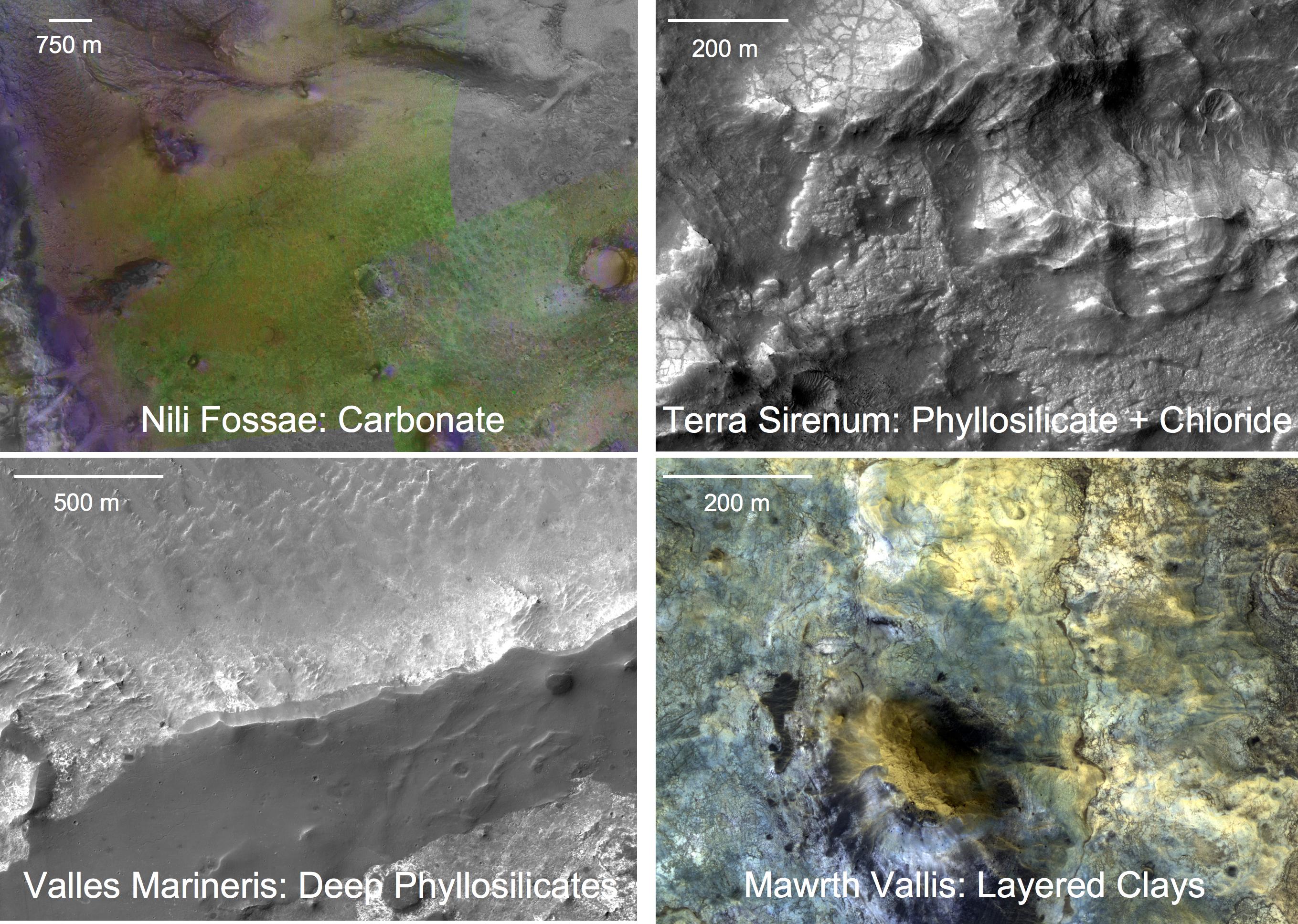
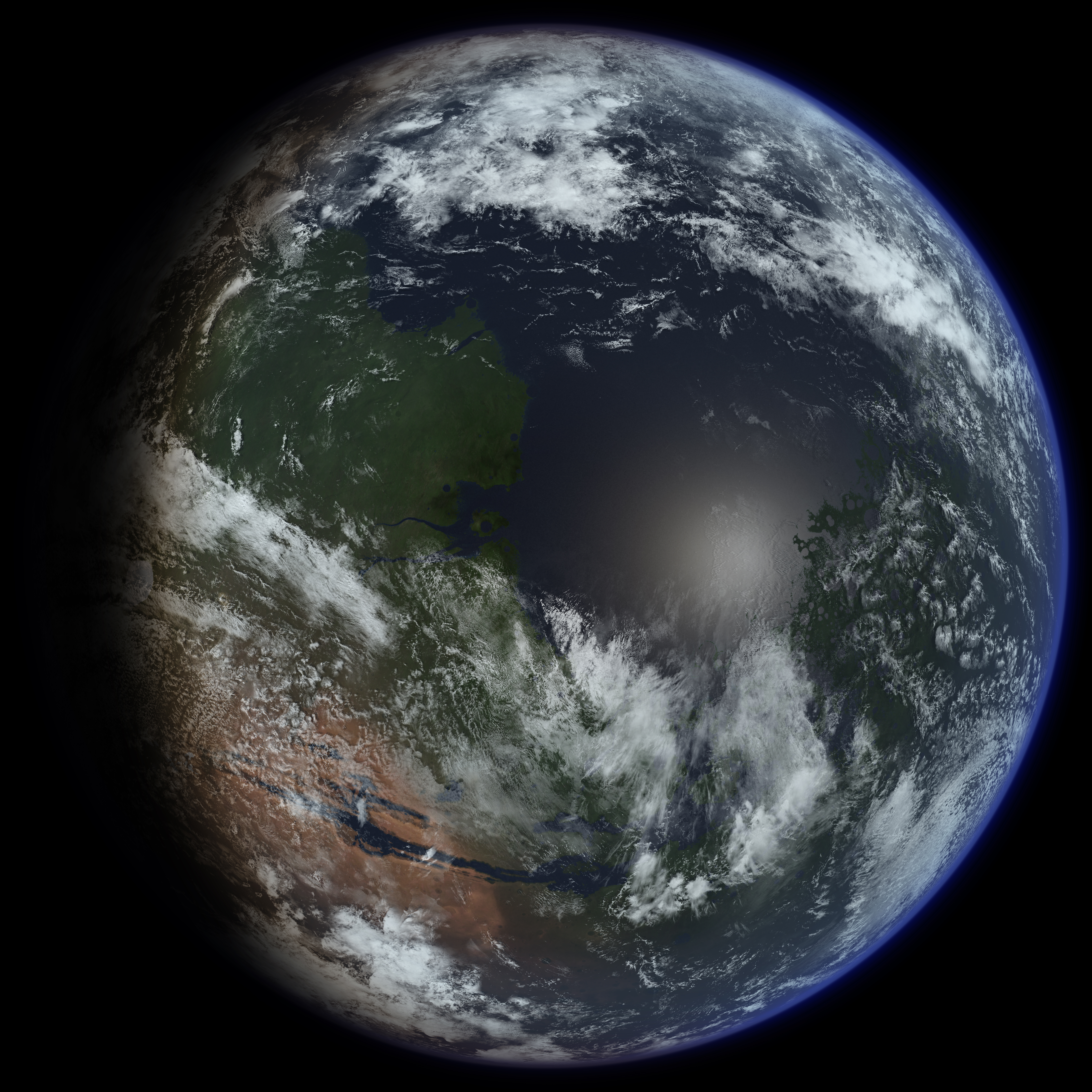
The Noachian is a geologic system and early time period on the planet Mars characterized by high rates of meteorite and asteroid impacts and the possible presence of abundant surface water. The absolute age of the Noachian period is uncertain but probably corresponds to the lunar Pre-Nectarian to Early Imbrian periods of 4100 to 3700 million years ago, during the interval known as the Late Heavy Bombardment. Many of the large impact basins on the Moon and Mars formed at this time. The Noachian Period is roughly equivalent to the Earth's Hadean and early Archean eons when the first life forms likely arose. Noachian-aged terrains on Mars are prime spacecraft landing sites to search for fossil evidence of life. During the Noachian, the atmosphere of Mars was denser than it is today, and the climate possibly warm enough to allow rainfall. Large lakes and rivers were present in the southern hemisphere, and an ocean may have covered the low-lying northern plains. Extensive volca ... [...More Info...] [...Related Items...] OR: [Wikipedia] [Google] [Baidu] |
Tarn (lake)
A tarn (or corrie loch) is a Proglacial lake, proglacial mountain lake, pond or pool, formed in a cirque excavated by a glacier. A moraine may form a natural dam below a tarn. Etymology The word is toponymy, derived from the Old Norse word ''tjörn'' ("a small mountain lake without tributaries") meaning pond. In parts of Northern England - predominantly Cumbria but also areas of North Lancashire and North Yorkshire - 'tarn' is widely used as the name for small lakes or ponds, regardless of their location and origin (e.g. Talkin Tarn, Urswick Tarn, Malham Tarn). Similarly, in Scandinavian languages, a ''tjern'' or ''tjørn'' (both Norwegian) or ''tjärn'' or ''tärn'' (both Swedish) is a small natural lake, often in a forest or with vegetation closely surrounding it or growing into the tarn. The specific technical use for a body of water in a glacial corrie comes from high number of tarns found in corries in the Lake District, an upland area in Cumbria. Nonetheless, there are ... [...More Info...] [...Related Items...] OR: [Wikipedia] [Google] [Baidu] |
Esker
An esker, eskar, eschar, or os, sometimes called an ''asar'', ''osar'', or ''serpent kame'', is a long, winding ridge of stratified sand and gravel, examples of which occur in glaciated and formerly glaciated regions of Europe and North America. Eskers are frequently several kilometres long and, because of their uniform shape, look like railway embankments. Etymology The term ''esker'' is derived from the Irish word ''eiscir'' (Old Irish: ''escir''), which means "ridge or elevation, especially one separating two plains or depressed surfaces". The Irish word was and is used particularly to describe long sinuous ridges, which are now known to be deposits of fluvio-glacial material. The best-known example of such an ''eiscir'' is the '' Eiscir Riada'', which runs nearly the whole width of Ireland from Dublin to Galway, a distance of , and is still closely followed by the main Dublin-Galway road The synonym ''os'' comes from the Swedish word ''ås'', "ridge". Geology Most eske ... [...More Info...] [...Related Items...] OR: [Wikipedia] [Google] [Baidu] |
Drumlin
A drumlin, from the Irish word ''droimnín'' ("littlest ridge"), first recorded in 1833, in the classical sense is an elongated hill in the shape of an inverted spoon or half-buried egg formed by glacial ice acting on underlying unconsolidated till or ground moraine. Assemblages of drumlins are referred to as fields or swarms; they can create a landscape which is often described as having a 'basket of eggs topography'. The low ground between two drumlins is known as a dungeon; dungeons have colder microclimates in winter from settling cold air. Morphology Drumlins occur in various shapes and sizes, including symmetrical (about the long axis), spindle, parabolic forms, and transverse asymmetrical forms. Generally, they are elongated, oval-shaped hills, with a long axis parallel to the orientation of ice flow and with an up-ice (stoss) face that is generally steeper than the down-ice (lee) face. Drumlins are typically 250 to 1,000 meters long and between 120 and 300 meters wide ... [...More Info...] [...Related Items...] OR: [Wikipedia] [Google] [Baidu] |
Life On Mars
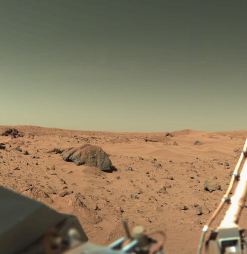
The possibility of life on Mars is a subject of interest in astrobiology due to the planet's proximity and similarities to Earth. To date, no proof of past or present life has been found on Mars. Cumulative evidence suggests that during the ancient Noachian time period, the surface environment of Mars had liquid water and may have been habitable for microorganisms, but habitable conditions do not necessarily indicate life. Scientific searches for evidence of life began in the 19th century and continue today via telescopic investigations and deployed probes. While early work focused on phenomenology and bordered on fantasy, the modern scientific inquiry has emphasized the search for water, chemical biosignatures in the soil and rocks at the planet's surface, and biomarker gases in the atmosphere. Mars is of particular interest for the study of the origins of life because of its similarity to the early Earth. This is especially true since Mars has a cold climate and lacks pl ... [...More Info...] [...Related Items...] OR: [Wikipedia] [Google] [Baidu] |
Sediment
Sediment is a naturally occurring material that is broken down by processes of weathering and erosion, and is subsequently transported by the action of wind, water, or ice or by the force of gravity acting on the particles. For example, sand and silt can be carried in suspension in river water and on reaching the sea bed deposited by sedimentation; if buried, they may eventually become sandstone and siltstone (sedimentary rocks) through lithification. Sediments are most often transported by water (fluvial processes), but also wind (aeolian processes) and glaciers. Beach sands and river channel deposits are examples of fluvial transport and deposition, though sediment also often settles out of slow-moving or standing water in lakes and oceans. Desert sand dunes and loess are examples of aeolian transport and deposition. Glacial moraine deposits and till are ice-transported sediments. Classification Sediment can be classified based on its grain size, grain shape, and c ... [...More Info...] [...Related Items...] OR: [Wikipedia] [Google] [Baidu] |
Amazonian Epoch
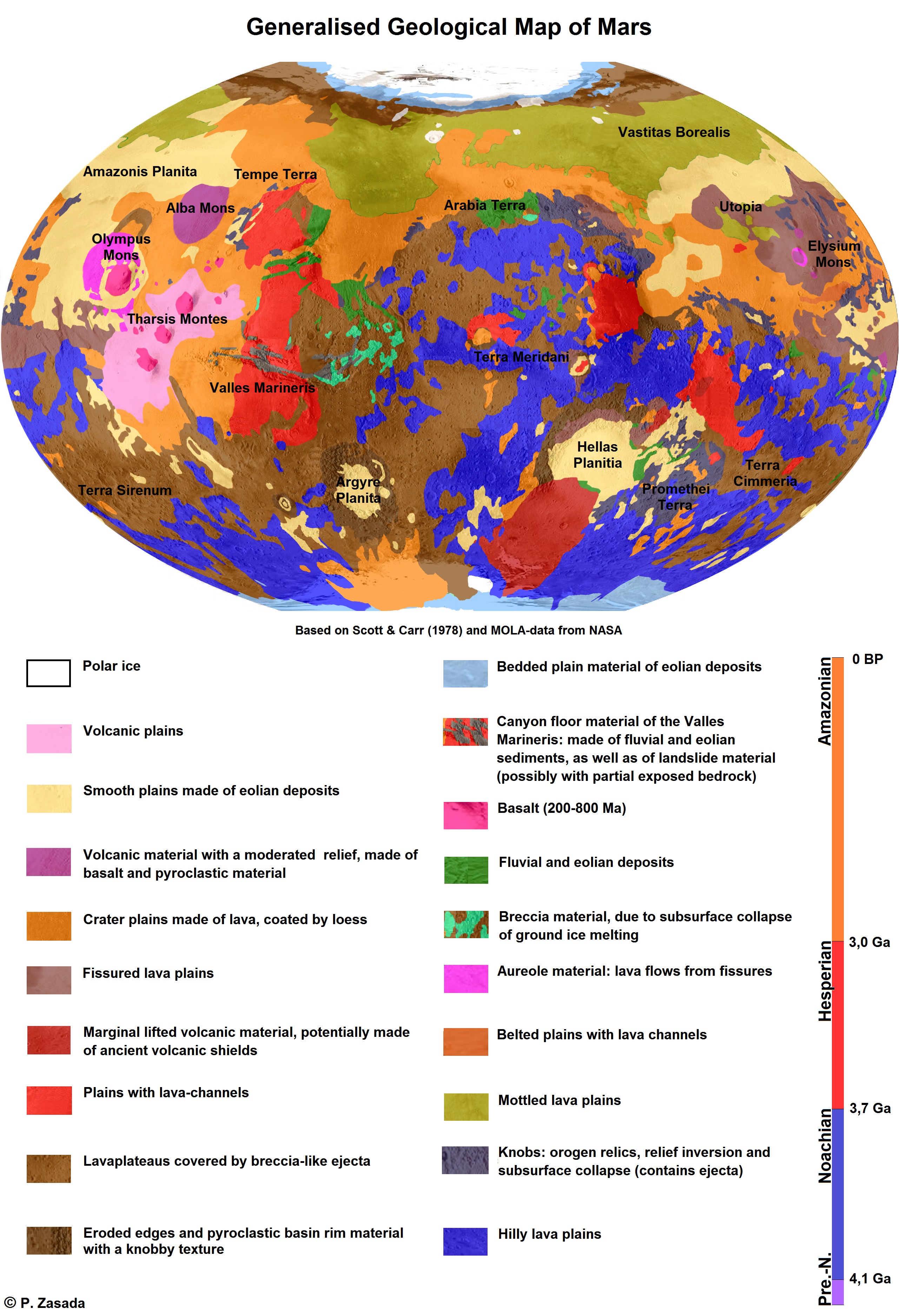
The geology of Mars is the scientific study of the surface, crust (geology), crust, and interior of the planet Mars. It emphasizes the composition, structure, history, and physical processes that shape the planet. It is analogous to the field of terrestrial geology. In planetary science, the term ''geology'' is used in its broadest sense to mean the study of the solid parts of planets and moons. The term incorporates aspects of geophysics, geochemistry, mineralogy, geodesy, and cartography. A neologism, areology, from the Greek word ''Arēs'' (Mars), sometimes appears as a synonym for Mars's geology in the popular media and works of science fiction (e.g. Kim Stanley Robinson, Kim Stanley Robinson's Mars trilogy). The term areology is also used by the Areological Society. Geological map of Mars (2014) File:Geologic Map of Mars figure2.pdf, Figure 2 for the geologic map of Mars Global Martian topography and large-scale features Composition of Mars Mars is a terrestrial ... [...More Info...] [...Related Items...] OR: [Wikipedia] [Google] [Baidu] |
Lake
A lake is an area filled with water, localized in a basin, surrounded by land, and distinct from any river or other outlet that serves to feed or drain the lake. Lakes lie on land and are not part of the ocean, although, like the much larger oceans, they do form part of the Earth's water cycle. Lakes are distinct from lagoons, which are generally coastal parts of the ocean. Lakes are typically larger and deeper than ponds, which also lie on land, though there are no official or scientific definitions. Lakes can be contrasted with rivers or streams, which usually flow in a channel on land. Most lakes are fed and drained by rivers and streams. Natural lakes are generally found in mountainous areas, rift zones, and areas with ongoing glaciation. Other lakes are found in endorheic basins or along the courses of mature rivers, where a river channel has widened into a basin. Some parts of the world have many lakes formed by the chaotic drainage patterns left over from the la ... [...More Info...] [...Related Items...] OR: [Wikipedia] [Google] [Baidu] |
Chryse Planitia
Chryse Planitia (Greek, "''Golden Plain''") is a smooth circular plain in the northern equatorial region of Mars close to the Tharsis region to the west, centered at . Chryse Planitia lies partially in the Lunae Palus quadrangle, partially in the Oxia Palus quadrangle, partially in the Mare Acidalium quadrangle. It is 1600 km or 994 mi in diameter and with a floor 2.5 km below the average planetary surface altitude, and has been suggested to be an ancient buried impact basin, though this is contested. It has several features in common with lunar maria, such as Wrinkle-ridge, wrinkle ridges. The density of impact craters in the range is close to half the average for lunar maria. Chryse Planitia shows evidence of water erosion in the past, and is the bottom end for many outflow channels from the southern highlands as well as from Valles Marineris and the flanks of the Tharsis bulge. It is one of the lowest regions on Mars ( below the mean surface elevation of Mars) ... [...More Info...] [...Related Items...] OR: [Wikipedia] [Google] [Baidu] |
Uzboi Vallis
Uzboi Vallis is a valley lying situated within the Margaritifer Sinus quadrangle (MC-19) region on Mars. It is named after the Uzboy dry channel, now in Turkmenistan, which repeatedly served as the main channel of the Amu Darya river. The valley begins on the northern rim of the Argyre basin, and cuts through several craters, before ending at Holden crater. Mapbondcrater.jpg, Part of Uzboi Vallis along with nearby craters. Colors relate to elevation. Bond crater Uzboi Vallis 574A14.jpg, Bond crater (bottom), Uzboi Vallis, and Martynov crater (top) ( Viking Orbiter 1 image) Uzboi Vallis is believed to have been formed by running water. It is believed that layers were formed on the floor of Uzboi Vallis (as shown in the HiRISE image below) when drainage was blocked by the impact that formed Holden Crater to the north. Eventually the lake in the area of Uzboi Vallis went high enough to overtop the rim of Holden. The water then eroded the deposits to expose the layers as th ... [...More Info...] [...Related Items...] OR: [Wikipedia] [Google] [Baidu] |


