|
Arctic Cordillera
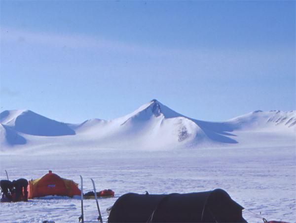
The Arctic Cordillera is a terrestrial ecozone in northern Canada characterized by a vast, deeply dissected chain of mountain ranges extending along the northeastern flank of the Canadian Arctic Archipelago from Ellesmere Island to the northeasternmost part of the Labrador Peninsula in northern Labrador and northern Quebec, Canada. It spans most of the eastern coast of Nunavut with high glaciated peaks rising through ice fields and some of Canada's largest ice caps, including the Penny Ice Cap on Baffin Island. It is bounded to the east by Baffin Bay, Davis Strait and the Labrador Sea while its northern portion is bounded by the Arctic Ocean. Overview The range is mostly located in Nunavut but extends southeast into the northernmost tip of Labrador and northeastern Quebec. The system is divided into a series of ranges, with mountains reaching heights of more than . The highest is Barbeau Peak on Ellesmere Island at , which is the highest point in eastern North America. The syst ... [...More Info...] [...Related Items...] OR: [Wikipedia] [Google] [Baidu] |
Baffin Mountains
The Baffin Mountains are a mountain range running along the northeastern coast of Baffin Island and Bylot Island, Nunavut, Canada. The ice-capped mountains are part of the Arctic Cordillera and have some of the highest peaks of eastern North America, reaching a height of above sea level. While they are separated by bodies of water to make Baffin Island, they are closely related to the other mountain ranges that make the much larger Arctic Cordillera mountain range. Terrain The highest point is Mount Odin at while Mount Asgard (''Sivanitirutinguak'') at is perhaps the best known. The highest point in the northern Baffin Mountains is Qiajivik Mountain at . There are no trees in the Baffin Mountains because they are north of the Arctic tree line. Rocks that compose the Baffin Mountains are primarily deeply dissected granitic rocks. They were covered with ice until about 1500 years ago, and vast parts of them are still ice-covered. Geologically, the Baffin Mountains form the easte ... [...More Info...] [...Related Items...] OR: [Wikipedia] [Google] [Baidu] |
Baffin Bay
Baffin Bay ( Inuktitut: ''Saknirutiak Imanga''; kl, Avannaata Imaa; french: Baie de Baffin), located between Baffin Island and the west coast of Greenland, is defined by the International Hydrographic Organization as a marginal sea of the Arctic Ocean. It is sometimes considered a sea of the North Atlantic Ocean. It is connected to the Atlantic via Davis Strait and the Labrador Sea. The narrower Nares Strait connects Baffin Bay with the Arctic Ocean. The bay is not navigable most of the year because of the ice cover and high density of floating ice and icebergs in the open areas. However, a polynya of about , known as the North Water, opens in summer on the north near Smith Sound. Most of the aquatic life of the bay is concentrated near that region. Extent The International Hydrographic Organization defines the limits of Baffin Bay as follows: History The area of the bay has been inhabited since BC. Around AD 1200, the initial Dorset settlers were replaced by ... [...More Info...] [...Related Items...] OR: [Wikipedia] [Google] [Baidu] |
Northern Arctic
The Northern Arctic Ecozone, as defined by the Commission for Environmental Cooperation (CEC), is a Canadian terrestrial ecozone which includes most of the Canadian Arctic Archipelago, the Boothia and Melville Peninsulas of Nunavut, and the northwestern tip of Quebec. Its marine borders are with the Arctic Archipelago Marine Ecozone, and it is adjacent to the mainland Southern Arctic Ecozone. Sparsely populated, it is home to 15,000 inhabitants, approximately 80% of whom are Inuit. The largest settlement is Iqaluit. The cold winters are very dark, typically having no daylight for weeks or even months north of the Arctic Circle. Geography Palaeozoic and Mesozoic sedimentary rock forms the western portion of the ecozone, whereas Precambrian granite is the dominant feature in the east. Broad flat plains are common on the coastlines, and extend inland up to in some parts. In the east, plateaus and rocky hills merge into the foothills of the Arctic Cordillera. The west is charact ... [...More Info...] [...Related Items...] OR: [Wikipedia] [Google] [Baidu] |
Mixedwood Plains Ecozone (Canada)
The Mixedwood Plains Ecozone is the Canadian ecozone with the most southern extent, covering all of southwestern Ontario, and parts of central and northeastern Ontario and southern Quebec along the Saint Lawrence River. It was originally dominated by temperate deciduous forest growing mostly on limestone covered by glacial till. It is the smallest ecozone in Canada, but it includes the country's most productive industrial and commercial region, and is home to nearly half of Canada's population, including its two largest cities, Toronto, Ontario and Montreal, Quebec. Hence, little of the original forest cover remains, making protection of the remaining forests a high conservation priority. This ecozone includes two regions described by J.S. Rowe in his classic ''Forest Regions of Canada'': the entire Deciduous Forest Region, and the southern portions of the Great Lakes-St. Lawrence Forest Region. In the province of Ontario, the Ontario Ministry of Natural Resources maps this area ... [...More Info...] [...Related Items...] OR: [Wikipedia] [Google] [Baidu] |
Cordillera
A cordillera is an extensive chain and/or network system of mountain ranges, such as those in the west coast of the Americas. The term is borrowed from Spanish, where the word comes from , a diminutive of ('rope'). The term is most commonly used in physical geography p. 687 (Encyclopedia Americana Corp., 1918): "It is used particularly in physical geography, although in geology also it is sometimes applied...." and is particularly applied to the various large |
Atlantic Provinces
Atlantic Canada, also called the Atlantic provinces (french: provinces de l'Atlantique), is the region of Eastern Canada comprising the provinces located on the Atlantic coast, excluding Quebec. The four provinces are New Brunswick, Newfoundland and Labrador, Nova Scotia, and Prince Edward Island. As of 2021, the landmass of the four Atlantic provinces was approximately 488,000 km2, and had a population of over 2.4 million people. The provinces combined had an approximate GDP of $121.888 billion in 2011. The term ''Atlantic Canada'' was popularized following the admission of Newfoundland as a Canadian province in 1949. History The first premier of Newfoundland, Joey Smallwood, coined the term "Atlantic Canada" when Newfoundland joined Canada in 1949. He believed that it would have been presumptuous for Newfoundland to assume that it could include itself within the existing term "Maritime provinces," used to describe the cultural similarities shared by New Brunswick, Prince E ... [...More Info...] [...Related Items...] OR: [Wikipedia] [Google] [Baidu] |
Gaspé Peninsula
The Gaspé Peninsula, also known as Gaspesia (; ), is a peninsula along the south shore of the Saint Lawrence River that extends from the Matapedia Valley in Quebec, Canada, into the Gulf of Saint Lawrence. It is separated from New Brunswick on its southern side by Chaleur Bay and the Restigouche River. The name ''Gaspé'' comes from the Miꞌkmaq word , meaning "end", referring to the end of the land. The Gaspé Peninsula is slightly larger than Belgium, at . The population is 140,599 as of the 2011 census.The population of the Gaspe Peninsula is determined by adding the population of two federal electoral districts, Haute-Gaspésie—La Mitis—Matane—Matapédia and Gaspésie—Îles-de-la-Madeleine, while subtracting that of the Magdalen Islands. It is also noted as being the only region outside the Channel Islands to contain native speakers of Jersey Norman. Geography Sea cliffs dominate the peninsula's northern shore along the St. Lawrence River. Cap Gaspé, jutt ... [...More Info...] [...Related Items...] OR: [Wikipedia] [Google] [Baidu] |
Appalachian Mountains
The Appalachian Mountains, often called the Appalachians, (french: Appalaches), are a system of mountains in eastern to northeastern North America. The Appalachians first formed roughly 480 million years ago during the Ordovician Period. They once reached elevations similar to those of the Alps and the Rocky Mountains before experiencing natural erosion. The Appalachian chain is a barrier to east–west travel, as it forms a series of alternating ridgelines and valleys oriented in opposition to most highways and railroads running east–west. Definitions vary on the precise boundaries of the Appalachians. The United States Geological Survey (USGS) defines the ''Appalachian Highlands'' physiographic division as consisting of 13 provinces: the Atlantic Coast Uplands, Eastern Newfoundland Atlantic, Maritime Acadian Highlands, Maritime Plain, Notre Dame and Mégantic Mountains, Western Newfoundland Mountains, Piedmont, Blue Ridge, Valley and Ridge, St. Lawrence Valley, Appalac ... [...More Info...] [...Related Items...] OR: [Wikipedia] [Google] [Baidu] |
Western Canada
Western Canada, also referred to as the Western provinces, Canadian West or the Western provinces of Canada, and commonly known within Canada as the West, is a Canadian region that includes the four western provinces just north of the Canada–United States border namely (from west to east) British Columbia, Alberta, Saskatchewan and Manitoba. The people of the region are often referred to as "Western Canadians" or "Westerners", and though diverse from province to province are largely seen as being collectively distinct from other Canadians along cultural, linguistic, socioeconomic, geographic, and political lines. They account for approximately 32% of Canada's total population. The region is further subdivided geographically and culturally between British Columbia, which is mostly on the western side of the Canadian Rockies and often referred to as the " west coast", and the "Prairie Provinces" (commonly known as "the Prairies"), which include those provinces on the easter ... [...More Info...] [...Related Items...] OR: [Wikipedia] [Google] [Baidu] |
Western Cordillera (North America)
The North American Cordillera, sometimes also called the Western Cordillera of North America, the Western Cordillera or the Pacific Cordillera, is the North American portion of the American Cordillera, the mountain chain system (cordillera) along the western coast (Pacific coast) of the Americas. The North American Cordillera covers an extensive area of mountain ranges, intermontane basins and plateaus in Western/ Northwestern Canada, Western United States and Mexico, including much of the territory west of the Great Plains. The precise boundaries of this cordillera and its subregions, as well as the names of its various features, may differ depending on the definitions in each country or jurisdiction, and also depending on the scientific field; this cordillera is a particularly prominent subject in the scientific field of physical geography.Melanie Ostopowich (2005) The Cordillera', Weigl Educational Publishers Limited, , pp. 6, 12, and 20: "The Cordillera is one of the seven g ... [...More Info...] [...Related Items...] OR: [Wikipedia] [Google] [Baidu] |
North America
North America is a continent in the Northern Hemisphere and almost entirely within the Western Hemisphere. It is bordered to the north by the Arctic Ocean, to the east by the Atlantic Ocean, to the southeast by South America and the Caribbean Sea, and to the west and south by the Pacific Ocean. Because it is on the North American Plate, North American Tectonic Plate, Greenland is included as a part of North America geographically. North America covers an area of about , about 16.5% of Earth's land area and about 4.8% of its total surface. North America is the third-largest continent by area, following Asia and Africa, and the list of continents and continental subregions by population, fourth by population after Asia, Africa, and Europe. In 2013, its population was estimated at nearly 579 million people in List of sovereign states and dependent territories in North America, 23 independent states, or about 7.5% of the world's population. In Americas (terminology)#Human ge ... [...More Info...] [...Related Items...] OR: [Wikipedia] [Google] [Baidu] |
Barbeau Peak
__NOTOC__ Barbeau Peak is a mountain in Qikiqtaaluk, Nunavut, Canada. Located on Ellesmere Island within Quttinirpaaq National Park, it is the highest mountain in Nunavut and the Canadian Arctic. The mountain was named in 1969 after Marius Barbeau, a Canadian anthropologist whose research into First Nations and Inuit cultures gained him international acclaim. Barbeau Peak is characterized by deep and long crevasses, razor thin ridges and highly variable and volatile weather. Barbeau Peak is the highest mountain within the British Empire Range as well as the Arctic Cordillera, as well as in all of eastern North America. Barbeau Peak was first climbed on 7 June 1967 by British geologist/glaciologist Geoffrey Hattersley-Smith as part of a joint Defence Research Board/Royal Air Force field party. The party both named the peak and determined its height. The second ascent was by an eight-man American team in June 1982 (Errington, Trafton AAC 1983) via the north ridge. Subsequent ascen ... [...More Info...] [...Related Items...] OR: [Wikipedia] [Google] [Baidu] |

.jpg)


.jpg)
