|
Appi Kogen Ski Resort
The is one of the largest ski resorts in Japan, operated by Iwate Hotel & Resort, adjacent to the Towada-Hachimantai National Park. The resort is most famous for its ski slopes, but it also has a guest ranch, golf courses, tennis courts, soccer fields, sports clubs, hot springs (onsen), and other amenities. The resort is 50 minutes from Morioka Station on the Tohoku Shinkansen by non-stop express bus. This station is approximately (2 hr 10 min) from Tokyo Station. By car, it is about 30-50 minute drive from the city of Morioka, 15 min from Matsuo-Hachimantai IC on the Tōhoku Expressway, or 20 min from Ashiro IC on the Tohoku Expwy. History The development of the resort was led by Hiromasa Ezoe, a Japanese entrepreneur and the founder of the advertising and human resources company Recruit. The name of this area, Appi, is derived from the Ainu language word, meaning "a place where one can live in peace" (Kogen means heights or highlands in Japanese). The construction ... [...More Info...] [...Related Items...] OR: [Wikipedia] [Google] [Baidu] |
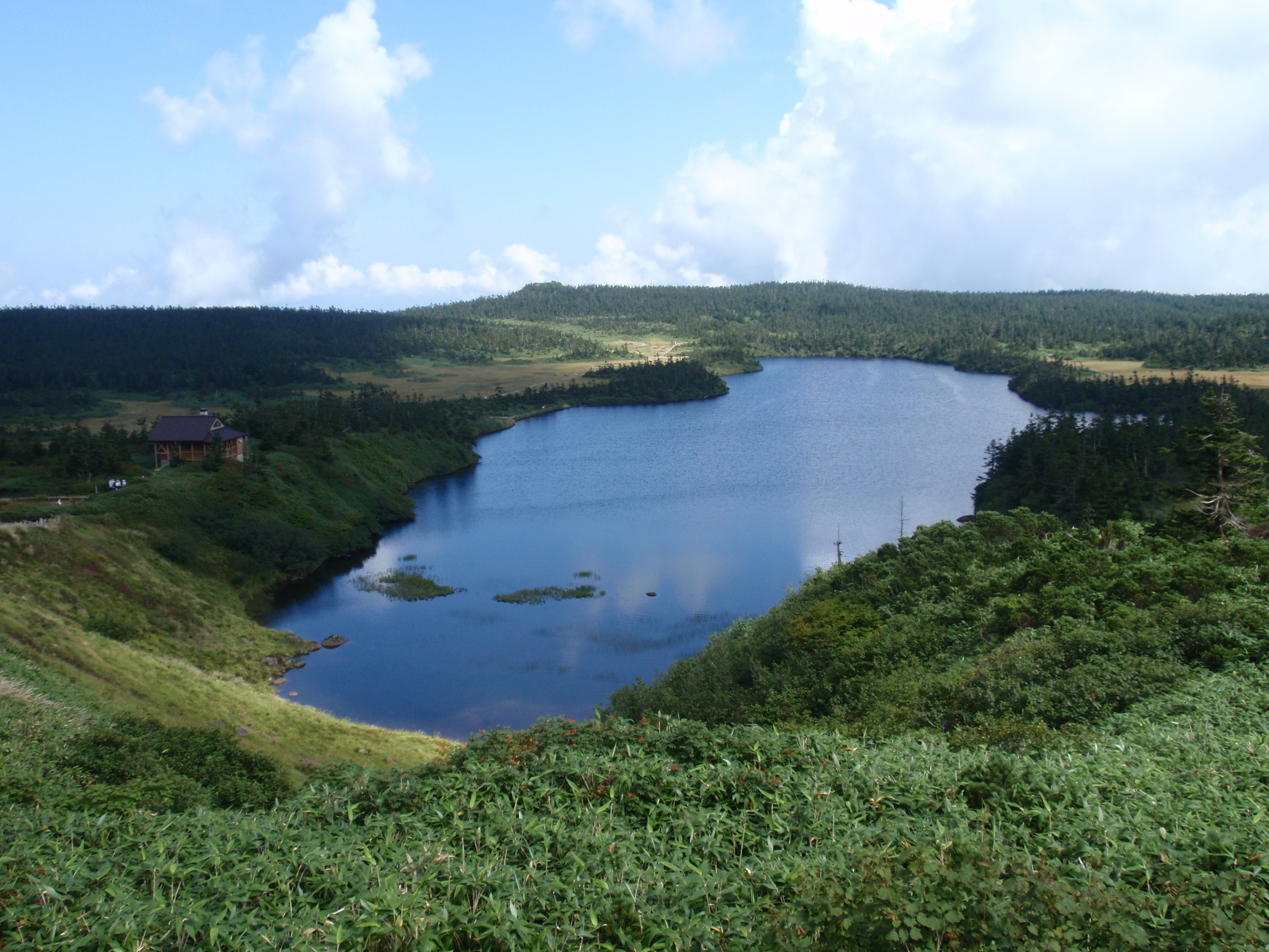
Hachimantai, Iwate
is a city located in Iwate Prefecture, Japan. , the city had an estimated population of 25,076, and a population density of 29 persons per km2 in 10,531 households. The total area of the city is . Geography Hachimantai is located in the Ōu Mountains of far northwest Iwate Prefecture, bordered by Aomori Prefecture to the north and Akita Prefecture to the west. The headwaters of the Yoneshiro River are in Hachimanai. Part of Mount Hachimantai and Mount Iwate are within its borders. Parts of the city are within the borders of the Towada-Hachimantai National Park. Mount Iwate, the highest mountain in Iwate Prefecture, is on the border of Hachimantai with Shizukuishi and Takizawa. Neighboring municipalities Aomori Prefecture *Takko Akita Prefecture *Kazuno * Semboku Iwate Prefecture *Morioka * Ninohe * Takizawa * Ichinohe * Iwate *Shizukuishi Climate Hachimantai has a humid continental climate (Köppen climate classification ''Dfa''), the same as much of Hokkaido to the north, cha ... [...More Info...] [...Related Items...] OR: [Wikipedia] [Google] [Baidu] |
Towada-Hachimantai National Park
is a national park comprising two separate areas of Aomori, Iwate, and Akita Prefectures, Japan. The Towada-Hakkōda area encompasses Lake Towada, Mount Hakkōda, and most of the Oirase River valley. The Hachimantai area includes Mount Hachimantai, Mount Iwate, Tamagawa Onsen, and . The two areas are apart, and cover . Related municipalities * Aomori: Aomori, Hirakawa, Kuroishi, Towada * Iwate: Hachimantai, Shizukuishi, Takizawa * Akita: Kazuno, Kosaka, Semboku See also *List of national parks of Japan References External links **Towada-Hachimantai National Park(JNTO The , JNTO, provides information about Japan to promote travel to and in the country. It was established in 1964 and its headquarters are in Yotsuya, Shinjuku-ku, Tokyo. The JNTO operates Tourist Information Centers (TICs) as well as a website ...) *Towada-Hachimantai National ParkMap of Towada-Hachimantai National Park (area 1)Map of Towada-Hachimantai National Park (area 2)* National p ... [...More Info...] [...Related Items...] OR: [Wikipedia] [Google] [Baidu] |
Tōhoku Expressway
The is a south-north national expressway, and the longest expressway in Japan at . Its southern terminus is in Kawaguchi, Saitama in the Greater Tokyo Area, at the Tokyo Gaikan Expressway and Kawaguchi Route near Araijuku Station, and its northern terminus is at Aomori Interchange in Aomori, Aomori in the northern part of the Tōhoku region, where it meets the Aomori Expressway and Aomori Belt Highway near the Sannai-Maruyama Site. It is owned by and operated by East Nippon Expressway Company. The expressway is signed E4 under the "2016 Proposal for Realization of Expressway Numbering", because it roughly parallels National Route 4. Route description The expressway links the Tōhoku region with the Kantō region and the greater Tokyo urban area. It is also the longest expressway among all expressways operated by East Nippon Expressway Company. Starting at a junction with the Tokyo Gaikan Expressway to the north of Tokyo, the expressway follows a northerly course through the ... [...More Info...] [...Related Items...] OR: [Wikipedia] [Google] [Baidu] |
Morioka
is the capital city of Iwate Prefecture located in the Tōhoku region of northern Japan. On 1 February 2021, the city had an estimated population of 290,700 in 132,719 households, and a population density of . The total area of the city is . Geography Morioka is located in the in central Iwate Prefecture, at the confluence of three rivers, the Kitakami, the Shizukuishi and the Nakatsu. The Kitakami River is the second largest river on the Pacific side of Japan (after the Tone River) and the longest in the Tōhoku region. It runs through the city from north to south and has a number of dams within the city boundaries, including the Shijūshida Dam and Gandō Dam. An active volcano, Mount Iwate, dominates the view to the northwest of the city. Mount Himekami is to the north and Mount Hayachine can sometimes be seen to the southeast. Surrounding municipalities Iwate Prefecture *Hanamaki * Hachimantai * Takizawa * Miyako *Shizukuishi * Kuzumaki * Shiwa *Yahaba * Iwaizumi Demo ... [...More Info...] [...Related Items...] OR: [Wikipedia] [Google] [Baidu] |
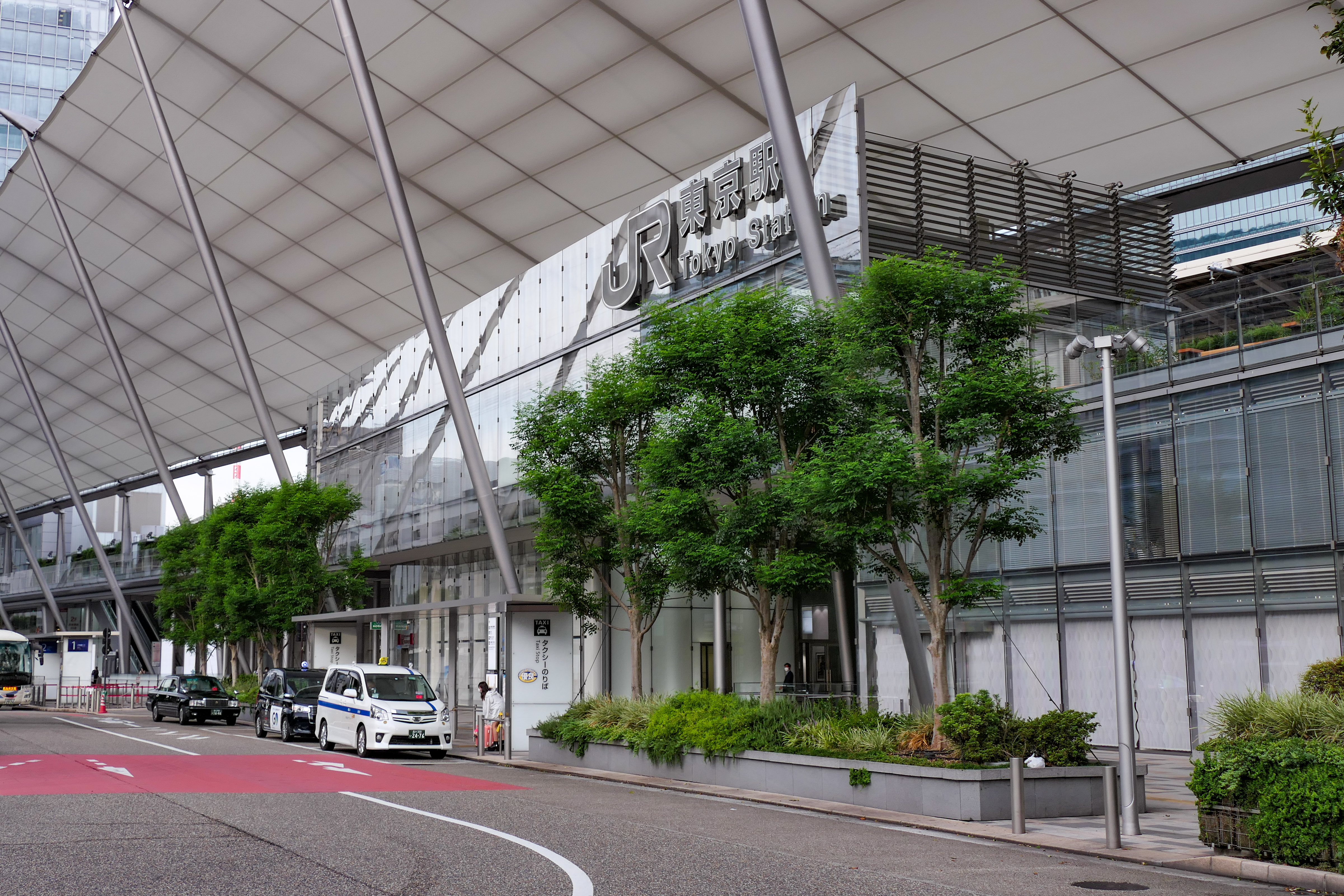
Tokyo Station
Tokyo Station ( ja, 東京駅, ) is a railway station in Chiyoda, Tokyo, Japan. The original station is located in Chiyoda's Marunouchi business district near the Tokyo Imperial Palace, Imperial Palace grounds. The newer Eastern extension is not far from the Ginza commercial district. Due to the large area covered by the station, it is divided into the Marunouchi (west) and Yaesu (east) sides in its directional signage. Served by the high-speed rail lines of the Shinkansen network, Tokyo Station is the main inter-city rail terminal in Tokyo. It is the busiest station in Japan, with more than 4,000 trains arriving and departing daily, and the fifth-busiest in Eastern Japan in terms of passenger throughput; on average, more than 500,000 people use Tokyo Station every day. The station is also served by many regional commuter lines of Japan Railways, as well as the Tokyo Metro network. Lines Trains on the following lines are available at Tokyo Station: * ** Tōhoku Shinkansen ** ... [...More Info...] [...Related Items...] OR: [Wikipedia] [Google] [Baidu] |
Morioka Station
Morioka Station ( ja, 盛岡駅, ) is a railway station in Morioka, Iwate Prefecture, Japan. It is operated by JR East. Lines Morioka Station is a major junction station, and is served by both the Tōhoku Shinkansen and the Akita Shinkansen. It is located 535.3 km from Tokyo Station. Local JR East services are provided by the Tohoku Main Line, Tazawako Line and Yamada Line, all of which terminate at Morioka Station. The station is also the southern terminus of the third-sector Iwate Ginga Railway Line. Station layout The station has three elevated island platforms for Shinkansen services, and four island platforms for local services. The station has a ''Midori no Madoguchi'' staffed ticket office. Platforms History The station was opened on November 1, 1890, by Japan's first private railway company, Nippon Railway. The line was nationalized in 1906. Services on the Tazawako Line started in 1921, on the Yamada line in 1923, the Tohoku Shinkansen in 198 ... [...More Info...] [...Related Items...] OR: [Wikipedia] [Google] [Baidu] |
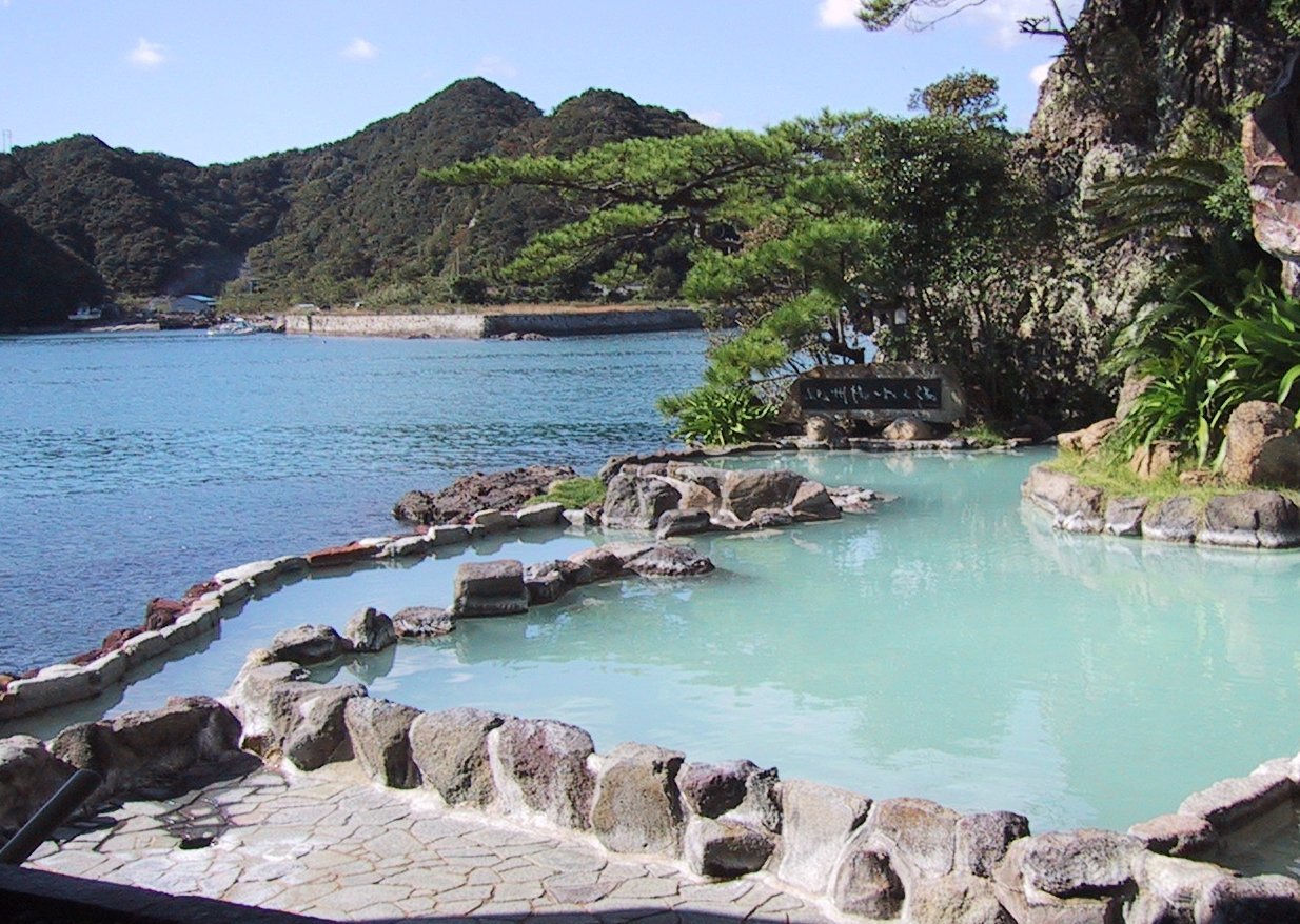
Onsen
In Japan, are the country's hot springs and the bathing facilities and traditional inns around them. As a volcanically active country, Japan has many onsens scattered throughout all of its major islands. There are approximately 25,000 hot spring sources throughout Japan that provide hot mineral water to about 3,000 genuine onsen establishments. Onsens come in many types and shapes, including and . Baths may be either publicly run by a municipality or privately, often as part of a hotel, ''ryokan'', or . The presence of an onsen is often indicated on signs and maps by the symbol ♨ or the kanji (''yu'', meaning "hot water"). Sometimes the simpler hiragana character ゆ (''yu''), understandable to younger children, is used. Traditionally, onsens were located outdoors, although many inns have now built indoor bathing facilities as well. Nowadays, as most households have their own bath, the number of traditional public baths has decreased, but the number of sightseeing ho ... [...More Info...] [...Related Items...] OR: [Wikipedia] [Google] [Baidu] |
Hot Spring
A hot spring, hydrothermal spring, or geothermal spring is a spring produced by the emergence of geothermally heated groundwater onto the surface of the Earth. The groundwater is heated either by shallow bodies of magma (molten rock) or by circulation through faults to hot rock deep in the Earth's crust. In either case, the ultimate source of the heat is radioactive decay of naturally occurring radioactive elements in the Earth's mantle, the layer beneath the crust. Hot spring water often contains large amounts of dissolved minerals. The chemistry of hot springs ranges from acid sulfate springs with a pH as low as 0.8, to alkaline chloride springs saturated with silica, to bicarbonate springs saturated with carbon dioxide and carbonate minerals. Some springs also contain abundant dissolved iron. The minerals brought to the surface in hot springs often feed communities of extremophiles, microorganisms adapted to extreme conditions, and it is possible that life on Earth had its ... [...More Info...] [...Related Items...] OR: [Wikipedia] [Google] [Baidu] |
Sports Club
A sports club or sporting club, sometimes an athletics club or sports society or sports association, is a group of people formed for the purpose of playing sports. Sports clubs range from organisations whose members play together, unpaid, and may play other similar clubs on occasion, watched mostly by family and friends, to large commercial organisations with professional players which have teams that regularly compete against those of other clubs and attract sometimes very large crowds of paying spectators. Clubs may be dedicated to a single sport or to several (multi-sport clubs). The term ''athletics club'' is sometimes used for a general sports club, rather than one dedicated to athletics proper. Organization Larger sports clubs are characterized by having professional and amateur departments in various sports such as bike polo, football, basketball, futsal, cricket, volleyball, handball, rink hockey, bowling, water polo, rugby, track and field athletics, boxing, bas ... [...More Info...] [...Related Items...] OR: [Wikipedia] [Google] [Baidu] |
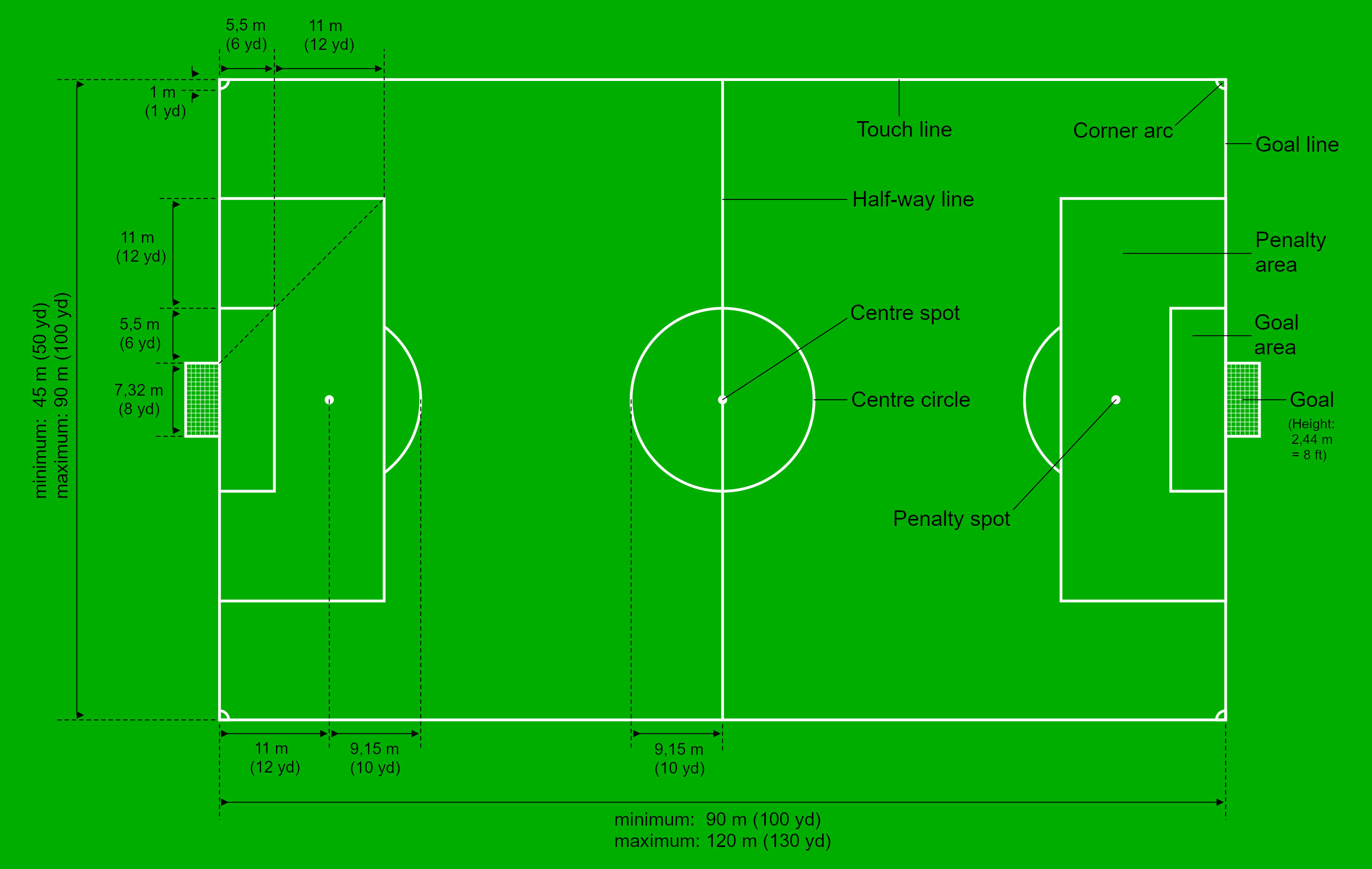
Soccer Field
A football pitch (also known as soccer field) is the playing surface for the game of association football. Its dimensions and markings are defined by Law 1 of the Laws of the Game, "The Field of Play". The pitch is typically made of natural turf or artificial turf, although amateur and recreational teams often play on dirt fields. Artificial surfaces are allowed only to be green in colour. All line markings on the pitch form part of the area which they define. For example, a ball on or above the touchline is still on the field of play, and a foul committed over the line bounding the penalty area results in a penalty. Therefore, a ball has to completely cross the touchline to be out of play, and a ball has to wholly cross the goal line (between the goal posts) in order for a goal to be scored; if any part of the ball is still on or above the line, a goal is not scored and the ball is still in play. The field descriptions that apply to adult matches are described below. Because ... [...More Info...] [...Related Items...] OR: [Wikipedia] [Google] [Baidu] |

.png)


.jpg)
