|
Aogram
Aogram is a village located in the Mongolkote sub district in Purba Bardhaman Purba Bardhaman district is in West Bengal. Its headquarters is in Bardhaman. It was formed on 7 April 2017 after the division of the previous Bardhaman district. Great revolutionary Rash Behari Bose was born in village Subaldaha in the district ..., West Bengal. It is located at a distance of 15 km from Guskhara and encompasses a total of 151.99 hectares. It is home to 182 households having a total populations of 702 individuals as of 2009. References Villages in Purba Bardhaman district {{WestBengal-geo-stub ... [...More Info...] [...Related Items...] OR: [Wikipedia] [Google] [Baidu] |
Mongalkote (community Development Block)
Mongalkote (also spelled variously as Mangalkot, Mangolkot, Mongolkot etc.) is a community development block that forms an administrative division in Katwa subdivision of Purba Bardhaman district in the Indian state of West Bengal. History Damage to embankments of the Ajay and consequent flooding was a regular problem in the Ausgram and Mangalkot area. The devastating flood of 1943 caused immense suffering and led to a mass movement for restoration/ repair of the embankments. A massive meeting was organised at Guskara in 1944, with Uday Chand Mahtab, Maharaja of Bardhaman. However, the government did not take any action. Ultimately, the Communist Party, which had been at the forefront of agitations for some years, provided a huge work force for the purpose and completed the repair work. It laid the foundation for the party's popularity in the area. Geography Location Mongalkote is located at . Mangolkote CD Block is part of the Kanksa Ketugram plain, which lies along the Ajay. ... [...More Info...] [...Related Items...] OR: [Wikipedia] [Google] [Baidu] |
Purba Bardhaman District
Purba Bardhaman district is in West Bengal. Its headquarters is in Bardhaman. It was formed on 7 April 2017 after the division of the previous Bardhaman district. Great revolutionary Rash Behari Bose was born in village Subaldaha in the district of Purba Bardhaman. Etymology Some historians link the name of the district to the 24th and last Jain ''tirthankara'', Mahavira Vardhamana, who came to preach in the area. Alternatively, ''Bardhamana'' means a prosperous and growing area. It was a forward frontier zone in the progress of Aryanisation by the people in the Upper Gangetic valley. ''Purba'' means east. History The district is recorded in the early 20th century British chronicles as ‘the richest tract in Bengal and the area of its oldest and most settled cultivation’. Archaeological excavations at Pandu Rajar Dhibi have indicated settlements in the Ajay valley in the Mesolithic age, around 5,000 BC. In early historical times Bardhamanbhukti, a part of the Rarh regio ... [...More Info...] [...Related Items...] OR: [Wikipedia] [Google] [Baidu] |
West Bengal
West Bengal (, Bengali: ''Poshchim Bongo'', , abbr. WB) is a state in the eastern portion of India. It is situated along the Bay of Bengal, along with a population of over 91 million inhabitants within an area of . West Bengal is the fourth-most populous and thirteenth-largest state by area in India, as well as the eighth-most populous country subdivision of the world. As a part of the Bengal region of the Indian subcontinent, it borders Bangladesh in the east, and Nepal and Bhutan in the north. It also borders the Indian states of Odisha, Jharkhand, Bihar, Sikkim and Assam. The state capital is Kolkata, the third-largest metropolis, and seventh largest city by population in India. West Bengal includes the Darjeeling Himalayan hill region, the Ganges delta, the Rarh region, the coastal Sundarbans and the Bay of Bengal. The state's main ethnic group are the Bengalis, with the Bengali Hindus forming the demographic majority. The area's early history featured a succession ... [...More Info...] [...Related Items...] OR: [Wikipedia] [Google] [Baidu] |
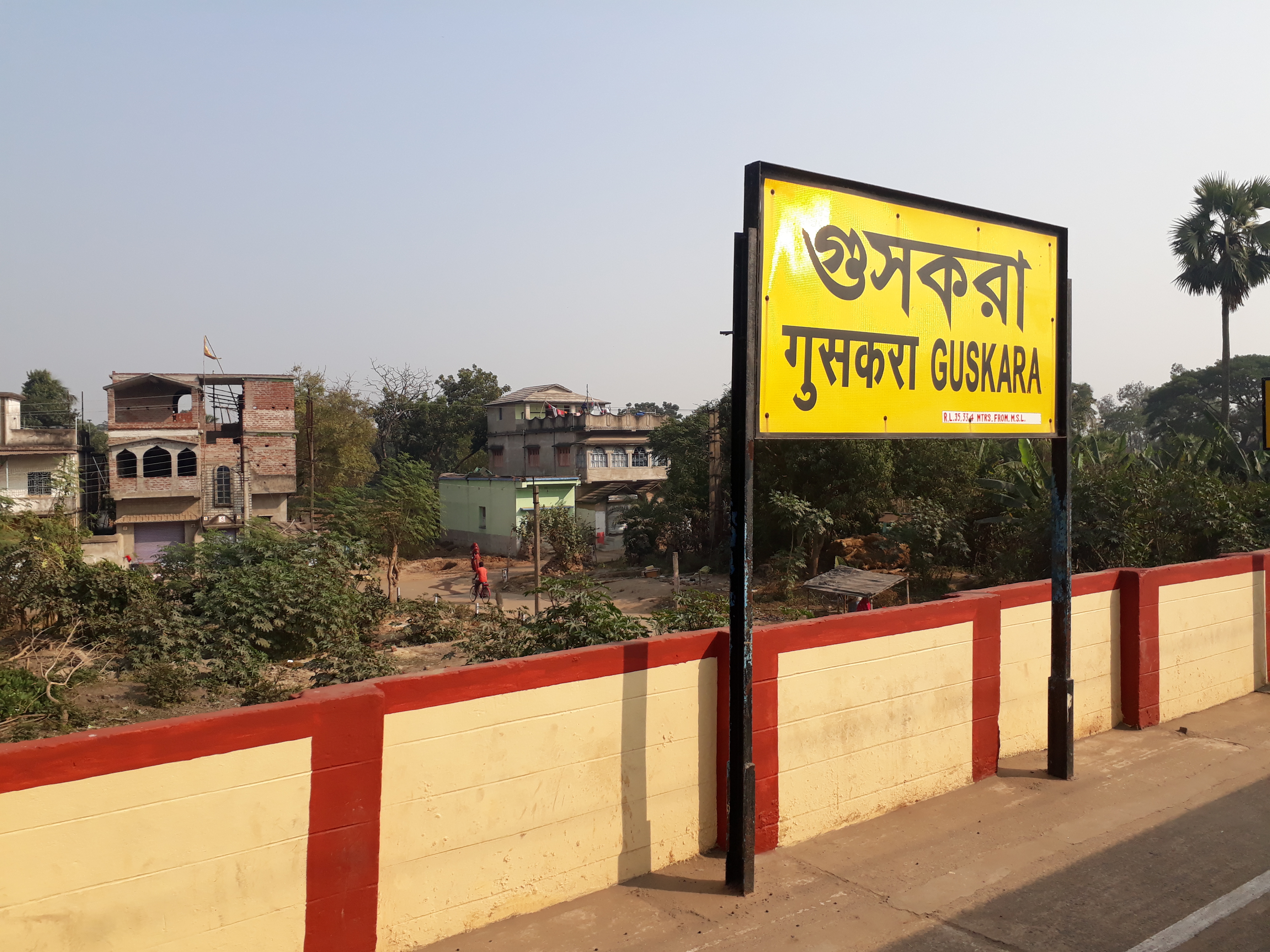
Guskara
Guskara is a town and a municipality under the Ausgram police station in Bardhaman Sadar North subdivision of Purba Bardhaman district in the Indian state of West Bengal. History The area between the Damodar and Ajay was previously known as Gopbhum. Geography Location Guskara is located at . It has an average elevation of 38 metres (125 feet). Guskara is located in the alluvial flood plains of several rivers. Kunur River flows past it. Urbanisation 73.58% of the population of Bardhaman Sadar North subdivision lives in rural areas. Only 26.42% of the population lives in urban areas, and that is the highest proportion of urban population amongst the four subdivisions in Purba Bardhaman district. The map alongside presents some of the notable locations in the subdivision. All places marked in the map are linked in the larger full-screen map. Guskara Airfield Guskara Airfield is a former wartime United States Army Air Forces airfield in India used during the Bur ... [...More Info...] [...Related Items...] OR: [Wikipedia] [Google] [Baidu] |


