|
Anza, California
Anza is a census-designated place located in southern Riverside County, California, in the Anza Valley, a semi-arid region at a mean elevation of above sea level. It is located south of Idyllwild, east-northeast of Temecula, southwest of Palm Springs, and northeast of San Diego, being traversed by State Route 371. Anza is on the Pacific Crest Trail. The population was 3,075 at the 2020 census. Locally, Anza and several other mountain communities (including Garner Valley, Idyllwild, Pinyon Pines and Aguanga) are collectively referred to as "the Hill." The ZIP code is 92539, and the community is inside area code 951. History It is estimated that the Cahuilla aboriginal tribes inhabited an area including what is today the Anza Valley more than two thousand years ago and encountered Europeans only as late as 1774, when a Spanish expedition in search of an overland route from Sonora to Alta California made its way from Tubac, Sonora through the valley to Monterey, ... [...More Info...] [...Related Items...] OR: [Wikipedia] [Google] [Baidu] |
Census-designated Place
A census-designated place (CDP) is a concentration of population defined by the United States Census Bureau for statistical purposes only. CDPs have been used in each decennial census since 1980 as the counterparts of incorporated places, such as self-governing cities, towns, and villages, for the purposes of gathering and correlating statistical data. CDPs are populated areas that generally include one officially designated but currently unincorporated community, for which the CDP is named, plus surrounding inhabited countryside of varying dimensions and, occasionally, other, smaller unincorporated communities as well. CDPs include small rural communities, edge cities, colonias located along the Mexico–United States border, and unincorporated resort and retirement communities and their environs. The boundaries of any CDP may change from decade to decade, and the Census Bureau may de-establish a CDP after a period of study, then re-establish it some decades later. Most unin ... [...More Info...] [...Related Items...] OR: [Wikipedia] [Google] [Baidu] |
State Route 371 (California)
State Route 371 (SR 371) is a state highway in Riverside County in the U.S. state of California, serving as a short connector of from SR 79 near Aguanga to SR 74 near Anza. It is a heavily-used shortcut from southwestern Riverside County to the Coachella Valley in central Riverside County via SR 74. The current route was part of SR 71 until 1973, when SR 79 and SR 71 were co-signed from Aguanga to Temecula. In 1974, the portion of SR 71 from Temecula to Corona along I-15's current alignment was deleted, and the orphaned route from Aguanga to Anza was re-signed as SR 371. SR 371 is the main highway serving the communities of Anza and Aguanga and connects both towns. SR 371 crosses through the private community of Lake Riverside, as well as Cahuilla and the Cahuilla Indian Reservation. It is the primary road running through the town of Anza but mostly serves rural areas. The highway is often plagued by shutdowns due to snow, ice, wind, and wildfires, which occasionally causes ... [...More Info...] [...Related Items...] OR: [Wikipedia] [Google] [Baidu] |
Lake Cahuilla
Lake Cahuilla ( ; also known as Lake LeConte and Blake Sea) was a prehistoric lake in California and northern Mexico. Located in the Coachella and Imperial valleys, it covered surface areas of to a height of above sea level during the Holocene. During earlier stages of the Pleistocene, the lake reached even higher elevations, up to above sea level. During the Holocene most of the water came from the Colorado River with little contribution from local runoff; in the Pleistocene local runoff was higher and it is possible that Lake Cahuilla was supported solely from local water sources during the Wisconsin glaciation. The lake overflowed close to Cerro Prieto into the Rio Hardy, eventually draining into the Gulf of California. The lake formed several times during the Holocene, when water from the Colorado River was diverted into the Salton Trough. This tectonic depression forms the northern basin of the Gulf of California, but it was separated from the sea proper by the growth o ... [...More Info...] [...Related Items...] OR: [Wikipedia] [Google] [Baidu] |
Native Sons Of The Golden West
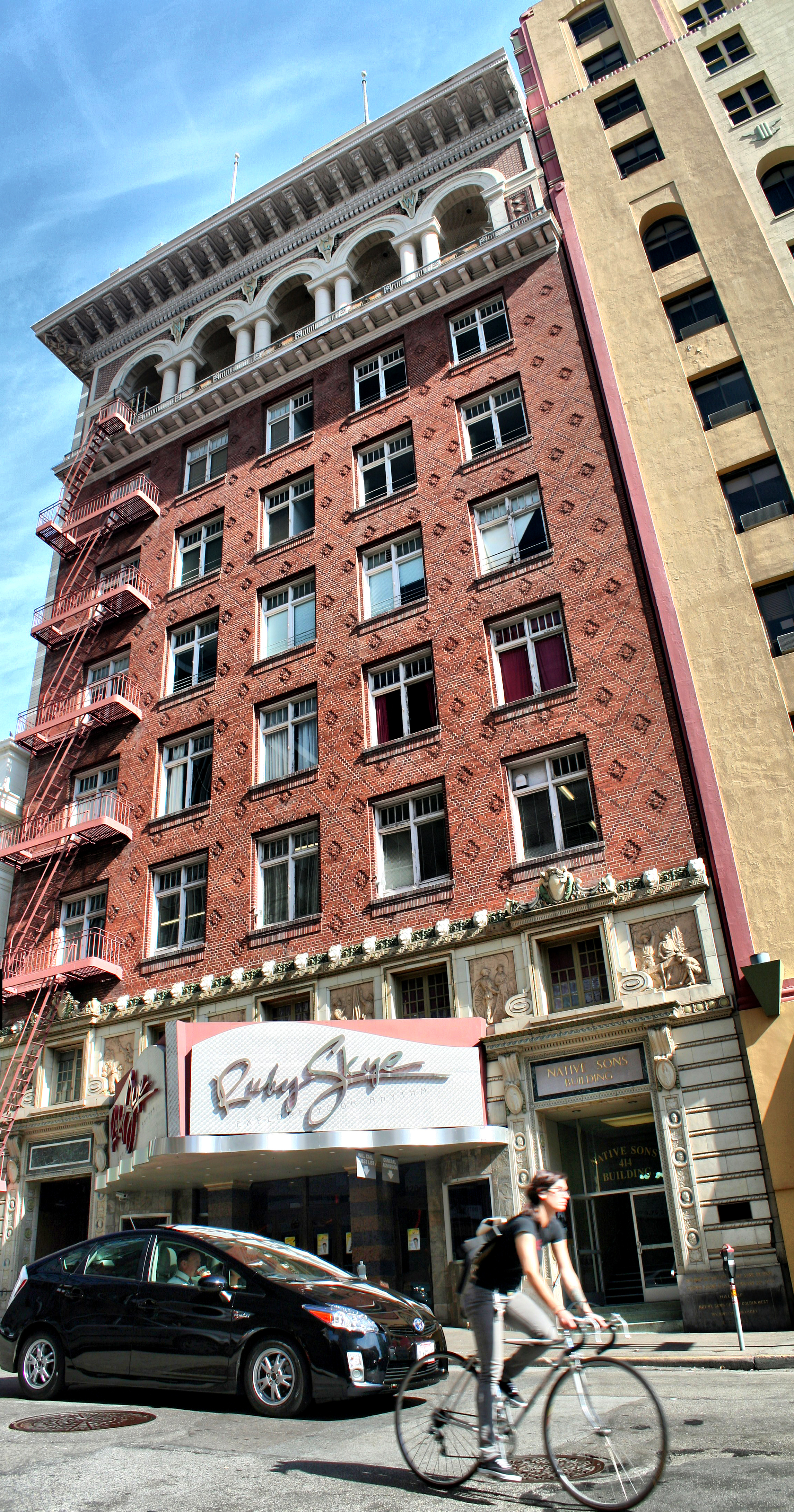
The Native Sons of the Golden West is a fraternal service organization founded in the U.S. state of California in 1875, dedicated to historic preservation, documentation of historic structures and places in the state, the placement of historic plaques and other charitable functions within California. In 1890 they placed the first historical marker in the state to honor the discovery of gold, which gave rise to the state nickname "Golden State" and "Golden West." Former U.S. President Richard M. Nixon and former Chief Justice Earl Warren were both past presidents of the NSGW. History The Native Sons of the Golden West was founded 11 July 1875 by General A. M. Winn, a Virginian, as a lasting monument to the men and women of the Gold Rush era. General Winn had lived in California during the Gold Rush and was impressed with the spirit and perseverance of the Forty-Niners. Speaking of his object in organizing the Order General Winn said, "For twenty years my mind had been running ... [...More Info...] [...Related Items...] OR: [Wikipedia] [Google] [Baidu] |
Juan Bautista De Anza
Juan Bautista de Anza Bezerra Nieto (July 6 or 7, 1736 – December 19, 1788) was an expeditionary leader, military officer, and politician primarily in California and New Mexico under the Spanish Empire. He is credited as one of the founding fathers of Spanish California and served as an official within New Spain as Governor of the Province of New Mexico. Early life Juan Bautista de Anza Bezerra Nieto was born in Fronteras, New Navarre, New Spain (today Sonora, Mexico) in 1736 (near Arizpe), most probably at Cuquiarachi, Sonora, but possibly at the Presidio of Fronteras. His family was a part of the military leadership in Nueva España, as his father and maternal grandfather, Captain Antonio Bezerra Nieto, had both served Spain, their families living on the frontier of Nueva Navarre. He was the son of Juan Bautista de Anza I. It is traditionally thought that he may have been educated at the College of San Ildefonso in Mexico City, and later at the military academy there. In ... [...More Info...] [...Related Items...] OR: [Wikipedia] [Google] [Baidu] |
Alta California
Alta California ('Upper California'), also known as ('New California') among other names, was a province of New Spain, formally established in 1804. Along with the Baja California peninsula, it had previously comprised the province of , but was split off into a separate province in 1804 (named ). Following the Mexican War of Independence, it became a territory of Mexico in April 1822 and was renamed in 1824. The territory included all of the modern U.S. states of California, Nevada, and Utah, and parts of Arizona, Wyoming, Colorado, and New Mexico. In the 1836 Siete Leyes government reorganization, the two Californias were once again combined (as a single ). That change was undone in 1846, but rendered moot by the U.S. military occupation of California in the Mexican-American War. Neither Spain nor Mexico ever colonized the area beyond the southern and central coastal areas of present-day California and small areas of present-day Arizona, so they exerted no effective cont ... [...More Info...] [...Related Items...] OR: [Wikipedia] [Google] [Baidu] |
Monterey
Monterey (; es, Monterrey; Ohlone: ) is a city located in Monterey County on the southern edge of Monterey Bay on the U.S. state of California's Central Coast. Founded on June 3, 1770, it functioned as the capital of Alta California under both Spain (1804–1821) and Mexico (1822–1846). During this period, Monterey hosted California's first theater, public building, public library, publicly-funded school, printing-press, and newspaper. It was originally the only port of entry for all taxable goods in California. In 1846, during the Mexican–American War of 1846–1848, the United States Flag was raised over the Customs House. After Mexico ceded California to the U.S. at the end of the war, Monterey hosted California's first constitutional convention in 1849. The city occupies a land area of and the city hall is at above sea level. The 2020 census recorded a population of 30,218. Monterey and the surrounding area have attracted artists since the late 19th-century, and m ... [...More Info...] [...Related Items...] OR: [Wikipedia] [Google] [Baidu] |
Sonora
Sonora (), officially Estado Libre y Soberano de Sonora ( en, Free and Sovereign State of Sonora), is one of the 31 states which, along with Mexico City, comprise the Administrative divisions of Mexico, Federal Entities of Mexico. The state is divided into Municipalities of Sonora, 72 municipalities; the capital (and largest) city of which being Hermosillo, located in the center of the state. Other large cities include Ciudad Obregón, Nogales, Sonora, Nogales (on the Mexico–United States border, Mexico-United States border), San Luis Río Colorado, and Navojoa. Sonora is bordered by the states of Chihuahua (state), Chihuahua to the east, Baja California to the northwest and Sinaloa to the south. To the north, it shares the Mexico–United States border, U.S.–Mexico border primarily with the state of Arizona with a small length with New Mexico, and on the west has a significant share of the coastline of the Gulf of California. Sonora's natural geography is divided into three ... [...More Info...] [...Related Items...] OR: [Wikipedia] [Google] [Baidu] |
Cahuilla
The Cahuilla , also known as ʔívil̃uqaletem or Ivilyuqaletem, are a Native American people of the various tribes of the Cahuilla Nation, living in the inland areas of southern California."California Indians and Their Reservations. ''SDSU Library and Information Access.'' Their original territory included an area of about . The traditional Cahuilla territory was near the geographic center of . It was bounded to the north by the , to the south by [...More Info...] [...Related Items...] OR: [Wikipedia] [Google] [Baidu] |
Portrait Of Juan Bautista De Anza (Painted By Fray Orci; 1774, Mexico City)
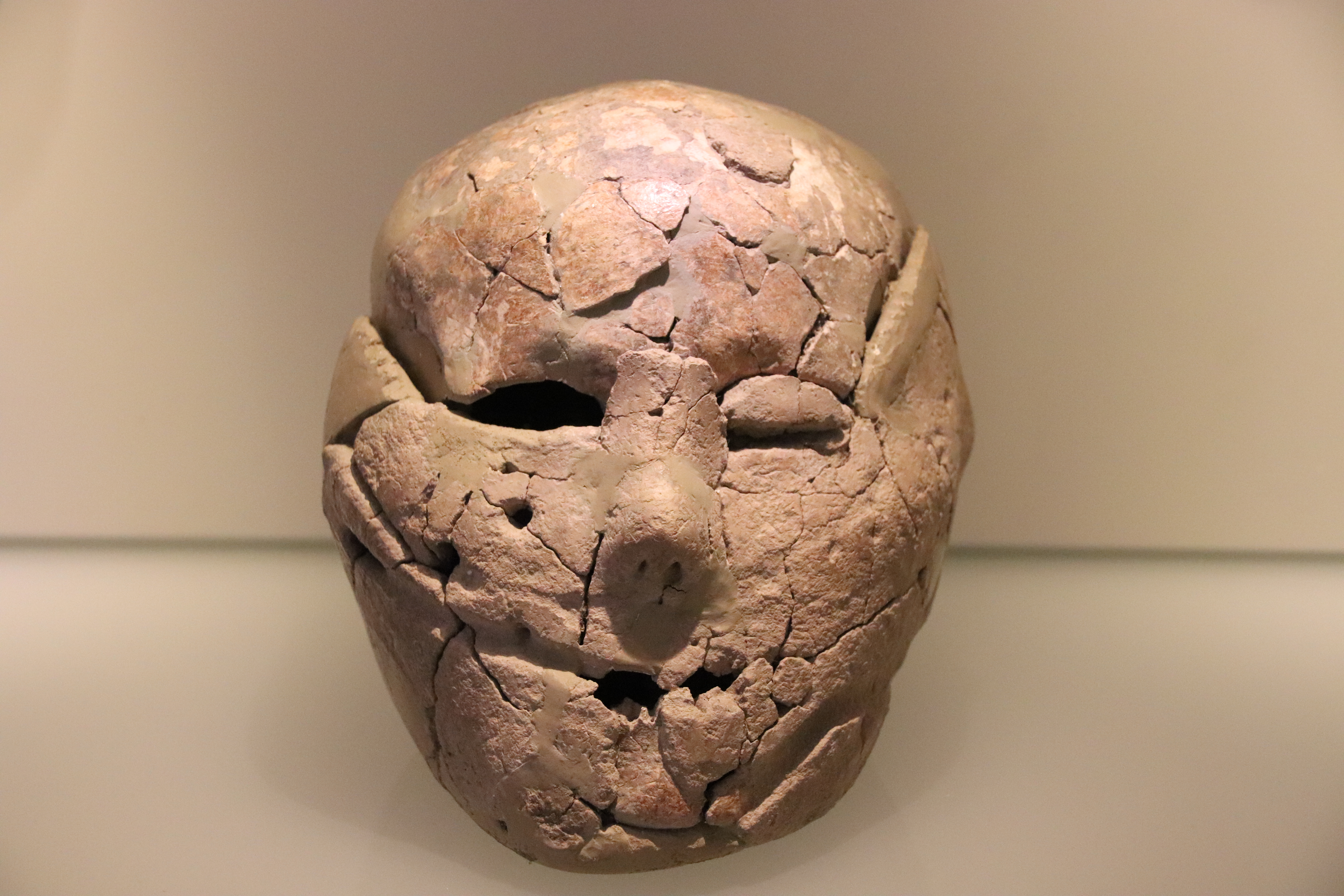
A portrait is a painting, photograph, sculpture, or other artistic representation of a person, in which the face and its expressions are predominant. The intent is to display the likeness, personality, and even the mood of the person. For this reason, in photography a portrait is generally not a snapshot, but a composed image of a person in a still position. A portrait often shows a person looking directly at the painter or photographer, in order to most successfully engage the subject with the viewer. History Prehistorical portraiture Plastered human skulls were reconstructed human skulls that were made in the ancient Levant between 9000 and 6000 BC in the Pre-Pottery Neolithic B period. They represent some of the oldest forms of art in the Middle East and demonstrate that the prehistoric population took great care in burying their ancestors below their homes. The skulls denote some of the earliest sculptural examples of portraiture in the history of art. Historical portraitur ... [...More Info...] [...Related Items...] OR: [Wikipedia] [Google] [Baidu] |
Area Code 951
Area code 951 is a California telephone area code that was split from area code 909 on July 17, 2004. It covers western Riverside County, including the cities and communities of Banning, Beaumont, Corona, Canyon Lake, Riverside, Temescal Valley, Woodcrest, Moreno Valley, Perris, Menifee, Lake Elsinore, Wildomar, Murrieta, Temecula, San Jacinto, Hemet, Lakeview, Nuevo, Norco, Eastvale, Jurupa Valley, and Idyllwild. History Until November 14, 1992, the area covered by 951 was part of area code 714. Area code 951 is currently the last new area code in California to have been split from another one. All codes introduced in the state since have been overlays. Prior to October 2021, area code 951 had telephone numbers assigned for the central office code 988. In 2020, ''988'' was designated nationwide as a dialing code for the National Suicide Prevention Lifeline, which created a conflict for exchanges that permit seven-digit dialing. This area code was therefore scheduled ... [...More Info...] [...Related Items...] OR: [Wikipedia] [Google] [Baidu] |
.jpg)


.jpg)
.jpg)
.jpg)
