|
Anthony, Rhode Island
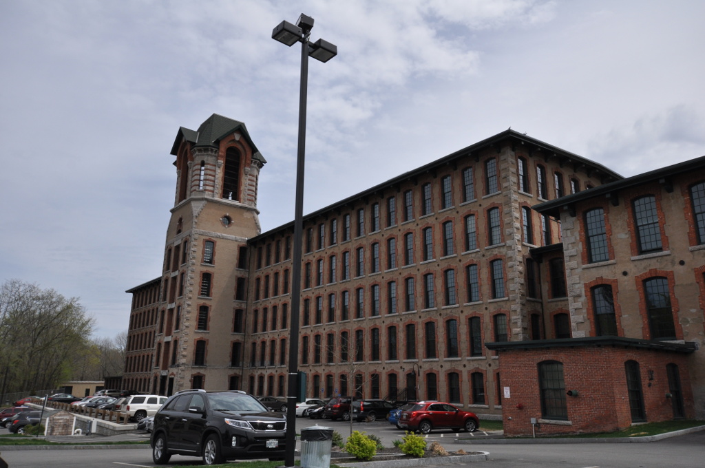
Anthony (previously known as Greenville and The Quaker Village) is a village along Route 117 within the town of Coventry, Rhode Island near the villages of Washington and Quidnick on the southwestern banks of the Pawtuxet River (Flat River). The village comprises "Anthony, Arnold, Boston, Mapledale, Meeting, Taft, Washington and Laurel Avenue."Andrew D. Boisvert, "Coventry Roots: Anthony," ''Coventry Patch'', March 18, 2011 http://coventry.patch.com/articles/coventry-roots-anthony Previously, Anthony was known as "Greenville" and "The Quaker Village." In the eighteenth century, the Greene Family were early owners of the land and gave their name to the village where they operated a gristmill, forge, and sawmill. Many of the village residents, including the Greene family, were Quakers, members of the Society of Friends and part of the Greenwich Monthly Meeting, attending meetings at the Quaker Meeting House on Meeting Street, which was used for services from 1825 to 1915. The bui ... [...More Info...] [...Related Items...] OR: [Wikipedia] [Google] [Baidu] |
Coventry, Rhode Island
Coventry is a town in Kent County, Rhode Island, United States. The population was 35,688 at the 2020 census and is part of the . Geography According to the United States Census Bureau, the town has a total area of . of it is land and of it (4.49%) is water. The town is bordered by West Warwick to the east, Foster, Scituate, and Cranston to the north, West Greenwich and East Greenwich to the south, and Sterling, Connecticut, to the west. It is the largest town in land area in Rhode Island, being surpassed in total area only by South Kingstown, Rhode Island, with water and land area of . Climate According to the Köppen Climate Classification system, Coventry has an oceanic climate, abbreviated "Cfb" on climate maps. History Coventry was first settled by English colonists in the early 18th century, when the town was part of Warwick. Since the area was so far away from the center of Warwick, the section that became Coventry grew very slowly. However, by 1741, enoug ... [...More Info...] [...Related Items...] OR: [Wikipedia] [Google] [Baidu] |
Pawtuxet River
The Pawtuxet River, also known as the Pawtuxet River Main Stem and the Lower Pawtuxet, is a river in the U.S. state of Rhode Island. It flows U.S. Geological Survey. National Hydrography Dataset high-resolution flowline dataThe National Map, accessed April 1, 2011 and empties into the upper Narragansett Bay of the Atlantic Ocean. Together with its two main tributary branches, the North Branch Pawtuxet River and the South Branch Pawtuxet River, it drains a watershed of , all of which is in the state of R.I. History The area around the river was occupied by members of the Native American Patuxet tribe, who were part of the larger Narragansett tribe. In the native language, the word "pawtuxet" means "little falls." In 1638, Roger Williams purchased the land north of the Pawtuxet, thus founding Providence. In 1642, Samuel Gorton purchased the land south of the river, thus founding Warwick. Collectively, all three branches of the Pawtuxet played an important role in the develo ... [...More Info...] [...Related Items...] OR: [Wikipedia] [Google] [Baidu] |
Quakers
Quakers are people who belong to a historically Protestant Christian set of denominations known formally as the Religious Society of Friends. Members of these movements ("theFriends") are generally united by a belief in each human's ability to experience the light within or see "that of God in every one". Some profess a priesthood of all believers inspired by the First Epistle of Peter. They include those with evangelical, holiness, liberal, and traditional Quaker understandings of Christianity. There are also Nontheist Quakers, whose spiritual practice does not rely on the existence of God. To differing extents, the Friends avoid creeds and hierarchical structures. In 2017, there were an estimated 377,557 adult Quakers, 49% of them in Africa. Some 89% of Quakers worldwide belong to ''evangelical'' and ''programmed'' branches that hold services with singing and a prepared Bible message coordinated by a pastor. Some 11% practice ''waiting worship'' or ''unprogramme ... [...More Info...] [...Related Items...] OR: [Wikipedia] [Google] [Baidu] |
Textile Mill
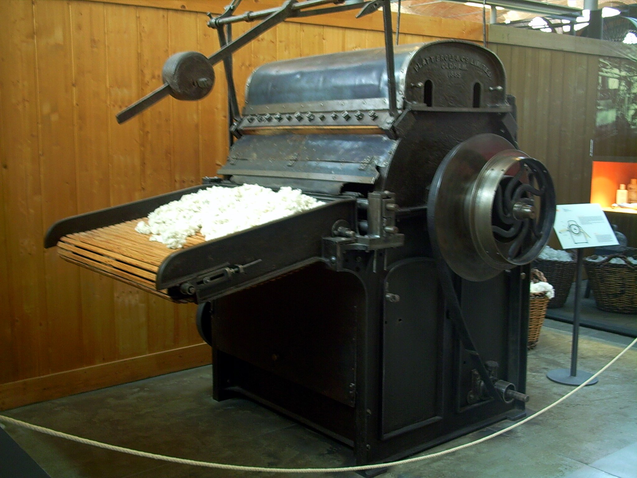
Textile Manufacturing or Textile Engineering is a major industry. It is largely based on the conversion of fibre into yarn, then yarn into fabric. These are then dyed or printed, fabricated into cloth which is then converted into useful goods such as clothing, household items, upholstery and various industrial products. Different types of fibres are used to produce yarn. Cotton remains the most widely used and common natural fiber making up 90% of all-natural fibers used in the textile industry. People often use cotton clothing and accessories because of comfort, not limited to different weathers. There are many variable processes available at the spinning and fabric-forming stages coupled with the complexities of the finishing and colouration processes to the production of a wide range of products. History Textile manufacturing in the modern era is an evolved form of the art and craft industries. Until the 18th and 19th centuries, the textile industry was a household work. ... [...More Info...] [...Related Items...] OR: [Wikipedia] [Google] [Baidu] |
General Nathanael Greene Homestead
The General Nathanael Greene Homestead, also known as Spell Hall, is a historic house at 20 Taft Street in Coventry, Rhode Island.The General's first name is Nathanael, but the National Historic Landmarks program listing for him misspells his first name as Nathaniel, and the NRHP Inventory/Nomination document misspells it as Nathanel in the title but not the main body of the document (where it is correctly spelled as Nathanael). It was the home of American Revolutionary War general Nathanael Greene from 1770 to 1776, and was owned afterwards by his brother Jacob Greene and his wife Margaret. The house is owned and operated by the General Nathanael Greene Homestead Association, a non-profit organization, and was opened as a museum in 1924. Description The house is a -story wood-frame structure with a gable roof, two interior chimneys, and clapboarded exterior. It is five bays wide and two deep, with a center entry framed by pilasters and topped by a transom window, triangular ped ... [...More Info...] [...Related Items...] OR: [Wikipedia] [Google] [Baidu] |
Nathanael Greene Homestead
The General Nathanael Greene Homestead, also known as Spell Hall, is a historic house at 20 Taft Street in Coventry, Rhode Island.The General's first name is Nathanael, but the National Historic Landmarks program listing for him misspells his first name as Nathaniel, and the NRHP Inventory/Nomination document misspells it as Nathanel in the title but not the main body of the document (where it is correctly spelled as Nathanael). It was the home of American Revolutionary War general Nathanael Greene from 1770 to 1776, and was owned afterwards by his brother Jacob Greene and his wife Margaret. The house is owned and operated by the General Nathanael Greene Homestead Association, a non-profit organization, and was opened as a museum in 1924. Description The house is a -story wood-frame structure with a gable roof, two interior chimneys, and clapboarded exterior. It is five bays wide and two deep, with a center entry framed by pilasters and topped by a transom window, triangular ped ... [...More Info...] [...Related Items...] OR: [Wikipedia] [Google] [Baidu] |
National Register Of Historic Places
The National Register of Historic Places (NRHP) is the United States federal government's official list of districts, sites, buildings, structures and objects deemed worthy of preservation for their historical significance or "great artistic value". A property listed in the National Register, or located within a National Register Historic District, may qualify for tax incentives derived from the total value of expenses incurred in preserving the property. The passage of the National Historic Preservation Act (NHPA) in 1966 established the National Register and the process for adding properties to it. Of the more than one and a half million properties on the National Register, 95,000 are listed individually. The remainder are contributing resources within historic districts. For most of its history, the National Register has been administered by the National Park Service (NPS), an agency within the U.S. Department of the Interior. Its goals are to help property owners and inte ... [...More Info...] [...Related Items...] OR: [Wikipedia] [Google] [Baidu] |
National Register Of Historic Places Listings In Kent County, Rhode Island
__NOTOC__ This is a list of the National Register of Historic Places listings in Kent County, Rhode Island. This is intended to be a complete list of the properties and districts on the National Register of Historic Places in Kent County, Rhode Island, United States. Latitude and longitude coordinates are provided for many National Register properties and districts; these locations may be seen together in a map. There are 80 properties and districts listed on the National Register in the county, including 1 National Historic Landmark. Current listings Former listings See also * List of National Historic Landmarks in Rhode Island * National Register of Historic Places listings in Rhode Island References {{Kent County, Rhode Island Kent Kent is a county in South East England and one of the home counties. It borders Greater London to the north-west, Surrey to the west and ... [...More Info...] [...Related Items...] OR: [Wikipedia] [Google] [Baidu] |
Villages In Kent County, Rhode Island
A village is a clustered human settlement or community, larger than a hamlet but smaller than a town (although the word is often used to describe both hamlets and smaller towns), with a population typically ranging from a few hundred to a few thousand. Though villages are often located in rural areas, the term urban village is also applied to certain urban neighborhoods. Villages are normally permanent, with fixed dwellings; however, transient villages can occur. Further, the dwellings of a village are fairly close to one another, not scattered broadly over the landscape, as a dispersed settlement. In the past, villages were a usual form of community for societies that practice subsistence agriculture, and also for some non-agricultural societies. In Great Britain, a hamlet earned the right to be called a village when it built a church. [...More Info...] [...Related Items...] OR: [Wikipedia] [Google] [Baidu] |
Providence Metropolitan Area
The Providence metropolitan area is a region extending into eight counties in two states, and is the 38th largest metropolitan area in the United States. Anchored by the city of Providence, Rhode Island, it has an estimated population of 1,622,520, exceeding that of Rhode Island by slightly over 60%. The area covers almost all of Rhode Island. Thirty-eight of the 39 municipalities in the state are included; only Westerly is not. The Providence Metropolitan Statistical Area also extends into southern Massachusetts with an average population density of 2300 per mi2 (888 per km2). Its Gross Metropolitan Product is the country's 42nd largest at $64.7 billion, just above the Gross State Product of the entire state of Hawaii. Since 2006, the Providence metropolitan area has been officially included in the Greater Boston Combined Statistical Area (CSA), the sixth-largest CSA in the country, with over eight million residents. Boundaries The Providence metropolitan area contains towns a ... [...More Info...] [...Related Items...] OR: [Wikipedia] [Google] [Baidu] |


