|
Anderton Boat Lift
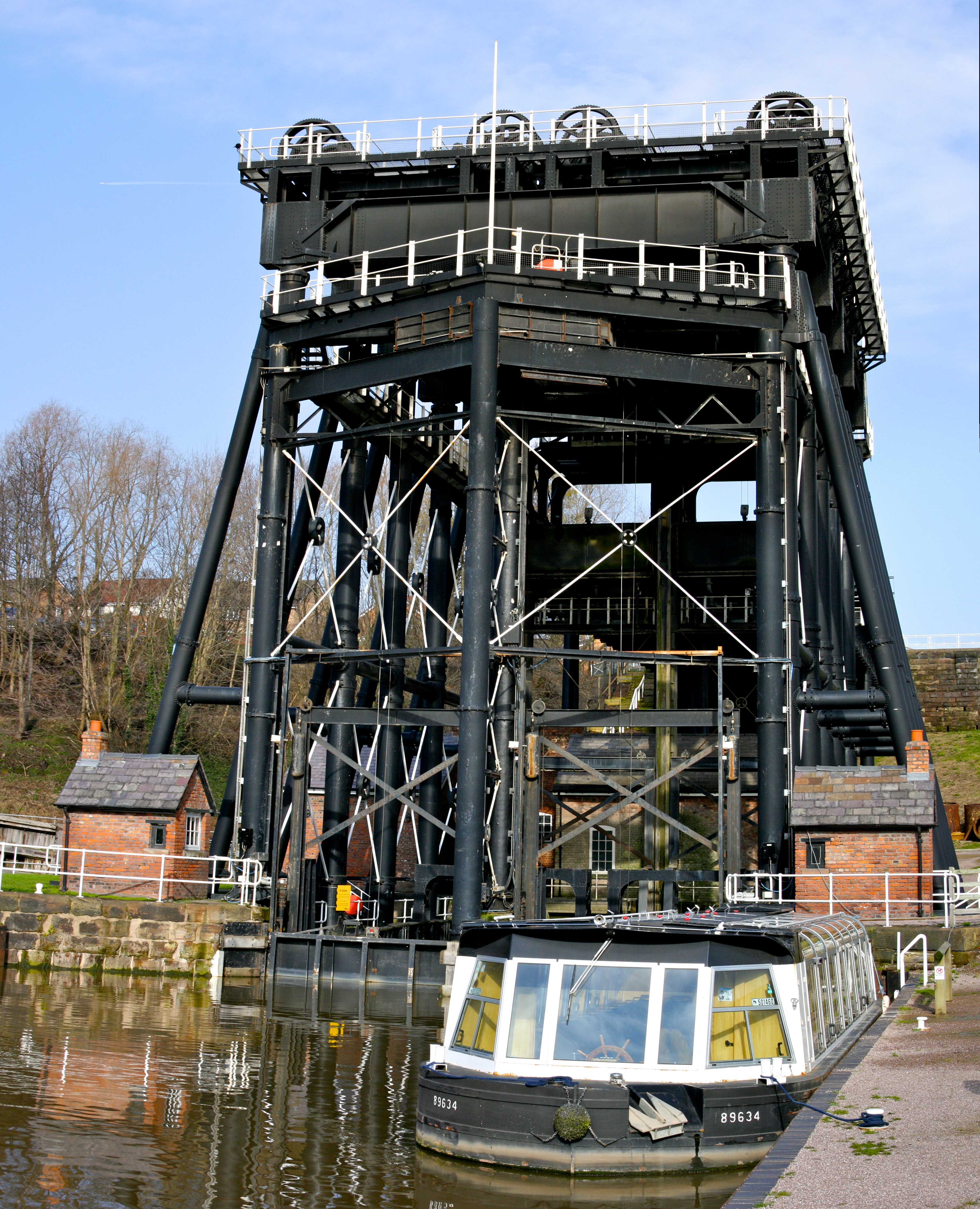
The Anderton Boat Lift is a two caisson lift lock near the village of Anderton, Cheshire, in North West England. It provides a vertical link between two navigable waterways: the River Weaver and the Trent and Mersey Canal. The structure is designated as a scheduled monument, and is included in the National Heritage List for England; it is also known as one of the Seven Wonders of the Waterways. Built in 1875, the boat lift was in use for over 100 years until it was closed in 1983 due to corrosion. Restoration started in 2001 and the boat lift was re-opened in 2002. The lift and associated visitor centre and exhibition are operated by the Canal & River Trust. It is one of only two working boat lifts in the United Kingdom; the other is the Falkirk Wheel in Scotland. Economic background Salt has been extracted from rock salt beds underneath the Cheshire Plain since Roman times. By the end of the 17th century a major salt mining industry had developed around the Cheshire "salt ... [...More Info...] [...Related Items...] OR: [Wikipedia] [Google] [Baidu] |
Anderton Boat Lift 8
Anderton may refer to: People * Anderton (surname) *The Anderton baronets of England Places * Anderton with Marbury, Cheshire * Anderton, Cornwall * Anderton, Lancashire Other uses * , a US Navy minesweeper in commission from 1917 to 1919 {{disambiguation, geo ... [...More Info...] [...Related Items...] OR: [Wikipedia] [Google] [Baidu] |
Northwich
{{Infobox UK place , static_image_name = Northwich - Town Bridge.jpg , static_image_caption = Town Bridge, the River Weaver and the spire of Holy Trinity Church , official_name = Northwich , country = England , region = North West England , population = 50,531 , population_ref = (2021){{NOMIS2021 , id=E35001305 Overview Profile: Northwich Town Council"; downloaded fro.gov.uk/find_out_more/datasets_and_statistics/statistics/census_2011/population_profiles Cheshire West and Chester: Population Profiles 16 May 2019 , os_grid_reference = SJ651733 , coordinates = {{coord, 53.259, -2.518, display=inline,title , post_town = NORTHWICH , postcode_area = CW , postcode_district = CW8,CW9 , dial_code = 01606 , constituency_westminster = Weaver Vale , constituency_westminster1 = Tatton , civil_pa ... [...More Info...] [...Related Items...] OR: [Wikipedia] [Google] [Baidu] |
Edward Leader Williams
Sir Edward Leader Williams (28 April 1828 – 1 January 1910) was an English civil engineer, chiefly remembered as the designer of the Manchester Ship Canal, but also heavily involved in other canal projects in north Cheshire. Early life Williams was born in Worcester on 28 April 1828, the son of a civil engineer also named Edward (responsible for works to make the River Severn navigable; also a keen amateur artist and friend of John Constable) and his Quaker wife Sarah Whiting. His brother Benjamin Williams Leader became a notable landscape artist. The family lived at Diglis House in Worcester (today the Diglis Hotel). Career After attending the Royal Grammar School Worcester Williams became an apprentice to his father. In 1856 he was chosen out of 110 applicants to be chief engineer for the development of the navigable northern section of the River Weaver in Cheshire. He began to specialise in canal construction and in 1865 produced plans for enlarging the Weston ... [...More Info...] [...Related Items...] OR: [Wikipedia] [Google] [Baidu] |
Anderton Boat Lift Diagram 1
Anderton may refer to: People *Anderton (surname) *The Anderton baronets of England Places *Anderton with Marbury, Cheshire *Anderton, Cornwall *Anderton, Lancashire Other uses * , a US Navy minesweeper in commission from 1917 to 1919 {{disambiguation, geo ... [...More Info...] [...Related Items...] OR: [Wikipedia] [Google] [Baidu] |
North Staffordshire Railway
The North Staffordshire Railway (NSR) was a British railway company formed in 1845 to promote a number of lines in the Staffordshire Potteries and surrounding areas in Staffordshire, Cheshire, Derbyshire and Shropshire. The company was based in Stoke-on-Trent and was nicknamed ''The Knotty''; its lines were built to the standard gauge of . The main routes were constructed between 1846 and 1852 and ran from Macclesfield via Stoke to Colwich Junction joining the Trent Valley Railway, with another branch to Norton Bridge, just north of Stafford, and from Crewe to Egginton Junction, west of Derby. Within these main connections with other railway companies, most notably the London and North Western Railway (LNWR), the company operated a network of smaller lines although the total route mileage of the company never exceeded . The majority of the passenger traffic was local although a number of LNWR services from Manchester to London were operated via Stoke. Freight traffic was mo ... [...More Info...] [...Related Items...] OR: [Wikipedia] [Google] [Baidu] |
Canal Lock
A lock is a device used for raising and lowering boats, ships and other watercraft between stretches of water of different levels on river and canal waterways. The distinguishing feature of a lock is a fixed chamber in which the water level can be varied; whereas in a caisson lock, a boat lift, or on a canal inclined plane, it is the chamber itself (usually then called a caisson) that rises and falls. Locks are used to make a river more easily navigable, or to allow a canal to cross land that is not level. Later canals used more and larger locks to allow a more direct route to be taken. Pound lock A ''pound lock'' is most commonly used on canals and rivers today. A pound lock has a chamber with gates at both ends that control the level of water in the pound. In contrast, an earlier design with a single gate was known as a flash lock. Pound locks were first used in China during the Song Dynasty (960–1279 AD), having been pioneered by the Song politician and naval en ... [...More Info...] [...Related Items...] OR: [Wikipedia] [Google] [Baidu] |
Coalport
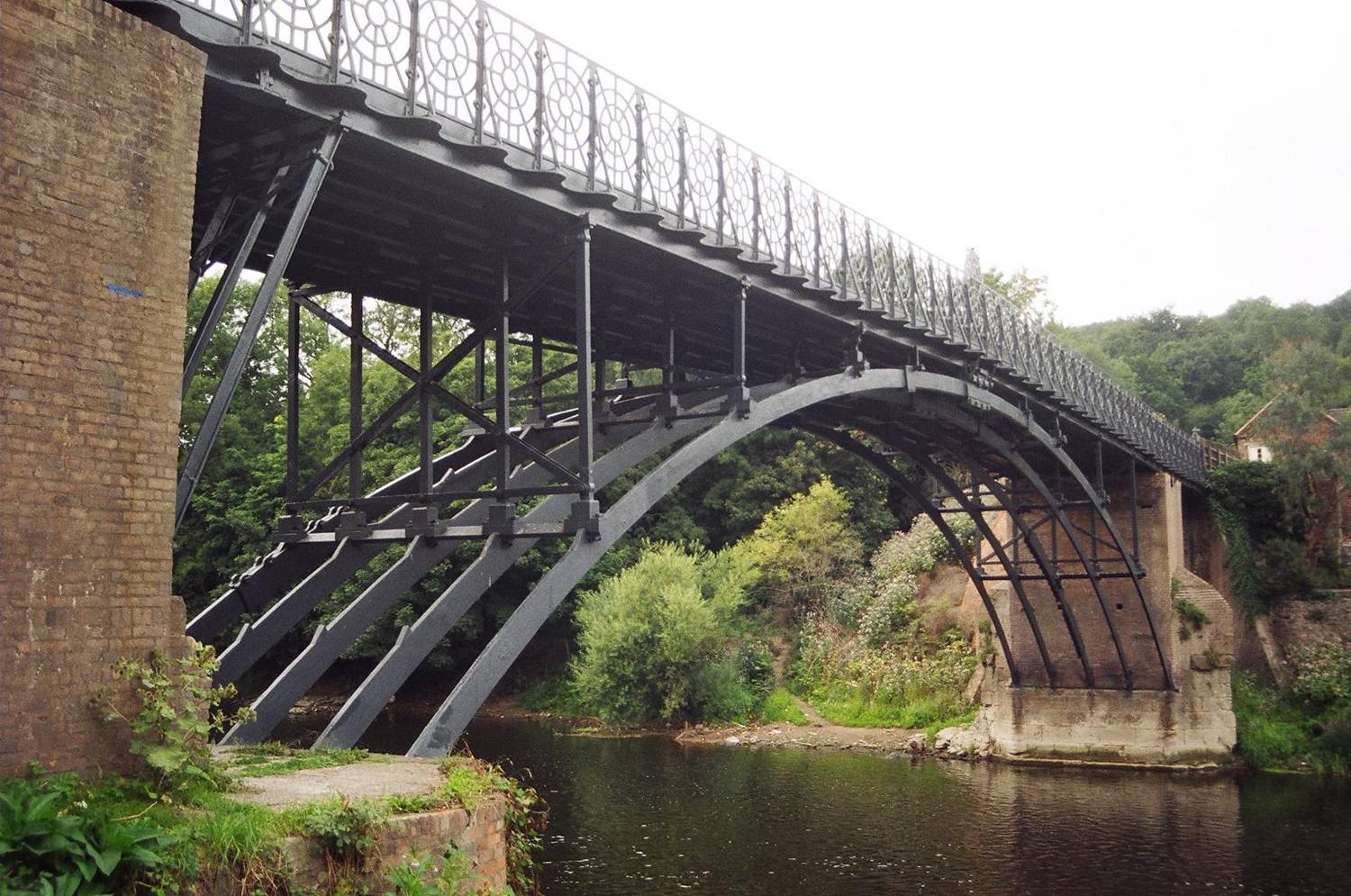
Coalport is a village in Shropshire, England. It is located on the River Severn in the Ironbridge Gorge, a mile downstream of Ironbridge. It lies predominantly on the north bank of the river; on the other side is Jackfield. The settlement was planned as a canal–river interchange and a complete "new town" by ironmaster William Reynolds, who between 1788 and 1796 built warehouses, workshops, factories and workers' accommodation in Coalport. He also directed the construction of the Shropshire Canal, linking the East Shropshire Coalfield with the River Severn — the terminus being Coalport Wharf between the Brewery Inn and Coalport Bridge. Coalport at this time was much larger than it is today. It forms part of the civil parish of the Gorge and is the southeastern corner of the borough of Telford and Wrekin. Cast iron bridge The Coalport Bridge of cast iron was built in 1818 and unlike its even more famous neighbour at Ironbridge, still takes vehicular traffic, albeit li ... [...More Info...] [...Related Items...] OR: [Wikipedia] [Google] [Baidu] |
Hay Inclined Plane
The Hay Inclined Plane is a canal inclined plane in the Ironbridge Gorge in Shropshire, with a height of . It was located at the end of the Shropshire Canal, part of a network of canals that linked the industrial region of east Shropshire with the River Severn. The inclined plane was in operation from 1793 to 1894. It can be visited as part of the Blists Hill Victorian Town and is also a waypoint on the South Telford Heritage Trail. History The proprietors of the Shropshire Canal held a competition in 1788 to find the best means of raising and lowering heavy weights between the canal and the river Severn. They selected a design by Henry Williams and James Loudon, which was also used at a number of other inclined planes in east Shropshire. Construction of the Hay inclined plane was completed in 1793. By 1820 it was in poor condition and substantial repairs were needed. Further repairs were also carried out in the 1840s.Ironbridge Gorge Museum information boards In 1857 the Hay ... [...More Info...] [...Related Items...] OR: [Wikipedia] [Google] [Baidu] |
Crane (machine)
A crane is a type of machine, generally equipped with a hoist rope, wire ropes or chains, and sheaves, that can be used both to lift and lower materials and to move them horizontally. It is mainly used for lifting heavy objects and transporting them to other places. The device uses one or more simple machines to create mechanical advantage and thus move loads beyond the normal capability of a human. Cranes are commonly employed in transportation for the loading and unloading of freight, in construction for the movement of materials, and in manufacturing for the assembling of heavy equipment. The first known crane machine was the shaduf, a water-lifting device that was invented in ancient Mesopotamia (modern Iraq) and then appeared in ancient Egyptian technology. Construction cranes later appeared in ancient Greece, where they were powered by men or animals (such as donkeys), and used for the construction of buildings. Larger cranes were later developed in the Roman Empire, e ... [...More Info...] [...Related Items...] OR: [Wikipedia] [Google] [Baidu] |
Stoke-on-Trent
Stoke-on-Trent (often abbreviated to Stoke) is a city and Unitary authorities of England, unitary authority area in Staffordshire, England, with an area of . In 2019, the city had an estimated population of 256,375. It is the largest settlement in Staffordshire and is surrounded by the towns of Newcastle-under-Lyme, Alsager, Kidsgrove, Biddulph and Stone, Staffordshire, Stone, which form a conurbation around the city. Stoke is wikt:polycentric, polycentric, having been formed by Federation of Stoke-on-Trent, the federation of six towns in 1910. It took its name from Stoke-upon-Trent where the main centre of government and the principal Stoke-on-Trent railway station, railway station in the district were located. Hanley, Staffordshire, Hanley is the primary commercial centre; the other four towns which form the city are Burslem, Tunstall, Staffordshire, Tunstall, Longton, Staffordshire, Longton and Fenton, Staffordshire, Fenton. Stoke-on-Trent is the home of the pottery industr ... [...More Info...] [...Related Items...] OR: [Wikipedia] [Google] [Baidu] |
River Mersey
The River Mersey () is in North West England. Its name derives from Old English and means "boundary river", possibly referring to its having been a border between the ancient kingdoms of Mercia and Northumbria. For centuries it has formed part of the boundary between the Historic counties of England, historic counties of Lancashire and Cheshire. The Mersey starts at the confluence of the River Tame, Greater Manchester, River Tame and River Goyt in Stockport. It flows westwards through south Manchester, then into the Manchester Ship Canal at Irlam, becoming a part of the canal and maintaining its water levels. After it exits the canal, flowing towards Warrington where it widens. It then narrows as it passes between Runcorn and Widnes. From Runcorn the river widens into a large estuary, which is across at its widest point near Ellesmere Port. The course of the river then turns northwards as the estuary narrows between Liverpool and Birkenhead on the Wirral Peninsula to the west ... [...More Info...] [...Related Items...] OR: [Wikipedia] [Google] [Baidu] |
Frodsham
Frodsham is a market town, civil parish, and electoral ward in the unitary authority of Cheshire West and Chester and the ceremonial county of Cheshire, England. Its population was 8,982 in 2001, increasing to 9,077 at the 2011 Census. It is south of Liverpool and southwest of Manchester. The River Weaver runs to its northeast and on the west it overlooks the estuary of the River Mersey. The A56 road and the Chester–Manchester railway line pass through the town, and the M56 motorway passes to the northwest. In medieval times, Frodsham was an important borough and port belonging to the Earls of Chester. Its parish church, St. Laurence's, still exhibits evidence of a building present in the 12th century in its nave and is referenced in the Domesday Book. A market is held each Thursday, and Frodsham's viability as a trading centre was emphasised by the presence of the "big five" clearing banks and several building societies, though the branches of HSBC and NatWest have recen ... [...More Info...] [...Related Items...] OR: [Wikipedia] [Google] [Baidu] |


Dec2002.jpg)