|
Amroth, Pembrokeshire
Amroth is both a village, a parish and a community northeast of Tenby, Pembrokeshire, Wales. Located on Carmarthen Bay, Amroth is noted for its long sandy beach which stretches the length of the village. It regularly earns a Blue Flag award. and is the south-to-north start of the Pembrokeshire Coast Path. Amroth is within the Pembrokeshire Coast National Park. The name is Welsh, and probably means "on (the brook called) Rhath". History The beach stretches the whole length of the village and at extreme low tide, the petrified forest, destroyed when sea levels rose 7,000 years ago, can still be seen. Fossilised antlers, nuts and animal bones and Neolithic flints have been discovered. The parish, which appeared as ''Amrath'' on a 1578 parish map of Pembrokeshire, was an important anthracite coal mining area until the end of the 19th century. Slight remains of mines and tramways are still visible. Ruins of Amroth Castle still remain, and one mile inland is the Anglican parish ... [...More Info...] [...Related Items...] OR: [Wikipedia] [Google] [Baidu] |
Pembrokeshire
Pembrokeshire ( ; cy, Sir Benfro ) is a county in the south-west of Wales. It is bordered by Carmarthenshire to the east, Ceredigion to the northeast, and the rest by sea. The county is home to Pembrokeshire Coast National Park. The Park occupies more than a third of the area of the county and includes the Preseli Hills in the north as well as the Pembrokeshire Coast Path. Historically, mining and fishing were important activities, while industry nowadays is focused on agriculture (86 per cent of land use), oil and gas, and tourism; Pembrokeshire's beaches have won many awards. The county has a diverse geography with a wide range of geological features, habitats and wildlife. Its prehistory and modern history have been extensively studied, from tribal occupation, through Roman times, to Welsh, Irish, Norman, English, Scandinavian and Flemish influences. Pembrokeshire County Council's headquarters are in the county town of Haverfordwest. The council has a majority of Independ ... [...More Info...] [...Related Items...] OR: [Wikipedia] [Google] [Baidu] |
Listed Building
In the United Kingdom, a listed building or listed structure is one that has been placed on one of the four statutory lists maintained by Historic England in England, Historic Environment Scotland in Scotland, in Wales, and the Northern Ireland Environment Agency in Northern Ireland. The term has also been used in the Republic of Ireland, where buildings are protected under the Planning and Development Act 2000. The statutory term in Ireland is "protected structure". A listed building may not be demolished, extended, or altered without special permission from the local planning authority, which typically consults the relevant central government agency, particularly for significant alterations to the more notable listed buildings. In England and Wales, a national amenity society must be notified of any work to a listed building which involves any element of demolition. Exemption from secular listed building control is provided for some buildings in current use for worsh ... [...More Info...] [...Related Items...] OR: [Wikipedia] [Google] [Baidu] |
Summerhill, Pembrokeshire
Summerhill is a small settlement northwest of Amroth, in Pembrokeshire, Wales, in Amroth parish and community A community is a social unit (a group of living things) with commonality such as place, norms, religion, values, customs, or identity. Communities may share a sense of place situated in a given geographical area (e.g. a country, villag .... History Summerhill was originally where farmers would graze their sheep in the summer, hence the name, but now it is a village of several houses and a corner shop. It is not marked on a pre-1850 map of Amroth parish. A Primitive Methodist chapel was established in 1879; chapel records, including baptisms, Sunday school papers and minutes are held by Pembrokeshire Records Office. By the 1990s the chapel had been converted to a residential property. Governance Summerhill comes under the governance of Amroth Community Council. Amenities Amroth Parish Hall is in Summerhill. With a capacity of 120, it hosts regular classe ... [...More Info...] [...Related Items...] OR: [Wikipedia] [Google] [Baidu] |
Crunwere
Crunwere ( cy, Cronwern - also written Crunwear and Cronwere) is a hamlet and parish in Pembrokeshire, Wales. It is situated 3 km north of the Carmarthen Bay coast, 8 km north-east of Saundersfoot. The parish includes the village of Llanteg and sub-hamlet of Llanteglos . Together with the village of Amroth, it constitutes the community of Amroth. Name The Welsh placename means "round alder swamp": the English form is a corruption of the Welsh. Part of Little England beyond Wales, although close to the Pembrokeshire language frontier, it has been predominantly English-speaking for centuries. History 1849 Description of Parish - Parish The parish had an area of 689 Ha. Its census populations were: 191 (1801): 289 (1851): 188 (1901): 160 (1951): 164 (1981). The percentage of Welsh speakers was 16 (1891): 12 (1931): 15 (1971) Crunwere Church (St Elidyr) is now declared redundant and the last service (open-air) held on 2 August 2009. Governance Crunwere is includ ... [...More Info...] [...Related Items...] OR: [Wikipedia] [Google] [Baidu] |
Ward (electoral Subdivision)
A ward is a local authority area, typically used for electoral purposes. In some countries, wards are usually named after neighbourhoods, thoroughfares, parishes, landmarks, geographical features and in some cases historical figures connected to the area (e.g. William Morris Ward in the London Borough of Waltham Forest, England). It is common in the United States for wards to simply be numbered. Origins The word “ward”, for an electoral subdivision, appears to have originated in the Wards of the City of London, where gatherings for each ward known as “wardmotes” have taken place since the 12th century. The word was much later applied to divisions of other cities and towns in England and Wales and Ireland. In parts of northern England, a ''ward'' was an administrative subdivision of a county, very similar to a hundred in other parts of England. Present day In Australia, Canada, New Zealand, Sri Lanka, South Africa, the United Kingdom, and the United States, wards ar ... [...More Info...] [...Related Items...] OR: [Wikipedia] [Google] [Baidu] |
Cistercian Way (Wales)
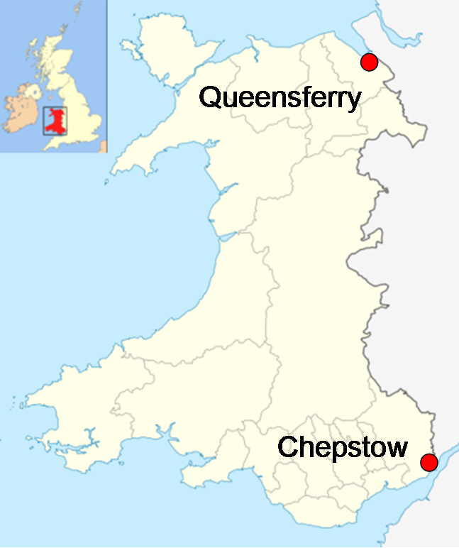
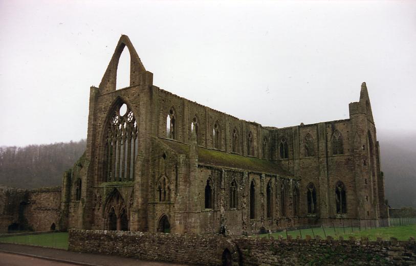
The Cistercian Way is a waymarked, long-distance trail which circumnavigates Wales, linking the Cistercian historic sites of Wales. It is a circular walk and can be started from any point along its route. The total length is approximately . The Cistercian Way started in May 1998 as part of the annual pilgrimage of the Society of St David and St Nicholas to Penrhys in the Rhondda as part of the celebrations of the 900th anniversary of the foundation of the Cistercian order. Tintern Abbey, founded by Walter de Clare in 1131, was the first Abbey to be built in Wales. One section of the route follows the medieval pilgrimage route from Llantarnam Abbey, built on the site of an old Cistercian monastery and now occupied by the Sisters of St. Joseph of Annecy, to the shrine of Our Lady of Penrhys. Not far from the shrine is Ffynnon Fair (or St. Mary's Well), a holy well overlooking the village of Llwynypia and the oldest recorded Christian site in the Rhondda. The waters from the ... [...More Info...] [...Related Items...] OR: [Wikipedia] [Google] [Baidu] |
St Davids Cathedral
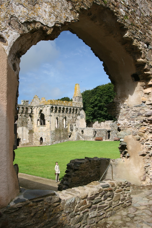
St Davids Cathedral ( cy, Eglwys Gadeiriol Tyddewi) is situated in St DavidsBritain's smallest city in the county of Pembrokeshire, near the most westerly point of Wales. Early history The monastic community was founded by Saint David, Abbot of Menevia, who died in 589. Between 645 and 1097, the community was attacked many times by raiders, including the Vikings; however it was of such note as both a religious and an intellectual centre that King Alfred summoned help from the monastic community at St Davids in rebuilding the intellectual life of the Kingdom of Wessex. Many of the bishops were murdered by raiders and marauders, including Bishop Moregenau in 999 and Bishop Abraham in 1080. The stone that marked his grave, known as the "Abraham Stone", is intricately carved with early Celtic symbols and is now on permanent display within the Cathedral Exhibition at Porth-y-Tŵr. In 1081, William the Conqueror visited St Davids to pray, and thus recognised it as a holy and respec ... [...More Info...] [...Related Items...] OR: [Wikipedia] [Google] [Baidu] |
Pendine
Pendine ( cy, Pentywyn, "end of the dunes") is a village and community in Carmarthenshire, Wales. Situated on the northern shore of Carmarthen Bay and bordered by the communities of Eglwyscummin and Llanddowror, the population at the 2011 census was 346. There are two parts of the village: the old hill-top settlement around the parish church; and the small harbour settlement on the shore. The latter developed into a small seaside resort during the 20th century. The seaside resort is best known for adjacent Pendine Sands. Development In 2016 Carmarthenshire County Council completed construction of a new building on the Pendine promenade. It was named the Parry Thomas Centre and contains five commercial premises and public toilets. In 2019 construction began on the next stage of the Pendine Tourism Attractor Project, creating an eco activity resort, including a hostel with Passivhaus certification. The Museum of Speed was demolished in 2019 and will be replaced in the new deve ... [...More Info...] [...Related Items...] OR: [Wikipedia] [Google] [Baidu] |
Wales Coast Path
The Wales Coast Path ( cy, Llwybr Arfordir Cymru) is a designated long-distance trail which follows, or runs close to, the coastline of Wales. Launched in 2012, the footpath is long and was heralded as the first dedicated coast path in the world to cover the entire length of a country's coastline. The Wales Coast Path runs through eleven national nature reserves and other nature reserves such as those managed by the Royal Society for the Protection of Birds and The Wildlife Trusts.www.firstnature.com - wales Coast Path . Retrieved 2 January 2012. 
[...More Info...] [...Related Items...] OR: [Wikipedia] [Google] [Baidu] |
National Trails
National Trails are long distance footpaths and bridleways in England and Wales. They are administered by Natural England, a statutory agency of the UK government, and Natural Resources Wales (successor body to the Countryside Council for Wales), a Welsh Government-sponsored body. National Trails are marked with an acorn symbol along the route. In Scotland, the equivalent trails are called Scotland's Great Trails and are administered by NatureScot. List of National Trails * Cleveland Way in England * Coast to Coast in England (announced in 2020) * Cotswold Way in England * England Coast Path around England (planned to be completed by 2020) * Glyndŵr's Way in Wales * Hadrian's Wall Path in England * North Downs Way in England * Offa's Dyke Path in Wales and England * Peddar's Way and Norfolk Coast Path in England (treated as a single National Trail) * Pembrokeshire Coast Path in Wales * Pennine Bridleway in England ( bridleway) * Pennine Way mainly in England wi ... [...More Info...] [...Related Items...] OR: [Wikipedia] [Google] [Baidu] |
Baron Kylsant
Baron is a rank of nobility or title of honour, often hereditary, in various European countries, either current or historical. The female equivalent is baroness. Typically, the title denotes an aristocrat who ranks higher than a lord or knight, but lower than a viscount or count. Often, barons hold their fief – their lands and income – directly from the monarch. Barons are less often the vassals of other nobles. In many kingdoms, they were entitled to wear a smaller form of a crown called a ''coronet''. The term originates from the Latin term , via Old French. The use of the title ''baron'' came to England via the Norman Conquest of 1066, then the Normans brought the title to Scotland and Italy. It later spread to Scandinavia and Slavic lands. Etymology The word '' baron'' comes from the Old French , from a Late Latin "man; servant, soldier, mercenary" (so used in Salic law; Alemannic law has in the same sense). The scholar Isidore of Seville in the 7th century t ... [...More Info...] [...Related Items...] OR: [Wikipedia] [Google] [Baidu] |
White Star Line
The White Star Line was a British shipping company. Founded out of the remains of a defunct packet company, it gradually rose up to become one of the most prominent shipping lines in the world, providing passenger and cargo services between the British Empire and the United States. While many other shipping lines focused primarily on speed, White Star branded their services by focusing more on providing comfortable passages for both upper class travellers and immigrants. Today, it is remembered for the innovative vessel and for the losses of some of their best passenger liners, including the wrecking of in 1873, the sinking of in 1909, the infamous loss of in 1912 and the wartime sinking of in 1916. Despite its casualties, the company retained a prominent hold on shipping markets around the globe before falling into decline during the Great Depression, which ultimately led to a merger with its chief rival, Cunard Line, which operated as Cunard-White Star Line until 19 ... [...More Info...] [...Related Items...] OR: [Wikipedia] [Google] [Baidu] |
.jpg)


