|
Amazon (1780 Ship)
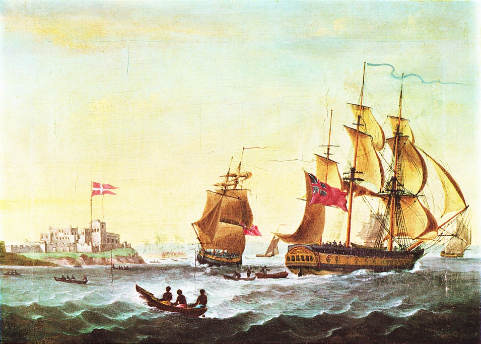
''Amazon'' was launched in France in 1775 under another name and taken in prize in 1780. British owners named her ''Amazon'' and she became a West Indiaman. In 1782 an American letter-of-marque, a former British Royal Navy frigate, captured her, but the Royal Navy quickly recaptured her. She then became ''Dumfries''. She may have been renamed again. She reappeared as ''Amazon'' in 1790, and traded between London and Smyrna. In 1798 she made one voyage for the British East India Company (EIC) between 1797 and 1798. She then made three voyages as a slave ship between 1800 and 1804. Her subsequent history is currently obscure. Career ''Amazon'' appears in ''Lloyd's Register'' in 1781 with W. Gray, master, Robinson & Co., owners, and trade London–Jamaica. Then on 16 August 1782, ''Lloyd's List'' reported that the transport ''Amazon'', Gray, master, had been taken while carrying clothing to Quebec. Her captor was the American letter of marque ''Flora'', formerly HMS ''Flora'', wh ... [...More Info...] [...Related Items...] OR: [Wikipedia] [Google] [Baidu] |
Thomas Parr (slave Trader)
Thomas Parr (1769–1847) was an English slave trader who profited from the Atlantic slave trade. He invested in at least 30 slave voyages. One of the slave ships that he had built for the slave trade, ', exploded on her maiden voyage. A street in Liverpool where he built a warehouse is named after him. Slave trade Parr invested in at least 30 slave voyages, and was sole owner of several ships: Personal life Parr built a house at Colquitt Street in Liverpool in 1797, that has been described as "magnificent". The south wing of the house was a counting house. The house is flanked by pavilions, with one of them being used as a coach house. There was also a courtyard, a pleasure garden, a pond, and walks. The house was used between 1817 and 1948 as Liverpool Royal Institution; many of the people that established the institution were former slave traders. Behind the house he built a warehouse that he used to store iron goods that were traded for slaves. The warehouse was ... [...More Info...] [...Related Items...] OR: [Wikipedia] [Google] [Baidu] |
Whampoa Anchorage
Pazhou is a subdistrict of Haizhu in southeastern Guangzhou, Guangdong Province, in China. , formerly Whampoa Island, has a total area of and is the site of Pazhou Pagoda. Its eastern bay was formerly the chief anchorage for ships participating in Guangzhou's foreign trade. Traders from the "Southern Sea", including Indians, Arabians, and most Europeans, were required to keep their ships at Pazhou while smaller craft ferried goods to and from the Thirteen Factories area of Guangzhou's western suburbs. Traders rented storage for ships supplies and repair shops on Whampoa Island. Images of the anchorage were a common theme in 18th-century art. With the expansion of Guangzhou, the subdistrict is now part of its downtown area, with many commercial and recreational facilities. The Guangzhou International Convention and Exhibition Center is the current site of the annual Canton Fair. Names The English, French, and Danish ''Whampoa'' and Swedish ' are irregular romanizati ... [...More Info...] [...Related Items...] OR: [Wikipedia] [Google] [Baidu] |
Age Of Sail Merchant Ships Of England
Age or AGE may refer to: Time and its effects * Age, the amount of time someone or something has been alive or has existed ** East Asian age reckoning, an Asian system of marking age starting at 1 * Ageing or aging, the process of becoming older ** Senescence, the gradual deterioration of biological function with age ** Human development (biology) * Periodization, the process of categorizing the past into discrete named blocks of time ** Ages of Man, the stages of human existence on the Earth according to Greek mythology and its subsequent Roman interpretation **Prehistoric age Places * AGE, the IATA airport code for Wangerooge Airfield, in Lower Saxony, Germany People * Åge, a given name * Aage, a given name * Agenore Incrocci, an Italian screenwriter Arts, entertainment, and media Fictional entities * ''Ages'', worlds in the ''Myst'' video game series Music * "Age" (song), a song by Jim and Ingrid Croce Periodicals * ''Age'' (journal), a scientific journal on ageing, now ... [...More Info...] [...Related Items...] OR: [Wikipedia] [Google] [Baidu] |
Captured Ships
Captured may refer to: * ''Captured'' (Journey album), 1981 * ''Captured'' (Rockwell album), 1985 * ''Captured'', a 1995 album by The Albion Band * ''Captured'' (Caroline's Spine album), 2007 * ''Captured'' (Christian Bautista album), 2008 * ''Captured'' (mixtape), a 2018 mixtape by Spice * ''Captured!'', a 1933 war film * ''Captured'' (1998 film), a 1998 thriller film * ''Captured'' (video game), a video game released in 1986 for the Commodore 64 * "Captured", a song by Heaven 17 Heaven 17 are an English new wave and synth-pop band that formed in Sheffield in 1980. The band were a trio for most of their career, composed of Martyn Ware (keyboards) and Ian Craig Marsh (keyboards) (both previously of the Human League), an ... See also * Capture (other) {{disambiguation ... [...More Info...] [...Related Items...] OR: [Wikipedia] [Google] [Baidu] |
Ships Built In France
A ship is a large watercraft that travels the world's oceans and other sufficiently deep waterways, carrying cargo or passengers, or in support of specialized missions, such as defense, research, and fishing. Ships are generally distinguished from boats, based on size, shape, load capacity, and purpose. Ships have supported exploration, trade, warfare, migration, colonization, and science. After the 15th century, new crops that had come from and to the Americas via the European seafarers significantly contributed to world population growth. Ship transport is responsible for the largest portion of world commerce. The word ''ship'' has meant, depending on the era and the context, either just a large vessel or specifically a ship-rigged sailing ship with three or more masts, each of which is square-rigged. As of 2016, there were more than 49,000 merchant ships, totaling almost 1.8 billion dead weight tons. Of these 28% were oil tankers, 43% were bulk carriers, and 13% were co ... [...More Info...] [...Related Items...] OR: [Wikipedia] [Google] [Baidu] |
1775 Ships
Events Summary The American Revolutionary War began this year, with the first military engagement being the April 19 Battles of Lexington and Concord on the day after Paul Revere's now-legendary ride. The Second Continental Congress takes various steps toward organizing an American government, appointing George Washington commander-in-chief (June 14), Benjamin Franklin postmaster general (July 26) and creating a Continental Navy (October 13) and a Marine force (November 10) as landing troops for it, but as yet the 13 colonies have not declared independence, and both the British (June 12) and American (July 15) governments make laws. On July 6, Congress issues the Declaration of the Causes and Necessity of Taking Up Arms and on August 23, King George III of Great Britain declares the American colonies in rebellion, announcing it to Parliament on November 10. On June 17, two months into the colonial siege of Boston, at the Battle of Bunker Hill, just north of Boston, Bri ... [...More Info...] [...Related Items...] OR: [Wikipedia] [Google] [Baidu] |
Bonny Island
Bonny Island is situated at the southern edge of Rivers State in the Niger Delta region of Nigeria. It is near Port Harcourt. Ferries are the main form of transport to and from the island. The local language spoken on Bonny Island is Ibani, which is an Ijaw dialect. Many natives also speak the Igbo language. History Located at the edge of the Atlantic Ocean on the Bight of Bonny, the island of Bonny serves as the seat of a traditional state known as the Kingdom of Bonny. Bonny was founded by a priest king known as Ndoli. He (as well as his successors Opuamakuba and Alagbariye) were the leaders of the founding group of Bonny Island. The virgin lands and territories of the island kingdom were settled about or before 1000AD. Asimini, the fourth king (but the first one to be crowned), founded a dynasty that went on to provide most of the kingdom's monarchs. Founding myth It is believed today that the founders of the island kingdom were originally from within the Isedani lineage ... [...More Info...] [...Related Items...] OR: [Wikipedia] [Google] [Baidu] |
Calabar
Calabar (also referred to as Callabar, Calabari, Calbari and Kalabar) is the capital city of Cross River State, Nigeria. It was originally named Akwa Akpa, in the Efik language. The city is adjacent to the Calabar and Great Kwa rivers and creeks of the Cross River (from its inland delta). Calabar is often described as the tourism capital of Nigeria, especially due to several initiatives implemented during the administration of Donald Duke as governor of Cross River State (1999–2007), which made the city the cleanest and most environmentally friendly city in Nigeria. Administratively, the city is divided into Calabar Municipal and Calabar South Local Government Areas. It has an area of and a population of 371,022 as at 2006 census. History Calabar was the name given by the Portuguese discoverers from the 15th century to the tribes on this part of the Guinea coast at the time of their arrival, when the present inhabitants in the district were the Quas. It was not till th ... [...More Info...] [...Related Items...] OR: [Wikipedia] [Google] [Baidu] |
Bight Of Biafra
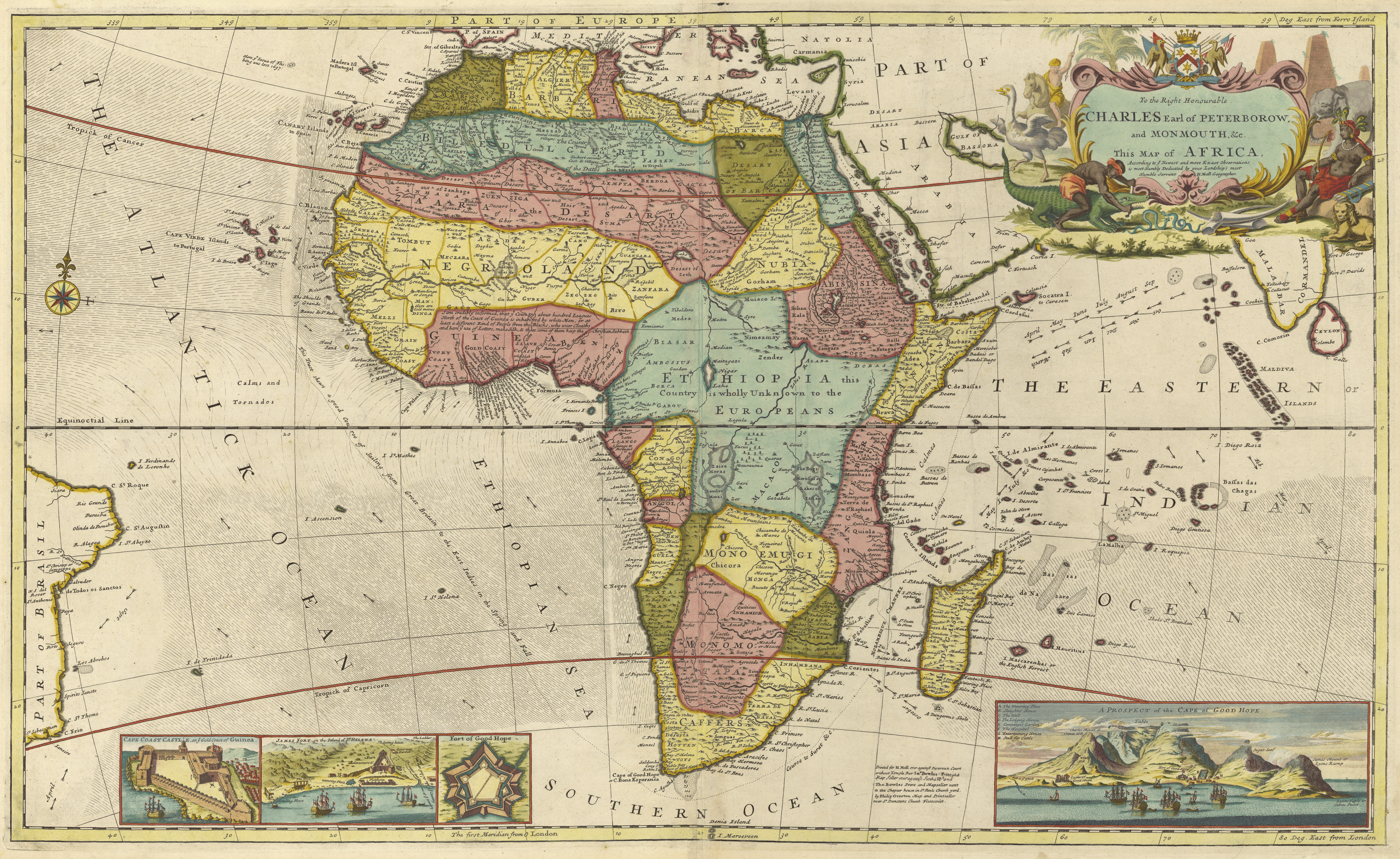
The Bight of Biafra (known as the Bight of Bonny in Nigeria) is a bight off the West African coast, in the easternmost part of the Gulf of Guinea. Geography The Bight of Biafra, or Mafra (named after the town Mafra in southern Portugal), between Capes Formosa and Lopez, is the most eastern part of the Gulf of Guinea; it contains the islands Bioko quatorial Guinea São Tomé and Príncipe. The name Biafra – as indicating the country – fell into disuse in the later part of the 19th century A 1710 map indicates that the region known as "Biafra" (Biafra) was located in present-day Cameroon. The Bight of Biafra extends east from the River Delta of the Niger in the north until it reaches Cape Lopez in Gabon. Besides the Niger River, other rivers reaching the bay are the Cross River, Calabar River, Ndian, Wouri, Sanaga, Nyong River, Ntem, Mbia, Mbini, Muni and Komo River. The main islands in the Bay are Bioko and Príncipe; other important islands are Ilhéu Bom Bom, Ilhéu ... [...More Info...] [...Related Items...] OR: [Wikipedia] [Google] [Baidu] |
Cork (city)
Cork ( , from , meaning 'marsh') is the second largest city in Ireland and third largest city by population on the island of Ireland. It is located in the south-west of Ireland, in the province of Munster. Following an extension to the city's boundary in 2019, its population is over 222,000. The city centre is an island positioned between two channels of the River Lee which meet downstream at the eastern end of the city centre, where the quays and docks along the river lead outwards towards Lough Mahon and Cork Harbour, one of the largest natural harbours in the world. Originally a monastic settlement, Cork was expanded by Viking invaders around 915. Its charter was granted by Prince John in 1185. Cork city was once fully walled, and the remnants of the old medieval town centre can be found around South and North Main streets. The city's cognomen of "the rebel city" originates in its support for the Yorkist cause in the Wars of the Roses. Corkonians sometimes refer to ... [...More Info...] [...Related Items...] OR: [Wikipedia] [Google] [Baidu] |
Saint Helena
Saint Helena () is a British overseas territory located in the South Atlantic Ocean. It is a remote volcanic tropical island west of the coast of south-western Africa, and east of Rio de Janeiro in South America. It is one of three constituent parts of the British Overseas Territory of Saint Helena, Ascension and Tristan da Cunha. Saint Helena measures about and has a population of 4,439 per the 2021 census. It was named after Helena, mother of Constantine I. It is one of the most remote islands in the world and was uninhabited when discovered by the Portuguese enroute to the Indian subcontinent in 1502. For about four centuries the island was an important stopover for ships from Europe to Asia and back, while sailing around the African continent, until the opening of the Suez canal. St Helena is the United Kingdom's second-oldest overseas territory after Bermuda. Saint Helena is known for being the site of Napoleon's second exile, following his final defeat in 1815. ... [...More Info...] [...Related Items...] OR: [Wikipedia] [Google] [Baidu] |
Cape Of Good Hope
The Cape of Good Hope ( af, Kaap die Goeie Hoop ) ;''Kaap'' in isolation: pt, Cabo da Boa Esperança is a rocky headland on the Atlantic coast of the Cape Peninsula in South Africa. A common misconception is that the Cape of Good Hope is the southern tip of Africa, based on the misbelief that the Cape was the dividing point between the Atlantic and Indian oceans, and have nothing to do with north or south. In fact, by looking at a map, the southernmost point of Africa is Cape Agulhas about to the east-southeast. The currents of the two oceans meet at the point where the warm-water Agulhas current meets the cold-water Benguela current and turns back on itself. That oceanic meeting point fluctuates between Cape Agulhas and Cape Point (about east of the Cape of Good Hope). When following the western side of the African coastline from the equator, however, the Cape of Good Hope marks the point where a ship begins to travel more eastward than southward. Thus, the first mode ... [...More Info...] [...Related Items...] OR: [Wikipedia] [Google] [Baidu] |


