|
Altamont, Tennessee
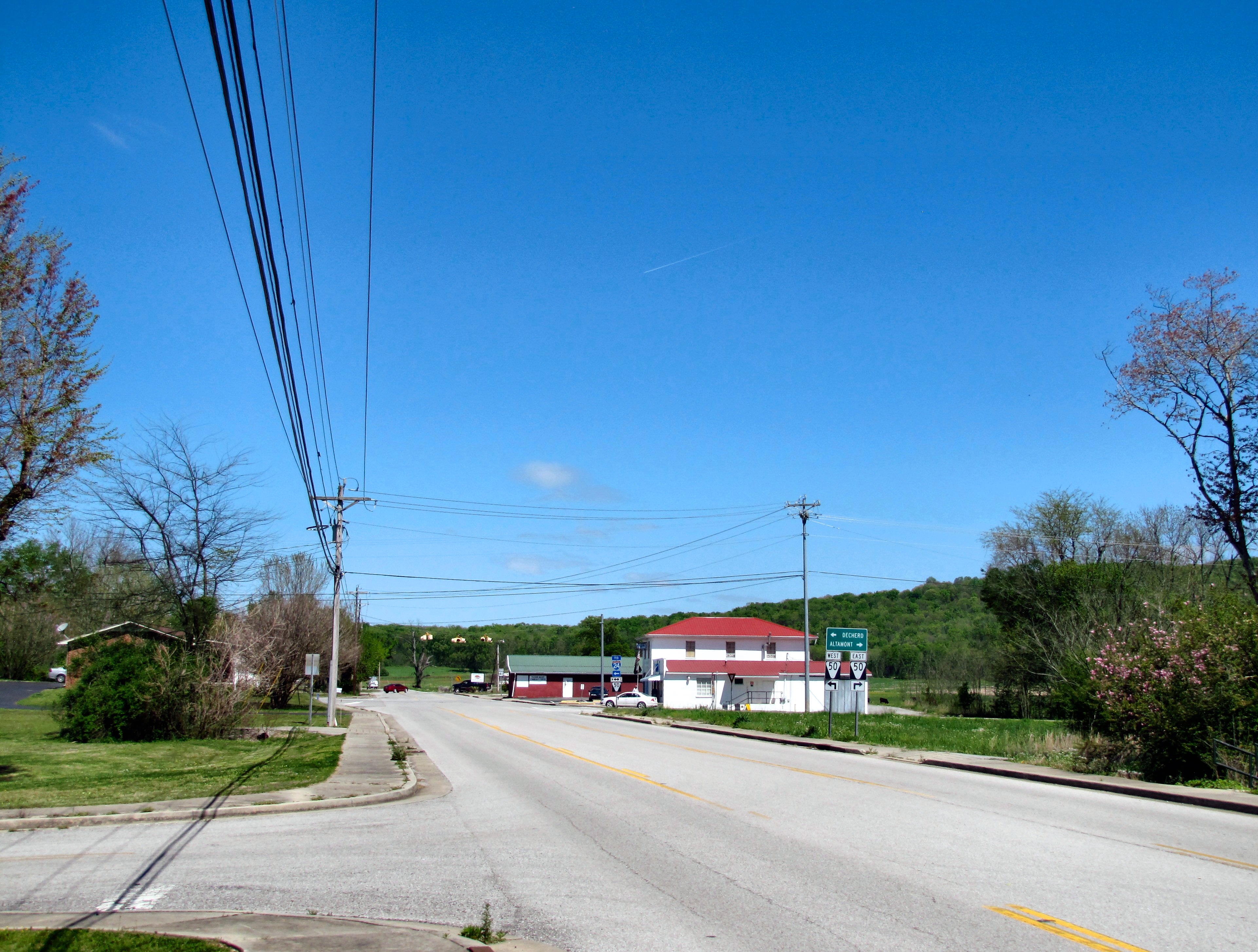
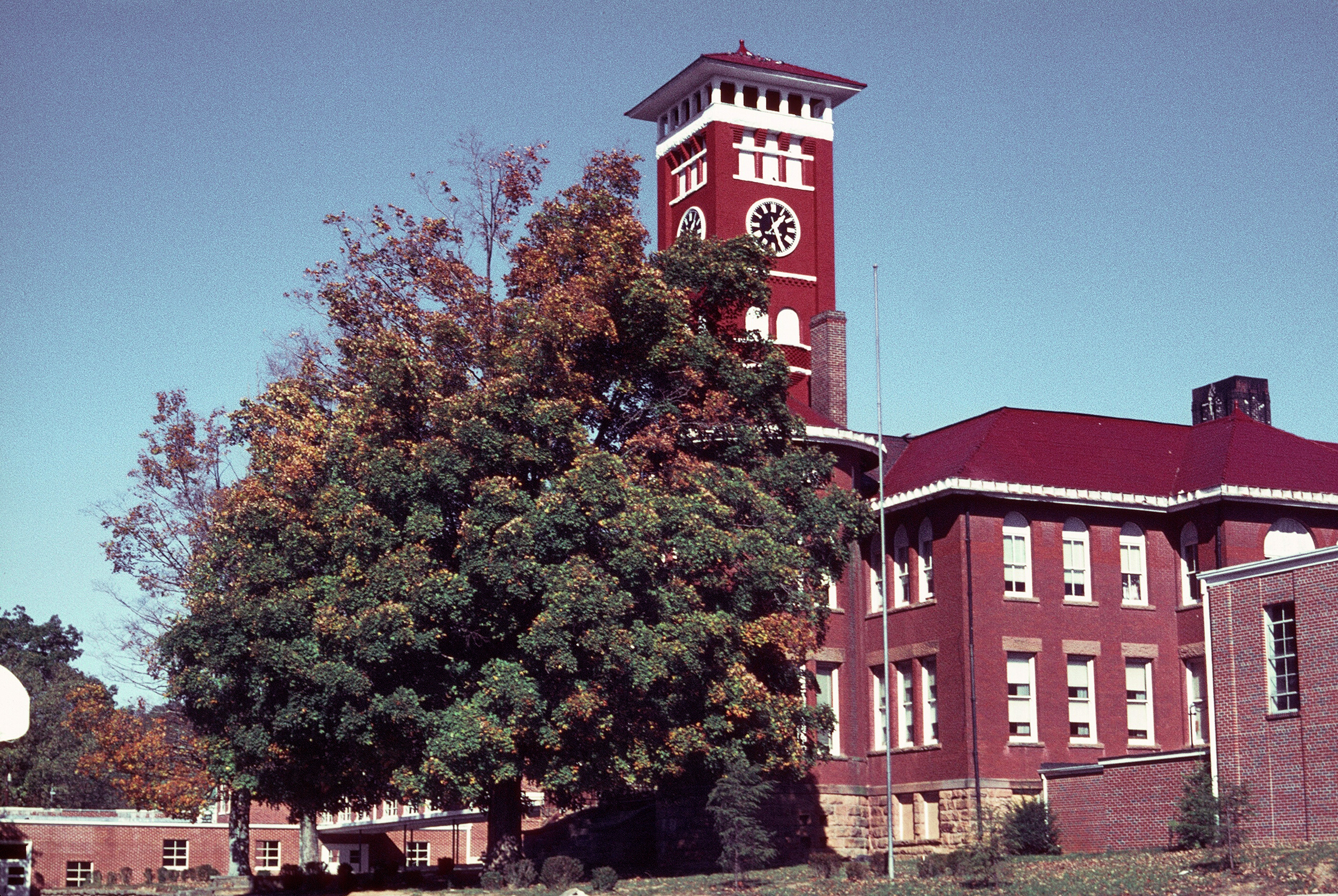
Altamont is a town in Grundy County, Tennessee, United States. The population was 1,117 at the 2020 census. It is the county seat of Grundy County. History Altamont was established in 1848 as a county seat for Grundy County, which had been created in 1844. Adrian Northcut, a prominent local farmer and military officer, was the prime advocate for the site's selection. The town's name comes from combining ''alto'' (meaning "altitude") and ''mont'' (meaning "mountain"). Although the Civil War somewhat stunted the town's growth, by 1870 Altamont's population had grown to 217. Altamont has one of the oldest Mormon congregations in the southeastern United States. The congregation was formed in the 1890s, and a Mormon chapel was built in Northcutt Cove just north of Altamont in 1909. Shortly thereafter, several members of the congregation migrated to Altamont. A Mormon chapel was completed along Main Street in 1947, and a newer chapel was completed just off Viola Road in 1981. In 19 ... [...More Info...] [...Related Items...] OR: [Wikipedia] [Google] [Baidu] |
Town
A town is a human settlement. Towns are generally larger than villages and smaller than cities, though the criteria to distinguish between them vary considerably in different parts of the world. Origin and use The word "town" shares an origin with the German word , the Dutch word , and the Old Norse . The original Proto-Germanic word, *''tūnan'', is thought to be an early borrowing from Proto-Celtic *''dūnom'' (cf. Old Irish , Welsh ). The original sense of the word in both Germanic and Celtic was that of a fortress or an enclosure. Cognates of ''town'' in many modern Germanic languages designate a fence or a hedge. In English and Dutch, the meaning of the word took on the sense of the space which these fences enclosed, and through which a track must run. In England, a town was a small community that could not afford or was not allowed to build walls or other larger fortifications, and built a palisade or stockade instead. In the Netherlands, this space was a garden, mor ... [...More Info...] [...Related Items...] OR: [Wikipedia] [Google] [Baidu] |
Highland Rim
The Highland Rim is a geographic term for the area in Tennessee surrounding the Central Basin. Nashville is largely surrounded by higher terrain in all directions. Geologically, the Central Basin is a dome. The Highland Rim is a cuesta surrounding the basin, and the border where the difference in elevation is sharply pronounced is an escarpment. Nashville is located in the northwestern corner of the basin. Geology and Physiography The Highland Rim is a physiographic section of the larger Interior Low Plateaus province, which in turn is part of the larger Interior Plains physiographic division. Most of the Highland Rim is located in U.S. EPA Ecoregion 71, Interior Plateau, which is a part of the Eastern Temperate Forest. The sections of the Highland Rim are referred to the four cardinal directions, e.g., "Northern Highland Rim", etc. The Highland Rim is rather continuous and any division of it, including the ones made below, are somewhat arbitrary. The term "highland" here is ... [...More Info...] [...Related Items...] OR: [Wikipedia] [Google] [Baidu] |
Tennessee State Route 50
State Route 50 (SR 50) is a west–to–east highway in Middle Tennessee. The road begins near Only and ends in Altamont. The current length is . Route description Hickman County SR 50 begins as a 2-lane secondary highway in Hickman County at exit 148 on I-40 near Only as a continuation of Duck River Road. SR 50 travels southeast and crosses a bridge over the Duck River to enter Only and have an intersection with Dyer Road, which follows SR 50's former alignment through the community. SR 50 then passes through wooded areas as it bypasses Only to the south before having an intersection with SR 229, which provides access to the Turney Center Industrial Complex. SR 50 continues east to cross the Duck River again before paralleling it and having an intersection with SR 438. The highway then has two more crossings of the Duck river before passing near Grinder's Switch and entering Centerville. SR 50 then passes south of downtown as it then comes to an in ... [...More Info...] [...Related Items...] OR: [Wikipedia] [Google] [Baidu] |
Whitwell, Tennessee
Whitwell is a city in Marion County, Tennessee, United States, approximately 24 miles northwest of Chattanooga. The population was 1,641 at the 2020 census. It is part of the Chattanooga, TN– GA Metropolitan Statistical Area. History The town that became Whitwell was originally known as Cheekville, but renamed "Whitwell" for Thomas Whitwell, a British metallurgist, inventor and co-founder of the Southern States Coal, Iron and Land Company, who was killed in an accident in his own ironworks in Thornaby in 1878. Whitwell was incorporated as a city in 1956, having grown as a mining town due to the abundance of coal in the mountains near the town. In 1981 there was a major mining accident when 13 coal miners were killed in an explosion. A full list of the names of those killed in the mine explosion is on a monument at Whitwell High School. Whitwell also has an annual Labor Day celebration that has been celebrated for over 50 consecutive years. Geography Whitwell is located at ... [...More Info...] [...Related Items...] OR: [Wikipedia] [Google] [Baidu] |
Viola, Tennessee
Viola is a town in Warren County, Tennessee, United States. The population was 129 at the 2000 census and 131 at the 2010 census. Geography Viola is located at (35.538085, -85.860606). According to the United States Census Bureau, the town has a total area of , all of it land. History Viola was founded in the late 1700s as the settlement of Blue Springs. It was home to one of the earliest churches in Tennessee of the Separate Baptists and several members of the denomination lived there. The settlement formerly named Blue Springs was named Viola with the opening of the first post office on August 23, 1858. The post office was named for Viola, the fictional character in Shakespeare's play Twelfth Night. Until closing in 1973 the Viola Mill produced the popular regional brand of flour "Viola's Best." This mill was later scrapped and the materials used to build a mill at The Farm. Demographics As of the census of 2000, there were 129 people, 52 households, and 37 families resi ... [...More Info...] [...Related Items...] OR: [Wikipedia] [Google] [Baidu] |
Tennessee State Route 108
State Route 108 (SR 108) is a state highway in Southeastern and Eastern Middle Tennessee. It connects SR 28 in Whitwell to SR 55 Bus/ SR 56/ SR 380 in McMinnville. Route description Marion County SR 108 begins as a primary highway in Marion County at an intersection with SR 28 in Whitwell. It travels to the north as Main Street into downtown and then turns northeast as Cumberland Drive and leaves Whitwell. It then ascends to the top of the Cumberland Plateau and passes through primarily rural terrain, where it passes through Griffith Creek, until it reaches Grundy County. Grundy County SR 108 continues north through rural terrain until it enters the town of Palmer and passes through its downtown area. It then comes to an intersection with SR 399, where it enters Gruetli-Laager. SR 108 passes through the city for approximately , Before entering Coalmont, where it has an intersection with SR 56 for the first time. Approximately past the SR 56 in ... [...More Info...] [...Related Items...] OR: [Wikipedia] [Google] [Baidu] |
Monteagle, Tennessee
Monteagle is a town in Franklin, Grundy, and Marion counties in the U.S. state of Tennessee, in the Cumberland Plateau region of the southeastern part of the state. The population was 1,238 at the 2000 census – 804 of the town's 1,238 residents (64.9%) lived in Grundy County, 428 (34.6%) in Marion County, and 6 (0.5%) in Franklin County. The population at the 2020 census was 1,393. The Marion County portion of Monteagle is part of the Chattanooga– GA Metropolitan Statistical Area, while the Franklin County portion is part of the Tullahoma, TN Micropolitan Statistical Area. Monteagle is famous for the treacherous stretch of Interstate 24 that passes through the town. It is here that the highway passes over what is colloquially referred to as "The Monteagle" or "Monteagle Mountain", a section of the southern Cumberland Plateau which is a major landmark on the road between Chattanooga and Nashville. The interstate regularly shuts down in inclement weather, routing ... [...More Info...] [...Related Items...] OR: [Wikipedia] [Google] [Baidu] |
Tracy City, Tennessee
Tracy City is a town in Grundy County, Tennessee, United States. Incorporated in 1915, the population was 1,481 at the 2010 census. Named after financier Samuel Franklin Tracy, the city developed out of railroad and mining interests after coal was found in 1840. In 2010 the people of Tracy City elected a dead man, Carl Robin Geary, as mayor. History In 1840 local boys digging a groundhog out of the ground discovered coal. In the early 1870s Tracy City an experimental blast furnace was built by Samuel Jones and owned by the Tennessee Coal, Iron and Railroad Company. The furnace, called "Fiery Gizzard", was built to see if local coal would be used to produce iron. The furnace made 15 tons of iron before the stovepipe fell on the third day. The former location of the furnace is marked with a historical marker. The coke ovens at Tracy City supplied railroad and industrial fuel and workers and their families moved into the area in great numbers from 1875 until 1900. By 1910 the in ... [...More Info...] [...Related Items...] OR: [Wikipedia] [Google] [Baidu] |
Coalmont, Tennessee
Coalmont is a city in Grundy County, Tennessee, United States. Established in 1904, the city has an area of 6 square miles. The population was 841 at the 2010 census. History Coalmont was established as a coal mining company town around 1904, operated by the Sewanee Coal, Coke and Land Company. Residences, businesses and commercial buildings in Coalmont were built and owned by the company, but individual miners could also build their own homes., 1987 A battery of coke ovens dating from the first decade of the 20th century is listed on the National Register of Historic Places. The Coalmont Bank Building also is listed. Geography Coalmont is located at (35.344309, -85.717252). According to the United States Census Bureau, the city has a total area of , of which, of it is land and of it (2.14%) is water. Demographics 2020 census As of the 2020 United States census, there were 784 people, 308 households, and 209 families residing in the city. 2000 census As of the census of ... [...More Info...] [...Related Items...] OR: [Wikipedia] [Google] [Baidu] |
McMinnville, Tennessee
McMinnville is the largest city in and the county seat of Warren County, Tennessee, United States. The population was 13,605 at the 2010 census. It was named for Governor Joseph McMinn. Geography McMinnville is located at (35.686708, -85.779309), approximately south of Cookeville and northwest of Chattanooga. According to the United States Census Bureau, the city has a total area of , all land. McMinnville lies at an elevation of , as it sits along the Eastern Highland Rim near the base of the Cumberland Plateau. The city is drained primarily by the Barren Fork, a tributary of the Collins River. Nearby cities and towns Climate Demographics 2020 census As of the 2020 United States census, there were 13,788 people, 5,581 households, and 3,131 families residing in the city. 2000 census As of the census of 2000, there were 12,749 people, 5,419 households and 3,332 families residing in the city. The population density was 1,273.4 per square mile (491.7/km2). There were 5, ... [...More Info...] [...Related Items...] OR: [Wikipedia] [Google] [Baidu] |
Beersheba Springs, Tennessee
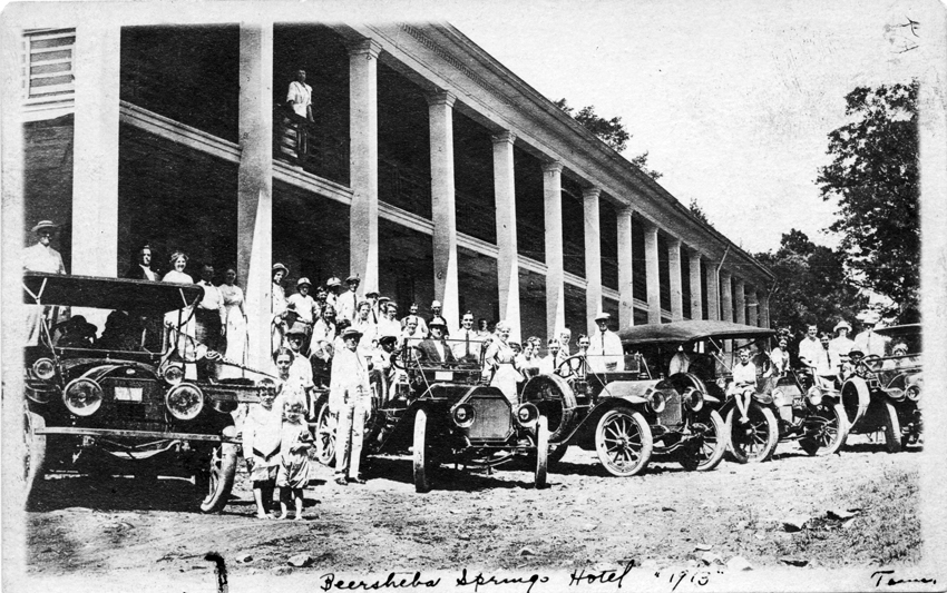
Beersheba Springs is a town in Grundy County, Tennessee, Grundy County, Tennessee, United States. The population was 477 at the 2010 census. A resort town in the 19th century, Beersheba Springs was the summer home of author Mary Noailles Murfree. It now serves as a major summer meeting center for the Tennessee United Methodist Church. History In 1833 Beersheba Porter Cain discovered a chalybeate spring. The spring and surrounding area, located above Collins River, Collins River Valley, would be incorporated in 1839. Upon its incorporation, Beersheba Springs would serve as a summer resort with a small hotel and log cabins. The resort would be popular with stagecoach traffic that would travel between Chattanooga, Tennessee, Chattanooga and McMinnville, Tennessee, McMinnville. It was notable for its mineral waters. Eventually Louisiana farmers also moved into the area, leaving behind the notoriously hot summers of their home state. Beersheba Springs served as the summer home for ... [...More Info...] [...Related Items...] OR: [Wikipedia] [Google] [Baidu] |
Tennessee State Route 56
State Route 56 (SR 56) is a state highway that runs south to north in Middle Tennessee, from the Alabama state line near Sherwood to the Kentucky state line near Red Boiling Springs. SR 56 is secondary south of Sewanee. It is primary (but unsigned) along US 41A and US 41 between Sewanee and Tracy City. From Tracy City to the Kentucky line, SR 56 is a signed primary route, except west from North Springs to Willette, where SR 151 carries primary traffic more directly to Red Boiling Springs. Route description Alabama state line to McMinnville SR 56 begins as a secondary state route at the Alabama state line south of Sherwood in Franklin County, (as a 2-lane) where the road continues south as Alabama State Route 117 into Jackson County, Alabama. SR 56 continues northward to the Crow Creek Valley, which is full of farmland, and passes through Sherwood before the highway becomes very curvy as it ascends into the Cumberland Plateau, passing through the Sherwood Forest, Carter S ... [...More Info...] [...Related Items...] OR: [Wikipedia] [Google] [Baidu] |
.jpg)


