|
Allegheny Front
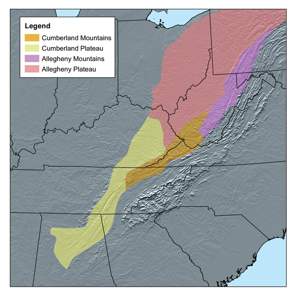
The Allegheny Front is the major southeast- or east-facing escarpment in the Allegheny Mountains in southern Pennsylvania, western Maryland, eastern West Virginia, and western Virginia, USA. The Allegheny Front forms the boundary between the Ridge-and-Valley Appalachians to its east and the Appalachian Plateau (locally called the Allegheny Plateau) to its west. The Front is closely associated with the Appalachian Mountains' Eastern Continental Divide, which in this area divides the waters of the Ohio/Mississippi river system, flowing to the Gulf of Mexico, from rivers flowing into Chesapeake Bay and from there into the Atlantic Ocean. The Allegheny Front and the Eastern Continental Divide do not always coincide; for example, the North Branch of the Potomac River begins well west of the Front, at the Fairfax Stone near the southwestern tip of Maryland, about and across the actual divide from the headwaters of the Youghiogheny River draining northwards into the Monongahela a ... [...More Info...] [...Related Items...] OR: [Wikipedia] [Google] [Baidu] |
Allegheny Mountains
The Allegheny Mountain Range (; also spelled Alleghany or Allegany), informally the Alleghenies, is part of the vast Appalachian Mountain Range of the Eastern United States and Canada and posed a significant barrier to land travel in less developed eras. The Allegheny Mountains have a northeast–southwest orientation, running for about from north-central Pennsylvania, southward through western Maryland and eastern West Virginia. The Alleghenies comprise the rugged western-central portion of the Appalachians. They rise to approximately in northeastern West Virginia. In the east, they are dominated by a high, steep escarpment known as the Allegheny Front. In the west, they slope down into the closely associated Allegheny Plateau, which extends into Ohio and Kentucky. The principal settlements of the Alleghenies are Altoona, State College, and Johnstown, Pennsylvania; and Cumberland, Maryland. Name The name is derived from the Allegheny River, which drains only a small porti ... [...More Info...] [...Related Items...] OR: [Wikipedia] [Google] [Baidu] |
Appalachian Plateau
The Appalachian Plateau is a series of rugged dissected plateaus located on the western side of the Appalachian Mountains. The Appalachian Mountains are a mountain range that run down the Eastern United States. The Appalachian Plateau is the northwestern part of the Appalachian Mountains, stretching from New York to Alabama. The plateau is a second level United States physiographic region, covering parts of the states of New York, Pennsylvania, Ohio, Maryland, West Virginia, Virginia, Kentucky, Tennessee, Alabama, and Georgia. Geography and physical features The formation of the plateau began during the Paleozoic Era. Regional uplift during this time caused the area to rise altogether without changing the topography of the land. The eastern side of the plateau appears as a mountain range. This false appearance is due to a very steep slope on the eastern side known as the Allegheny Front. The eastern edge is the highest part of the Appalachian Plateau. In Pennsylvania, the ele ... [...More Info...] [...Related Items...] OR: [Wikipedia] [Google] [Baidu] |
Wind Farm
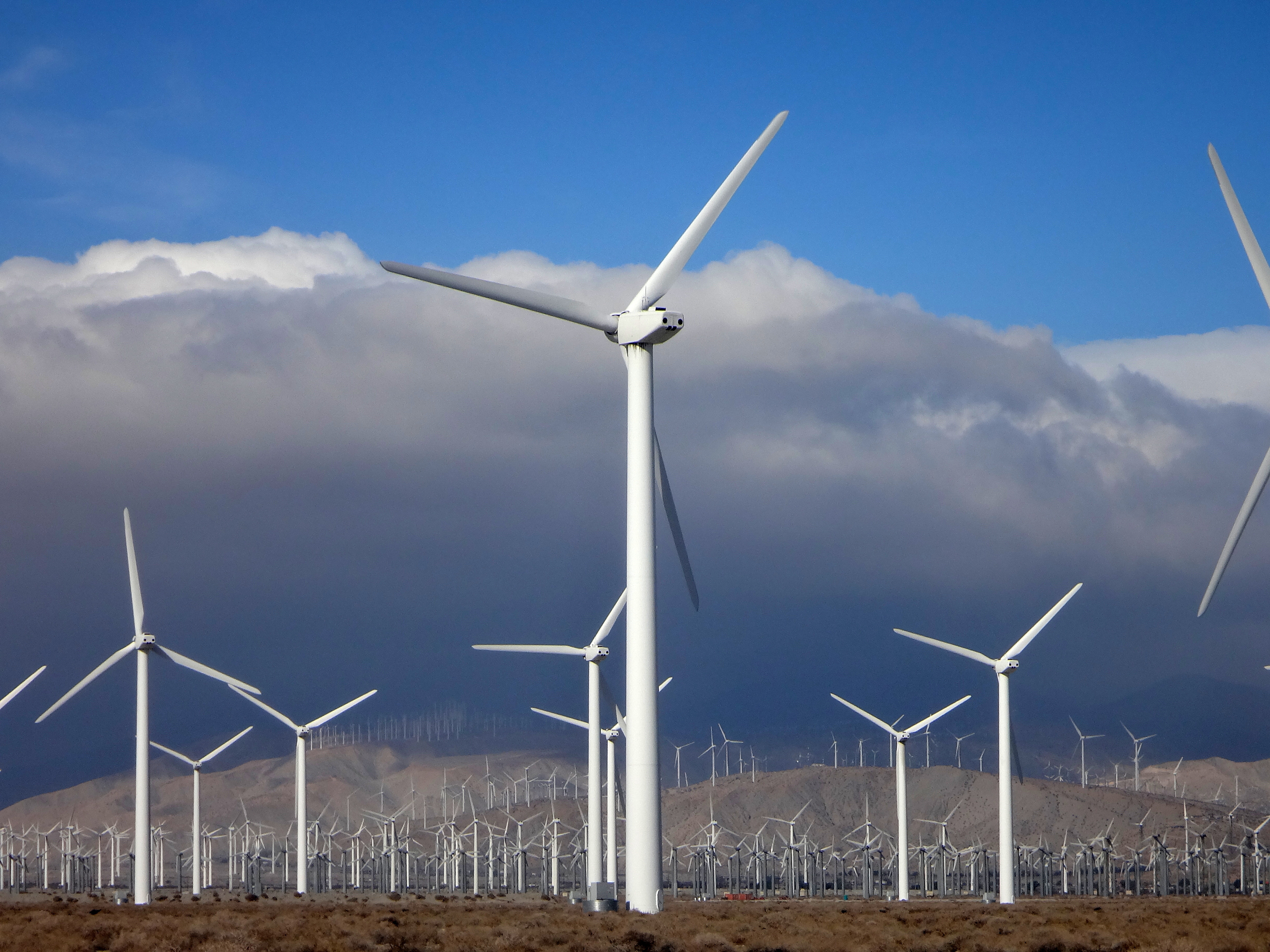
A wind farm or wind park, also called a wind power station or wind power plant, is a group of wind turbines in the same location used Wind power, to produce electricity. Wind farms vary in size from a small number of turbines to several hundred wind turbines covering an extensive area. Wind farms can be either onshore or offshore. Many of the largest operational onshore wind farms are located in China, India, and the United States. For example, the List of onshore wind farms, largest wind farm in the world, Gansu Wind Farm in China had a capacity of over 6,000 megawatt, MW by 2012,Watts, Jonathan & Huang, CecilyWinds Of Change Blow Through China As Spending On Renewable Energy Soars ''The Guardian'', 19 March 2012, revised on 20 March 2012. Retrieved 4 January 2012. with a goal of 20,000 MWFahey, JonathanIn Pictures: The World's Biggest Green Energy Projects ''Forbes'', 9 January 2010. Retrieved 19 June 2019. by 2020.Kanter, DougGansu Wind Farm ''Forbes''. Retrieved 1 ... [...More Info...] [...Related Items...] OR: [Wikipedia] [Google] [Baidu] |
Monongahela River
The Monongahela River ( , )—often referred to locally as the Mon ()—is a U.S. Geological Survey. National Hydrography Dataset high-resolution flowline dataThe National Map accessed August 15, 2011 river on the Allegheny Plateau in North Central West Virginia, north-central West Virginia and Greater Pittsburgh, Southwestern Pennsylvania. The river flows from the confluence of its west and east forks in north-central West Virginia northeasterly into southwestern Pennsylvania, then northerly to Pittsburgh and its confluence with the Allegheny River to form the Ohio River. The river's entire length is navigable via a series of locks and dams. Etymology The Unami language, Unami word ''Monongahela'' means "falling banks", in reference to the geological instability of the river's banks. Moravian Church, Moravian missionary David Zeisberger (1721–1808) gave this account of the naming: "In the Lenape language, Indian tongue the name of this river was ''Mechmenawungihilla'' (alter ... [...More Info...] [...Related Items...] OR: [Wikipedia] [Google] [Baidu] |
Drainage Basin
A drainage basin is an area of land where all flowing surface water converges to a single point, such as a river mouth, or flows into another body of water, such as a lake or ocean. A basin is separated from adjacent basins by a perimeter, the '' drainage divide'', made up of a succession of elevated features, such as ridges and hills. A basin may consist of smaller basins that merge at river confluences, forming a hierarchical pattern. Other terms for a drainage basin are catchment area, catchment basin, drainage area, river basin, water basin, and impluvium. In North America, they are commonly called a watershed, though in other English-speaking places, "watershed" is used only in its original sense, that of a drainage divide. In a closed drainage basin, or endorheic basin, the water converges to a single point inside the basin, known as a sink, which may be a permanent lake, a dry lake, or a point where surface water is lost underground. Drainage basins are similar ... [...More Info...] [...Related Items...] OR: [Wikipedia] [Google] [Baidu] |
Youghiogheny River
The Youghiogheny River , or the Yough (pronounced Yok ) for short, is a U.S. Geological Survey. National Hydrography Dataset high-resolution flowline dataThe National Map accessed August 15, 2011 tributary of the Monongahela River in the U.S. states of West Virginia, Maryland, and Pennsylvania. It drains an area on the west side of the Allegheny Mountains northward into Pennsylvania, providing a small watershed in extreme western Maryland into the tributaries of the Mississippi River. Youghiogheny is a Lenape word meaning "a stream flowing in a contrary direction". Variant names According to the Geographic Names Information System, it has also been known historically as: * Gawgawgamie, Ohio Gani River, Roonanetto, Yanghyanghgain, Yaughvaughani, Yauyougaine River, Yawyawganey, Yawyougaine River, Yeoyogani, Yochio Geni, Yoghioghenny River, Yogyogany River, Yohioganey, Yohogany, Youghiogeny River, Youghogania, Youghyaughye, Youghyoghgyina River, Yoxhio geni River, Yoxhiogany, Yoxh ... [...More Info...] [...Related Items...] OR: [Wikipedia] [Google] [Baidu] |
Fairfax Stone
Fairfax Stone Historical Monument State Park is a West Virginia state park commemorating the Fairfax Stone, a surveyor's marker and boundary stone at the source of the North Branch of the Potomac River. The original stone was placed on October 23, 1746 to settle a boundary dispute between Thomas Fairfax, 6th Lord Fairfax of Cameron and the English Privy Council concerning the Northern Neck of Virginia. It determined the proprietorship and boundaries of a large tract of mostly unsurveyed land in the English colonies of Maryland and Virginia. Park Fairfax Stone Historical Monument, part of a four-acre West Virginia state park, is six miles north of Thomas, West Virginia. The site is sparsely developed, lacking any buildings or restroom facilities. History The exact boundaries of the " Northern Neck Land Grant" (later called the "Fairfax Grant") had been undetermined since it was first contrived in 1649 by the then-exiled King Charles II. John Savage and his survey party had ... [...More Info...] [...Related Items...] OR: [Wikipedia] [Google] [Baidu] |
Potomac River
The Potomac River () drains the Mid-Atlantic United States, flowing from the Potomac Highlands into Chesapeake Bay. It is long,U.S. Geological Survey. National Hydrography Dataset high-resolution flowline dataThe National Map. Retrieved August 15, 2011 with a drainage area of 14,700 square miles (38,000 km2), and is the fourth-largest river along the East Coast of the United States and the 21st-largest in the United States. Over 5 million people live within its watershed. The river forms part of the borders between Maryland and Washington, D.C. on the left descending bank and between West Virginia and Virginia on the right descending bank. Except for a small portion of its headwaters in West Virginia, the North Branch Potomac River is considered part of Maryland to the low-water mark on the opposite bank. The South Branch Potomac River lies completely within the state of West Virginia except for its headwaters, which lie in Virginia. Course The Potomac River runs ... [...More Info...] [...Related Items...] OR: [Wikipedia] [Google] [Baidu] |
Atlantic Ocean
The Atlantic Ocean is the second-largest of the world's five oceans, with an area of about . It covers approximately 20% of Earth's surface and about 29% of its water surface area. It is known to separate the " Old World" of Africa, Europe and Asia from the "New World" of the Americas in the European perception of the World. The Atlantic Ocean occupies an elongated, S-shaped basin extending longitudinally between Europe and Africa to the east, and North and South America to the west. As one component of the interconnected World Ocean, it is connected in the north to the Arctic Ocean, to the Pacific Ocean in the southwest, the Indian Ocean in the southeast, and the Southern Ocean in the south (other definitions describe the Atlantic as extending southward to Antarctica). The Atlantic Ocean is divided in two parts, by the Equatorial Counter Current, with the North(ern) Atlantic Ocean and the South(ern) Atlantic Ocean split at about 8°N. Scientific explorations of the A ... [...More Info...] [...Related Items...] OR: [Wikipedia] [Google] [Baidu] |
Chesapeake Bay
The Chesapeake Bay ( ) is the largest estuary in the United States. The Bay is located in the Mid-Atlantic (United States), Mid-Atlantic region and is primarily separated from the Atlantic Ocean by the Delmarva Peninsula (including the parts: the Eastern Shore of Maryland / Eastern Shore of Virginia and the state of Delaware) with its mouth of the Bay at the south end located between Cape Henry and Cape Charles (headland), Cape Charles. With its northern portion in Maryland and the southern part in Virginia, the Chesapeake Bay is a very important feature for the ecology and economy of those two states, as well as others surrounding within its watershed. More than 150 major rivers and streams flow into the Bay's drainage basin, which covers parts of six states (New York, Pennsylvania, Delaware, Maryland, Virginia and West Virginia) and all of District of Columbia. The Bay is approximately long from its northern headwaters in the Susquehanna River to its outlet in the Atlantic Ocea ... [...More Info...] [...Related Items...] OR: [Wikipedia] [Google] [Baidu] |
Gulf Of Mexico
The Gulf of Mexico ( es, Golfo de México) is an oceanic basin, ocean basin and a marginal sea of the Atlantic Ocean, largely surrounded by the North American continent. It is bounded on the northeast, north and northwest by the Gulf Coast of the United States; on the southwest and south by the Mexico, Mexican States of Mexico, states of Tamaulipas, Veracruz, Tabasco, Campeche, Yucatan, and Quintana Roo; and on the southeast by Cuba. The Southern United States, Southern U.S. states of Texas, Louisiana, Mississippi, Alabama, and Florida, which border the Gulf on the north, are often referred to as the "Third Coast" of the United States (in addition to its Atlantic and Pacific Ocean, Pacific coasts). The Gulf of Mexico took shape approximately 300 million years ago as a result of plate tectonics.Huerta, A.D., and D.L. Harry (2012) ''Wilson cycles, tectonic inheritance, and rifting of the North American Gulf of Mexico continental margin.'' Geosphere. 8(1):GES00725.1, first p ... [...More Info...] [...Related Items...] OR: [Wikipedia] [Google] [Baidu] |
Mississippi River
The Mississippi River is the second-longest river and chief river of the second-largest drainage system in North America, second only to the Hudson Bay drainage system. From its traditional source of Lake Itasca in northern Minnesota, it flows generally south for to the Mississippi River Delta in the Gulf of Mexico. With its many tributaries, the Mississippi's watershed drains all or parts of 32 U.S. states and two Canadian provinces between the Rocky and Appalachian mountains. The main stem is entirely within the United States; the total drainage basin is , of which only about one percent is in Canada. The Mississippi ranks as the thirteenth-largest river by discharge in the world. The river either borders or passes through the states of Minnesota, Wisconsin, Iowa, Illinois, Missouri, Kentucky, Tennessee, Arkansas, Mississippi, and Louisiana. Native Americans have lived along the Mississippi River and its tributaries for thousands of years. Most were hunter-ga ... [...More Info...] [...Related Items...] OR: [Wikipedia] [Google] [Baidu] |


