|
Alewife Brook Parkway
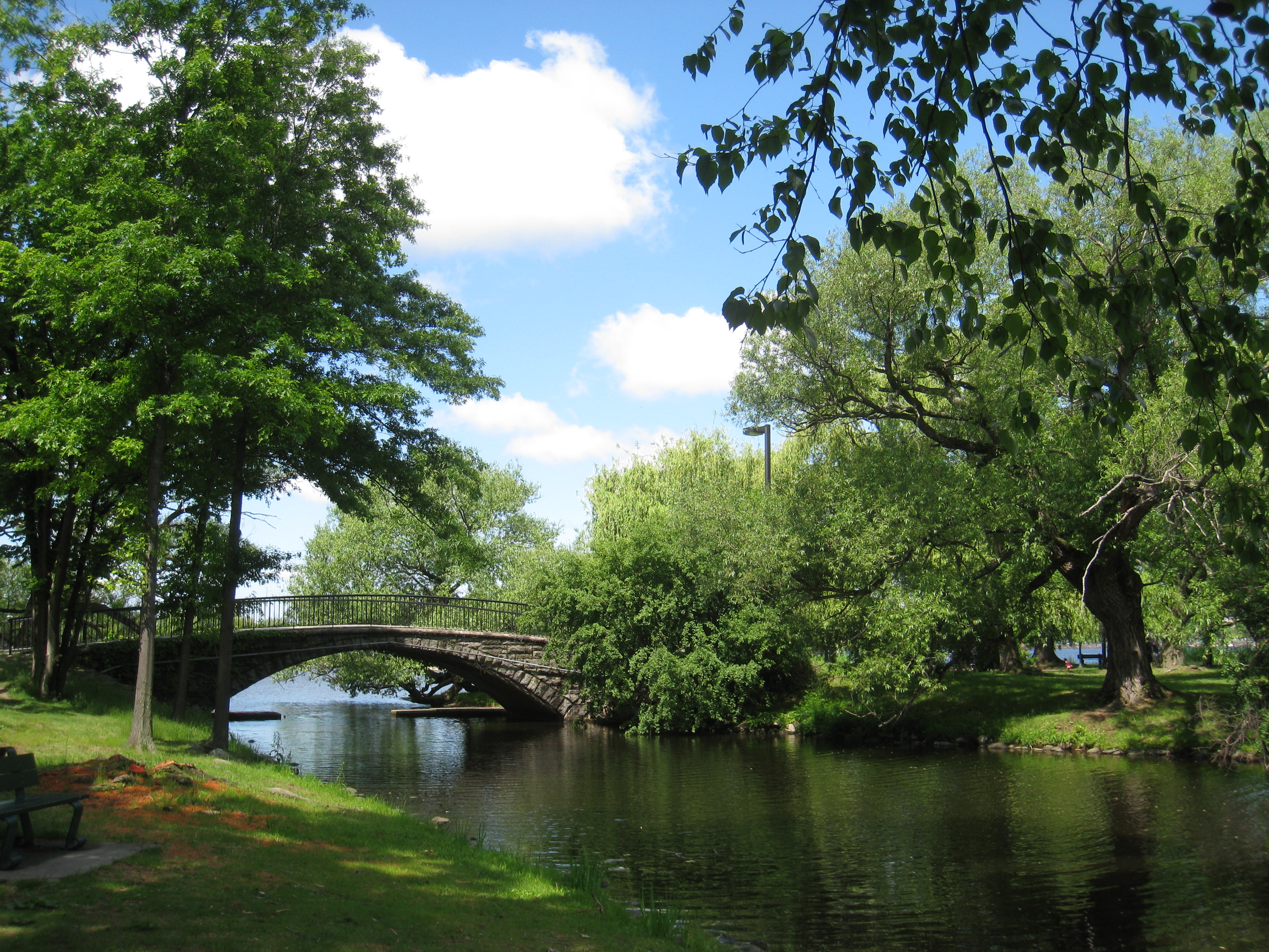
Alewife Brook Parkway is a short parkway in Cambridge and Somerville, Massachusetts. It is listed on the National Register of Historic Places. It begins at Fresh Pond in Cambridge (linking to Fresh Pond Parkway via Concord Avenue), and heads north on the east bank of Alewife Brook, crossing into West Somerville and ending at the Mystic River on the Medford town line, where it becomes Mystic Valley Parkway. The entire length of Alewife Brook Parkway is designated as part of Massachusetts Route 16 (Route 16), while the southernmost sections are also designated as part of Route 2 and U.S. Route 3 (US 3). It is managed by the Department of Conservation and Recreation with the Massachusetts Department of Transportation responsible for bridge maintenance. Route description The southern terminus of the parkway is the westernmost of the two Fresh Pond rotaries, with Concord Avenue connecting the parkway to Fresh Pond Parkway at the eastern rotary. The road ... [...More Info...] [...Related Items...] OR: [Wikipedia] [Google] [Baidu] |
Middlesex County, Massachusetts
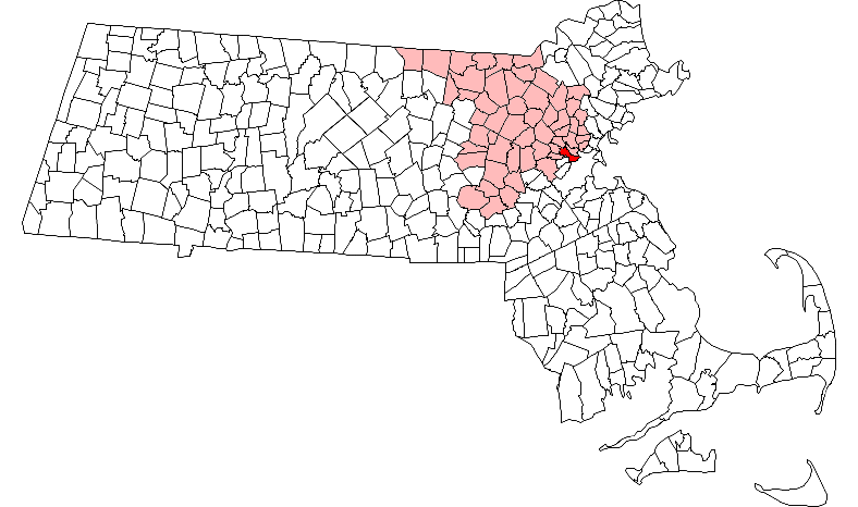
Middlesex County is located in the Commonwealth (U.S. state), Commonwealth of Massachusetts, in the United States. As of the 2020 census, the population was 1,632,002, making it the most populous county in both Massachusetts and New England and the List of the most populous counties in the United States, 22nd most populous county in the United States. Middlesex County is one of two U.S. counties (along with Santa Clara County, California) to be amongst the top 25 counties with the highest household income and the 25 most populated counties. It is included in the Census Bureau's Boston–Cambridge, Massachusetts, Cambridge–Newton, Massachusetts, Newton, MA–New Hampshire, NH Greater Boston, Metropolitan Statistical Area. As part of the 2020 United States census, the Commonwealth's mean center of population for that year was Geographic coordinate system, geo-centered in Middlesex County, in the town of Natick, Massachusetts, Natick (this is not to be confused with the geographic ... [...More Info...] [...Related Items...] OR: [Wikipedia] [Google] [Baidu] |
Massachusetts Route 16
Route 16 is a east–west state highway in Massachusetts. It begins in the west at an intersection with Route 12 and Route 193 in Webster, just north of the Connecticut state border. It runs in a generally southwest-northeast routing through a number of Boston's suburbs and runs to the west and then north of the city before ending in Revere at an intersection with Route 1A and Route 60. Much of Route 16 east of the Newton- Wellesley town line, and especially from Cambridge eastward, is a multi-lane parkway, although it is not limited access for any significant length of road. Segments of Route 16 are also known as the Mystic Valley Parkway, the Alewife Brook Parkway, and the Revere Beach Parkway, among other names. From the western end of the Route 135 concurrency in Wellesley to Route 30 (Commonwealth Avenue) in Newton, the route serves as a part of the Boston Marathon, from the halfway point to just before Mile 18 and the hills. Route description Webster to Milford R ... [...More Info...] [...Related Items...] OR: [Wikipedia] [Google] [Baidu] |
National Register Of Historic Places Listings In Cambridge, Massachusetts
This is a list of sites listed on the National Register of Historic Places in Cambridge, Massachusetts. This is intended to be a complete list of the properties and districts on the National Register of Historic Places in Cambridge, Massachusetts, United States. Latitude and longitude coordinates are provided for many National Register properties and districts; these locations may be seen together in an online map. There are 206 properties and districts listed on the National Register in Cambridge, including 18 National Historic Landmarks. Current listings Former listing See also *Blue plaque *List of National Historic Landmarks in Massachusetts *National Register of Historic Places listings in Massachusetts *National Register of Historic Places listings in Middle ... [...More Info...] [...Related Items...] OR: [Wikipedia] [Google] [Baidu] |
Traffic Circle
A roundabout is a type of circular intersection (road), intersection or junction in which road traffic is permitted to flow in one direction around a central island, and priority is typically given to traffic already in the junction.''The New Shorter Oxford English Dictionary,'' Volume 2, Clarendon Press, Oxford (1993), page 2632 Engineers use the term modern roundabout to refer to junctions installed after 1960 that incorporate various design rules to increase safety. Both modern and non-modern roundabouts, however, may bear street names or be identified colloquially by local names such as rotary or traffic circle. Compared to stop signs, traffic signals, and earlier forms of roundabouts, modern roundabouts reduce the likelihood and severity of collisions greatly by reducing traffic speeds and minimizing Side collision#Broadside or T-bone collision, T-bone and head-on collisions. Variations on the basic concept include integration with tram or train lines, two-way flow, hi ... [...More Info...] [...Related Items...] OR: [Wikipedia] [Google] [Baidu] |
Alewife Linear Park , an improvisational comedy troupe
{{disamb ...
Alewife may refer to: * Alewife (fish), a North American herring * Alewife (trade), a female brewer * Alewife station, in Cambridge, Massachusetts * "Alewife", a song from the Clairo album ''Immunity'' * Alewife Brook Reservation, a state park in Massachusetts * Alewife Brook Parkway, in Massachusetts * Alewife Linear Park, in Massachusetts * Alewife (multiprocessor), a computer system See also *Dead Alewives The Dead Alewives was an improvisational comedy troupe during the 1980s and 1990s from Milwaukee. Some of the group's individual members went on to become noteworthy after the group's breakup. The Dead Alewives began as a splinter group from the M ... [...More Info...] [...Related Items...] OR: [Wikipedia] [Google] [Baidu] |
Alewife Station
Alewife station is a Massachusetts Bay Transportation Authority (MBTA) intermodal transit station in the North Cambridge neighborhood of Cambridge, Massachusetts. It is the northwest terminal of the rapid transit Red Line (part of the MBTA subway system) and a hub for several MBTA bus routes. The station is at the confluence of the Minuteman Bikeway, Alewife Linear Park, Fitchburg Cutoff Path, and Alewife Greenway off Alewife Brook Parkway adjacent to Massachusetts Route 2, with a five-story parking garage for park and ride use. The station has three bike cages. Alewife station is named after nearby Alewife Brook Parkway and Alewife Brook, themselves named after the alewife fish. The Fitchburg Railroad (now the MBTA Commuter Rail Fitchburg Line) opened through North Cambridge in 1842, followed by the now-closed Lexington Branch and Fitchburg Cutoff branch lines. An extension of the 1912-opened Cambridge–Dorchester line to North Cambridge was first proposed in the 1930s, ... [...More Info...] [...Related Items...] OR: [Wikipedia] [Google] [Baidu] |
Fitchburg Line
The Fitchburg Line is a branch of the MBTA Commuter Rail system which runs from Boston's North Station to Wachusett station in Fitchburg, Massachusetts. The line is along the tracks of the former Fitchburg Railroad, which was built across northern Massachusetts, United States, in the 1840s. Winter weekend service includes a specially equipped seasonal "ski train" to Wachusett Mountain . At long, the Fitchburg Line is the second-longest line in the system (and was the longest until the Providence/Stoughton Line's 2010 extension to T. F. Green Airport and later to Wickford Junction), and ranked as one of the worst lines in terms of on-time performance. The Fitchburg Line had the oldest infrastructure in the system, and commuter trains must share trackage with freight trains on the outer segment of the line. A $150 million project completed in 2017 included adding nine miles of double track, an extension to Wachusett, rebuilding two stations, and building a new layover yard. Only ... [...More Info...] [...Related Items...] OR: [Wikipedia] [Google] [Baidu] |
Aesthetics
Aesthetics, or esthetics, is a branch of philosophy that deals with the nature of beauty and taste, as well as the philosophy of art (its own area of philosophy that comes out of aesthetics). It examines aesthetic values, often expressed through judgments of taste. Aesthetics covers both natural and artificial sources of experiences and how we form a judgment about those sources. It considers what happens in our minds when we engage with objects or environments such as viewing visual art, listening to music, reading poetry, experiencing a play, watching a fashion show, movie, sports or even exploring various aspects of nature. The philosophy of art specifically studies how artists imagine, create, and perform works of art, as well as how people use, enjoy, and criticize art. Aesthetics considers why people like some works of art and not others, as well as how art can affect moods or even our beliefs. Both aesthetics and the philosophy of art try to find answers for what exact ... [...More Info...] [...Related Items...] OR: [Wikipedia] [Google] [Baidu] |
Metropolitan Park System Of Greater Boston
The Metropolitan Park System of Greater Boston is a system of reservations, parks, parkways and roads under the control of the Massachusetts Department of Conservation and Recreation (DCR) in and around Boston that has been in existence for over a century. The title is used by the DCR to describe the areas collectively: "As a whole, the Metropolitan Park System is currently eligible for listing on the National Register of Historic Places", as outlined on the department's website. The DCR maintains a separate Urban Parks and Recreation division to oversee the system, one of five such divisions within the department—DCR's Bureau of State Parks and Recreation manages the remainder of Massachusetts state parks. Direct design and maintenance functions for the parkways and roads within the system are provided by the DCR Bureau of Engineering. The park system consists of coastal reservations and beaches including Revere Beach, river reservations along the three major rivers in the area ... [...More Info...] [...Related Items...] OR: [Wikipedia] [Google] [Baidu] |
Porter Square
Porter Square is a neighborhood in Cambridge and Somerville, Massachusetts, located around the intersection of Massachusetts Avenue and Somerville Avenue, between Harvard and Davis Squares. The Porter Square station serves both the MBTA Red Line and the Commuter Rail Fitchburg Line. A major part of the Lesley University campus is located within the Porter Square area. In 2004–06 the principal intersection, including the area adjacent to the shopping center, underwent extensive construction both to improve access for vehicles, pedestrians, bicyclists, and mass transit users, and to improve drainage and storm water conditions. The artist Toshihiro Katayama of Harvard University, in conjunction with the landscape architect Cynthia Smith, designed a new visual look for the new circulation design, including contrasting light and dark concrete paving, stone walls and boulders. History Previously called Union Square, Porter Square was renamed in 1899 for the now-vanished Porter's ... [...More Info...] [...Related Items...] OR: [Wikipedia] [Google] [Baidu] |
Massachusetts Route 2A
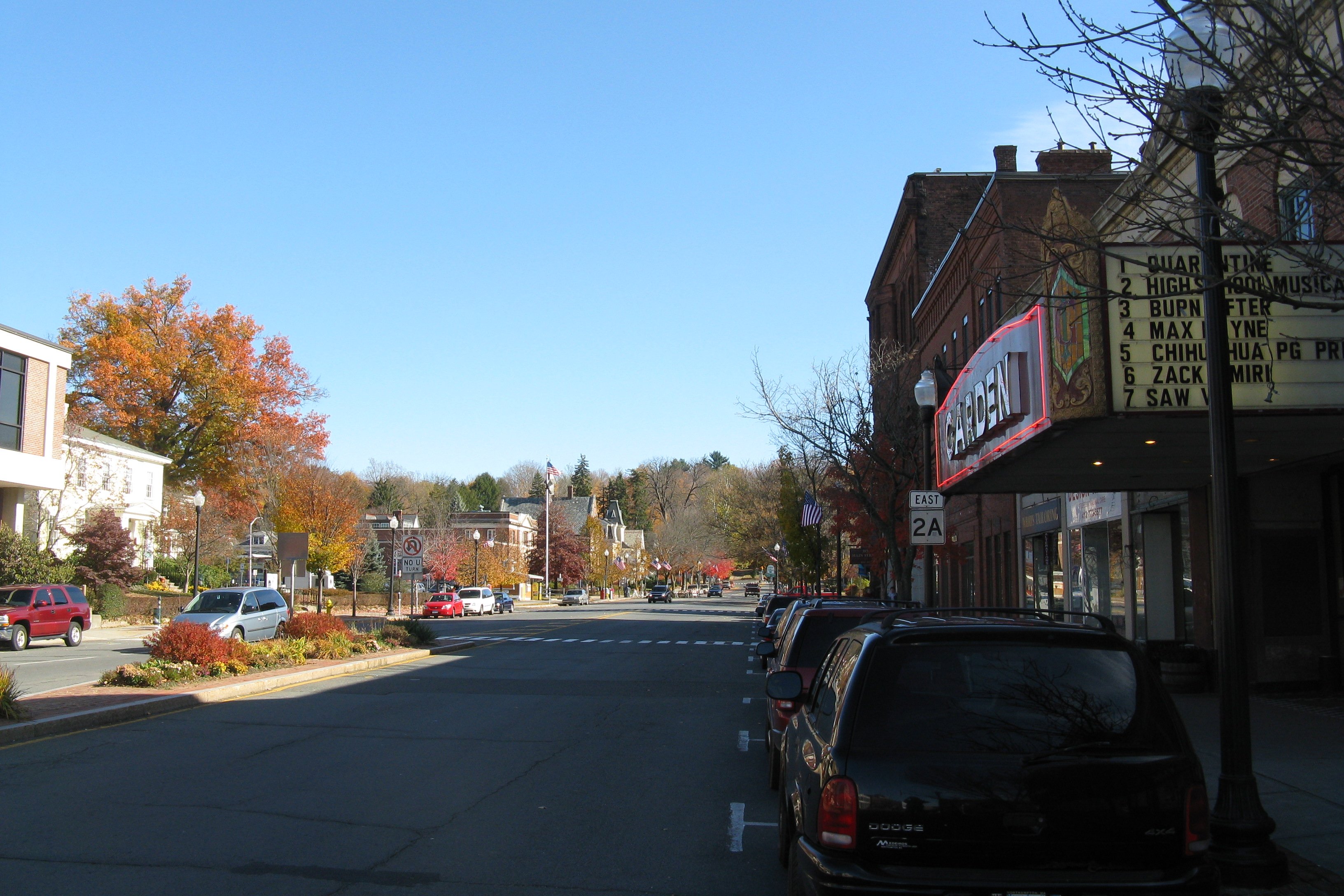
Route 2A is a east–west state highway in Massachusetts. It exists in several sections of Massachusetts, mainly as parts of former Route 2 that have been moved or upgraded. Route 2A runs from Greenfield in the west to Boston in the east. It formerly extended to Shelburne Falls in Buckland in the west, but as of 2007, the route terminates at Interstate 91 (I-91) in Greenfield. Route description Route 2A begins at the rotary intersection with Route 2 at I-91 in Greenfield. It passes through downtown Greenfield before reconnecting to its parent route just west of the Greenfield-Gill town line. After a silent concurrency, Route 2A leaves Route 2 once more, passing through Orange and Athol. In Athol it passes the former northern terminus of Route 21, which was truncated to Belchertown after the creation of the Quabbin Reservoir. From Phillipston through Westminster, Route 2A weaves around its parent route, crossing it a total o ... [...More Info...] [...Related Items...] OR: [Wikipedia] [Google] [Baidu] |
Massachusetts Avenue (Boston)
Massachusetts Avenue (colloquially referred to as Mass Ave) is a major thoroughfare in Boston, Massachusetts, and several cities and towns northwest of Boston. According to ''Boston'' magazine, "Its 16 miles of blacktop run from gritty industrial zones to verdant suburbia, passing gentrified brownstones, college campuses and bustling commercial strips." Route The street begins in the Boston neighborhood of Dorchester and runs southeast-northwest through Boston, paralleling Interstate 93 for a short distance. Massachusetts Avenue passes below part of the Boston Medical Center complex near Harrison Street, before passing above routes 9, 2, and the Massachusetts Turnpike (Interstate 90). It crosses the Charles River from the Back Bay neighborhood of Boston into the city of Cambridge via the Harvard Bridge, where passes both U.S. Route 3 and MA-Route 3, it then bisects the campus of the Massachusetts Institute of Technology, passes through Central Square, and curves around two s ... [...More Info...] [...Related Items...] OR: [Wikipedia] [Google] [Baidu] |


