|
Al-Qadmus
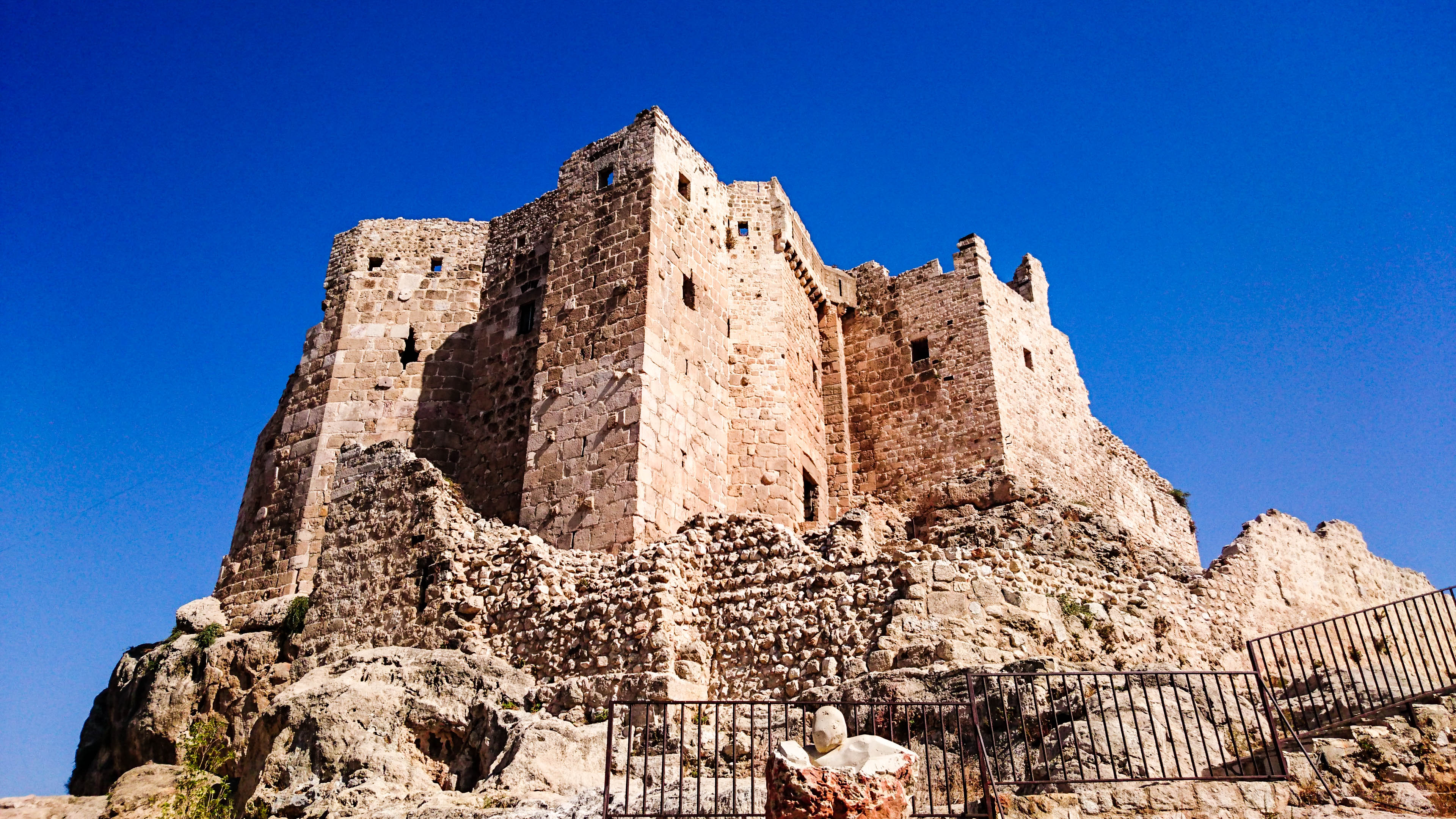
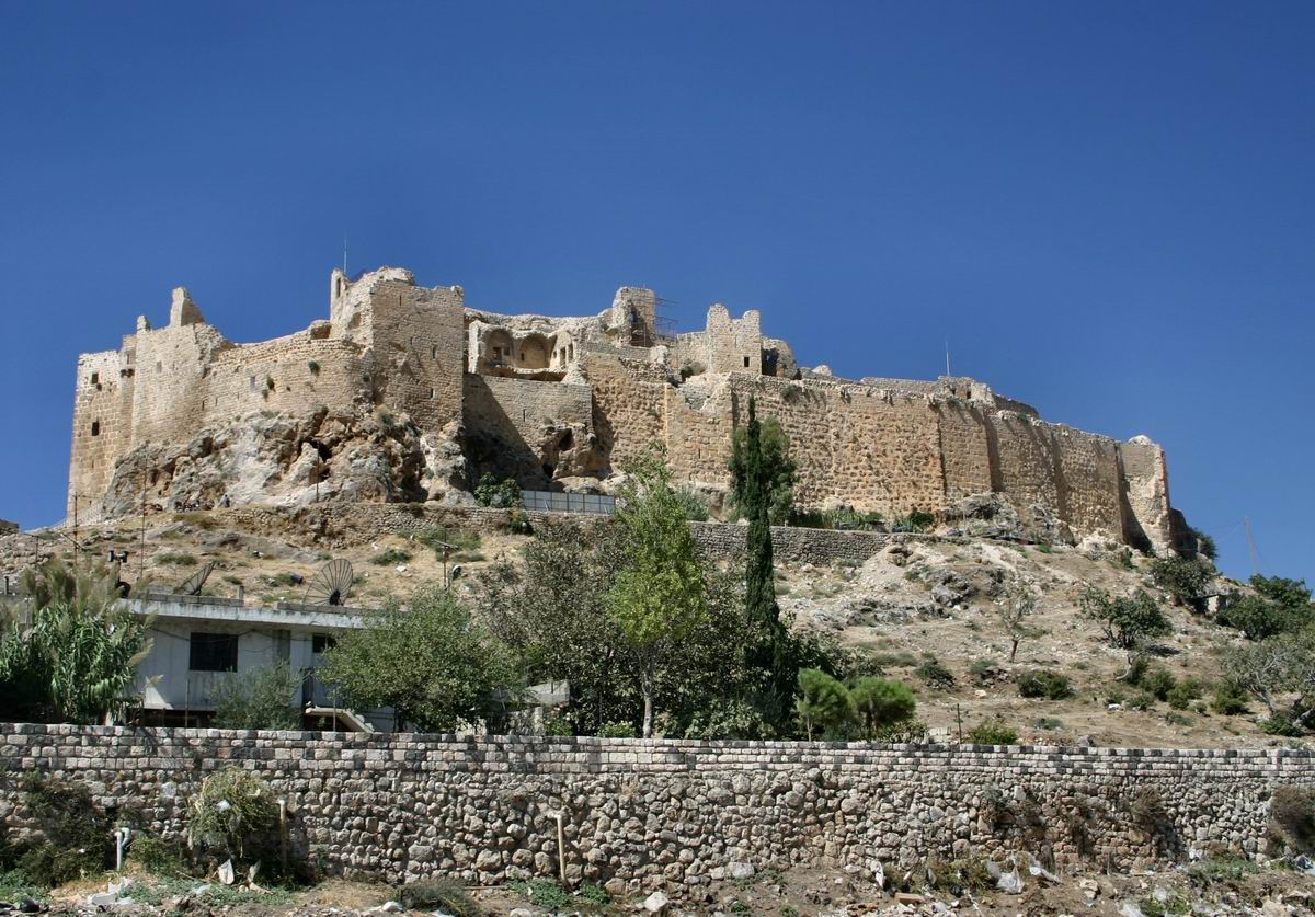
Al-Qadmus ( ar, القدموس, also spelled al-Qadmous or Cadmus) is a town in northwestern Syria, administratively part of the Tartus Governorate, located northeast of Tartus and southeast of Baniyas. Nearby localities include Kaff al-Jaa and Masyaf to the east, Wadi al-'Uyun and al-Shaykh Badr to the south, Hammam Wasel, al-Qamsiyah and Maten al-Sahel to the southwest, Taanita to the west, al-Annazeh to the northwest and Deir Mama to the northeast. It is situated just east of the Mediterranean coast and its ruined castle stands on a plateau roughly above sea level and just above the town. According to the Syria Central Bureau of Statistics, al-Qadmus had a population of 5,551 in the 2004 census. It is the administrative center of the al-Qadmus ''nahiyah'' ("sub-district") which contained 25 localities with a collective population of 22,370 in 2004. [...More Info...] [...Related Items...] OR: [Wikipedia] [Google] [Baidu] |
Order Of Assassins
The Order of Assassins or simply the Assassins ( fa, حَشّاشین, Ḥaššāšīn, ) were a Nizārī Ismāʿīlī order and sect of Shīʿa Islam that existed between 1090 and 1275 CE. During that time, they lived in the mountains of Persia and in Syria, and held a strict subterfuge policy throughout the Middle East through the covert murder of Muslim and Christian leaders who were considered enemies of the Nizārī Ismāʿīlī State. The modern term assassination is believed to stem from the tactics used by the Assassins. Nizārī Ismāʿīlīsm formed in the late 11th century after a succession crisis within the Fatimid Caliphate between Nizār ibn al-Mustanṣir and his half-brother, caliph al-Musta‘lī. Contemporaneous historians include Arabs ibn al-Qalanisi and Ali ibn al-Athir, and the Persian Ata-Malik Juvayni. The first two referred to the Assassins as ''batiniyya'', an epithet widely accepted by Ismāʿīlīs themselves. Overview The Nizari Isma'il ... [...More Info...] [...Related Items...] OR: [Wikipedia] [Google] [Baidu] |
Masyaf
Masyaf ( ar, مصياف ') is a city in northwestern Syria. It is the center of the Masyaf District in the Hama Governorate. As of 2004, Masyaf had a religiously diverse population of approximately 22,000 Ismailis, Alawites and Christians. The city is well known for its large medieval castle, particularly its role as the headquarters of the Nizari Ismailis and their elite Assassins unit. Etymology Throughout the Islamic era and until the modern day, the Arabic name of the city was pronounced in a number of different ways by the inhabitants of the region as ''Maṣyaf'', ''Maṣyat'' or ''Maṣyad''. The Arabic name is a local pronunciation that evolved from the Assyrian name ''Manṣuate''. The "nṣw" in ''Manṣuate'' correlates with the Arabic "nṣṣ", which means "to set up", according to orientalist scholar Edward Lipinsky. Moreover, Lipinsky suggests that the Assyrian name was likely a configuration of the Assyrian word ''manṣuwatu'' which correlates with the Arabic wo ... [...More Info...] [...Related Items...] OR: [Wikipedia] [Google] [Baidu] |
Hammam Wasel
Hammam Wasel ( ar, حمام واصل, also spelled Hamam Wasil) is a town in northwestern Syria, administratively part of the Tartus Governorate, located northeast of Tartus. Nearby localities include Ayn al-Sharqiyah and al-Baydah to the west, Baniyas to the northwest, Annaza to the north, and al-Qadmus to the northeast, Masyaf to the east, Wadi al-Oyun to the southeast, al-Shaykh Badr to the south and al-Qamsiyah to the southeast. According to the Syria Central Bureau of Statistics, Hammam Wasel had a population of 1,801 in the 2004 census. It is the administrative center of the Hammam Wasel ''nahiyah'' ("sub-district") which contained 12 localities with a collective population of 8,522 in 2004.General Census of Population and Housing 2 ... [...More Info...] [...Related Items...] OR: [Wikipedia] [Google] [Baidu] |
Alawite
The Alawis, Alawites ( ar, علوية ''Alawīyah''), or pejoratively Nusayris ( ar, نصيرية ''Nuṣayrīyah'') are an ethnoreligious group that lives primarily in Levant and follows Alawism, a sect of Islam that originated from Shia Islam. The Alawites revere Ali (Ali ibn Abi Talib), considered the first Imam of the Twelver school. The group is believed to have been founded by Ibn Nusayr during the 9th century. Ibn Nusayr was a disciple of the tenth Twelver Imam, Ali al-Hadi and of the eleventh Twelver Imam, Hasan al-Askari. For this reason, Alawites are also called ''Nusayris''. Surveys suggest Alawites represent an important portion of the Syrian population and are a significant minority in the Hatay Province of Turkey and northern Lebanon. There is also a population living in the village of Ghajar in the Golan Heights. Alawites form the dominant religious group on the Syrian coast and towns near the coast, which are also inhabited by Sunnis, Christians, and Ism ... [...More Info...] [...Related Items...] OR: [Wikipedia] [Google] [Baidu] |
Kaff Al-Jaa
Kaff al-Jaa ( ar, كاف الجاع, pronounced ''Kāf al Jā`''; also spelled Kaf al-Jaz and Caaf Aljaa) is a village in northwestern Syria, administratively part of the Tartus Governorate. Nearby localities include al-Qadmus to the west, Deir Mama to the northeast, Masyaf to the east, Wadi al-Oyun to the south and Hammam Wasel to the southwest. According to the Syria Central Bureau of Statistics, Kaff al-Jaa had a population of 2,068 in the 2004 census.General Census of Population and Housing 2004 Syria Central Bureau of Statistics (CBS). Idlib Governorate. Its inhabitants are predominantly |
Countries Of The World
The following is a list providing an overview of sovereign states around the world with information on their status and recognition of their sovereignty. The 206 listed states can be divided into three categories based on membership within the United Nations System: 193 member states of the United Nations, UN member states, 2 United Nations General Assembly observers#Present non-member observers, UN General Assembly non-member observer states, and 11 other states. The ''sovereignty dispute'' column indicates states having undisputed sovereignty (188 states, of which there are 187 UN member states and 1 UN General Assembly non-member observer state), states having disputed sovereignty (16 states, of which there are 6 UN member states, 1 UN General Assembly non-member observer state, and 9 de facto states), and states having a political status of the Cook Islands and Niue, special political status (2 states, both in associated state, free association with New Zealand). Compi ... [...More Info...] [...Related Items...] OR: [Wikipedia] [Google] [Baidu] |
Above Sea Level
Height above mean sea level is a measure of the vertical distance (height, elevation or altitude) of a location in reference to a historic mean sea level taken as a vertical datum. In geodesy, it is formalized as ''orthometric heights''. The combination of unit of measurement and the physical quantity (height) is called "metres above mean sea level" in the metric system, while in United States customary and imperial units it would be called "feet above mean sea level". Mean sea levels are affected by climate change and other factors and change over time. For this and other reasons, recorded measurements of elevation above sea level at a reference time in history might differ from the actual elevation of a given location over sea level at a given moment. Uses Metres above sea level is the standard measurement of the elevation or altitude of: * Geographic locations such as towns, mountains and other landmarks. * The top of buildings and other structures. * Flying objects such ... [...More Info...] [...Related Items...] OR: [Wikipedia] [Google] [Baidu] |
Deir Mama
Deir Mama ( ar, ديرماما) is a village in northwestern Syria, administratively part of the Hama Governorate, located west of Hama. It is situated at the eastern side of the coastal al-Ansariyah mountains. Nearby localities include Masyaf to the south, Deir al-Salib to the southwest and al-Laqbah and Deir Shamil to the north. According to the Syria Central Bureau of Statistics (CBS), Deir Mama had a population of 2,985 in the 2004 census.General Census of Population and Housing 2004 Syria Central Bureau of Statistics (CBS). Hama Governorate. The inhabitants of Deir Mama are predominantly |
Mediterranean Sea
The Mediterranean Sea is a sea connected to the Atlantic Ocean, surrounded by the Mediterranean Basin and almost completely enclosed by land: on the north by Western and Southern Europe and Anatolia, on the south by North Africa, and on the east by the Levant. The Sea has played a central role in the history of Western civilization. Geological evidence indicates that around 5.9 million years ago, the Mediterranean was cut off from the Atlantic and was partly or completely desiccated over a period of some 600,000 years during the Messinian salinity crisis before being refilled by the Zanclean flood about 5.3 million years ago. The Mediterranean Sea covers an area of about , representing 0.7% of the global ocean surface, but its connection to the Atlantic via the Strait of Gibraltar—the narrow strait that connects the Atlantic Ocean to the Mediterranean Sea and separates the Iberian Peninsula in Europe from Morocco in Africa—is only wide. The Mediterranean Sea e ... [...More Info...] [...Related Items...] OR: [Wikipedia] [Google] [Baidu] |
Nahiyah
A nāḥiyah ( ar, , plural ''nawāḥī'' ), also nahiya or nahia, is a regional or local type of administrative division that usually consists of a number of villages or sometimes smaller towns. In Tajikistan, it is a second-level division while in Syria, Iraq, Lebanon, Jordan, Xinjiang, and the former Ottoman Empire, where it was also called a '' bucak'', it is a third-level or lower division. It can constitute a division of a ''qadaa'', ''mintaqah'' or other such district-type of division and is sometimes translated as " subdistrict". Ottoman Empire The nahiye ( ota, ناحیه) was an administrative territorial entity of the Ottoman Empire, smaller than a . The head was a (governor) who was appointed by the Pasha. The was a subdivision of a Selçuk Akşin Somel. "Kazâ". ''The A to Z of the Ottoman Empire''. Volume 152 of A to Z Guides. Rowman & Littlefield, 2010. p. 151. and corresponded roughly to a city with its surrounding villages. s, in turn, were divided into ... [...More Info...] [...Related Items...] OR: [Wikipedia] [Google] [Baidu] |
Central Bureau Of Statistics (Syria)
The Central Bureau of Statistics (CBS) ( ar, المكتب المركزي للإحصاء) is the statistical agency responsible for the gathering of "information relating to economic, social and general activities and conditions" in the Syrian Arab Republic. The office is answerable to the office of the Prime Minister A prime minister, premier or chief of cabinet is the head of the cabinet and the leader of the ministers in the executive branch of government, often in a parliamentary or semi-presidential system. Under those systems, a prime minister i ... and has its main offices in Damascus. The CBS was established in 2005 and is administered by an administrative council headed by the deputy prime minister for economic affairs. After the Syrian government began reconstructing infrastructure in 2011, the bureau began releasing data from 2011 to 2018. References External links * Government of Syria Syria Government agencies established in 2005 2005 establis ... [...More Info...] [...Related Items...] OR: [Wikipedia] [Google] [Baidu] |


