|
Airports In Myanmar
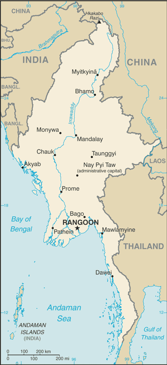
This is a list of airports in Burma (Myanmar), grouped by type and sorted by location. Burma, officially the Union of Burma (now The Republic of the Union of Myanmar), has 25 operating airports with commercial flights. The country is bordered by People's Republic of China to the northeast, Laos to the east, Thailand to the southeast, Bangladesh to the west, India to the northwest, the Bay of Bengal to the southwest, and the Andaman Sea to the south. The country is divided into 14 administrative subdivisions, which include 7 states (''pyi-ne'') and 7 divisions (''tyne''). Its capital is Naypyitaw (Nay Pyi Taw) and its largest city (and prior capital) is Yangon. File:Mandalay_Airport.JPG , Mandalay Airport File:Ygnairport2006.jpg , Yangon Airport __TOC__ Airports Airport names shown in bold have scheduled passenger service on commercial airlines. See also * Myanmar Air Force * Transport in Burma * List of airports by ICAO code: V#VY - Myanmar (Burma) * Wikipedia:Wi ... [...More Info...] [...Related Items...] OR: [Wikipedia] [Google] [Baidu] |
Geographic Coordinate System
The geographic coordinate system (GCS) is a spherical or ellipsoidal coordinate system for measuring and communicating positions directly on the Earth as latitude and longitude. It is the simplest, oldest and most widely used of the various spatial reference systems that are in use, and forms the basis for most others. Although latitude and longitude form a coordinate tuple like a cartesian coordinate system, the geographic coordinate system is not cartesian because the measurements are angles and are not on a planar surface. A full GCS specification, such as those listed in the EPSG and ISO 19111 standards, also includes a choice of geodetic datum (including an Earth ellipsoid), as different datums will yield different latitude and longitude values for the same location. History The invention of a geographic coordinate system is generally credited to Eratosthenes of Cyrene, who composed his now-lost ''Geography'' at the Library of Alexandria in the 3rd century ... [...More Info...] [...Related Items...] OR: [Wikipedia] [Google] [Baidu] |
Anisakan Airport
Anisakhan Airport is an airport located at Anisakhan, Pyin Oo Lwin, Mandalay Region of Myanmar Myanmar, ; UK pronunciations: US pronunciations incl. . Note: Wikipedia's IPA conventions require indicating /r/ even in British English although only some British English speakers pronounce r at the end of syllables. As John C. Wells, Joh .... This airport no longer serves commercial airlines. This airport is now a military airport References Airports in Myanmar Pyin Oo Lwin District {{Myanmar-airport-stub ... [...More Info...] [...Related Items...] OR: [Wikipedia] [Google] [Baidu] |
Hanthawaddy International Airport
Hanthawaddy International Airport ( my, ဟံသာဝတီအပြည်ပြည်ဆိုင်ရာလေဆိပ်) is an international airport currently under construction in Bago Region, Myanmar that is located about away from Yangon. The project was started in 2001 but it was subsequently halted. The proposed site of the airport has a gross area of . Myanmar's government have announced their plan to restart the project in 2012 to meet their future developments. A consortium led by Incheon International Airport Corporation (IIAC), including South Korean firms (Halla Engineering & Construction Corporation, Lotte Engineering & Construction Corporation, POSCO ICT and Kumho Industrial Company) was awarded the US$1.1 billion contract, to build the new airport and operate the airport for 50 years. The airport will have the capacity to handle 12 million passengers per year and expected to be start operation by 2018. Due to financial related issue and disagreement over pas ... [...More Info...] [...Related Items...] OR: [Wikipedia] [Google] [Baidu] |
Bago Region
Bago Region ( my, ပဲခူးတိုင်းဒေသကြီး, ; formerly Pegu Division and Bago Division) is an administrative region of Myanmar, located in the southern central part of the country. It is bordered by Magway Region and Mandalay Region to the north; Kayin State, Mon State and the Gulf of Martaban to the east; Yangon Region to the south and Ayeyarwady Region and Rakhine State to the west. It is located between 46°45'N and 19°20'N and 94°35'E and 97°10'E. It has a population of 4,867,373 (2014). History According to legend, two Mon princes from Thaton founded the city of Bago in 573 AD. They saw a female Hamsa standing on the back of a male Hamsa on an island in a huge lake. Believing this was an auspicious omen, the princes built a city called Hanthawady (Pali: Hamsavati) on the edge of the lake. The Arab geographer Ibn Khordadbeh mentions the city around 850 AD. The Mon capital was still in Thaton at that time. The Thiruvalangadu plate descri ... [...More Info...] [...Related Items...] OR: [Wikipedia] [Google] [Baidu] |
Bago, Burma
Bago (formerly spelt Pegu; , ), formerly known as Hanthawaddy, is a city and the capital of the Bago Region in Myanmar. It is located north-east of Yangon. Etymology The Burmese name Bago (ပဲခူး) is likely derived from the Mon language place name Bagaw ( mnw, ဗဂေါ, ). Until the Burmese government renamed English place names throughout the country in 1989, Bago was known as Pegu. Bago was formerly known as Hanthawaddy (; ; ; lit. "she who possesses the sheldrake"), the name of a Burmese-Mon kingdom. An alternative etymology from the 1947 Burmese encyclopedia derives Bago (ပဲခူး) from Wanpeku ( my, ဝမ်းပဲကူး) as a shortening of Where the Hinthawan Ducks Graze ( my, ဟင်္သာဝမ်းဘဲများ ကူးသန်းကျက်စားရာ အရပ်). This etymology relies on the non-phonetic Burmese spelling as its main reasoning. History Foundation Various Mon language chronicles report widely diverg ... [...More Info...] [...Related Items...] OR: [Wikipedia] [Google] [Baidu] |
Nay Pyi Taw International Airport
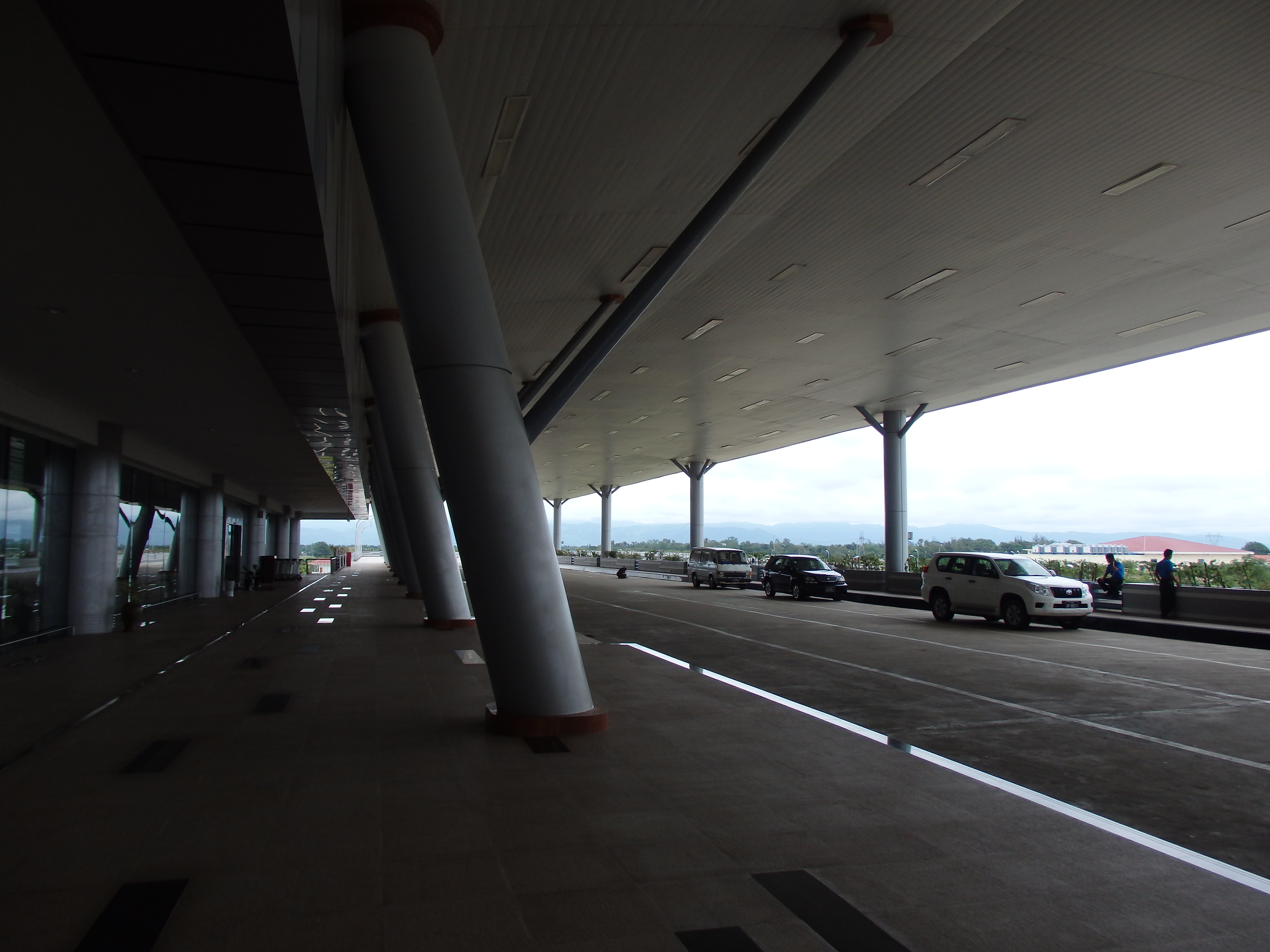
Naypyidaw International Airport officially spelled Nay Pyi Taw , ( my, နေပြည်တော် အပြည်ပြည်ဆိုင်ရာ လေဆိပ်; previously known as Ela Airport), is located 16 kilometres (10 mi) southeast of Naypyidaw, the capital of Myanmar. Before the foundation of Naypyidaw, this was referred to as the airport of the nearby town of Lewe. The airport officially opened on 19 December 2011. Expansion project The airport is able to handle 3.5 million passengers annually. The design of Nay Pyi Daw International Airport was drawn by CPG Consultants Pte., Ltd. Of Singapore. The company previously designed the annex to Yangon International Airport, as well as Singapore's Changi Airport and several airports of Vietnam and Laos. The construction work of the airport, performed by Asia World Company, a Myanmar corporation, began in January 2009. At the completion of the project, the airport will have two runways and three terminals with mode ... [...More Info...] [...Related Items...] OR: [Wikipedia] [Google] [Baidu] |
Naypyidaw
Naypyidaw, officially spelled Nay Pyi Taw (; ), is the capital and third-largest city of Myanmar. The city is located at the centre of the Naypyidaw Union Territory. It is unusual among Myanmar's cities, as it is an entirely planned city outside of any state or region. The city, then known only as Pyinmana District, officially replaced Yangon as the administrative capital of Myanmar on 6 November 2005; its official name was revealed to the public on Armed Forces Day, 27 March 2006. As the seat of the government of Myanmar, Naypyidaw is the site of the Union Parliament, the Supreme Court, the Presidential Palace, the official residences of the Cabinet of Myanmar and the headquarters of government ministries and military. Naypyidaw is notable for its unusual combination of large size and very low population density. The city hosted the 24th and 25th ASEAN Summit, the 3rd BIMSTEC Summit, the Ninth East Asia Summit, the 2013 Southeast Asian Games and the 2014 AFC U-19 Championsh ... [...More Info...] [...Related Items...] OR: [Wikipedia] [Google] [Baidu] |
Yangon International Airport
Yangon International Airport ( ) is the primary and busiest international airport of Myanmar. The airport is located in Mingaladon, north of central Yangon. All ten Myanmar carriers and about 30 international airlines operate at Yangon International Airport. The airport is also colloquially known as Mingaladon Airport due to its location. History During World War II, the airfield was called RAF Mingaladon and served as an operating base for fighter aircraft such as: *No. 60 Squadron RAF from February 1941 to February 1942 flying Bristol Blenheim I *No. 67 Squadron RAF from October 1941 to March 1942 flying Brewster F2A Buffalo and Hawker Hurricane IIs * No. 135 Squadron RAF from January–February 1942 flying Hawker Hurricane IIs * No. 681 Squadron RAF from June to September 1945 flying Supermarine Spitfire *3rd Squadron of 1st American Volunteer Group (Flying Tigers) of the Chinese Air Force flying Curtiss P-40s There was also a Communication Flight of the Burma Volunteer A ... [...More Info...] [...Related Items...] OR: [Wikipedia] [Google] [Baidu] |
Yangon Region
Yangon Region(, ; formerly Rangoon Division and Yangon Division) is an administrative region of Myanmar. Located in the heart of Lower Myanmar, the division is bordered by Bago Region to the north and east, the Gulf of Martaban to the south, and Ayeyarwady Region to the west. Yangon Region is dominated by its capital city of Yangon, the former national capital and the largest city in the country. Other important cities are Thanlyin and Twante. The division is the most developed region of the country and the main international gateway. The division measures . History The region was historically populated by the Mon. Politically, the area was controlled by Mon kingdoms prior to 1057, and after 1057, with few exceptions, by Burman kingdoms from the north. The control of the region reverted to Pegu-based Mon kingdoms in the 13th to 16th centuries (1287–1539) and briefly in the 18th century (1740–57). The Portuguese were in control of Thanlyin (Syriam) and the surrounding ... [...More Info...] [...Related Items...] OR: [Wikipedia] [Google] [Baidu] |
Mandalay International Airport
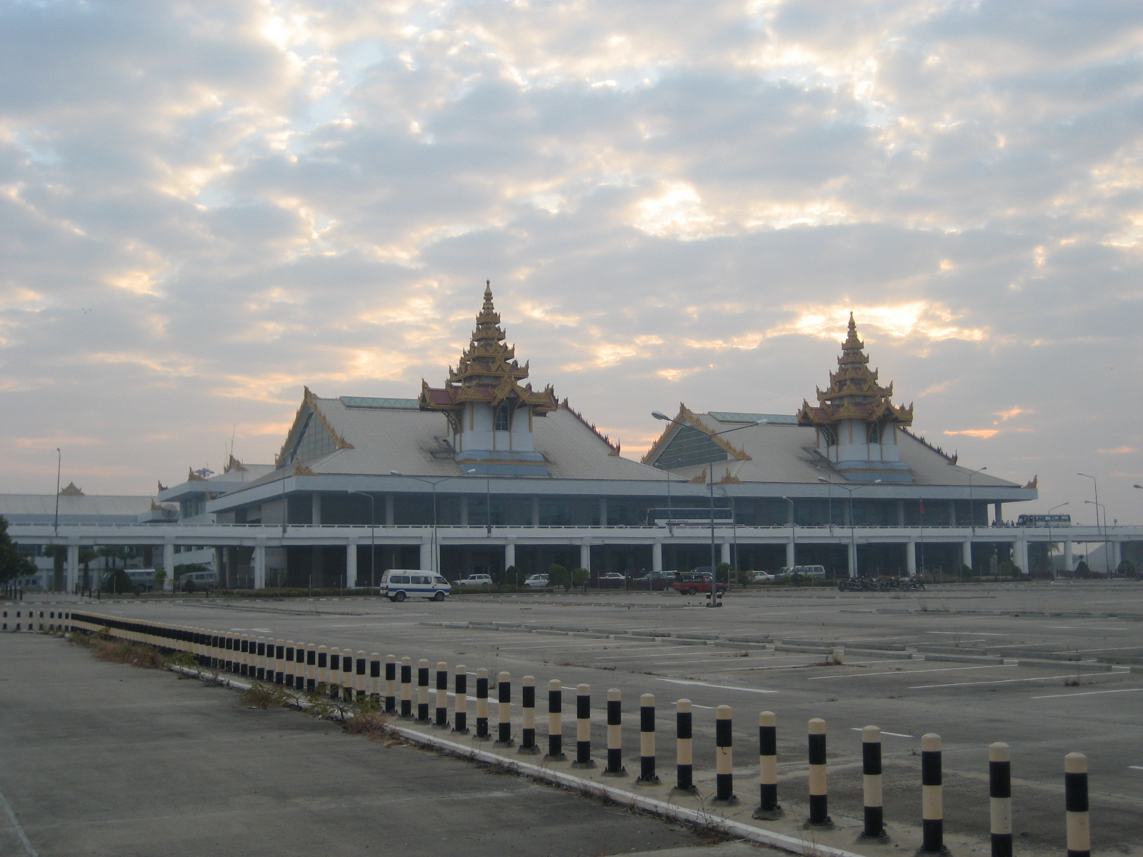
Mandalay International Airport ( my, မန္တလေး အပြည်ပြည်ဆိုင်ရာ လေဆိပ်; ), located 35 km south of Mandalay in Tada-U, is one of three international airports in Myanmar. Completed in 1999, it was the largest and most modern airport in the country until the modernization of Yangon International Airport in 2008. The airport connects 11 domestic and seven international destinations. Its runway is the longest runway in use in Southeast Asia and has the capacity to handle up to 3 million passengers a year. The airport is the main operating base of Golden Myanmar Airlines. History The Mandalay International Airport project was first conceived by the Burmese military government in the mid-1990s as a way to increase overall levels of foreign investment and tourism in Myanmar. With Yangon boasting the only other international airport in the whole country, the new Mandalay airport was regarded as crucial in achieving a planne ... [...More Info...] [...Related Items...] OR: [Wikipedia] [Google] [Baidu] |


