|
Agden Reservoir
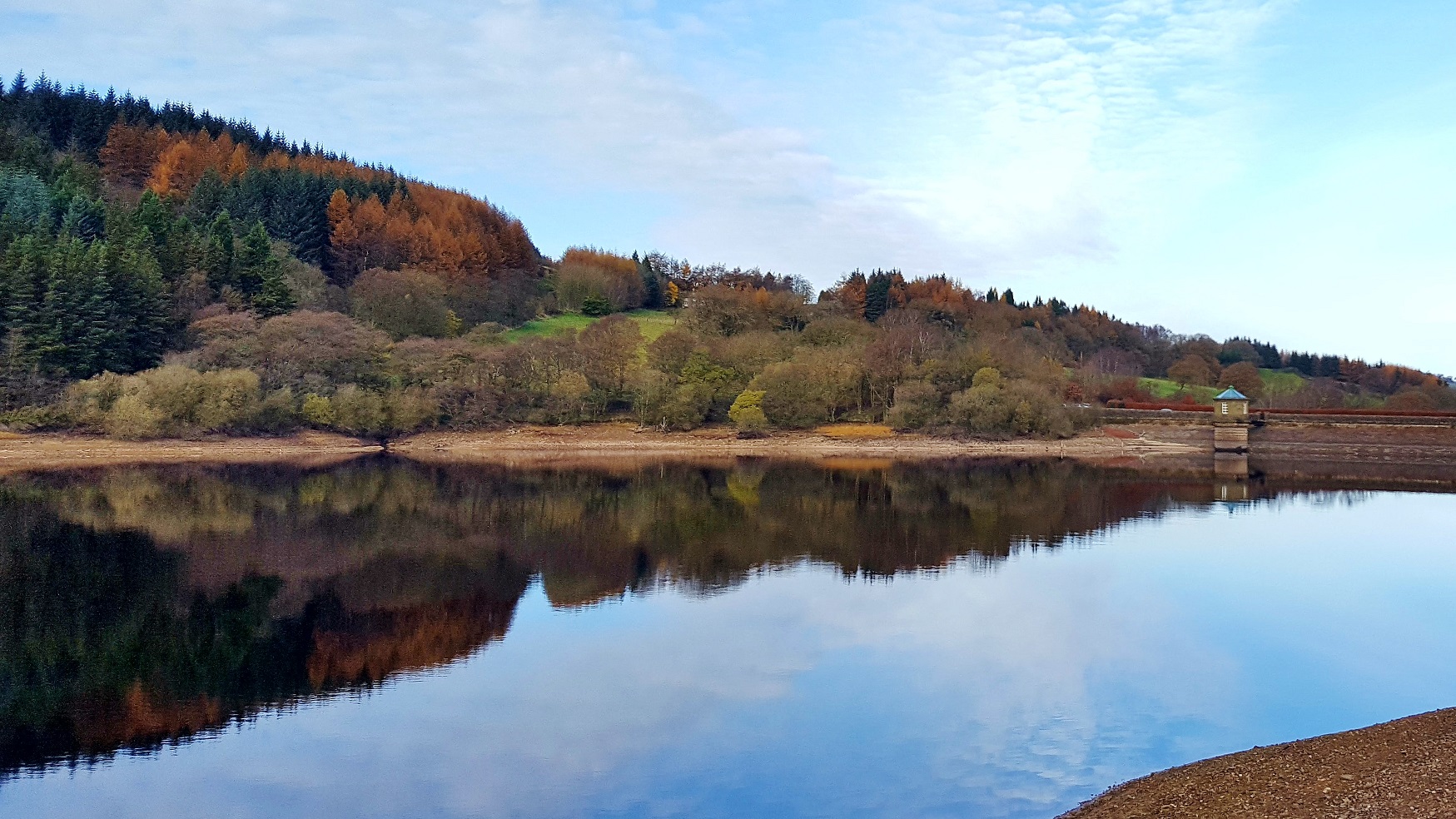
Agden Reservoir is a water storage reservoir, situated at grid reference , west of the centre of Sheffield, South Yorkshire, England. It is owned by Yorkshire Water / Kelda Group. The reservoir covers an area of and has a capacity of 559 million gallons (2.11x10⁹ litres) of water, the dam wall has a width of approximately with a height of . 'Agden' means 'Valley of the Oak Trees'. The reservoir is one of four built in the second half of the 19th century to satisfy the developing steel industry of Sheffield, collecting water from the moorlands around the village of Low Bradfield, west of Sheffield. The other three being Damflask, Dale Dike and Strines reservoirs. Agden was completed in 1869 and is fed by Hobson Moss Dike and Emlin Dike which flow off the Broomhead and Bradfield moors respectively. The reservoir is surrounded mainly by coniferous woodland, however, Sheffield City Council who own much of the woodland have started a policy of replanting and thinning to encoura ... [...More Info...] [...Related Items...] OR: [Wikipedia] [Google] [Baidu] |
High Bradfield
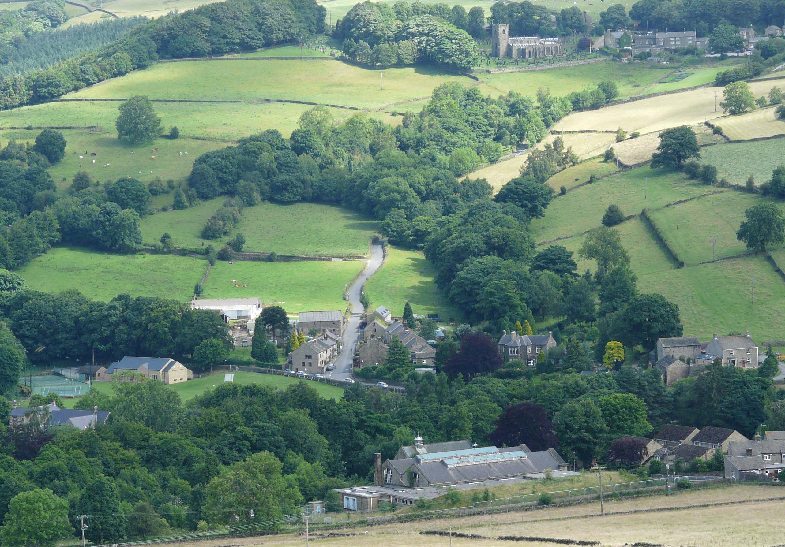
High Bradfield is a rural village north-west of the centre of Sheffield in South Yorkshire, England and within the city's boundaries. The village lies just within the Peak District National Park, inside the park's north-eastern border, is at an altitude of 260 metres (850 feet) AOD, and has extensive views across Bradfield Dale towards Derwent Edge and the Dark Peak. The most striking feature of the village is the medieval Church of St. Nicholas, Bradfield. It is one of only five Grade I Listed buildings in Sheffield. The name Bradfield failed to shift during the Great Vowel Shift from Old English to Broadfield, a name with a double emphasis on its broad stretch of open countryside.Local place names Bradfield and beyond. Gives translated meaning of name. and the area around the village ... [...More Info...] [...Related Items...] OR: [Wikipedia] [Google] [Baidu] |
Damflask Reservoir
Damflask Reservoir is situated at grid reference five miles (eight kilometres) west of the centre of Sheffield in the Loxley valley close to the village of Low Bradfield and within the city's boundaries. The hamlet of Stacey Bank is located to the east. The reservoir has a capacity of 4,250.9 million litres (1,123.1 million gallons) and has a surface area of with a maximum depth of . The dam wall is approximately wide with a height of . Construction Damflask reservoir was built as one of a group of reservoirs in the Bradfield area (the others being Strines, Agden and Dale Dike reservoirs) to supply both fresh drinking water and a guaranteed supply of running water to the population and industries respectively of Sheffield. It was completed in 1896 with the dam walls being constructed from local stone, and its original purpose was primarily as a compensation reservoir to ensure a continuous flow of water to the River Loxley downstream. It takes its name from Damflask v ... [...More Info...] [...Related Items...] OR: [Wikipedia] [Google] [Baidu] |
Reservoirs Of The Peak District
A reservoir (; from French ''réservoir'' ) is an enlarged lake behind a dam. Such a dam may be either artificial, built to store fresh water or it may be a natural formation. Reservoirs can be created in a number of ways, including controlling a watercourse that drains an existing body of water, interrupting a watercourse to form an embayment within it, through excavation, or building any number of retaining walls or levees. In other contexts, "reservoirs" may refer to storage spaces for various fluids; they may hold liquids or gasses, including hydrocarbons. ''Tank reservoirs'' store these in ground-level, elevated, or buried tanks. Tank reservoirs for water are also called cisterns. Most underground reservoirs are used to store liquids, principally either water or petroleum. Types Dammed valleys Dammed reservoirs are artificial lakes created and controlled by a dam constructed across a valley, and rely on the natural topography to provide most of the basin of ... [...More Info...] [...Related Items...] OR: [Wikipedia] [Google] [Baidu] |
Peak District Boundary Walk
The Peak District Boundary Walk is a circular walking trail, starting and finishing at Buxton and broadly following the boundary of the Peak District, Britain's first national park. The route was developed by the Friends of the Peak District (a branch of the Campaign to Protect Rural England) and was launched on 17 June 2017. The Friends of the Peak District's founders, Gerald and Ethel Haythornthwaite, proposed the boundary of the Peak District National Park, which was subsequently established as the United Kingdom's first National Park in 1951. The route is waymarked with green markers and uses existing footpaths, tracks, quiet lanes, disused railway lines and a canal towpath. The start and finish is at the King's Head pub on Buxton Market Place, where a plaque has been installed by the Peak & Northern Footpaths Society (PNFS). The terrain covers open moorlands of the South Pennines, the limestone scenery of the Derbyshire Dales, woodlands, reservoirs and rural farming ... [...More Info...] [...Related Items...] OR: [Wikipedia] [Google] [Baidu] |
Wildlife Trust For Sheffield And Rotherham
Sheffield and Rotherham Wildlife Trust is a wildlife trust covering Sheffield and Rotherham, South Yorkshire, England. It has 15 reserves with its base in Sheffield. Reserves The trust manages fifteen reserves: : Agden Bog : Blacka Moor :Carbrook Ravine :Carr House Meadows : Centenary Riverside :Crabtree Ponds :Fox Hagg : Greno Woods : Hammond's Field : Kilnhurst Ings : Moss Valley Woodlands : Salmon Pastures :Sunnybank : Woodhouse Washlands :Wyming Brook Blackburn Meadows was managed by the Trust, but is no longer listed in 2020. In 2019 the Trust reported, 'Blackburn Meadows is owned by Sheffield City Council Sheffield City Council is the city council for the metropolitan borough of Sheffield in South Yorkshire, England. It consists of 84 councillors, elected to represent 28 wards, each with three councillors. It is currently under No Overall Contr ... and not in the Trust’s control. We are working the Council to find a long-term solution to managing this site.' Refere ... [...More Info...] [...Related Items...] OR: [Wikipedia] [Google] [Baidu] |
Sheffield City Council
Sheffield City Council is the city council for the metropolitan borough of Sheffield in South Yorkshire, England. It consists of 84 councillors, elected to represent 28 wards, each with three councillors. It is currently under No Overall Control, with Labour, the Liberal Democrats and the Green Party each holding chair positions in a proportionate number of committees, with Labour chairing four Committees, the Liberal Democrats chairing three and the Greens chairing two. History The council was founded as the Corporation of Sheffield in 1843, when Sheffield was incorporated (see History of Sheffield). In 1889, it attained county borough status and in 1893 city status. In 1974, the Local Government Act 1972, reconstituted the City Council as a metropolitan district council of South Yorkshire, governed also by South Yorkshire County Council. It established a system of 90 councillors, three to each of 30 wards. This was reduced in 1980 with the merger of the Attercliffe and Dar ... [...More Info...] [...Related Items...] OR: [Wikipedia] [Google] [Baidu] |
Strines Reservoir
Strines is a village in Greater Manchester, in the valley of the River Goyt. It is located midway between Marple and New Mills, about six miles south-east of Stockport. The village falls within the Marple parish and the Metropolitan Borough of Stockport. Immediately surrounding Strines are the villages of Woodend, Hague Bar and Brookbottom, where there is a conservation area. Close by are the villages of Mellor and Rowarth, and the hamlet of Turf Lea. Transport The village is served by Strines railway station on the Hope Valley Line. The station, and all stopping services, are operated by Northern Trains. It has a two-hourly daily daytime service each way between New Mills and Manchester Piccadilly, with additional calls during weekday peak periods. On Saturdays and Sundays, most eastbound services continue through to Sheffield. The 358 bus route, which runs between Stockport and Hayfield, passes through Strines; buses are operated by Stagecoach Manchester. Strines Pr ... [...More Info...] [...Related Items...] OR: [Wikipedia] [Google] [Baidu] |
Low Bradfield
Low Bradfield is a village within the civil parish of Bradfield in South Yorkshire, England. It is situated within the boundary of the city of Sheffield in the upper part of the Loxley Valley, 6¼ miles west-northwest of the city centre and just inside the northeast boundary of the Peak District National Park. Low Bradfield and the surrounding area is noted for its attractive countryside which draws many visitors from the more urban parts of Sheffield. At weekends the village can become quite crowded, especially when there is a match on the village cricket pitch. Low Bradfield which stands in the shadow of Agden Reservoir has a sister village High Bradfield which is located at a higher altitude, ½ mile to the northeast. The two villages are joined by the steep Woodfall Lane. History Early history The earliest historical sign of settlement in the Bradfield area is an early to mid Bronze Age ring cairn on Broomhead Moors, three miles to the northwest of Low Bradfield. Thi ... [...More Info...] [...Related Items...] OR: [Wikipedia] [Google] [Baidu] |
Bradfield, South Yorkshire
Bradfield is a civil parish in the City of Sheffield, in South Yorkshire, England. The civil parish is extensive, the western half is situated in the moorlands of the Peak District, the eastern half is in lower agricultural land and contains the parish's significant habitations, which include the Sheffield suburb of Stannington, as well as Oughtibridge and Worrall, and the villages of High Bradfield and Low Bradfield. The parish also includes several reservoirs, and a number of minor settlements, such as Ewden. Bradfield is located from Sheffield city centre and from Barnsley. On 6 July 2014, Stage 2 of the 2014 Tour de France from York to Sheffield, passed through the village. It was also the location of the seventh climb of the stage, the Category 4 Côte de Bradfield. It was long at an average gradient of 7.4%. The one point in the King of the Mountains competition was claimed by Andriy Hrivko of Astana Pro Team. Description Bradfield is one of the largest parishes i ... [...More Info...] [...Related Items...] OR: [Wikipedia] [Google] [Baidu] |
Kelda Group
Kelda Group is a British utility company. It is based in Bradford, England. It was formerly listed on the London Stock Exchange and a constituent of the FTSE 100 Index, but was taken private by a group of investors, Saltaire Water, in 2008. Saltaire Water members include CitiBank and HSBC Holdings. History Kelda Group, originally known as ''Yorkshire Water plc'', was one of the regional water companies privatised in 1989. It changed to its current name in 1999. In 2000 Kelda purchased the United States water supply business Aquarion and subsequently announced the conditional sale of this asset in February 2006. It was taken private in a £3.04 billion deal in February 2008 by Saltaire Water, a consortium of investment companies including Citigroup and HSBC. Citi sold its infrastructure investments to Corsair Capital in 2015. Operations Yorkshire Water remains its principal UK business. It provides water to 4.5 million people in northern England, mainly within the geograph ... [...More Info...] [...Related Items...] OR: [Wikipedia] [Google] [Baidu] |
Yorkshire Water
Yorkshire Water is a water supply and treatment utility company servicing West Yorkshire, South Yorkshire, the East Riding of Yorkshire, part of North Lincolnshire, most of North Yorkshire and part of Derbyshire, in England. The company has its origins in the Yorkshire Water Authority, one of ten regional water authorities created by the Water Act 1973, and privatised under the terms of the Water Act 1989, when Yorkshire Water plc, the parent company of the Yorkshire Water business, was floated on the London Stock Exchange. The parent company was Kelda Group in 1999. In February 2008, Kelda Group was bought by a consortium of infrastructure funds. It is regulated under the Water Industry Act 1991. Area The company's area includes West Yorkshire, South Yorkshire, the East Riding of Yorkshire, part of North Lincolnshire, most of North Yorkshire and part of Derbyshire. The area is adjoined on the north by that of Northumbrian Water, on the west by United Utilities, on the south ... [...More Info...] [...Related Items...] OR: [Wikipedia] [Google] [Baidu] |


.jpg)


