|
Administrative Divisions Of Portugal
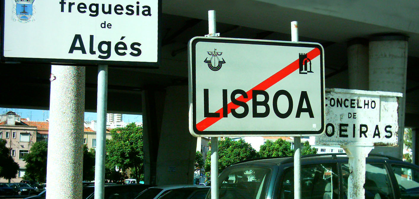
Administratively, Portugal is ''de jure'' unitary and decentralized state. Nonetheless, operationally, it is a highly centralized system with administrative divisions organized into three tiers.Carlos Nuno Silva (2002), p.5 The State is organized under the principles of subsidiarity, local government autonomy, and democratic decentralization of the public service. The government structure is based on the 1976 Constitution, adopted after the 1974 Carnation Revolution. In addition to defining the status of the autonomous regions ( pt, regiões autónomas) Azores and Madeira (Articles 225-234), the Constitution specifically identifies the three tiers of government (Article 235-262): civil parishes (''freguesias''), municipalities (''municípios'') and administrative regions (). In addition, the Portuguese territory was redefined during European integration, under a system of statistical regions and subregions known as Nomenclature of Territorial Units for Statistics. Thes ... [...More Info...] [...Related Items...] OR: [Wikipedia] [Google] [Baidu] |
Faro District
Faro District ( pt, Distrito de Faro ) is the southernmost district of Portugal, coincident with the Algarve region. The administrative centre, or district capital, is the city of Faro. Municipalities The district is composed of 16 municipalities: * Albufeira * Alcoutim * Aljezur * Castro Marim * Faro * Lagoa * Lagos * Loulé * Monchique * Olhão * Portimão * São Brás de Alportel * Silves * Tavira * Vila do Bispo * Vila Real de Santo António Cities * Albufeira * Faro * Lagoa * Lagos * Loulé * Olhão * Portimão * Quarteira (Loulé) * Silves * Tavira * Vila Real de Santo António Villages * Alcantarilha (Silves) * Alcoutim * Algoz (Silves) * Almancil (Loulé) * Alvor (Portimão) * Armação de Pêra (Silves) * Aljezur * Bensafrim (Lagos) * Cabanas de Tavira (Tavira) * Carvoeiro (Lagoa) * Castro Marim * Estômbar (Lagoa) * Ferragudo (Lagoa) * Fuseta (Olhão) * Luz (Lagos) * Luz de Tavira (Tavira) * Mexilhoeira Grande (Olhão) * Moncarapac ... [...More Info...] [...Related Items...] OR: [Wikipedia] [Google] [Baidu] |
Viana Do Castelo District
The Viana do Castelo District ( pt, Distrito de Viana do Castelo ) is a district located in the northwest of Portugal, bordered on the north by Spain (Galicia) and on the south by Braga District. It has an area of and a population of 252,011 (2006), for a density of 111.8 inhabitants/km2. The district capital is the city of Viana do Castelo. Municipalities The district is composed of ten municipalities: * Arcos de Valdevez Municipality * Caminha Municipality * Melgaço Municipality * Monção Municipality * Paredes de Coura Municipality * Ponte da Barca Municipality * Ponte de Lima Municipality Ponte de Lima () is the oldest ''vila'' (chartered town, head of a municipality) in Portugal. It is part of the district of Viana do Castelo. The population in 2011 was 43,498, in an area of 320.25 km2. The town proper has about 2,800 inhabit ... * Valença Municipality * Viana do Castelo Municipality * Vila Nova de Cerveira Municipality List of Parliamentary Representative ... [...More Info...] [...Related Items...] OR: [Wikipedia] [Google] [Baidu] |
Braga District
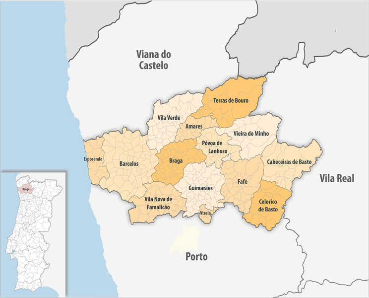
The district of Braga ( pt, Distrito de Braga ) is a district in the northwest of Portugal. The district capital is the city of Braga, and it is bordered by the district of Viana do Castelo in the north, Vila Real in the east, Spain (Galicia) in the northeast and Porto in the south. Its area is and it has a population of 831,368. Municipalities The district comprises 14 municipalities: * Amares * Barcelos * Braga * Cabeceiras de Basto * Celorico de Basto * Esposende * Fafe * Guimarães * Póvoa de Lanhoso * Terras de Bouro * Vieira do Minho * Vila Nova de Famalicão * Vila Verde * Vizela Vizela () is a municipality in the Braga District in Portugal. The population in 2011 was 23,736, in an area of 24.70 km². The present mayor is Vitor Hugo Salgado, elected as an independent. The municipal holiday is March 19. History In Au ... Geography The district of Braga has a very rugged terrain, dominated by high altitudes to the east, close to the Spanish border ... [...More Info...] [...Related Items...] OR: [Wikipedia] [Google] [Baidu] |
Porto District
The District of Porto ( pt, Distrito do Porto ) is located on the north-west coast of Portugal. The district capital is the city of Porto, the second largest city in the country. It is bordered by the Aveiro and Viseu districts to the south, Braga district to the north and Vila Real district to the east. Its area is and its population is 1,817,172. In 2017, the main legal foreign populations were from Brazil (9,442), China (2,475), Ukraine (2,160), Italy (1,273), Spain (1,189), Angola (1,118), and Cape Verde (1,040). These numbers exclude those who obtained Portuguese citizenship, which is regular among recent Portuguese Brazilians or Portuguese-Africans. – SEF Municipalities The district comprises 18 municipalities: *[...More Info...] [...Related Items...] OR: [Wikipedia] [Google] [Baidu] |
Vila Real District
The District of Vila Real ( pt, Distrito de Vila Real ) is a district of northern Portugal. With an area of , the district is located east of the port city of Porto and north of the Douro River. Vila Real has always belonged to the historical province of Trás-os-Montes. Approximate population in the 2001 census was 230,000. The population has shown negative rates in recent years due to emigration and aging. Many of the villages have lost population and have become deserted while the district capital has gained in population. It is bordered by Spain (Galicia) in the north and east, Braga District and Porto District in the west, Viseu District in the south and Bragança District in the east. Geographic and socioeconomic characteristics Vila Real is a rugged area of low mountains and narrow valleys. Historically it had always been cut off from the coast by the Marão, Gerês, and Cabreira mountains until a highway was cut through in the eighties. Due to poor soil, agri ... [...More Info...] [...Related Items...] OR: [Wikipedia] [Google] [Baidu] |
Bragança District
Bragança District ( pt, Distrito de Bragança ; mwl, Çtrito de Bergáncia) is a traditional political division of Portugal, in the northeast corner bordering on Spain ( Castile and Leon and Galicia), covering 7.4% of the nation's continental landmass. the total resident population was 136,252, making it the second-least populous district in Portugal, only surpassing Portalegre District. Bragança is administratively divided in twelve municipalities and 299 parishes located in the north-eastern part of Trás-os-Montes. The capital of the district, Bragança, is from Porto, the second largest town in Portugal, from the Spanish town of Zamora and from Salamanca, also in Spain.Sreko Devjak et al. (2007), p.2 It is bordered by Spain ( Castile and Leon and Galicia) in the north and northeast, Vila Real District in the west, Viseu District in the southwest and Guarda District in the south. History During the Roman era, the territory was part of the much larger province of ... [...More Info...] [...Related Items...] OR: [Wikipedia] [Google] [Baidu] |
Viseu District
The District of Viseu ( pt, Distrito de Viseu ) is located in the Central Inland of Portugal, the District Capital is the city of Viseu. Municipalities The district is composed by 24 municipalities: * Armamar * Carregal do Sal * Castro Daire * Cinfães * Lamego * Mangualde * Moimenta da Beira * Mortágua * Nelas * Oliveira de Frades * Penalva do Castelo * Penedono * Resende * Santa Comba Dão * São João da Pesqueira * São Pedro do Sul * Sátão * Sernancelhe * Tabuaço * Tarouca * Tondela * Vila Nova de Paiva * Viseu * Vouzela Vouzela () is a municipality in the district Viseu in Portugal. The population in 2011 was 10,564, in an area of 193.69 km2. The present mayor is Rui Ladeira, elected by the Social Democratic Party. The municipal holiday is May 14. Parishes ... List of Parliamentary Representatives Summary of votes and seats won 1976-2022 , - class="unsortable" !rowspan=2, Parties!!%!!S!!%!!S!!%!!S!!%!!S!!%!!S!!%!!S!!%!!S!!%!!S!!%!!S!!% ... [...More Info...] [...Related Items...] OR: [Wikipedia] [Google] [Baidu] |
Aveiro District
Aveiro District ( pt, Distrito de Aveiro, or ) is located in the central coastal region of Portugal. The capital of the district is the city of Aveiro, which also serves as the seat of Aveiro Municipality. Aveiro District is bordered by the Porto District to the north, the Viseu District to the east, the Coimbra District to the south, and the Atlantic Ocean to the west. The 19 municipalities of Aveiro District are split between Norte Region (Metropolitan Area of Porto and Espinho subregion: Grande Porto) and Centro Region ( Baixo Vouga subregion). Municipalities The district is composed of 19 municipalities: Summary of votes and seats won 1976-2022 , - class="unsortable" !rowspan=2, Parties!!%!!S!!%!!S!!%!!S!!%!!S!!%!!S!!%!!S!!%!!S!!%!!S!!%!!S!!%!!S!!%!!S!!%!!S!!%!!S!!%!!S!!%!!S!!%!!S , - class="unsortable" align="center" !colspan=2 , 1976 !colspan=2 , 1979 !colspan=2 , 1980 !colspan=2 , 1983 !colspan=2 , 1985 !colspan=2 , 1987 !colspan=2 , 1991 !colspan=2 , 19 ... [...More Info...] [...Related Items...] OR: [Wikipedia] [Google] [Baidu] |
Coimbra District
Coimbra District ( pt, Distrito de Coimbra, or ) is located in the Centro Region, Portugal. The district capital is the city of Coimbra. Municipalities The district is composed by 17 municipalities: * Arganil * Cantanhede * Coimbra * Condeixa-a-Nova * Figueira da Foz * Góis * Lousã * Mira * Miranda do Corvo * Montemor-o-Velho * Oliveira do Hospital * Pampilhosa da Serra Pampilhosa da Serra () is a town and a municipality in the Coimbra District Coimbra District ( pt, Distrito de Coimbra, or ) is located in the Centro Region, Portugal. The district capital is the city of Coimbra. Municipalities The district ... * Penacova * Penela * Soure * Tábua * Vila Nova de Poiares Summary of votes and seats won 1976-2022 , - class="unsortable" !rowspan=2, Parties!!%!!S!!%!!S!!%!!S!!%!!S!!%!!S!!%!!S!!%!!S!!%!!S!!%!!S!!%!!S!!%!!S!!%!!S!!%!!S!!%!!S!!%!!S!!%!!S , - class="unsortable" align="center" !colspan=2 , 1976 !colspan=2 , 1979 !colspan=2 , 1980 !colspan=2 , ... [...More Info...] [...Related Items...] OR: [Wikipedia] [Google] [Baidu] |
Guarda District
The district of Guarda ( pt, Distrito de Guarda ) is located in the Centro Region of Portugal, except Vila Nova de Foz Côa, which is in the Norte Region. The district capital and most populous city is Guarda. Municipalities The district contains 14 municipalities: * Aguiar da Beira * Almeida * Celorico da Beira * Figueira de Castelo Rodrigo * Fornos de Algodres * Gouveia * Guarda * Manteigas * Mêda * Pinhel * Sabugal * Seia * Trancoso * Vila Nova de Foz Côa Cities The following seat of municipalities have city (cidade)status: Gouveia, Guarda, Meda, Pinhel, Sabugal, Trancoso. Subregions Included within the District of Guarda Beira Interior Norte, Serra da Estrela, Douro and Dão-Lafões. Geography The main mountain ranges are the Serra da Estrela and Serra da Marofa. The main rivers are the Mondego, Côa, and Douro. Main Monuments/Castles * Guarda Sé/ Cathedral of Guarda. *Castles:(Castelos de) Pinhel, Sabugal, Sortelha, Marialva, Celorico, Rod ... [...More Info...] [...Related Items...] OR: [Wikipedia] [Google] [Baidu] |


