|
Adamello-Presanella Alps
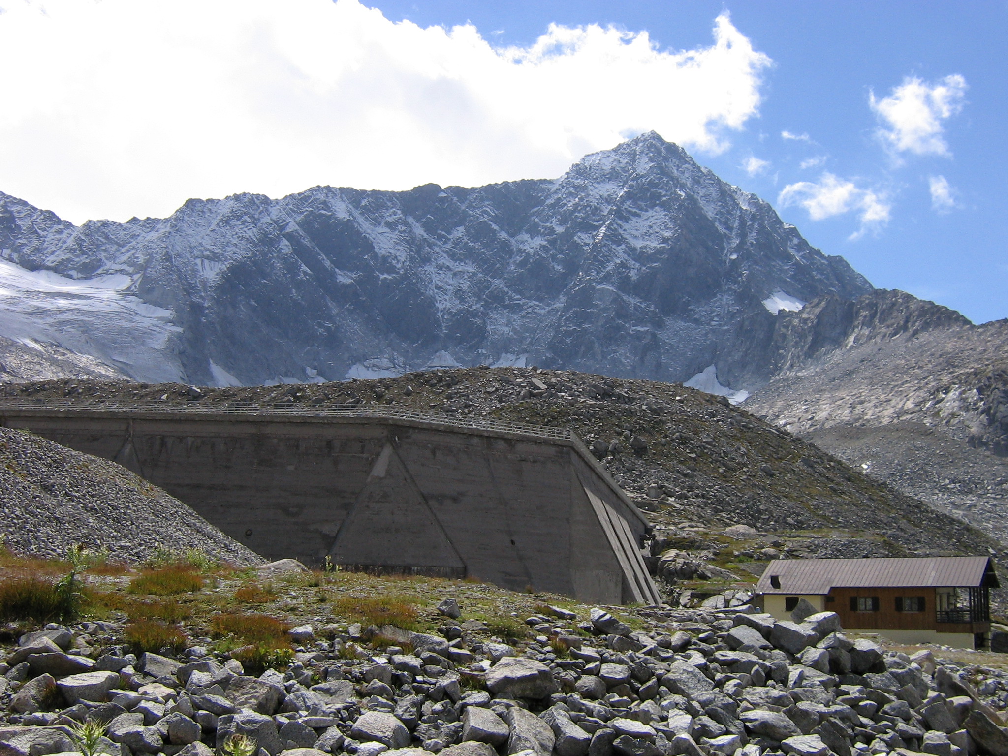
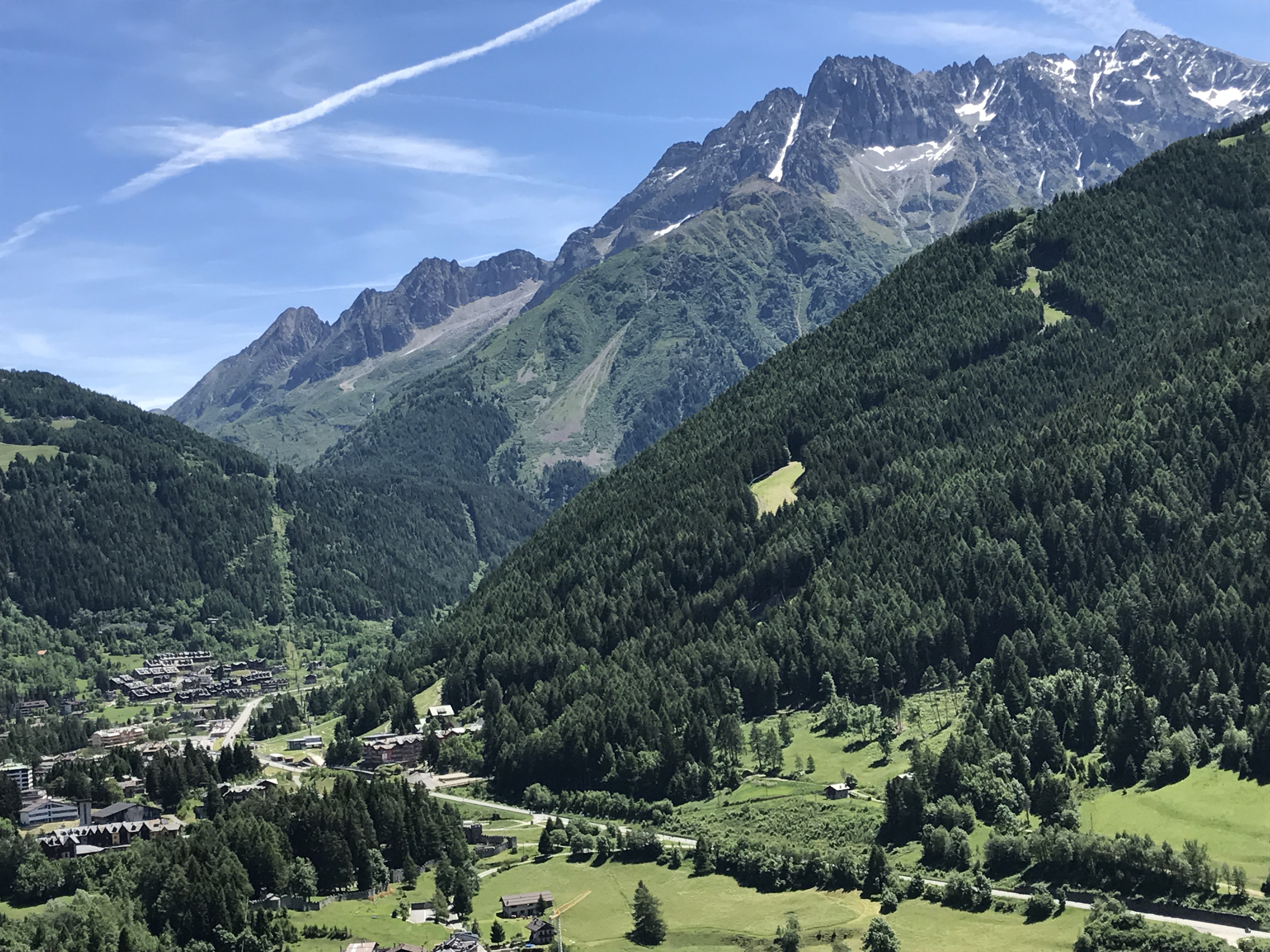
The Adamello-Presanella Alps Alpine group is a mountain range in the Southern Limestone Alps mountain group of the Eastern Alps. It is located in northern Italy, in the provinces of Trentino and Brescia. The name stems from its highest peaks: Adamello and Presanella. The Adamello-Presanella Group is separated from the Ortler Alps in the north by the Tonale Pass; from the Bergamo Alps in the west by the Oglio valley (Val Camonica); from the Brenta Group in the east by the Campo Carlo Magno Pass and the river Sarca; to the south it continues towards Lake Iseo. Peaks The main peaks of the Adamello-Presanella Group are: Passes The main mountain passes of the Adamello-Presanella Group are: See also * Southern Limestone Alps * Geography of the Alps The Alps form a large mountain range dominating Central Europe, including parts of Italy, France, Switzerland, Liechtenstein, Austria, Slovenia, Germany and possibly Hungary (if one includes the Kőszeg Mountains). This ar ... [...More Info...] [...Related Items...] OR: [Wikipedia] [Google] [Baidu] |
Tonale Pass
Tonale Pass ( it, Passo del Tonale) (el. 1883 m./6178 ft.) is a high mountain pass in northern Italy across the Rhaetian Alps, between Lombardy and Trentino. It connects Valcamonica and Val di Sole. It is delimited by the Ortler Alps to the north and the Adamello range to the south. The pass has hotels and shops for tourists in winter, as the land around the pass is used for winter sports - mainly skiing (see Adamello Ski Raid) and snowboarding. During World War I the place was heavily fought for between Italians holding Western side (Lombardy) and the troops of Habsburg Empire holding the Eastern side (Trentino). A memorial for the fallen Italian soldiers was erected during the fascist period. See also * List of highest paved roads in Europe * List of mountain passes * Tonalite Tonalite is an igneous, plutonic ( intrusive) rock, of felsic composition, with phaneritic (coarse-grained) texture. Feldspar is present as plagioclase (typically oligoclase or ande ... [...More Info...] [...Related Items...] OR: [Wikipedia] [Google] [Baidu] |
Lake Iseo
Lake Iseo or Iseo lake ( ; it, Lago d'Iseo ; lmo, Lach d'Izé, label=Eastern Lombard), also known as Sebino (; la, Sebinus), is the fourth largest lake in Lombardy, Italy, fed by the Oglio River. It is in the north of the country in the Val Camonica area, near the cities of Brescia and Bergamo. The lake is almost equally divided between the provinces of Bergamo and Brescia. Northern Italy is known for its heavily industrialised towns and in between there are several natural lakes. Lake Iseo retains its natural environment, with its lush green mountains surrounding the crystal clear lake. There are several medieval towns around the lake, the largest being Iseo and Sarnico. A notable tourism sector has emerged. A road has been carved into the side of the mountains that circumnavigates the entire lake. In the middle of the lake there are Montisola island, Loreto isle and San Paolo isle (which compound the Monte Isola municipality). There is easy access via the regular running la ... [...More Info...] [...Related Items...] OR: [Wikipedia] [Google] [Baidu] |
Cedegolo
Cedegolo (Camunian dialect, Camunian: ) is an Italian ''comune'' of 1,258 inhabitants in Val Camonica, province of Brescia, in Lombardy, northern Italy. Geography The village of Cedegolo is located in a narrow gorge formed by Oglio river, on its eastern side. It is crossed by two streams: the Val Gravagna, further north, and the Poia, to the south. History The comune of Cedegolo was created in 1797, at the fall of the Republic of Venice, but became a hamlet of Grevo in 1798. The bridge over the river Poglia (Pôya in eastern Lombard), in the center of the village, was completed in 1592. From Cedegolo in July 1866 the fourth regiment of volunteers in Italy and the Second Battalion of bersaglieri moved to enter Austrian Trentino, through the Lake Arno. Main sights * Parish of Saint Jerome, from the early 17th century. The altar is by Pietro Ramus. Culture The skötöm are in camunian dialect nicknames, sometimes personal, elsewhere showing the characteristic features of ... [...More Info...] [...Related Items...] OR: [Wikipedia] [Google] [Baidu] |
Ponte Di Legno
Ponte di Legno ( Camunian: ) is an Italian ''comune'' of 1,729 inhabitants in Val Camonica, province of Brescia, in Lombardy. Geography Situated at the confluence of the two source rivers of the Oglio, Ponte di Legno is the uppermost comune of Valle Camonica. History The territory of the municipality of Ponte di Legno was part of the ancient Dalaunia (Dalegno), which included also the comune of Temù. On September 27, 1917 the village was bombarded by Austrian cannons and razed to the ground in a short time. Monuments and places of interest Religious architectures The churches of Ponte di Legno are: * Parish of the Holy Trinity, dated 1685, though the wooden door is from 1929. Inside there are works from the workshop of Ramus. * Church St. Appollonio in Plampezzo. It is an ancient church dating from the twelfth century, with frescoes of the thirteenth century of the hand of the painter Johannes from Volpino. Society Demographic trends Colors= id:lightgrey value:gray(0. ... [...More Info...] [...Related Items...] OR: [Wikipedia] [Google] [Baidu] |
Fucine
The Fucine Lake ( it, Lago Fucino or ) was a large endorheic lake in western Abruzzo, central Italy, stretching from Avezzano in the northwest to Ortucchio in the southeast, and touching Trasacco in the southwest. Once the third largest lake in Italy, it was drained in 1878. Lore Virgil mentioned the former lake in the Aeneid in book 7, in that it weeps for Umbro, the healer priest killed tragically in battle. (See line 7:882 in the Fagles translation). Roman drainage The Romans knew the lake as ''Fucinus Lacus'' and founded settlements on its banks, including Marruvium. It was the site of the Battle of Fucine Lake in 89 BC; however, while the lake provided fertile soil and a large quantity of fish, it was also believed to harbour malaria, and, having no natural outflow, repeatedly flooded the surrounding arable land. The Emperor Claudius attempted to control the lake's maximum level by digging a drainage tunnel through ''Monte Salviano'', requiring 30,000 workers and eleve ... [...More Info...] [...Related Items...] OR: [Wikipedia] [Google] [Baidu] |
Val Di Genova
Val may refer to: Val-a Film * ''Val'' (film), an American documentary about Val Kilmer, directed by Leo Scott and Ting Poo Military equipment * Aichi D3A, a Japanese World War II dive bomber codenamed "Val" by the Allies * AS Val, a Soviet assault rifle Music *''Val'', album by Val Doonican *VAL (band), Belarusian pop duo People * Val (given name), a unisex given name * Rafael Merry del Val (1865–1930), Spanish Catholic cardinal * Val (sculptor) (1967–2016), French sculptor * Val (footballer, born 1983), Lucivaldo Lázaro de Abreu, Brazilian football midfielder * Val (footballer, born 1997), Valdemir de Oliveira Soares, Brazilian football defensive midfielder Places * Val (Rychnov nad Kněžnou District), a village and municipality in the Czech Republic * Val (Tábor District), a village and municipality in the Czech Republic * Vál, a village in Hungary * Val, Iran, a village in Kurdistan Province, Iran * Val, Italy, a ''frazione'' in Cortina d'Ampezzo, Veneto, ... [...More Info...] [...Related Items...] OR: [Wikipedia] [Google] [Baidu] |
Mountain Pass
A mountain pass is a navigable route through a mountain range or over a ridge. Since many of the world's mountain ranges have presented formidable barriers to travel, passes have played a key role in trade, war, and both Human migration, human and animal migration throughout history. At lower elevations it may be called a hill pass. A mountain pass is typically formed between two volcanic peaks or created by erosion from water or wind. Overview Mountain passes make use of a gap (landform), gap, saddle (landform), saddle, col or notch (landform), notch. A topographic saddle is analogous to the mathematical concept of a saddle surface, with a saddle point marking the highest point between two valleys and the lowest point along a ridge. On a topographic map, passes are characterized by contour lines with an hourglass shape, which indicates a low spot between two higher points. In the high mountains, a difference of between the summit and the mountain is defined as a mountain pas ... [...More Info...] [...Related Items...] OR: [Wikipedia] [Google] [Baidu] |
Monte Frerone
Monte Frerone is a mountain of Lombardy, Italy Italy ( it, Italia ), officially the Italian Republic, ) or the Republic of Italy, is a country in Southern Europe. It is located in the middle of the Mediterranean Sea, and its territory largely coincides with the homonymous geographical re ..., It has an elevation of 2673 metres. Mountains of the Alps Mountains of Lombardy {{Lombardy-geo-stub ... [...More Info...] [...Related Items...] OR: [Wikipedia] [Google] [Baidu] |
Monte Tredenus
Monte Tredenus is a mountain of Lombardy, Italy Italy ( it, Italia ), officially the Italian Republic, ) or the Republic of Italy, is a country in Southern Europe. It is located in the middle of the Mediterranean Sea, and its territory largely coincides with the homonymous geographical re .... It has an elevation of 2,796 metres above sea level Mountains of the Alps Mountains of Lombardy {{Lombardy-geo-stub ... [...More Info...] [...Related Items...] OR: [Wikipedia] [Google] [Baidu] |
Corno Baitone
Corno Baitone is a mountain of Lombardy, Italy Italy ( it, Italia ), officially the Italian Republic, ) or the Republic of Italy, is a country in Southern Europe. It is located in the middle of the Mediterranean Sea, and its territory largely coincides with the homonymous geographical re .... It has an elevation of 3330 metres. References Mountains of the Alps Alpine three-thousanders Mountains of Lombardy {{Lombardy-geo-stub ... [...More Info...] [...Related Items...] OR: [Wikipedia] [Google] [Baidu] |


.jpg)

.jpg)
