|
Aba Tenna Dejazmach Yilma International Airport
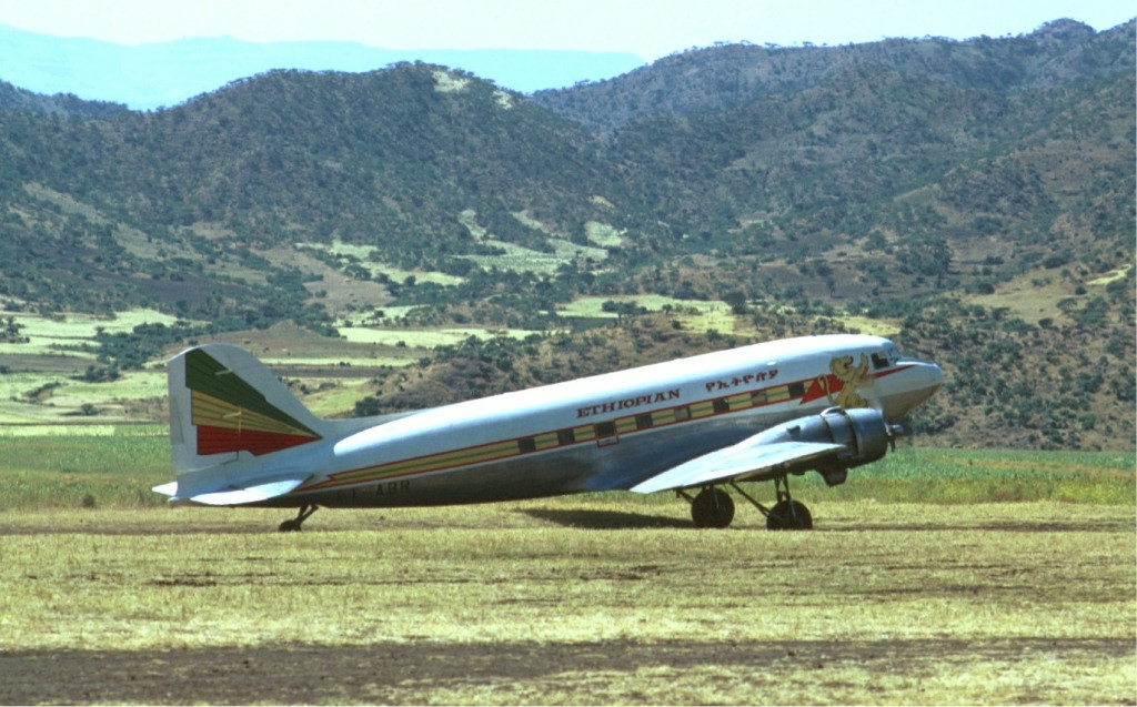
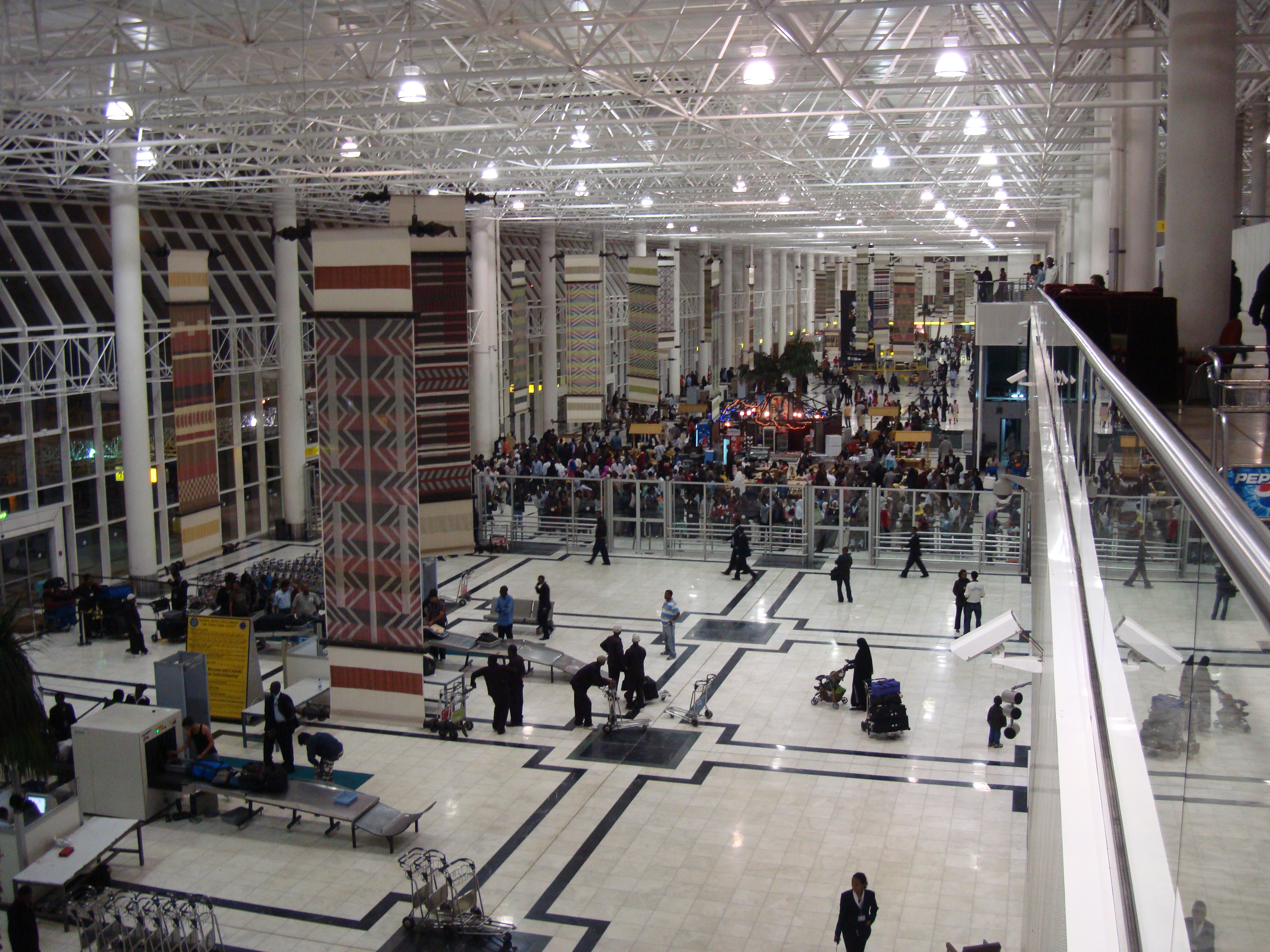
Dire Dawa International Airport , is an international airport serving Dire Dawa, a city in eastern Ethiopia. It is located northwest of the city centre. Facilities The airport is located at an elevation of above mean sea level. It has one runway designated 15/33, with an asphalt surface measuring . Airlines and destinations Accidents and incidents *On 27 August 1981, Douglas C-47B ET-AGX of RRC Air Services was written off when the port undercarriage collapsed on landing. *On 9 January 2020, an Ethiopian Airlines Boeing 737-700 registered ET-ALN operating flight ET363 was on approach to the airport, but flew through a swarm of desert locusts that obscured visibility from the cockpit. The crew depressurized the aircraft and manually cleaned the windscreens before attempting a second approach, but were faced with the same problem. After a second depressurization and manual cleaning, the flight diverted to Addis Ababa Addis Ababa (; am, አዲስ አበባ, , new fl ... [...More Info...] [...Related Items...] OR: [Wikipedia] [Google] [Baidu] |
Dire Dawa
Dire Dawa ( am, ድሬዳዋ, om, Dirree Dhawaa, 3=Place of Remedy; so, Diridhaba, meaning "where Dir hit his spear into the ground" or "The true Dir", ar, ديري داوا,) is a city in eastern Ethiopia near the Oromia and Somali Region border and one of two chartered cities in Ethiopia (the other being Addis Ababa, the capital). Dire Dawa alongside present-day Sitti Zone were apart of the Dire Dawa autonomous region stipulated in the 1987 Ethiopian Constitution until 1993 when it was split by the federal government into a separately administered chartered city. This was due to the ongoing clashes between the OLF and IGLF and prevented any further escalation. It is divided administratively into two woredas, the city proper and the non-urban woreda of Gurgura. Dire Dawa lies in the eastern part of the nation, on the Dechatu River, at the foot of a ring of cliffs. The western outskirts of the city lie on the Gorro River, a tributary of the Dechatu River. It is ... [...More Info...] [...Related Items...] OR: [Wikipedia] [Google] [Baidu] |
DAFIF
DAFIF () or the ''Digital Aeronautical Flight Information File'' is a comprehensive database of up-to-date aeronautical data, including information on airports, airways, airspaces, navigation data, and other facts relevant to flying in the entire world, managed by the National Geospatial-Intelligence Agency (NGA) of the United States. Withdrawal of public access DAFIF was publicly available until October 2006 through the Internet; however, it was closed to public access because "increased numbers of foreign source providers are claiming intellectual property rights or are forewarning NGA that they intend to copyright their source". Currently, only federal and state government agencies, authorized government contractors, and Department of Defense customers are able to access the DAFIF data. At the time of the announcement, the NGA did not say who the "foreign source providers" were. It was subsequently revealed that the Australian Government was behind the move. The Australian ... [...More Info...] [...Related Items...] OR: [Wikipedia] [Google] [Baidu] |
International Airport
An international airport is an airport with customs and border control facilities enabling passengers to travel between countries around the world. International airports are usually larger than domestic airports and they must feature longer runways and have facilities to accommodate the heavier aircraft such as the Boeing 747 commonly used for international and intercontinental travel. International airports often also host domestic flights, which often help feed both passengers and cargo into international ones (and vice versa). Buildings, operations and management have become increasingly sophisticated since the mid-20th century, when international airports began to provide infrastructure for international civilian flights. Detailed technical standards have been developed to ensure safety and common coding systems implemented to provide global consistency. The physical structures that serve millions of individual passengers and flights are among the most complex and interc ... [...More Info...] [...Related Items...] OR: [Wikipedia] [Google] [Baidu] |
Ethiopia
Ethiopia, , om, Itiyoophiyaa, so, Itoobiya, ti, ኢትዮጵያ, Ítiyop'iya, aa, Itiyoppiya officially the Federal Democratic Republic of Ethiopia, is a landlocked country in the Horn of Africa. It shares borders with Eritrea to the north, Djibouti to the northeast, Somalia to the east and northeast, Kenya to the south, South Sudan to the west, and Sudan to the northwest. Ethiopia has a total area of . As of 2022, it is home to around 113.5 million inhabitants, making it the 13th-most populous country in the world and the 2nd-most populous in Africa after Nigeria. The national capital and largest city, Addis Ababa, lies several kilometres west of the East African Rift that splits the country into the African and Somali tectonic plates. Anatomically modern humans emerged from modern-day Ethiopia and set out to the Near East and elsewhere in the Middle Paleolithic period. Southwestern Ethiopia has been proposed as a possible homeland of the Afroasiatic langua ... [...More Info...] [...Related Items...] OR: [Wikipedia] [Google] [Baidu] |
Mean Sea Level
There are several kinds of mean in mathematics Mathematics is an area of knowledge that includes the topics of numbers, formulas and related structures, shapes and the spaces in which they are contained, and quantities and their changes. These topics are represented in modern mathematics ..., especially in statistics. Each mean serves to summarize a given group of data, often to better understand the overall value (magnitude (mathematics), magnitude and sign (mathematics), sign) of a given data set. For a data set, the ''arithmetic mean'', also known as "arithmetic average", is a measure of central tendency of a finite set of numbers: specifically, the sum of the values divided by the number of values. The arithmetic mean of a set of numbers ''x''1, ''x''2, ..., x''n'' is typically denoted using an overhead bar, \bar. If the data set were based on a series of observations obtained by sampling (statistics), sampling from a statistical population, the arithmetic mean is th ... [...More Info...] [...Related Items...] OR: [Wikipedia] [Google] [Baidu] |
Runway
According to the International Civil Aviation Organization (ICAO), a runway is a "defined rectangular area on a land aerodrome prepared for the landing and takeoff of aircraft". Runways may be a man-made surface (often asphalt concrete, asphalt, concrete, or a mixture of both) or a natural surface (sod, grass, soil, dirt, gravel, ice, sand or road salt, salt). Runways, as well as taxiways and Airport apron, ramps, are sometimes referred to as "tarmac", though very few runways are built using Tarmacadam, tarmac. Takeoff and landing areas defined on the surface of water for seaplanes are generally referred to as waterways. Runway lengths are now International Civil Aviation Organization#Use of the International System of Units, commonly given in meters worldwide, except in North America where feet are commonly used. History In 1916, in a World War I war effort context, the first concrete-paved runway was built in Clermont-Ferrand in France, allowing local company Michelin to ... [...More Info...] [...Related Items...] OR: [Wikipedia] [Google] [Baidu] |
Asphalt
Asphalt, also known as bitumen (, ), is a sticky, black, highly viscous liquid or semi-solid form of petroleum. It may be found in natural deposits or may be a refined product, and is classed as a pitch. Before the 20th century, the term asphaltum was also used. Full text at Internet Archive (archive.org) The word is derived from the Ancient Greek ἄσφαλτος ''ásphaltos''. The largest natural deposit of asphalt in the world, estimated to contain 10 million tons, is the Pitch Lake located in La Brea in southwest Trinidad (Antilles island located on the northeastern coast of Venezuela), within the Siparia Regional Corporation. The primary use (70%) of asphalt is in Road surface, road construction, where it is used as the glue or binder mixed with construction aggregate, aggregate particles to create asphalt concrete. Its other main uses are for bituminous waterproofing products, including production of roofing felt and for sealing flat roofs. In material sciences an ... [...More Info...] [...Related Items...] OR: [Wikipedia] [Google] [Baidu] |
Ethiopian Airlines
Ethiopian Airlines (commonly referred to as Ethiopian; am, የኢትዮጵያ አየር መንገድ, translit=Ye-Ītyōṗṗyā āyer menged), formerly ''Ethiopian Air Lines'' (EAL), is the flag carrier of Ethiopia, and is wholly owned by the country's government. EAL was founded on 21 December 1945 and commenced operations on 8 April 1946, expanding to international flights in 1951. The firm became a share company in 1965 and changed its name from ''Ethiopian Air Lines'' to ''Ethiopian Airlines''. The airline has been a member of the International Air Transport Association since 1959 and of the African Airlines Association (AFRAA) since 1968. Ethiopian is a Star Alliance member, having joined in . The company slogan is ''The New Spirit of Africa.'' Ethiopian's hub and headquarters are at Bole International Airport in Addis Ababa, from where it serves a network of 125 passenger destinations—20 of them domestic—and 44 freighter destinations. The airline has secondary h ... [...More Info...] [...Related Items...] OR: [Wikipedia] [Google] [Baidu] |
Bole International Airport
Addis Ababa Bole International Airport is an international airport in Addis Ababa, Ethiopia. It is in the Bole district, southeast of the city centre and north of Bishoftu. The airport was formerly known as ''Haile Selassie I International Airport''. It is the main hub of Ethiopian Airlines, the national airline that serves destinations in Ethiopia and throughout the African continent, as well as nonstop service to Asia, Europe, North America and South America. The airport is also the base of the Ethiopian Aviation Academy. As of June 2018, nearly 450 flights per day were departing from and arriving at the airport. History In 1960, Ethiopian Airlines realized the runway at Lidetta was too short for its new jet aircraft, the Boeing 720. Thus a new airport was built at Bole. By December 1962 the new runway and control tower were operational. In 1997, an expansion plan was announced for the airport. This expansion was done in three phases: * Phase One: Adding a parallel r ... [...More Info...] [...Related Items...] OR: [Wikipedia] [Google] [Baidu] |
Gode Airport
Gode Airport, also known as Ugas Mirad Airport , is an airport in Gode, Ethiopia. Located at an elevation of 254 meters above sea level, it has one runway made of a variety of materials 2288 meters long by 35 wide. Construction of the airport began in 1965 by the Swedish construction firm Skanska, and was formally inaugurated by Emperor Haile Selassie Haile Selassie I ( gez, ቀዳማዊ ኀይለ ሥላሴ, Qädamawi Häylä Səllasé, ; born Tafari Makonnen; 23 July 189227 August 1975) was Emperor of Ethiopia from 1930 to 1974. He rose to power as Regent Plenipotentiary of Ethiopia (' ... on 10 June 1966. Although originally a military air base, Gode Airport was afterwards also used for civil flights. (pdf) The Nordic Africa Institute website (accessed 21 Novembe ... [...More Info...] [...Related Items...] OR: [Wikipedia] [Google] [Baidu] |
Douglas C-47
The Douglas C-47 Skytrain or Dakota (RAF, RAAF, RCAF, RNZAF, and SAAF designation) is a military transport aircraft developed from the civilian Douglas DC-3 airliner. It was used extensively by the Allies during World War II and remained in front-line service with various military operators for many years.Parker 2013, pp. 13, 35, 37, 39, 45-47. Design and development The C-47 differed from the civilian DC-3 by way of numerous modifications, including being fitted with a cargo door, hoist attachment and strengthened floor - along with a shortened tail cone for glider-towing shackles, and an astrodome in the cabin roof.Wilson, Stewart. ''Aircraft of WWII''. Fyshwick, ACT, Australia: Aerospace Publications Pty Ltd., 1998. . During World War II, the armed forces of many countries used the C-47 and modified DC-3s for the transport of troops, cargo, and wounded. The U.S. naval designation was R4D. More than 10,000 aircraft were produced in Long Beach and Santa Monica, California, ... [...More Info...] [...Related Items...] OR: [Wikipedia] [Google] [Baidu] |


