|
A58 Motorway (Netherlands)
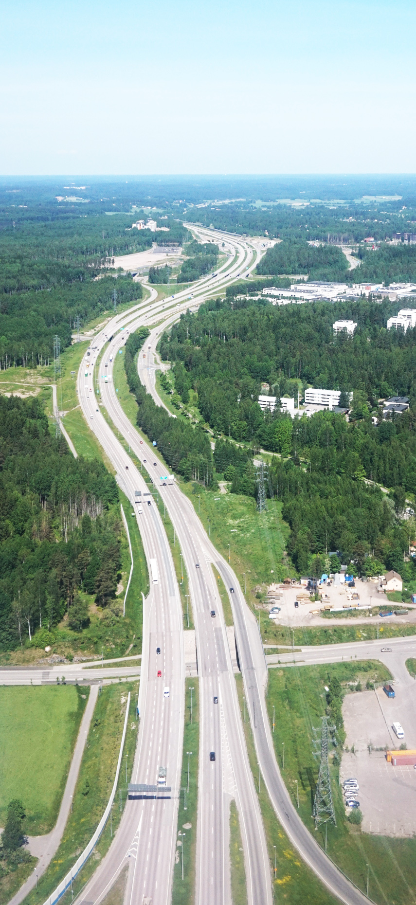
The A58 motorway is a motorway in the Netherlands. It is approximately in length. The A58 is located in the Dutch provinces of North Brabant and Zeeland. The A58 connects North Brabant's three major cities Eindhoven, Tilburg and Breda with the cities Goes, Middelburg and Vlissingen in Zeeland. History With the reconstruction works of the ''Randweg Eindhoven'', the beltway of the city, nearing completion, the A58 motorway has been shortened by a few kilometers. The road now only starts at the interchange Batadorp. The section between its former eastern terminus (interchange Ekkersrijt/John F. Kennedylaan) and the interchange Ekkersweijer has now become part of the A50, while the section between interchanges Ekkersweijer and Batadorp is now only a part of the A2, and is no longer shared with the A58. Traffic jams The motorway 58 is congested everyday, especially between Oirschot - Tilburg and between Roosendaal - Bergen Op Zoom. In 2011, experiments with "" (lower speed limits ... [...More Info...] [...Related Items...] OR: [Wikipedia] [Google] [Baidu] |
Rijkswaterstaat
Rijkswaterstaat, founded in 1798 as the ''Bureau voor den Waterstaat'' and formerly translated to Directorate General for Public Works and Water Management, is a Directorate-General of the Ministry of Infrastructure and Water Management of the Netherlands. Its role is the practical execution of the public works and water management, including the construction and maintenance of waterways and roads, and flood protection and prevention. The agency was also involved in the construction of big railway projects such as the Betuweroute and the HSL-Zuid. The mission of the organisation is: "Rijkswaterstaat is de rijksdienst die werkt aan droge voeten, schoon en voldoende water én aan de vlotte en veilige doorstroming van het verkeer" (Rijkswaterstaat is the national agency that provides dry feet, clean and sufficient water and a quick and safe flow of traffic). The agency is divided in 10 regional, 6 specialist services and 2 special services. As of 15 May 2017, the director-general (DG ... [...More Info...] [...Related Items...] OR: [Wikipedia] [Google] [Baidu] |
Motorways In North Brabant
A controlled-access highway is a type of highway that has been designed for high-speed vehicular traffic, with all traffic flow—ingress and egress—regulated. Common English terms are freeway, motorway and expressway. Other similar terms include ''throughway'' and ''parkway''. Some of these may be limited-access highways, although this term can also refer to a class of highways with somewhat less isolation from other traffic. In countries following the Vienna convention, the motorway qualification implies that walking and parking are forbidden. A fully controlled-access highway provides an unhindered flow of traffic, with no traffic signals, intersections or property access. They are free of any at-grade crossings with other roads, railways, or pedestrian paths, which are instead carried by overpasses and underpasses. Entrances and exits to the highway are provided at interchanges by slip roads (ramps), which allow for speed changes between the highway and arterials a ... [...More Info...] [...Related Items...] OR: [Wikipedia] [Google] [Baidu] |
Motorways In The Netherlands
A controlled-access highway is a type of highway that has been designed for high-speed vehicular traffic, with all traffic flow—ingress and egress—regulated. Common English terms are freeway, motorway and expressway. Other similar terms include ''throughway'' and '' parkway''. Some of these may be limited-access highways, although this term can also refer to a class of highways with somewhat less isolation from other traffic. In countries following the Vienna convention, the motorway qualification implies that walking and parking are forbidden. A fully controlled-access highway provides an unhindered flow of traffic, with no traffic signals, intersections or property access. They are free of any at-grade crossings with other roads, railways, or pedestrian paths, which are instead carried by overpasses and underpasses. Entrances and exits to the highway are provided at interchanges by slip roads (ramps), which allow for speed changes between the highway and arterials ... [...More Info...] [...Related Items...] OR: [Wikipedia] [Google] [Baidu] |
Reimerswaal (municipality)
Reimerswaal () is a Municipalities of the Netherlands, municipality in the province of Zeeland in the southwestern Netherlands on Zuid-Beveland, named after the Reimerswaal (city), lost city. The municipality had a population of in , and has a surface area of of which is water. The central town Yerseke is known for trade in mussels and oysters. Kruiningen is known for the former ferry from Kruiningen to Perkpolder which was in service up to 2003. The municipality of Reimerswaal was established in 1970, from the aggregation of the municipalities Krabbendijke, Kruiningen, Rilland-Bath, Waarde, and Yerseke. The municipal coat of arms(:nl:Wapen van Reimerswaal, nl) dates to 1970. The sword in a red field is derived from the coat of arms of the Reimerswaal (city), lost city of Reimerswaal in use in the 15th century (Beyeren Armorial]p. 107 of ''gules two swords inverted saltirewise argent and or''. In addition, the municipal coat of arms shows the comital arms of Count_of_Hainaut#Ho ... [...More Info...] [...Related Items...] OR: [Wikipedia] [Google] [Baidu] |
Best, Netherlands
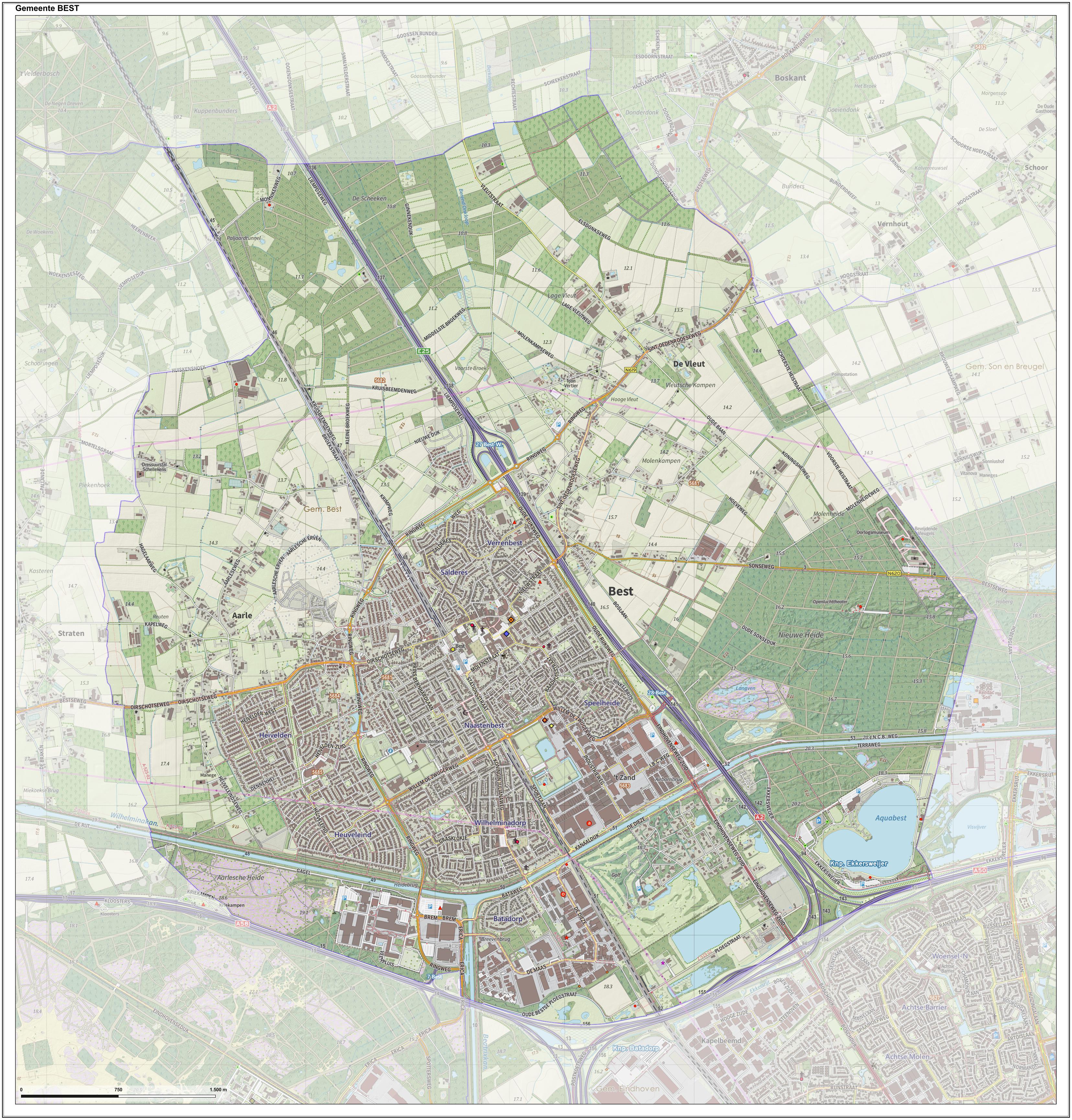
Best () is a municipality and a village in the southern Netherlands. It is situated northwest of the city Eindhoven, and is also part of the agglomeration of this city. The headquarters of Europe's largest meat processor Vion NV are located in Best, as are Philips Healthcare and the Bata Shoe Organization's "Bata Protective" operations (B2B). History The village used to be a part of Oirschot, a nearby town. But as Best was situated on the state road from Amsterdam to Maastricht, this often created difficulties. Each time the military wanted to quarter troops in Best, they had to request to be stationed in Oirschot, 10 km away, for this to be allowed. Because of this difficulty, the government decided to separate Best from Oirschot in 1819. Archaeological excavations around the village suggest settlement in the area dating back to the Roman era. The Armenhoef is a monumental farm on the Oirschotseweg 117 in Best. This stable is the oldest still in use within Western Europe. ... [...More Info...] [...Related Items...] OR: [Wikipedia] [Google] [Baidu] |
European Route E19
European route E19 is a long European route. It connects the Netherlands to France via Belgium. Among the places included in its itinerary are: * ''Netherlands:'' Amsterdam - The Hague - Rijswijk - Rotterdam - Breda * ''Belgium:'' Antwerp - Mechelen - Brussels - Mons * ''France:'' Valenciennes - Cambrai - Compiègne - Paris Overview Since October 2007 construction works have started on a new railroad between Schaerbeek and Mechelen on the central reservation of the E 19 (Belgian A1) with the purpose of improving the train connection between Antwerp, Brussels Airport and Brussels. In the Netherlands, the E19 starts in Amsterdam on the A4 to pass Through to the Hague, where it switches to the A13 to run Delft and to Rotterdam. There it goes on the Kleinpolderplein on the A20 and Terbregseplein on the A16. At Zwijndrecht it passes through the Drechttunnel as it goes on to Dordrecht, over the Moerdijkbruggen, Breda by the forest Mastbos over and over the border town of Ha ... [...More Info...] [...Related Items...] OR: [Wikipedia] [Google] [Baidu] |
A16 Motorway (Netherlands)
The A16 motorway is a motorway in the Netherlands. It runs from the interchange Terbregseplein in the northeastern part of Rotterdam, towards the Belgian border near Hazeldonk. The motorway has 19 exits including 7 interchanges. Speed limit Nearly the entire A16 motorway, including both the local and express lanes near Rotterdam, featured a maximum speed of 100 km/h. The only exception to this were two short sections: between Dordrecht and Klaverpolder as well as the section between the intersection Princeville, west of Breda and the Belgian border, where a speed of 120 km/h is allowed. At the section between the Moerdijk bridges and the Belgian border the maximum speed changed to 130 km/h as of 2011. Local–express lanes near Rotterdam Near Rotterdam, a system of collector–express lanes is used. The exits 24 through 26 are only accessible through the outer (collector) lanes. The inner lanes serve as express lanes and do not have any exits. In the northern direct ... [...More Info...] [...Related Items...] OR: [Wikipedia] [Google] [Baidu] |
European Route E312
E 312 is a European B class road in the Netherlands, connecting the cities of Flushing (''Vlissingen'') and Eindhoven. During its entire course, it follows highway 58 ( A58) and is a motorway. *Road connections: ** (Highway 57 - Middelburg) ** (Highway 4 - Bergen op Zoom) ** (Highway 16 - Princenhage) ** (Highway 27 - Ginneken en Bavel) ** (Highway 65 - Tilburg) ** (Highway 2 - Best) ** (Highway 50 - Eindhoven Eindhoven () is a city and municipality in the Netherlands, located in the southern province of North Brabant of which it is its largest. With a population of 238,326 on 1 January 2022, [...More Info...] [...Related Items...] OR: [Wikipedia] [Google] [Baidu] |
European Route
The international E-road network is a numbering system for roads in Europe developed by the United Nations Economic Commission for Europe, United Nations Economic Commission for Europe (UNECE). The network is numbered from E1 up and its roads cross national borders. It also reaches Central Asian countries like Kyrgyzstan, since they are members of the UNECE. Main international traffic arteries in Europe are defined by ECE/TRANS/SC.1/2016/3/Rev.1 which consider three types of roads: motorways, Limited-access road, limited access roads, and ordinary roads. In most countries, the roads carry the European route designation alongside national designations. Belgium, Norway and Sweden have roads which only have the European route designations (examples: European route E18, E18 and European route E6, E6). The United Kingdom, Iceland and Albania only use national road designations and do not show the European designations at all. Ukraine does not number its routes at all except in int ... [...More Info...] [...Related Items...] OR: [Wikipedia] [Google] [Baidu] |
Randstad
The Randstad (; "Rim" or "Edge" City) is a roughly crescent-shaped conurbation in the central-western Netherlands, consisting primarily of the four largest Dutch cities (Amsterdam, Rotterdam, The Hague, and Utrecht); their suburbs, and many towns in between, that all grew and merged into each other, containing almost half the country's population. Among other things, it includes the Port of Rotterdam (the busiest seaport outside of Asia), the Port of Amsterdam (Europe's fourth-busiest seaport), and Amsterdam Airport Schiphol (the List of busiest airports by aircraft movements, busiest airport in Europe by aircraft movements). With a population of approximately 8.4 million people it is one of the largest metropolitan area, metropolitan regions in Europe, comparable in population size to the Rhine-Ruhr metropolitan region or the San Francisco Bay Area, and covers an area of approximately . The Randstad had a gross regional product of €397 billion in 2017, making it the third most ... [...More Info...] [...Related Items...] OR: [Wikipedia] [Google] [Baidu] |
A2 Motorway (Netherlands)
The A2 motorway is a motorway in the Netherlands. It is one of the busiest highways in the Netherlands. The road connects the city of Amsterdam, near the Amstel interchange with the Belgian border, near Maastricht (NL) and Liège (B), and the Belgian A25 road. The route of the A2 motorway is shared with two major European routes. Between its start, at Amstel Interchange, near Amsterdam, and the Interchange Oudenrijn, near Utrecht, European route E35 follows the A2 motorway. From the Oudenrijn Interchange towards the Belgian border just south of Maastricht, European route E25 follows the route of the A2. Local and express lanes on A2 have different speed limits. The speed limit on express lanes is 120 km/h (75 mph) and locals is 100 km/h (63 mph). Route description Road N2 In the past, the motorway A2 was interrupted at one location, near Maastricht. This section was referred to as N2, to make a distinction between the motorway (A2) and the non-motorway (N2). The N2 throu ... [...More Info...] [...Related Items...] OR: [Wikipedia] [Google] [Baidu] |
.jpg)


