|
A286 Road
The A286 is an A class road in the south of England, from its northernmost point in Milford, Surrey, to Birdham, West Sussex. It passes through the market towns of Haslemere and Midhurst, and the cathedral city of Chichester. The road is mostly single carriageway, with a small dual carriageway section as part of the Chichester ring road. The road is long and follows a predominantly rural route through common land, farmland, woodland and the South Downs. Route Surrey The A286 begins at a junction with the A3100 (the old A3 London to Portsmouth road) in Milford. A few hundred metres south of its origin the A286 crosses the A283 road to Petworth, then crosses Witley Common, a Site of Special Scientific Interest. The route passes Witley Park and through the village centres of Brook and Grayswood before dropping down into Haslemere, passing Haslemere Educational Museum and Haslemere Town Hall, where it crosses the B2131 road leading west to Liphook and east to Petworth. Th ... [...More Info...] [...Related Items...] OR: [Wikipedia] [Google] [Baidu] |
Milford, Surrey
Milford is the civil parish and large village which is south west of Godalming in Surrey, England which was a small village in the early medieval period — it grew significantly after the building of the Portsmouth Direct Line which serves Godalming railway station and its own minor stop railway station. The village, served by a wide array of shops and amenities, has to one side an all-directions junction of the A3, one of Britain's trunk roads. Nearby settlements are Eashing, Shackleford, Witley and Elstead, and the hamlets of Enton and Hydestile, all of which are in the Borough of Waverley. The west of the parish is in the Surrey Hills AONB. Transportation Until the 1990s, the A3 road ran through the village (it now bypasses it to the west). Milford is still an important road junction, where the A283 road and A286 roads leave the A3 and run south to West Sussex. Milford railway station is on the mainline between and . Education Milford has a primary school, Milfor ... [...More Info...] [...Related Items...] OR: [Wikipedia] [Google] [Baidu] |
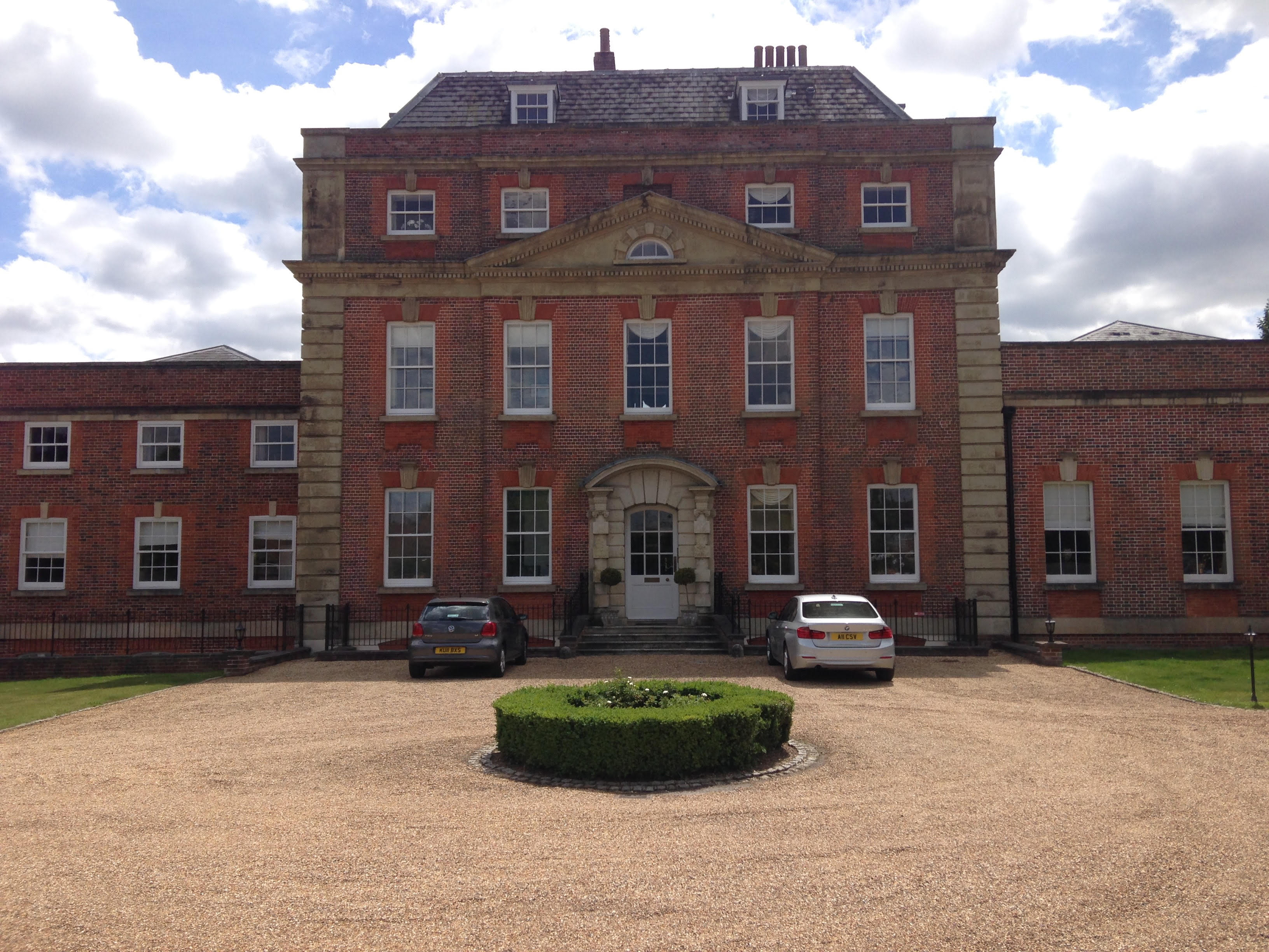
Witley Park
Witley Park, formerly known as Lea Park, is an estate dating from the 19th-century between Godalming and Haslemere, Surrey, England. Its landscaped grounds include three artificial lakes, one of which conceals an underwater conservatory and smoking room. In 1890, the swindler Whitaker Wright purchased Lea Park, and the adjacent South Park Farm, from the Earl of Derby. The title to the estate included the titular Lordship of the Manor and control of Hindhead Common and the Devil's Punch Bowl. He then developed it as part of an extensive set of real estate holdings, approximately , that he purchased in the Haslemere and Hindhead area. Wright developed the pre-existing house into a 32-bedroom mansion adjacent to one of three artificial lakes, and within the landscaped grounds. Underneath an adjacent lake Wright built an underwater conservatory and smoking room, with aquarium windows, upon which a statue of Neptune stands, giving the appearance it is floating on the water. After ... [...More Info...] [...Related Items...] OR: [Wikipedia] [Google] [Baidu] |
River Rother (Western)
The River Rother flows from Empshott in Hampshire, England, to Stopham in West Sussex, where it joins the River Arun. At long, most of the river lies within West Sussex except for the first which lie in Hampshire. The upper river, from its source to Midhurst, has been used to power watermills, with the earliest recorded use being in 1086, when the Domesday survey was conducted. Although none are still operational, many of the buildings which housed the mills still exist, and in some cases, still retain their milling machinery. This upper section is also noted for a number of early bridges, which have survived since their construction in the fifteenth, sixteenth and seventeenth centuries. The lower river, from Midhurst to its junction with the River Arun, has been used for navigation. Boats used the section from the Arun to Fittleworth following improvements made to the Arun in 1615, and after the Arun Navigation was completed in 1790, the Earl of Egremont made the river na ... [...More Info...] [...Related Items...] OR: [Wikipedia] [Google] [Baidu] |
Cowdray House
Cowdray House consists of the ruins of one of England's great Tudor houses, architecturally comparable to many of the great palaces and country houses of that time. It is situated in the Parish of Easebourne, just east of Midhurst, West Sussex standing on the north bank of the River Rother. It was largely destroyed by fire on 24 September 1793, but the ruins have nevertheless been Grade I listed. Manor House The original fortified manor house was built between 1273 and 1284 by Sir John Bohun across the river from the town of Midhurst. He named it ''Coudreye'', the Norman word for the nearby hazel woods. 16th century In the 1520s, Sir David Owen, uncle to Henry VII, began construction of the current Cowdray House on the site of the former home Coudreye, which he had acquired upon the death of his wife Mary Bohun in 1496. In 1529, Sir David's son, Henry, sold the estate of Cowdray to Sir William Fitzwilliam. In 1533 Henry VIII granted a licence to Fitzwilliam's trustees ... [...More Info...] [...Related Items...] OR: [Wikipedia] [Google] [Baidu] |
Cowdray Park, West Sussex
Cowdray Park is a country house at the centre of the Cowdray Estate in Midhurst, West Sussex. The park lies in the South Downs National Park. The estate belongs to Viscount Cowdray, whose family have owned it since 1909. It has a golf course, and it offers clay pigeon shooting and corporate activity days, as well as the more traditional activities of agriculture, forestry and property lets. History The estate was owned by the Bohun family from approximately 1185. Sir David Owen, son of Owen Tudor, built Cowdray House in the 16th century. His son sold the estate to William FitzWilliam, 1st Earl of Southampton in 1529. His half-brother Sir Anthony Browne inherited the estate in 1542. Browne's son Anthony Browne, 1st Viscount Montagu inherited in 1548. The 7th Viscount employed Capability Brown to landscape the park in 1770. The park and gardens are Grade II* listed. On 25 September 1793, a fire destroyed Cowdray House, reducing it to its present ruined state. The ruins are Gr ... [...More Info...] [...Related Items...] OR: [Wikipedia] [Google] [Baidu] |
Easebourne
Easebourne () is a village, Anglican parish and civil parish in the Chichester District of West Sussex, England. It is half a mile (0.8 km) north of Midhurst, across the River Rother on the A272 and A286 roads. The parish includes the hamlet of Henley to the north. In the 2001 census there were 708 households with a total population of 1,717 of whom 785 were economically active. History Easebourne (''Eseburne'') was listed in the Domesday Book of 1086 as an ancient Hundred, an extensive area reaching as far afield as Graffham and Cocking to the south, Stedham to the west and Tillington to the east, as well as two hamlets that were not parishes: Todham to the southeast and Buddington to the west; in total it included 12 settlements containing 276 households. In 1861, the population was 859, and the area of the parish . Governance An electoral ward of the same name exists. This ward includes Lodsworth and at the 2011 census had a population of 2,492. Amenities There i ... [...More Info...] [...Related Items...] OR: [Wikipedia] [Google] [Baidu] |
A286-A272 Junction, Easebourne
A, or a, is the first letter and the first vowel of the Latin alphabet, used in the modern English alphabet, the alphabets of other western European languages and others worldwide. Its name in English is ''a'' (pronounced ), plural ''aes''. It is similar in shape to the Ancient Greek letter alpha, from which it derives. The uppercase version consists of the two slanting sides of a triangle, crossed in the middle by a horizontal bar. The lowercase version can be written in two forms: the double-storey a and single-storey ɑ. The latter is commonly used in handwriting and fonts based on it, especially fonts intended to be read by children, and is also found in italic type. In English grammar, " a", and its variant " an", are indefinite articles. History The earliest certain ancestor of "A" is aleph (also written 'aleph), the first letter of the Phoenician alphabet, which consisted entirely of consonants (for that reason, it is also called an abjad to distinguish it fro ... [...More Info...] [...Related Items...] OR: [Wikipedia] [Google] [Baidu] |
Fernhurst
Fernhurst is a village and civil parish in the Chichester District of West Sussex, England, on the A286 Milford, Surrey, to Chichester road, south of Haslemere. The parish includes the settlements of Henley Common, Kingsley Green and Bell Vale, lies within the boundaries of the South Downs National Park and is surrounded by hills. The area of the parish is . In the 2001 census there were 1,158 households with a total population of 2,765 of whom 1,244 were economically active. The population had increased to 2,942 at the 2011 Census. Geography The village is surrounded by hills, including Telegraph Hill at , Marley Heights at , Bexley Hill at , Fridays Hill at and the highest hill in Sussex, Blackdown at , to the northeast. Fernhurst is surrounded by miles of footpaths, the path to the summit of Blackdown commencing at the ''Red Lion'' pub.Ordnance Survey History The village, on the Weald, originally developed around crossroads (''The Cross'') and the village green, and anc ... [...More Info...] [...Related Items...] OR: [Wikipedia] [Google] [Baidu] |
A287 Road
List of A roads in zone 2 in Great Britain starting south of the River Thames The River Thames ( ), known alternatively in parts as the The Isis, River Isis, is a river that flows through southern England including London. At , it is the longest river entirely in England and the Longest rivers of the United Kingdom, se ... and east of the A3 (roads beginning with 2). __FORCETOC__ Single- and double-digit roads Triple-digit roads Four digit roads {{United Kingdom roads 2 2 ... [...More Info...] [...Related Items...] OR: [Wikipedia] [Google] [Baidu] |
Liphook
Liphook is a large village in the East Hampshire district of Hampshire, England. It is 4.1 miles (6.6 km) west of Haslemere, bypassed by the A3 road, and lies on the Hampshire/West Sussex/Surrey borders. It is in the civil parish of Bramshott and Liphook, which also includes Bramshott and Hammer Bottom. Liphook has a railway station, on the Portsmouth Direct Line. The village grew as a coaching stop between London and Portsmouth during the 17th and 18th centuries. It served as a base during the First World War and the Second World War for Canadian troops stationed in Southern England. History Pre-coaching times The first record of Liphook is in the Bramshott Manor Court Rolls to one 'Robert of Lupe' in 1281. Then follows Matilda of 'Lhupe' in 1337, William at 'Lupe' in 1365, John at 'Lepe' in 1386, and John Maunser at 'Leope' in 1423. On his death in 1428, John Maunser's tenancy at 'Lepe' between modern London Road and Headley Road is the first identifiable landmark i ... [...More Info...] [...Related Items...] OR: [Wikipedia] [Google] [Baidu] |


