|
A2199 Road
The A2199 is an urban A-road in south London. It runs from the A215 Norwood Road, in the centre of Herne Hill, to the A212 Crystal Palace Parade. Route Herne Hill The A2199 commences its journey on the A215 Norwood Road, opposite Brockwell Park. Starting as Croxted Road, it heads south, forming a boundary between the London Borough of Lambeth, to the west, and the London Borough of Southwark, to the east. In this section, Lambeth is the dominant borough. It immediately comes under a bridge, carrying the Sutton Loop Line, between the stations of Herne Hill and Tulse Hill and then afterwards bending to the right. We pass a petrol garage, quickly followed by passing under another bridge, this time the Caterham Line, between the stations of North Dulwich and Tulse Hill, before the road comes to a crossroads with Turney Road. It continues straight, eventually arriving to a junction with the A205 Thurlow Park Road ( South Circular Road), near to West Dulwich Station. We ... [...More Info...] [...Related Items...] OR: [Wikipedia] [Google] [Baidu] |
Herne Hill
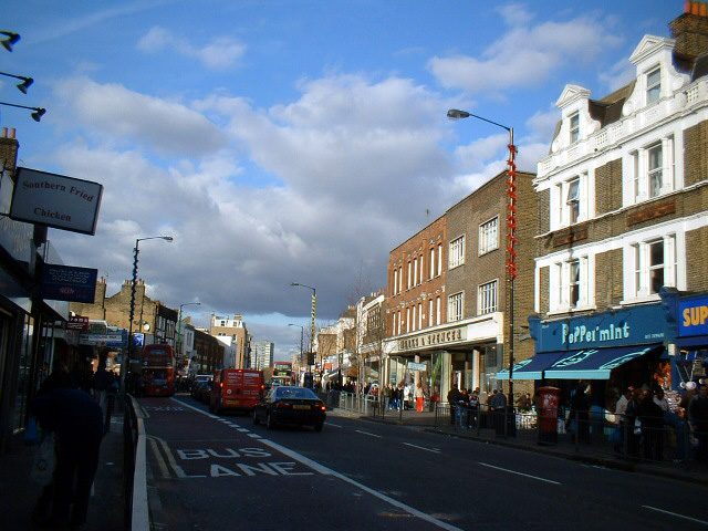
Herne Hill is a district in South London, approximately four miles from Charing Cross and bordered by Brixton, Camberwell, Dulwich, and Tulse Hill. It sits to the north and east of Brockwell Park and straddles the boundary between the boroughs of Lambeth and Southwark. There is a road of the same name in the area (which is part of the A215 and was formerly called Herne Hill Road), as well as a railway station. Toponymy In Rocque's 1746 map, the area is shown as "Island Green", probably reflecting the presence of the River Effra and smaller tributaries.''The Story of Norwood'' J.B. Wilson & H.A. Wilson Early references to the area also use the form "Ireland Green". The earliest documented reference to "Herne Hill" is in two fire insurance policies issued by the Sun Insurance Company in 1792 (where the spelling is "Hearns" and "Herns" Hill). History 1291 - Manor of Milkwell The area now known as Herne Hill was part of the Manor of Milkwell, which existed from at least 129 ... [...More Info...] [...Related Items...] OR: [Wikipedia] [Google] [Baidu] |
Crystal Palace, London
Crystal Palace is an area in south London, England, named after the Crystal Palace Exhibition building, which stood in the area from 1854 until it was destroyed by fire in 1936. Approximately south-east of Charing Cross, it includes one of the highest points in London, at , offering views over the capital. The area has no defined boundaries and straddles five London boroughs and three postal districts, although there is a Crystal Palace electoral ward and Crystal Palace Park in the London Borough of Bromley. It forms a part of the greater area known as Upper Norwood, and is contiguous with the areas of Anerley, Dulwich Wood, Gipsy Hill, Penge, South Norwood and Sydenham. Until development began in the 19th century, and before the arrival of the Crystal Palace, the area was known as Sydenham Hill. The Norwood Ridge and an historic oak tree were used to mark parish boundaries. The area is represented by three parliamentary constituencies, four London Assembly constituenci ... [...More Info...] [...Related Items...] OR: [Wikipedia] [Google] [Baidu] |
South London
South London is the southern part of London, England, south of the River Thames. The region consists of the Districts of England, boroughs, in whole or in part, of London Borough of Bexley, Bexley, London Borough of Bromley, Bromley, London Borough of Croydon, Croydon, Royal Borough of Greenwich, Greenwich, Royal Borough of Kingston upon Thames, Kingston, London Borough of Lambeth, Lambeth, London Borough of Lewisham, Lewisham, London Borough of Merton, Merton, London Borough of Richmond, Richmond, London Borough of Southwark, Southwark, London Borough of Sutton, Sutton and London Borough of Wandsworth, Wandsworth. South London originally emerged from Southwark, first recorded as ''Suthriganaweorc'',David J. Johnson. ''Southwark and the City''. Oxford University Press, 1969. p. 7. meaning 'fort of the men of Surrey'. From Southwark, London then extended further down into northern Surrey and western Kent. Emergence and growth South London began at Southwark at the southern end o ... [...More Info...] [...Related Items...] OR: [Wikipedia] [Google] [Baidu] |
A215 Road
The A215 is an A road in south London, starting at Elephant and Castle and finishing around Shirley. It runs through the London Boroughs of Lambeth, Southwark and Croydon. Beginning as Walworth Road, the A215 becomes Camberwell Road—much of which is a conservation area—after entering the former Metropolitan Borough of Camberwell. Crossing the A202, the A215 becomes Denmark Hill, originally known as Dulwich Hill, but renamed in 1683 to commemorate the marriage of Princess Anne (later Queen Anne) to Prince George of Denmark. After passing Herne Hill railway station the road becomes Norwood Road, Knights Hill, and then Beulah Hill at its crossroads with the A214. Beulah Hill was the site of the Croydon transmitting station, Britain's first independent television transmitter, built by the Independent Television Authority in 1955. Descending towards South Norwood the A215 becomes South Norwood Hill and then Portland Road, just after crossing the A213. A short section star ... [...More Info...] [...Related Items...] OR: [Wikipedia] [Google] [Baidu] |
A212 Road
The A212 is an A road in South London, linking Lewisham to Croydon. Route It runs southwest from the South Circular at Catford, going through Sydenham, Norwood and Crystal Palace before heading south to Croydon. It then turns east to terminate at the A2022 road in Forestdale. Vicar's Oak The junction with the A214 at Crystal Palace is the meeting point of four London Boroughs – London Borough of Bromley, London Borough of Croydon, London Borough of Lambeth and London Borough of Southwark The London Borough of Southwark ( ) in South London forms part of Inner London and is connected by bridges across the River Thames to the City of London and London Borough of Tower Hamlets. It was created in 1965 when three smaller council areas .... The ''Vicar's Oak'', a tree which stood here from the 16th century was once the traditional marker of this boundary. References Roads in England Streets in the London Borough of Croydon Streets in the London Borough of Le ... [...More Info...] [...Related Items...] OR: [Wikipedia] [Google] [Baidu] |
Brockwell Park
Brockwell Park is a 50.8 hectare (125.53 acres) park located south of Brixton, in Herne Hill and Tulse Hill in south London. It is bordered by the roads Brixton Water Lane, Norwood Road, Tulse Hill and Dulwich Road. The park commands views of the skyline of the city and Central London, and hosts almost 4 million annual visits. At the top of the hill within the park stands Brockwell Hall. Whilst competing against multiple demands from a broad range of other interests, the entirety of Brockwell Park is a Site of Importance for Nature Conservation (SINC) of Borough Importance (Grade I), with mature trees including ancient oaks, substantial lawn areas set to meadow, and a series of lakes. As well as adding to the landscape value, these support a variety of birds, and bats including Pipistrelles, with frequent visits from rarer species like Daubentons, Noctule, Leisler's and Serotine bat. The Park is listed for its heritage value on The National Heritage List for England, Parks & Gar ... [...More Info...] [...Related Items...] OR: [Wikipedia] [Google] [Baidu] |
London Borough Of Lambeth
Lambeth () is a London boroughs, London borough in South London, England, which forms part of Inner London. Its name was recorded in 1062 as ''Lambehitha'' ("landing place for lambs") and in 1255 as ''Lambeth''. The geographical centre of London is at Frazier Street near Lambeth North tube station, though nearby Charing Cross on the other side of the Thames in the City of Westminster is traditionally considered the centre of London. History Origins Lambeth was part of the large ancient parish of Lambeth (parish), Lambeth St Mary, the site of the archepiscopal Lambeth Palace, in the Brixton (hundred), hundred of Brixton in the county of Surrey. It was an elongated north–south parish with of River Thames frontage opposite the cities of City of London, London and City and Liberty of Westminster, Westminster. Lambeth became part of the Metropolitan Police District in 1829. It remained a parish for English Poor Laws, Poor Law purposes after the Poor Law Amendment Act 1834, and w ... [...More Info...] [...Related Items...] OR: [Wikipedia] [Google] [Baidu] |
London Borough Of Southwark
The London Borough of Southwark ( ) in South London forms part of Inner London and is connected by bridges across the River Thames to the City of London and London Borough of Tower Hamlets. It was created in 1965 when three smaller council areas amalgamated under the London Government Act 1963. All districts of the area are within the London postal district. It is governed by Southwark London Borough Council. The part of the South Bank within the borough is home to London Bridge terminus station and the attractions of The Shard, Tate Modern, Shakespeare's Globe and Borough Market that are the largest of the venues in Southwark to draw domestic and international tourism. Dulwich is home to the Dulwich Picture Gallery and the Imperial War Museum is in Elephant and Castle. History Southwark is the oldest part of south London. An urban area to the south of the bridge was first developed in the Roman period, but subsequently abandoned. The name Southwark dates from the establishm ... [...More Info...] [...Related Items...] OR: [Wikipedia] [Google] [Baidu] |
Tulse Hill
Tulse Hill is a district in the London Borough of Lambeth in South London that sits on Brockwell Park. It is approximately five miles from Charing Cross and is bordered by Brixton, Dulwich, Herne Hill, Streatham and West Norwood. History The area known as Tulse Hill is part of the former Manor or Manors of Bodley, Upgroves and Scarlettes whose precise boundaries are now uncertain. The name of the area comes from the Tulse family who came into ownership of farmland in the area during the period of the Commonwealth in the 1650s. Sir Henry Tulse was Lord Mayor of London in 1683 and his daughter Elizabeth married Richard Onslow, 1st Baron Onslow. The land remained in Onslow ownership until 1789 when most of it was purchased by William Cole. The estate was further divided on Cole's death in 1807. The western part was left to "Mercy Cressingham, spinster" (now commemorated by the Cressingham Gardens estate in the area) and the eastern part -now mostly occupied by Brockwell Park - w ... [...More Info...] [...Related Items...] OR: [Wikipedia] [Google] [Baidu] |
North Dulwich
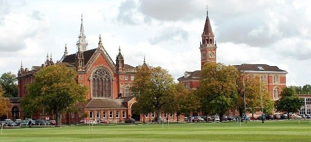
Dulwich (; ) is an area in south London, England. The settlement is mostly in the London Borough of Southwark, with parts in the London Borough of Lambeth, and consists of Dulwich Village, East Dulwich, West Dulwich, and the Southwark half of Herne Hill (which is often referred to as the North Dulwich triangle). Dulwich lies in a valley between the neighbouring districts of Camberwell (to the west), Crystal Palace, Denmark Hill, Forest Hill, Peckham, Sydenham Hill, and Tulse Hill. For the last four centuries Dulwich has been centred on the College of God's Gift, also known as the "Old College", which owned most of the land in the area today known as the Dulwich Estate. The College, founded with educational and charitable aims, established three large independent schools in the 19th century (Dulwich College, Alleyn's School and James Allen's Girls' School). In recent decades four large state secondary schools have opened in the area (The Charter School East Dulwich, The C ... [...More Info...] [...Related Items...] OR: [Wikipedia] [Google] [Baidu] |
A205 Road
The South Circular Road (formally the A205 and often simply called the South Circular) in south London, England, is a major road that runs from the Woolwich Ferry in the east to the Chiswick Flyover in the west via Eltham, Lee Green, Catford, Forest Hill, Dulwich, Tulse Hill, Clapham Common, Clapham Junction, Wandsworth, Putney, Barnes, Mortlake and Kew Bridge. Together with the North Circular Road and Woolwich Ferry, it makes a complete ring-road around Central London and forms the boundary of the Ultra Low Emission Zone. The South Circular is largely a sequence of urban streets joined together, requiring several at-grade turns, unlike the mostly purpose-made carriageways of the North Circular. As a result, it is frequently congested. Originally planned as a new-build route across South London, construction of the first section of the South Circular near Eltham began in 1921 to a high-quality specification. The remainder of the road was supposed to be of a similar standar ... [...More Info...] [...Related Items...] OR: [Wikipedia] [Google] [Baidu] |
South Circular Road, London
The South Circular Road (formally the A205 and often simply called the South Circular) in south London, England, is a major road that runs from the Woolwich Ferry in the east to the Chiswick Flyover in the west via Eltham, Lee Green, Catford, Forest Hill, Dulwich, Tulse Hill, Clapham Common, Clapham Junction, Wandsworth, Putney, Barnes, Mortlake and Kew Bridge. Together with the North Circular Road and Woolwich Ferry, it makes a complete ring-road around Central London and forms the boundary of the Ultra Low Emission Zone. The South Circular is largely a sequence of urban streets joined together, requiring several at-grade turns, unlike the mostly purpose-made carriageways of the North Circular. As a result, it is frequently congested. Originally planned as a new-build route across South London, construction of the first section of the South Circular near Eltham began in 1921 to a high-quality specification. The remainder of the road was supposed to be of a similar standar ... [...More Info...] [...Related Items...] OR: [Wikipedia] [Google] [Baidu] |


