|
A102 Road (Great Britain)
The A102 is a road that starts in Clapton, east London, and ends by merging into the A2 road just south of the Sun in the Sands roundabout in Blackheath, south-east London. The A102 was formerly a continuous route including two motorway sections classified as the A102(M), but road renumbering means that it is separated into two sections linked by the A106 and the A12, one consisting of non-primary urban roads and the other a primary dual carriageway south of the river. The route includes the Blackwall Tunnel. Route North section The A102 starts in Clapton at the junction of Lower Clapton Road and Urswick Road. It runs south along Urswick Road and continues east past 16th century Sutton House and into Homerton High Street. It next turns south and runs along Kenworthy Road and then east into Wick Road for a short distance before the road designation ends at the A106 just to the west of the Hackney Wick interchange with the A12. South section South of the A12/A13 interchang ... [...More Info...] [...Related Items...] OR: [Wikipedia] [Google] [Baidu] |
Millennium Dome
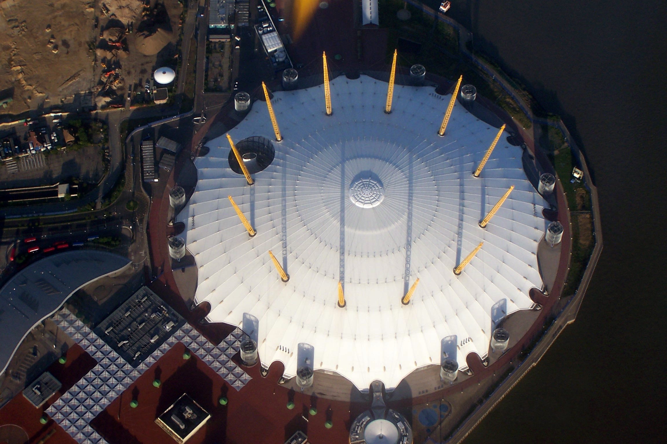
The Millennium Dome was the original name of the large dome-shaped building on the Greenwich Peninsula in South East (London sub region), South East London, England, which housed a major exhibition celebrating the beginning of the third millennium. As of 2022, it is the List of largest buildings#Largest usable volume, ninth largest building in the world by usable volume. The exhibition was open to the public from 1 January to 31 December 2000. The project and exhibition were highly political and attracted barely half of the 12 million customers its sponsors forecasted, and so were deemed a failure by the press. All the original exhibition elements were sold or dismantled. In a 2005 report, the cost of the Dome and surrounding land (which increased to 170 acres from the initial offering of the 48 acres enclosed by the Dome) and managing the Dome until the deal was closed was £28.7 million. The value of the 48 acres occupied by the Dome was estimated at £48 million, which could ... [...More Info...] [...Related Items...] OR: [Wikipedia] [Google] [Baidu] |
River Thames
The River Thames ( ), known alternatively in parts as the The Isis, River Isis, is a river that flows through southern England including London. At , it is the longest river entirely in England and the Longest rivers of the United Kingdom, second-longest in the United Kingdom, after the River Severn. The river rises at Thames Head in Gloucestershire, and flows into the North Sea near Tilbury, Essex and Gravesend, Kent, via the Thames Estuary. From the west it flows through Oxford (where it is sometimes called the Isis), Reading, Berkshire, Reading, Henley-on-Thames and Windsor, Berkshire, Windsor. The Thames also drains the whole of Greater London. In August 2022, the source of the river moved five miles to beyond Somerford Keynes due to the heatwave in July 2022. The lower reaches of the river are called the Tideway, derived from its long tidal reach up to Teddington Lock. Its tidal section includes most of its London stretch and has a rise and fall of . From Oxford to th ... [...More Info...] [...Related Items...] OR: [Wikipedia] [Google] [Baidu] |
Roads In London
A road is a linear way for the conveyance of traffic that mostly has an improved surface for use by vehicles (motorized and non-motorized) and pedestrians. Unlike streets, the main function of roads is transportation. There are many types of roads, including parkways, avenues, controlled-access highways (freeways, motorways, and expressways), tollways, interstates, highways, thoroughfares, and local roads. The primary features of roads include lanes, sidewalks (pavement), roadways (carriageways), medians, shoulders, verges, bike paths (cycle paths), and shared-use paths. Definitions Historically many roads were simply recognizable routes without any formal construction or some maintenance. The Organization for Economic Co-operation and Development (OECD) defines a road as "a line of communication (travelled way) using a stabilized base other than rails or air strips open to public traffic, primarily for the use of road motor vehicles running on their own wheels", which i ... [...More Info...] [...Related Items...] OR: [Wikipedia] [Google] [Baidu] |
Roads In England
The United Kingdom has a network of roads, of varied quality and capacity, totalling about . Road distances are shown in miles or yards and UK speed limits are indicated in miles per hour (mph) or by the use of the national speed limit (NSL) symbol. Some vehicle categories have various lower maximum limits enforced by speed limiters. A unified numbering system is in place for Great Britain, whilst in Northern Ireland, there is no available explanation for the allocation of road numbers. The earliest specifically engineered roads were built during the British Iron Age. The road network was expanded during the Roman occupation. Some of these roads still remain to this day. New roads were added in the Middle Ages and from the 17th century onwards. Whilst control has been transferred between local and central bodies, current management and development of the road network is shared between local authorities, the devolved administrations of Scotland, Wales and Northern Ireland, a ... [...More Info...] [...Related Items...] OR: [Wikipedia] [Google] [Baidu] |
M11 Link Road Protest
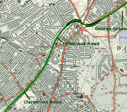
The M11 link road protest was a campaign against the construction of the M11 link road in east London in the early to mid-1990s. "A12 Hackney to M11 link road", as it was officially called, was part of a significant local road scheme to connect traffic from the East Cross Route ( A12) in Hackney Wick to the M11 via Leyton, Leytonstone, Wanstead and the Redbridge Roundabout, avoiding urban streets. The road had been proposed since the 1960s, as part of the London Ringways, and was an important link between central London and the Docklands to East Anglia. However, road protests elsewhere had become increasingly visible, and urban road building had fallen out of favour with the public. A local Member of Parliament Harry Cohen, representing Leyton, had been a vocal opponent of this scheme. The protests reached a new level of visibility during 1993 as part of a grassroots campaign where protesters came from outside the area to support local opposition to the road. The initial f ... [...More Info...] [...Related Items...] OR: [Wikipedia] [Google] [Baidu] |
Leyton
Leyton () is a town in east London, England, within the London Borough of Waltham Forest. It borders Walthamstow to the north, Leytonstone to the east, and Stratford to the south, with Clapton, Hackney Wick and Homerton, across the River Lea, to the west. The area includes New Spitalfields Market, Leyton Orient Football Club, as well as part of the Queen Elizabeth Olympic Park. The town consists largely of terraced houses built between 1870 and 1910, interspersed with some modern housing estates. It is north-east of Charing Cross. It was originally part of the ancient parish of Leyton St Mary in the Becontree hundred and part of historic county of Essex. The town expanded rapidly in the late 19th century, forming part of the conurbation of London and becoming a suburb, similar to much of south-west Essex. It became part of the Metropolitan Police District in 1839 and has been part of the London postal district since its inception in 1856. The parish became an urban dis ... [...More Info...] [...Related Items...] OR: [Wikipedia] [Google] [Baidu] |
Leytonstone
Leytonstone () is an area in east London, England, north-east of Charing Cross. Part of the London Borough of Waltham Forest, a local authority district of Greater London. It adjoins Wanstead to the north-east, Forest Gate to the south-east, Stratford, London, Stratford to the south-west, Leyton to the west, and Walthamstow to the north-west. Historically part of the ancient parish of Municipal Borough of Leyton, Leyton in the Becontree Hundred, Becontree hundred of Essex, the first documented evidence of settlement is from the 14th century, describing a Hamlet_(place), hamlet at ‘Leyton-atte-stone’; a reference to the Milestone#Roman_Empire, Roman milestone located within the area, that formed a northerm boundary of the parish. It remained largely rural until the 19th century, becoming part of the London postal district in 1856, the same year its Leytonstone tube station, railway station was opened (now on the Central line (London Underground), Central line). When Greater ... [...More Info...] [...Related Items...] OR: [Wikipedia] [Google] [Baidu] |
Wanstead
Wanstead () is a town in East London, England, in the London Borough of Redbridge. It borders South Woodford to the north, Redbridge, London, Redbridge to the east and Forest Gate to the south, with Leytonstone and Walthamstow to the west. It is located 8 miles northeast of Charing Cross. Historically an ancient parish in the Becontree Hundred, Becontree hundred of Essex, it was granted Urban district (Great Britain and Ireland), urban district status in 1894, and formed part of the Municipal Borough of Wanstead and Woodford between 1937 and 1965, when it became part of the London Borough of Redbridge. Wanstead was a key part of the M11 link road protest from 1993 to 1995, which ended with the construction of the A12 road (England), A12 that runs through the town. The area contains a number of open spaces that are part of Epping Forest, including the grasslands of Wanstead Flats and the woodland of Wanstead Park. Wanstead Park was the site of Wanstead Roman Villa, a Roman villa ... [...More Info...] [...Related Items...] OR: [Wikipedia] [Google] [Baidu] |
Greater London Council
The Greater London Council (GLC) was the top-tier local government administrative body for Greater London from 1965 to 1986. It replaced the earlier London County Council (LCC) which had covered a much smaller area. The GLC was dissolved in 1986 by the Local Government Act 1985 and its powers were devolved to the London boroughs and other entities. A new administrative body, known as the Greater London Authority (GLA), was established in 2000. Creation The GLC was established by the London Government Act 1963, which sought to create a new body covering more of London rather than just the inner part of the conurbation, additionally including and empowering newly created London boroughs within the overall administrative structure. In 1957 a Royal Commission on Local Government in Greater London had been set up under Edwin Herbert, Baron Tangley, Sir Edwin Herbert, and this reported in 1960, recommending the creation of 52 new London boroughs as the basis for local government. It ... [...More Info...] [...Related Items...] OR: [Wikipedia] [Google] [Baidu] |
London Ringways
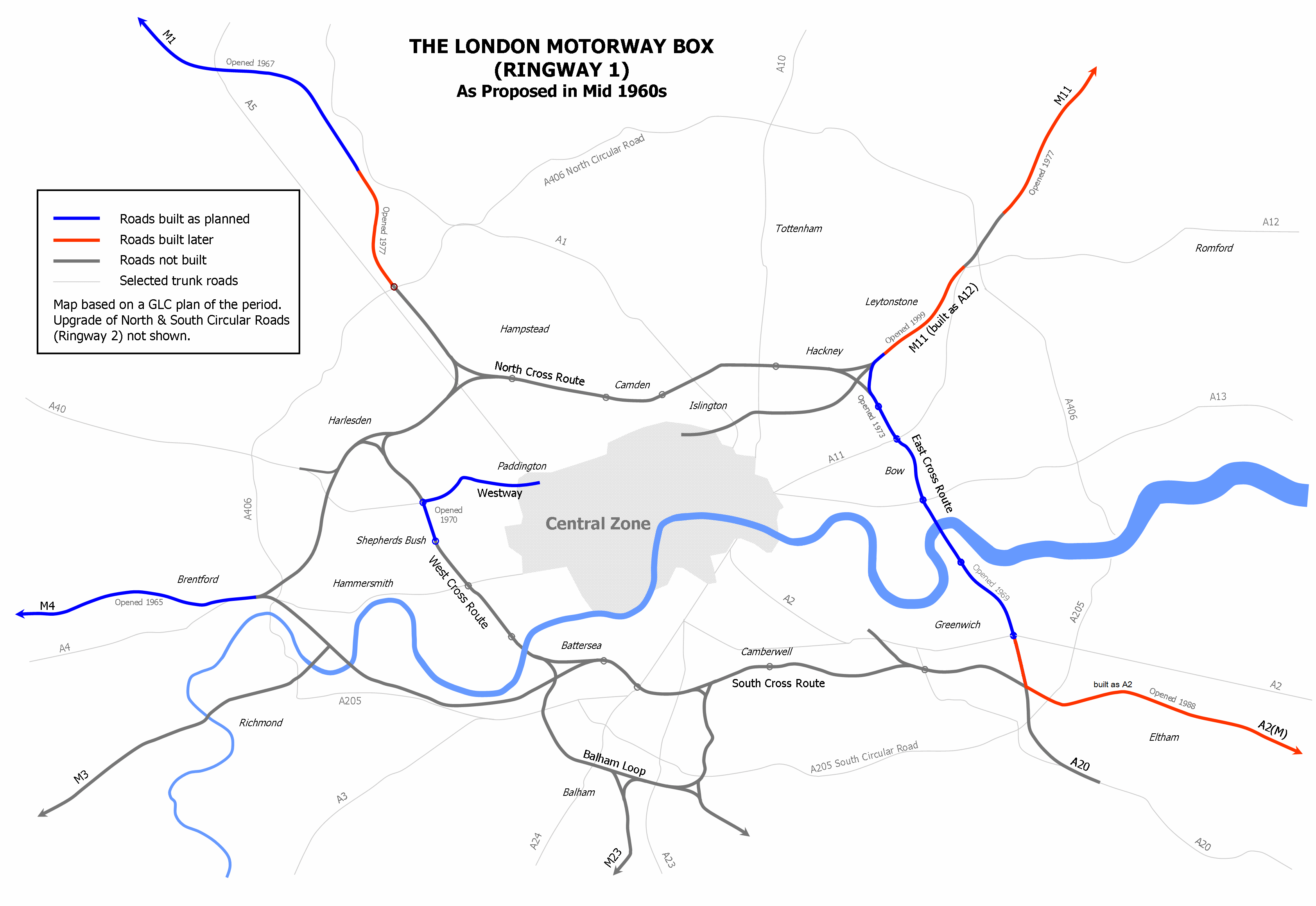
The London Ringways were a series of four ring roads planned in the 1960s to circle London at various distances from the city centre. They were part of a comprehensive scheme developed by the Greater London Council (GLC) to alleviate traffic congestion on the city's road system by providing high speed motorway-standard roads within the capital, linking a series of radial roads taking traffic into and out of the city. There had been plans to construct new roads around London to help traffic since at least the 17th century. Several were built in the early 20th century such as the North Circular Road, Western Avenue and Eastern Avenue, and further plans were put forward in 1937 with ''The Highway Development Survey'', followed by the ''County of London Plan'' in 1943. The Ringways originated from these earlier plans, and consisted of the main four ring roads and other developments. Certain sections were upgrades of existing earlier projects such as the North Circular, but much of ... [...More Info...] [...Related Items...] OR: [Wikipedia] [Google] [Baidu] |
East Cross Route
East Cross Route (ECR) is a dual-carriageway road constructed in east London as part of the uncompleted Ringway 1 as part of the London Ringways plan drawn up the 1960s to create a series of high speed roads circling and radiating out from central London. The road was constructed between 1967 and 1973 and runs from Hackney Wick in north-east London, through the Blackwall Tunnel, to Kidbrooke in south-east London. The ECR was initially designated as part of the A102, but has, subsequently, been partially renumbered so that sections of it are now the A2 and A12. Route At its northern end, the ECR (A12) follows part of the route of the former North London Railway between the closed Victoria Park and Old Ford stations. The railway junction at Victoria Park, where the still open section of the North London Line to Stratford station diverged, was reconstructed to permit the construction of the junction with the non-dual carriageway section of the A102 and the A106 and A115 roa ... [...More Info...] [...Related Items...] OR: [Wikipedia] [Google] [Baidu] |


.jpg)

