|
Ayer Station
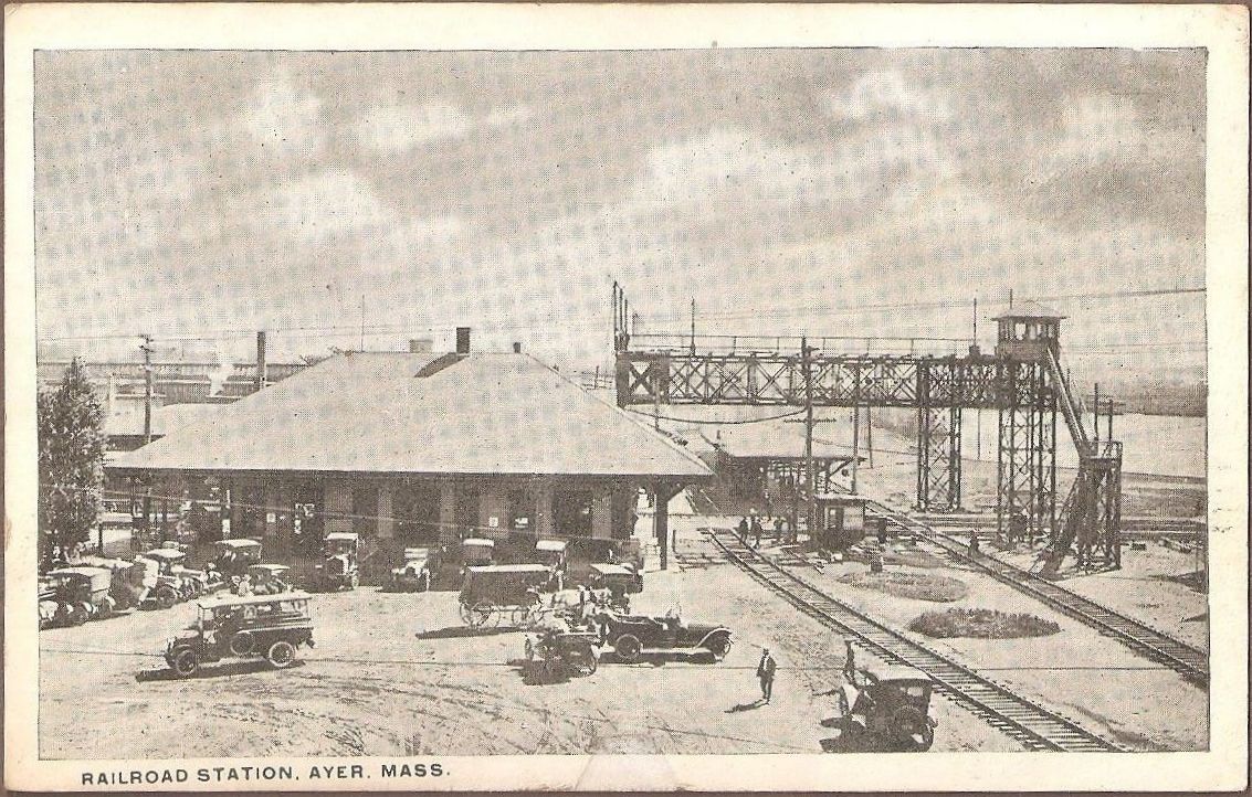
Ayer station is an MBTA Commuter Rail station located off Main Street (Route 2A/ 111) in the Ayer Main Street Historic District of Ayer, Massachusetts. It serves the Fitchburg Line. There are three tracks through the station, two of which are served by a pair of low-level side platforms, which are not accessible. There is a shelter on the inbound platform. Ayer has been a major railroad interchange since the Fitchburg Railroad opened through South Groton in 1845, followed by the Stony Brook Railroad, Worcester and Nashua Railroad, and Peterborough and Shirley Railroad in 1848. The original depot was replaced with a union station with a large trainshed in 1848. Land speculation and industrial development spurred by the railroad access expanded the tiny farm village into the independent town of Ayer. A new station was constructed in 1896. By 1900, the town was served by five lines all controlled by the Boston and Maine Railroad, with service to Boston, Worcester, and Lowell ... [...More Info...] [...Related Items...] OR: [Wikipedia] [Google] [Baidu] |
Ayer, Massachusetts
Ayer () is a New England town, town in Middlesex County, Massachusetts, Middlesex County, Massachusetts, United States. Originally part of Groton, Massachusetts, Groton, it was incorporated February 14, 1871, and became a major commercial railroad junction. The town was home to Camp Stevens, a training camp for Massachusetts volunteers during the American Civil War. Later, Fort Devens was established by the federal government to train New England soldiers for World War I. Fort Devens is a major influence on the area, although it is considerably smaller than when it was first closed in the mid-1990s. The town's population was 8,479 at the 2020 census. History Native American history Ayer was originally inhabited by the Nashaway, a Nipmuc people that inhabited the lands along the Nashua River and its tributaries. A small settlement was located along the banks of the Nonacoicus Brook, located in the western part of the town. The name of the Nashaway village, its people and the brook, ... [...More Info...] [...Related Items...] OR: [Wikipedia] [Google] [Baidu] |
Worcester, Massachusetts
Worcester ( , ) is a city and county seat of Worcester County, Massachusetts, United States. Named after Worcester, England, the city's population was 206,518 at the 2020 United States census, 2020 census, making it the second-List of cities in New England by population, most populous city in New England after Boston. Worcester is approximately west of Boston, east of Springfield, Massachusetts, Springfield and north-northwest of Providence, Rhode Island, Providence. Due to its location near the geographic center of Massachusetts, Worcester is known as the "Heart of the Commonwealth"; a heart is the official symbol of the city. Worcester developed as an industrial city in the 19th century due to the Blackstone Canal and rail transport, producing machinery, textiles and wire. Large numbers of European immigrants made up the city's growing population. However, the city's manufacturing base waned following World War II. Long-term economic and population decline was not reversed ... [...More Info...] [...Related Items...] OR: [Wikipedia] [Google] [Baidu] |
Littleton/Route 495 Station
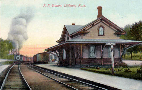
Littleton/Route 495 is an MBTA Commuter Rail station in Littleton, Massachusetts. It serves the Fitchburg Line. The station is located at the intersection of Grimes Lane and Foster Street near Route 2 and I-495 and serves as a park-and-ride station for both highways. A previous station was open at King Street in West Littleton until 1975. Littleton/Route 495 station opened several miles away in 1980 as an inexpensive park-and-ride to gather commuters from the northwest Boston suburbs. In 2011, work began on the construction of a new station, with a full-length handicapped accessible platform and a pedestrian bridge to the parking lot, as part of a larger project to improve the Fitchburg Line. After about 16 months of construction, the new station and pedestrian bridge opened in June 2013. History Littleton Depot The Fitchburg Railroad was extended westward from Cambridge between 1843 and 1845, reaching Littleton around November 1844. Residents at Littleton Common did not like ... [...More Info...] [...Related Items...] OR: [Wikipedia] [Google] [Baidu] |
North Chelmsford, Massachusetts
North Chelmsford is an unincorporated village in the town of Chelmsford, Massachusetts, United States. Although North Chelmsford has its own zip code (01863), library, post office, fire station, water district, and local calling area, it is otherwise run by the same local town government and shares a school district with Chelmsford. North Chelmsford is smaller and more densely populated than neighboring Chelmsford. North Chelmsford's separate identity, though not a seriously debated issue, is still a topic of discussion - the ''Lowell Sun'' ran an article on August 7, 2005 titled "Chelmsford's civil war still raging on." Education Chelmsford High School is located in North Chelmsford. Most students who live in North Chelmsford go to Harrington Elementary School and later, Parker Middle School. Government and infrastructure The Fay A. Rotenberg School, a juvenile correctional facility for girls operated by the Robert F. Kennedy Children's Action Corps, Inc. on behalf of the M ... [...More Info...] [...Related Items...] OR: [Wikipedia] [Google] [Baidu] |
Groton, Massachusetts
Groton is a town in northwestern Middlesex County, Massachusetts, United States, within the Greater Boston metropolitan area. The population was 11,315 at the 2020 census. It is home to two prep schools: Lawrence Academy at Groton, founded in 1792 and the third-oldest private school in Massachusetts; and Groton School, founded in 1884. The town was a battlefield in King Philip's War and Queen Anne's War, as England and France competed through their North American colonies from the 17th century well into the 18th century. It was the birthplace of William Prescott, who commanded the colonial forces at the Battle of Bunker Hill during the American Revolution. In postwar years, it had incidents of insurrection during Shays' Rebellion (1786–1787). History The area surrounding modern-day Groton has, for thousands of years, been the territory of various cultures of indigenous peoples. They settled along the rivers, which they used for domestic tasks, fishing and transportation. His ... [...More Info...] [...Related Items...] OR: [Wikipedia] [Google] [Baidu] |
1889 Ayer Map, Station Detail
Events January–March * January 1 ** The total solar eclipse of January 1, 1889 is seen over parts of California and Nevada. ** Paiute spiritual leader Wovoka experiences a vision, leading to the start of the Ghost Dance movement in the Dakotas. * January 4 – An Act to Regulate Appointments in the Marine Hospital Service of the United States is signed by President Grover Cleveland. It establishes a Commissioned Corps of officers, as a predecessor to the modern-day U.S. Public Health Service Commissioned Corps. * January 5 – Preston North End F.C. is declared the winner of the inaugural Football League in England. * January 8 – Herman Hollerith receives a patent for his electric tabulating machine in the United States. * January 15 – The Coca-Cola Company is originally incorporated as the Pemberton Medicine Company in Atlanta, Georgia. * January 22 – Columbia Phonograph is formed in Washington, D.C. * January 30 – Rudolf, Crown Prince of Austria and his m ... [...More Info...] [...Related Items...] OR: [Wikipedia] [Google] [Baidu] |
Passing Loop
A passing loop (UK usage) or passing siding (North America) (also called a crossing loop, crossing place, refuge loop or, colloquially, a hole) is a place on a single line railway or tramway, often located at or near a station, where trains or trams travelling in opposite directions can pass each other. Trains/trams going in the same direction can also overtake, provided that the signalling arrangement allows it. A passing loop is double-ended and connected to the main track at both ends, though a dead end siding known as a refuge siding, which is much less convenient, can be used. A similar arrangement is used on the gauntlet track of cable railways and funiculars, and in passing places on single-track roads. Ideally, the loop should be longer than all trains needing to cross at that point. Unless the loop is of sufficient length to be dynamic, the first train to arrive must stop or move very slowly, while the second to arrive may pass at speed. If one train is too long for ... [...More Info...] [...Related Items...] OR: [Wikipedia] [Google] [Baidu] |
Wye (rail)
In railroad structures, and rail terminology, a wye (like the'' 'Y' ''glyph) or triangular junction (often shortened to just "triangle") is a triangular joining arrangement of three rail lines with a railroad switch (set of points) at each corner connecting to each incoming line. A turning wye is a specific case. Where two rail lines join, or in a joint between a railroad's mainline and a spur, wyes can be used at a mainline rail junction to allow incoming trains the ability to travel in either direction, or in order to allow trains to pass from one line to the other line. Wyes can also be used for turning railway equipment, and generally cover less area than a balloon loop doing the same job, but at the cost of two additional sets of points to construct, then maintain. These turnings are accomplished by performing the railway equivalent of a three-point turn through successive junctions of the wye, the direction of travel and the relative orientation of a locomotive or rai ... [...More Info...] [...Related Items...] OR: [Wikipedia] [Google] [Baidu] |
Accessible
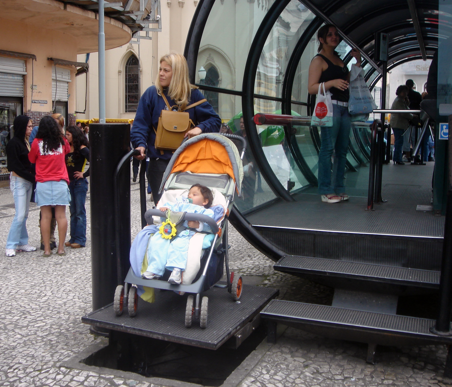
Accessibility is the design of products, devices, services, vehicles, or environments so as to be usable by people with disabilities. The concept of accessible design and practice of accessible development ensures both "direct access" (i.e. unassisted) and "indirect access" meaning compatibility with a person's assistive technology (for example, computer screen readers). Accessibility can be viewed as the "ability to access" and benefit from some system or entity. The concept focuses on enabling access for people with disabilities, or enabling access through the use of assistive technology; however, research and development in accessibility brings benefits to everyone. Accessibility is not to be confused with usability, which is the extent to which a product (such as a device, service, or environment) can be used by specified users to achieve specified goals with effectiveness, efficiency, convenience, or satisfaction in a specified context of use. Accessibility is also s ... [...More Info...] [...Related Items...] OR: [Wikipedia] [Google] [Baidu] |
Side Platforms
A side platform (also known as a marginal platform or a single-face platform) is a platform positioned to the side of one or more railway tracks or guideways at a railway station, tram stop, or transitway. A station having dual side platforms, one for each direction of travel, is the basic design used for double-track railway lines (as opposed to, for instance, the island platform where a single platform lies between the tracks). Side platforms may result in a wider overall footprint for the station compared with an island platform where a single width of platform can be shared by riders using either track. In some stations, the two side platforms are connected by a footbridge running above and over the tracks. While a pair of side platforms is often provided on a dual-track line, a single side platform is usually sufficient for a single-track line. Layout Where the station is close to a level crossing (grade crossing) the platforms may either be on the same side of the cross ... [...More Info...] [...Related Items...] OR: [Wikipedia] [Google] [Baidu] |
Ayer Station From Main Street Bridge, July 2021
Ayer may refer to: Places * Ayer, Massachusetts, United States ** Ayer (CDP), Massachusetts, the central village in the town of Ayer ** Ayer (MBTA station), commuter rail station * Aller, Asturias, a municipality in Spain known in Asturian as Ayer * Ayer, Switzerland, a municipality in the Val d'Anniviers, canton of Valais People *Ayer (surname) * Iyer (also spelled Ayer or Ayyar), a Hindu Brahmin community from India Music * "Ayer" (Enrique Iglesias song), a song by Enrique Iglesias * "Ayer" (Gloria Estefan song), by singer-songwriter Gloria Estefan * "Ayer" (Luis Miguel song), 1993 song by Luis Miguel * "Ayer", 1992 song by Juan Luis Guerra and 440 from the album ''Areíto ''Areíto'' or ''areyto'' was a Taíno language word adopted by the Spanish colonizers to describe a type of religious song and dance performed by the Taíno people of the Caribbean. The areíto was a ceremonial act that was believed to narrate an ...'' * " In the Ayer" by rappers Flo Rida, Tiffany Vi ... [...More Info...] [...Related Items...] OR: [Wikipedia] [Google] [Baidu] |
Park-and-ride
A park and ride, also known as incentive parking or a commuter lot, is a parking lot with public transport connections that allows commuters and other people heading to city centres to leave their vehicles and transfer to a bus, rail system (rapid transit, light rail, or commuter rail), or carpool for the remainder of the journey. The vehicle is left in the parking lot during the day and retrieved when the owner returns. Park and rides are generally located in the suburbs of metropolitan areas or on the outer edges of large cities. A park and ride that only offers parking for meeting a carpool and not connections to public transport may also be called a park and pool. Park and ride is abbreviated as "P+R" on road signs in some countries, and is often styled as "Park & Ride" in marketing. Adoption In Sweden, a tax has been introduced on the benefit of free or cheap parking paid by an employer, if workers would otherwise have to pay. The tax has reduced the number of workers driv ... [...More Info...] [...Related Items...] OR: [Wikipedia] [Google] [Baidu] |


.jpg)

