|
Australian Mangroves
Australia has approximately 11,500 km2 of mangroves, primarily on the northern and eastern coasts of the continent. Areas where mangroves occur include the intertidal zone of tropical, subtropical and protected temperate coastal rivers, estuaries, bays and marine shorelines. Less than 1% of Australia's total forest area is mangrove forest. Although mangroves are typically found in tropical and subtropical tidal areas,Mangal (Mangrove). ''World Vegetation''. Mildred E. Mathias Botanical Garden, University of California at Los Angeles there are occurrences as far south as Millers Landing in |
Australasian Realm
The Australasian realm is a biogeographic realm that is coincident with, but not (by some definitions) the same as, the geographical region of Australasia. The realm includes Australia, the island of New Guinea (comprising Papua New Guinea and the Indonesian province of Papua), and the eastern part of the Indonesian archipelago, including the island of Sulawesi, the Moluccan islands (the Indonesian provinces of Maluku and North Maluku), and the islands of Lombok, Sumbawa, Sumba, Flores, and Timor, often known as the Lesser Sundas. The Australasian realm also includes several Pacific island groups, including the Bismarck Archipelago, Vanuatu, the Solomon Islands, and New Caledonia. New Zealand and its surrounding islands are a distinctive sub-region of the Australasian realm. The rest of Indonesia is part of the Indomalayan realm. In the classification scheme developed by Miklos Udvardy, New Guinea, New Caledonia, Solomon Islands and New Zealand are placed in the Oceania ... [...More Info...] [...Related Items...] OR: [Wikipedia] [Google] [Baidu] |
Barker Inlet
The Barker Inlet is a tidal inlet of the Gulf St Vincent in Adelaide, South Australia, named after Captain Collet Barker who first sighted it in 1831. It contains one of the southernmost mangrove forests in the world, a dolphin sanctuary, seagrass meadows and is an important fish and shellfish breeding ground. The inlet separates Torrens Island and Garden Island from the mainland to the east, and is characterised by a network of tidal creeks, artificially deepened channels, and wide mudflats. The extensive belt of mangroves are bordered by samphire saltmarsh flats and low-lying sand dunes. There are two boardwalks (at Garden Island and St Kilda), and ships graveyards in Broad Creek, Angas Inlet and the North Arm (which is just south of North Arm Creek). The Eastern Passage runs between Garden Island and the mainland, narrowing to form Angas Channel north of North Arm Creek. The inlet has been adversely impacted since the settlement of South Australia, with stormwater and raw ... [...More Info...] [...Related Items...] OR: [Wikipedia] [Google] [Baidu] |
Epiphyte
An epiphyte is an organism that grows on the surface of a plant and derives its moisture and nutrients from the air, rain, water (in marine environments) or from debris accumulating around it. The plants on which epiphytes grow are called phorophytes. Epiphytes take part in nutrient cycles and add to both the diversity and biomass of the ecosystem in which they occur, like any other organism. They are an important source of food for many species. Typically, the older parts of a plant will have more epiphytes growing on them. Epiphytes differ from parasites in that they grow on other plants for physical support and do not necessarily affect the host negatively. An organism that grows on another organism that is not a plant may be called an epibiont. Epiphytes are usually found in the temperate zone (e.g., many mosses, liverworts, lichens, and algae) or in the tropics (e.g., many ferns, cacti, orchids, and bromeliads). Epiphyte species make good houseplants due to their minimal wat ... [...More Info...] [...Related Items...] OR: [Wikipedia] [Google] [Baidu] |
Acrostichum Speciosum
''Acrostichum speciosum'', the mangrove fern is a widespread plant found in Asia, Malesia and Australia. A clumping plant to 1.5 metres tall with reddish/brown fertile fronds and pointed leaf tips. It is found as far south as New South Wales. It may be seen on coastal cliffs, but is usually seen in tidal flats, brackish swamps and with mangroves. The specific epithet ''speciosum'' refers to the attractive form of the plant. It first appeared in scientific literature in the year 1810, published in the Species Plantarum by Carl Ludwig Willdenow. It is now placed in the Parkerioideae subfamily of the family Pteridaceae Pteridaceae is a family of ferns in the order Polypodiales, including some 1150 known species in ca 45 genera (depending on taxonomic opinions), divided over five subfamilies. The family includes four groups of genera that are sometimes recogni .... References Pteridaceae Flora of New South Wales Flora of Queensland Flora of Western Australia Flora o ... [...More Info...] [...Related Items...] OR: [Wikipedia] [Google] [Baidu] |
Nypa Fruticans
''Nypa fruticans'', commonly known as the nipa palm (or simply nipa, from ms, nipah) or mangrove palm, is a species of palm native to the coastlines and estuarine habitats of the Indian and Pacific Oceans. It is the only palm considered adapted to the mangrove biome. The genus ''Nypa'' and the subfamily Nypoideae are monotypic taxa because this species is their only member. Description Unlike most palms, the nipa palm's trunk grows beneath the ground; only the leaves and flower stalk grow upwards above the surface. The leaves extend up to in height. The flowers are a globular inflorescence of female flowers at the tip with catkin-like red or yellow male flowers on the lower branches. The flower produces woody nuts arranged in a globular cluster up to across on a single stalk. The ripe nuts separate from the ball and float away on the tide, occasionally germinating while still water-borne. Fossil record While only one species of ''Nypa'' now exists, ''N. fruticans'', w ... [...More Info...] [...Related Items...] OR: [Wikipedia] [Google] [Baidu] |
Avicennia Marina
''Avicennia marina'', commonly known as grey mangrove or white mangrove, is a species of mangrove tree classified in the plant family Acanthaceae (formerly in the Verbenaceae or Avicenniaceae). As with other mangroves, it occurs in the intertidal zones of estuarine areas. Description Grey mangroves grow as a shrub or tree to a height of , or up to in tropical regions. The habit is a gnarled arrangement of multiple branches. It has smooth light-grey bark made up of thin, stiff, brittle flakes. This may be whitish, a characteristic described in the common name. The leaves are thick, long, a bright, glossy green on the upper surface, and silvery-white, or grey, with very small matted hairs on the surface below. As with other ''Avicennia'' species, it has aerial roots (pneumatophores); these grow to a height of about , and a diameter of . These allow the plant to absorb oxygen, which is deficient in its habitat. These roots also anchor the plant during the frequent inundation o ... [...More Info...] [...Related Items...] OR: [Wikipedia] [Google] [Baidu] |
Mangrove And Pneumatophores In Moreton Bay, Qld
A mangrove is a shrub or tree that grows in coastal saline or brackish water. The term is also used for tropical coastal vegetation consisting of such species. Mangroves are taxonomically diverse, as a result of convergent evolution in several plant families. They occur worldwide in the tropics and subtropics and even some temperate coastal areas, mainly between latitudes 30° N and 30° S, with the greatest mangrove area within 5° of the equator. Mangrove plant families first appeared during the Late Cretaceous to Paleocene epochs, and became widely distributed in part due to the movement of tectonic plates. The oldest known fossils of mangrove palm date to 75 million years ago. Mangroves are salt-tolerant trees, also called halophytes, and are adapted to live in harsh coastal conditions. They contain a complex salt filtration system and a complex root system to cope with saltwater immersion and wave action. They are adapted to the low-oxygen conditions of water ... [...More Info...] [...Related Items...] OR: [Wikipedia] [Google] [Baidu] |
Mandora Marsh
Mandora Marsh, also known as Mandora Salt Marsh, is a complex and diverse wetland system in Western Australia close to Eighty Mile Beach, and included in the Eighty Mile Beach Ramsar Site. It lies at the western edge of the Great Sandy Desert bioregion and within the Mandora Station pastoral lease. The marsh is part of the 3337 km2 Mandora Marsh and Anna Plains Important Bird Area, identified as such by BirdLife International because of its importance for supporting large numbers of waders and waterbirds. Description Mandora Marsh has formed over thousands of years on what used to be the lower reaches and estuary of an ancient river. The main features are two large lakes which are flooded after heavy cyclonic rainfall. The westernmost Lake Walyarta is a claypan that extends eastwards about 30 km from the inland side of the Great Northern Highway. Although its width may reach 5 km, the depth of water never exceeds 2 m. The eastern lake is separated from Wal ... [...More Info...] [...Related Items...] OR: [Wikipedia] [Google] [Baidu] |
University Of Western Australia
The University of Western Australia (UWA) is a public research university in the Australian state of Western Australia. The university's main campus is in Perth, the state capital, with a secondary campus in Albany, Western Australia, Albany and various other facilities elsewhere. UWA was established in 1911 by an act of the Parliament of Western Australia and began teaching students two years later. It is the sixth-oldest university in Australia and was Western Australia's only university until the establishment of Murdoch University in 1973. Because of its age and reputation, UWA is classed one of the "sandstone universities", an informal designation given to the oldest university in each state. The university also belongs to several more formal groupings, including the Group of Eight (Australian universities), Group of Eight and the Matariki Network of Universities. In recent years, UWA has generally been ranked either in the bottom half or just outside the University rankings ... [...More Info...] [...Related Items...] OR: [Wikipedia] [Google] [Baidu] |
Leeuwin Current
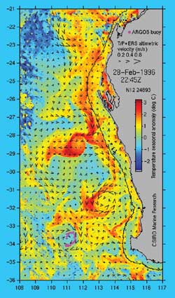
The Leeuwin Current is a warm ocean current which flows southwards near the western coast of Australia. It rounds Cape Leeuwin to enter the waters south of Australia where its influence extends as far as Tasmania. Discovery The existence of the current was first suggested by William Saville-Kent in 1897. Saville-Kent noted the presence of warm tropical water offshore in the Houtman Abrolhos, making the water there in winter much warmer than inshore at the adjacent coast. The existence of the current was confirmed over the years, but not characterised and named until Cresswell and Golding did so in the 1980s. Track The West Australian Current and Southern Australian Countercurrent, which are produced by the West Wind Drift on the southern Indian Ocean and at Tasmania, respectively, flow in the opposite direction, producing one of the most interesting oceanic current systems in the world. The ‘core’ of the Leeuwin Current can generally be detected as a peak in the surface te ... [...More Info...] [...Related Items...] OR: [Wikipedia] [Google] [Baidu] |
Propagule
In biology, a propagule is any material that functions in propagating an organism to the next stage in its life cycle, such as by dispersal. The propagule is usually distinct in form from the parent organism. Propagules are produced by organisms such as plants (in the form of seeds or spores), fungi (in the form of spores), and bacteria (for example endospores or microbial cysts). In disease biology, pathogens are said to generate infectious propagules, the units that transmit a disease. These can refer to bacteria, viruses, fungi, or protists, and can be contained within host material. For instance, for influenza, the infectious propagules are carried in droplets of host saliva or mucus that are expelled during coughing or sneezing. In horticulture, a propagule is any plant material used for the purpose of plant propagation. In asexual reproduction, a propagule is often a stem cutting. In some plants, a leaf section or a portion of root can be used. In sexual reproduction, a ... [...More Info...] [...Related Items...] OR: [Wikipedia] [Google] [Baidu] |
Shark Bay
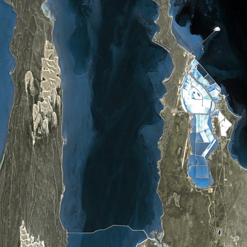
Shark Bay (Malgana: ''Gathaagudu'', "two waters") is a World Heritage Site in the Gascoyne region of Western Australia. The http://www.environment.gov.au/heritage/places/world/shark-bay area is located approximately north of Perth, on the westernmost point of the Australian continent. UNESCO's official listing of Shark Bay as a World Heritage Site reads: : History The record of Australian Aboriginal occupation of Shark Bay extends to years BP. At that time most of the area was dry land, rising sea levels flooding Shark Bay between BP and BP. A considerable number of aboriginal midden sites have been found, especially on Peron Peninsula and Dirk Hartog Island which provide evidence of some of the foods gathered from the waters and nearby land areas. An expedition led by Dirk Hartog happened upon the area in 1616, becoming the second group of Europeans known to have visited Australia. (The crew of the ''Duyfken'', under Willem Janszoon, had visited Cape York in 1606). ... [...More Info...] [...Related Items...] OR: [Wikipedia] [Google] [Baidu] |


