|
Atlantic 85-class Lifeboat
The Atlantic 85 is part of the B-class of lifeboats that serve the shores of the United Kingdom and Ireland as a part of the RNLI inshore fleet. The Atlantic 85 is the third generation B-class Rigid Inflatable Boat (RIB) developed from the and the later . The Atlantic design of the B-class of lifeboats is named after Atlantic College, where the design was originally developed. Design The hull is constructed in a fibre reinforced composite, consisting of a carbon fibre and foam core laminate with an epoxy glass and foam sandwich layup. The tubes are Hypalon. The boat is powered by twin Yamaha 4-stroke outboard engines that have been inversion-proofed to ensure the engines are still operational after a capsize. Like previous RIBs, it has a manually operated self-righting mechanism that deploys an airbag mounted atop the A-frame. It is capable of being beached in an emergency without sustaining damage to engines or steering gear. The Atlantic 85 is fitted with radar and VHF d ... [...More Info...] [...Related Items...] OR: [Wikipedia] [Google] [Baidu] |
Cowes
Cowes () is an English seaport town and civil parish on the Isle of Wight. Cowes is located on the west bank of the estuary of the River Medina, facing the smaller town of East Cowes on the east bank. The two towns are linked by the Cowes Floating Bridge, a chain ferry. As of 2020 it had an estimated population of 14,724. Charles Godfrey Leland's 19th-century verses describe the towns poetically as "The two great Cowes that in loud thunder roar/This on the eastern, that the western shore". Cowes has been seen as a home for international yacht racing since the founding of the Royal Yacht Squadron in 1815. It gives its name to the world's oldest regular regatta, Cowes Week, which occurs annually in the first week of August. Later, powerboat races are held. Much of the town's architecture is still heavily influenced by the style of ornate building that Prince Albert popularised. History Name The name ''Westcowe'' was attested in 1413 as the name of one of two sandbanks, o ... [...More Info...] [...Related Items...] OR: [Wikipedia] [Google] [Baidu] |
Chartplotter
A Chartplotter is a device used in marine navigation that integrates GPS data with an electronic navigational chart (ENC). The chartplotter displays the ENC along with the position, heading and speed of the ship, and may display additional information from radar, automatic information systems (AIS) or other sensors. As appropriate to particular marine applications, chartplotters may also display data from other sensors, such as echolocators or sonar. Technology Electronic chartplotters are by nature CPU (and GPU) intensive applications. Chartplotters need to retrieve the Navigation Signal (Galileo, GPS, GLONASS, WAAS etc.) and overlay that on a map. Map updates on dedicated hardware typically have screen refresh rates from 5 Hz to 30 Hz. Some navigation software can run on standard computers (and mobile phones, etc.) but most higher end systems are dedicated hardware. Especially when the chartplotter generates three-dimensional displays, as used for fishing, conside ... [...More Info...] [...Related Items...] OR: [Wikipedia] [Google] [Baidu] |
Talus MB-4H Amphibious Tractor
Talus MB-4H is a four-wheel-drive launch tractor which was specifically designed for the RNLI, to launch and recover inshore lifeboats from beach launched lifeboat stations. The tractor is produced by the British company of Clayton Engineering Limited who are based in Knighton, Powys.OS Explorer Map 201 - Knighton and Presteigne Tref-y-clawdd a Dyffryn Elan, Author: Ordnance Survey. Publisher: Ordnance Survey. Work: Folded Map. The tractor plays an important role within the operations required for saving lives at sea. RNLI Talus MB-4H Fleet See also * Talus MB-H Launch tractor * Talus MB-764 Launch tractor * TC45 launch tractor * Talus Atlantic 85 DO-DO launch carriage The Talus Atlantic 85 DO-DO launch carriage is a Drive On - Drive Off lifeboat launch and recovery carriage used by the RNLI to launch its Atlantic class inshore lifeboats. Design The design is by Clayton Engineering Limited, who worked with ... References {{reflist, 2 Royal National Lifeboa ... [...More Info...] [...Related Items...] OR: [Wikipedia] [Google] [Baidu] |
E-class Lifeboat
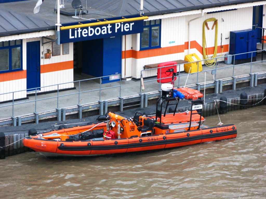
The E-class lifeboat forms part of the RNLI fleet in the United Kingdom, operating exclusively in the tidal reach of the River Thames in London. The class was introduced in 2002 to serve the tidal reach of the River Thames, which had not previously been covered by an RNLI rescue service, as a result of a much delayed enquiry into the Marchioness disaster in 1989, in which 51 people died. The enquiry criticised the lack of a rescue service for the tidal Thames, and the UK government asked the Maritime and Coastguard Agency, the Port of London Authority and the RNLI to work together to set up a dedicated Search and Rescue service for this stretch of the river. There are two different versions of the E-class, described as the mark I and mark II. The original intention was that the mark II boats would replace the mark Is, but building of the last two mark Is has been put on hold and there are currently two mark Is and three mark IIs in use, split between Chiswick Lifeboat Station t ... [...More Info...] [...Related Items...] OR: [Wikipedia] [Google] [Baidu] |
RNLI B Class Atlantic 85 Lifeboat, Poole, England Arp
The Royal National Lifeboat Institution (RNLI) is the largest charity that saves lives at sea around the coasts of the United Kingdom, the Republic of Ireland, the Channel Islands, and the Isle of Man, as well as on some inland waterways. It is one of several lifeboat services operating in the same area. Founded in 1824 as the National Institution for the Preservation of Life from Shipwreck, soon afterwards becoming the Royal National Institution for the Preservation of Life from Shipwreck, under the patronage of King George IV. On 5 October 1854, the institution’s name was changed to its current name (RNLI), and in 1860 was granted a royal charter. The RNLI is a charity in the UK and in the Republic of Ireland and has enjoyed royal patronage since its foundation, the most recent being Queen Elizabeth II until her death on 8 September 2022. The RNLI is principally funded by legacies (65%) and donations (28%), with the remainder from merchandising and investment. Most of th ... [...More Info...] [...Related Items...] OR: [Wikipedia] [Google] [Baidu] |
Porthcawl Atlantic 85 - B832
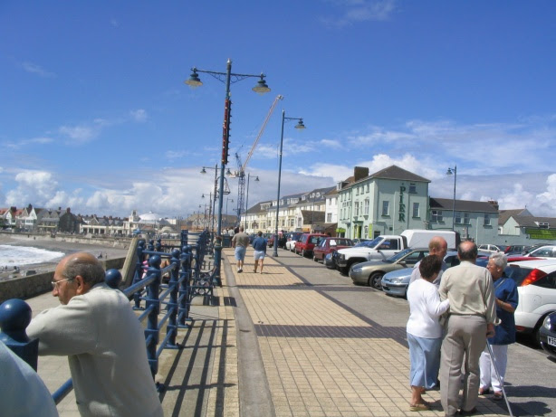
Porthcawl (, ) is a town and community on the south coast of Wales in the county borough of Bridgend, west of the capital city, Cardiff and southeast of Swansea. Historically part of Glamorgan and situated on a low limestone headland on the South Wales coast, overlooking the Bristol Channel, Porthcawl developed as a coal port during the 19th century, but its trade was soon taken over by more rapidly developing ports such as Barry. Northwest of the town, in the dunes known as Kenfig Burrows, are hidden the last remnants of the town and Kenfig Castle, which were overwhelmed by sand about 1400. Toponymy is a common Welsh element meaning "harbour" and the ' here refers to "sea kale", which must have grown in profusion or even been collected here. Local folk etymology holds the ''cawl'' to be a corruption of ''Gaul'', and that the area was an ancient landing point for Gaulish and Breton, or later Frankish and Norman knights. Holiday resort Porthcawl is a holiday resort in So ... [...More Info...] [...Related Items...] OR: [Wikipedia] [Google] [Baidu] |
Porthcawl Atlantic 85 Hard Left - B832
Porthcawl (, ) is a town and community on the south coast of Wales in the county borough of Bridgend, west of the capital city, Cardiff and southeast of Swansea. Historically part of Glamorgan and situated on a low limestone headland on the South Wales coast, overlooking the Bristol Channel, Porthcawl developed as a coal port during the 19th century, but its trade was soon taken over by more rapidly developing ports such as Barry. Northwest of the town, in the dunes known as Kenfig Burrows, are hidden the last remnants of the town and Kenfig Castle, which were overwhelmed by sand about 1400. Toponymy is a common Welsh element meaning "harbour" and the ' here refers to "sea kale", which must have grown in profusion or even been collected here. Local folk etymology holds the ''cawl'' to be a corruption of ''Gaul'', and that the area was an ancient landing point for Gaulish and Breton, or later Frankish and Norman knights. Holiday resort Porthcawl is a holiday resort in South W ... [...More Info...] [...Related Items...] OR: [Wikipedia] [Google] [Baidu] |
Jesse Hilliard - B805
Jesse may refer to: People and fictional characters * Jesse (biblical figure), father of David in the Bible. * Jesse (given name), including a list of people and fictional characters * Jesse (surname), a list of people Music * ''Jesse'' (album), a 2003 album by Jesse Powell * "Jesse", a 1973 song by Roberta Flack - see Roberta Flack discography * "Jesse", a song from the album ''Valotte'' by Julian Lennon * "Jesse", a song from the album ''The People Tree'' by Mother Earth * "Jesse" (Carly Simon song), a 1980 song * "Jesse", a song from the album ''The Drift'' by Scott Walker * "Jesse", a song from the album '' If I Were Your Woman'' by Stephanie Mills Other * ''Jesse'' (film), a 1988 American television film * ''Jesse'' (TV series), a sitcom starring Christina Applegate * ''Jesse'' (novel), a 1994 novel by Gary Soto * ''Jesse'' (picture book), a 1988 children's book by Tim Winton * Jesse, West Virginia, an unincorporated community * Jesse Hall, University of Missouri ... [...More Info...] [...Related Items...] OR: [Wikipedia] [Google] [Baidu] |
Atlantic 85 Controls (B805)
The Atlantic Ocean is the second-largest of the world's five oceans, with an area of about . It covers approximately 20% of Earth's surface and about 29% of its water surface area. It is known to separate the "Old World" of Africa, Europe and Asia from the "New World" of the Americas in the European perception of the World. The Atlantic Ocean occupies an elongated, S-shaped basin extending longitudinally between Europe and Africa to the east, and North and South America to the west. As one component of the interconnected World Ocean, it is connected in the north to the Arctic Ocean, to the Pacific Ocean in the southwest, the Indian Ocean in the southeast, and the Southern Ocean in the south (other definitions describe the Atlantic as extending southward to Antarctica). The Atlantic Ocean is divided in two parts, by the Equatorial Counter Current, with the North(ern) Atlantic Ocean and the South(ern) Atlantic Ocean split at about 8°N. Scientific explorations of the Atlantic ... [...More Info...] [...Related Items...] OR: [Wikipedia] [Google] [Baidu] |
DGPS
Differential Global Positioning Systems (DGPSs) supplement and enhance the positional data available from global navigation satellite systems (GNSSs). A DGPS for GPS can increase accuracy by about a thousandfold, from approximately to . DGPSs consist of networks of fixed position, ground-based reference stations. Each reference station calculates the difference between its highly accurate known position and its less accurate satellite-derived position. The stations broadcast this data locally—typically using ground-based transmitters of shorter range. Non-fixed (mobile) receivers use it to correct their position by the same amount, thereby improving their accuracy. The United States Coast Guard (USCG) and the Canadian Coast Guard (CCG) each run DGPSs in the United States and Canada on longwave radio frequencies between and near major waterways and harbors. The USCG's DGPS was named NDGPS (Nationwide DGPS) and was jointly administered by the Coast Guard and the U.S. Departmen ... [...More Info...] [...Related Items...] OR: [Wikipedia] [Google] [Baidu] |
_(LOC)_(16333616919).jpg)
.jpg)


