|
Alimineti Madhava Reddy Project
Alimineti Madhava Reddy Project earlier known as Srisailam Left Bank Canal is an irrigation project located in Nalgonda district in Telangana, India. History This Project has two following alternatives * Lift scheme from foreshore of Nagarjuna Sagar Reservoir: This scheme is completed by 2004 and 300,000 acres of land is under irrigation. * Gravity scheme from foreshore of Srisailam reservoir, through two tunnels: This alternative to eliminate water pumping was taken up in 2004 and was scheduled for completion in 2010 but was delayed inordinately. Project Water is fed from the Puttamgandi foreshore pump house located at in to the nearby Puttamgandi tank from Nagarjuna Sagar reservoir. The pump house has ultimate capacity of five pumps each of 600 cusecs pumping capacity. Water is supplied from the Puttamgandi tank by gravity to the entire irrigated area of the project via balancing reservoir called Akkampalli reservoir with 1.5 tmcft storage capacity. From Akkampalli reservoi ... [...More Info...] [...Related Items...] OR: [Wikipedia] [Google] [Baidu] |
Nalgonda District
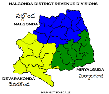
Nalgonda district is a district in the Telangana state of India. Nalgonda district has the highest number of mandals in the state with 31 mandals. The district shares boundaries with Suryapet, Rangareddy, Yadadri and Nagarkurnool districts and with the state boundary of Andhra Pradesh. Etymology Nalgonda is derived from two Telugu words Nalla (Black) & Konda (Hills) i.e. ''Black Hills''. History Nalgonda was earlier referred to as Neelagiri, the name given by some local rulers and the name was changed to ''Nallagonda'' only after its conquest by Allauddin Bahaman Shah, the founder of Bahmani Sultanate . The district had a major role in the Telangana Rebellion. Geography The district is spread over an area of . Demographics Census of India, the district has a population of 1,618,416. According to the 2011 census, 81.75% of the population spoke Telugu, 11.91% Lambadi and 5.51% Urdu as their first language. The Krishna River, Musi River, Aleru, Peddav ... [...More Info...] [...Related Items...] OR: [Wikipedia] [Google] [Baidu] |
Nagarjuna Sagar Dam
Nagarjuna Sagar Dam is a masonry dam across the Krishna River at Nagarjuna Sagar which straddles the border between Nalgonda district in Telangana and Palnadu district in Andhra Pradesh. The dam provides irrigation water to the Nalgonda, Suryapet, Krishna, NTR, Bapatla, Eluru, Palnadu, Khammam, West Godavari, Guntur, and Prakasam districts along with electricity generation. Constructed between 1955 and 1967, the dam created a water reservoir with gross storage capacity of , its effective capacity is 6.92 cubic kms or 244.41 Tmcft. The dam is tall from its deepest foundation and long with 26 flood gates which are wide and tall. It is jointly operated by Andhra Pradesh and Telangana. Nagarjuna Sagar Dam was the earliest in a series of large infrastructure projects termed as "modern temples" initiated for achieving the Green Revolution in India. It is also one of the earliest multi-purpose irrigation and hydroelectric projects in India. History The Nizam made the Brit ... [...More Info...] [...Related Items...] OR: [Wikipedia] [Google] [Baidu] |
Tmcft
Tmcft, (Tmc ft), (TMC), (tmc), is the abbreviation of thousand million cubic feet (1,000,000,000 = 109 = 1 billion), commonly used in India in reference to volume of water in a reservoir or river flow. Conversion 1 tmcft is equivalent to: * (approx) * 2,831 crore litres * 2.83168466×10¹⁰ litres * 2.83168466×10⁷ cubic metres * 22,956.841139 acre feet * 6.228835459×10⁹ imperial gallon The gallon is a unit of volume in imperial units and United States customary units. Three different versions are in current use: *the imperial gallon (imp gal), defined as , which is or was used in the United Kingdom, Ireland, Canada, Austral ...s Alternatively, 35.32 tmcft = 1 cubic kilometer (km3) is the standard unit used by Central Water Commission of Government of India for reporting gross and effective storage capacities of dams in India in National Register of Large Dams (NRLD). The amount of water that can be discharged through a conduit per second in a cubic foot is described as ... [...More Info...] [...Related Items...] OR: [Wikipedia] [Google] [Baidu] |
Srisailam Dam
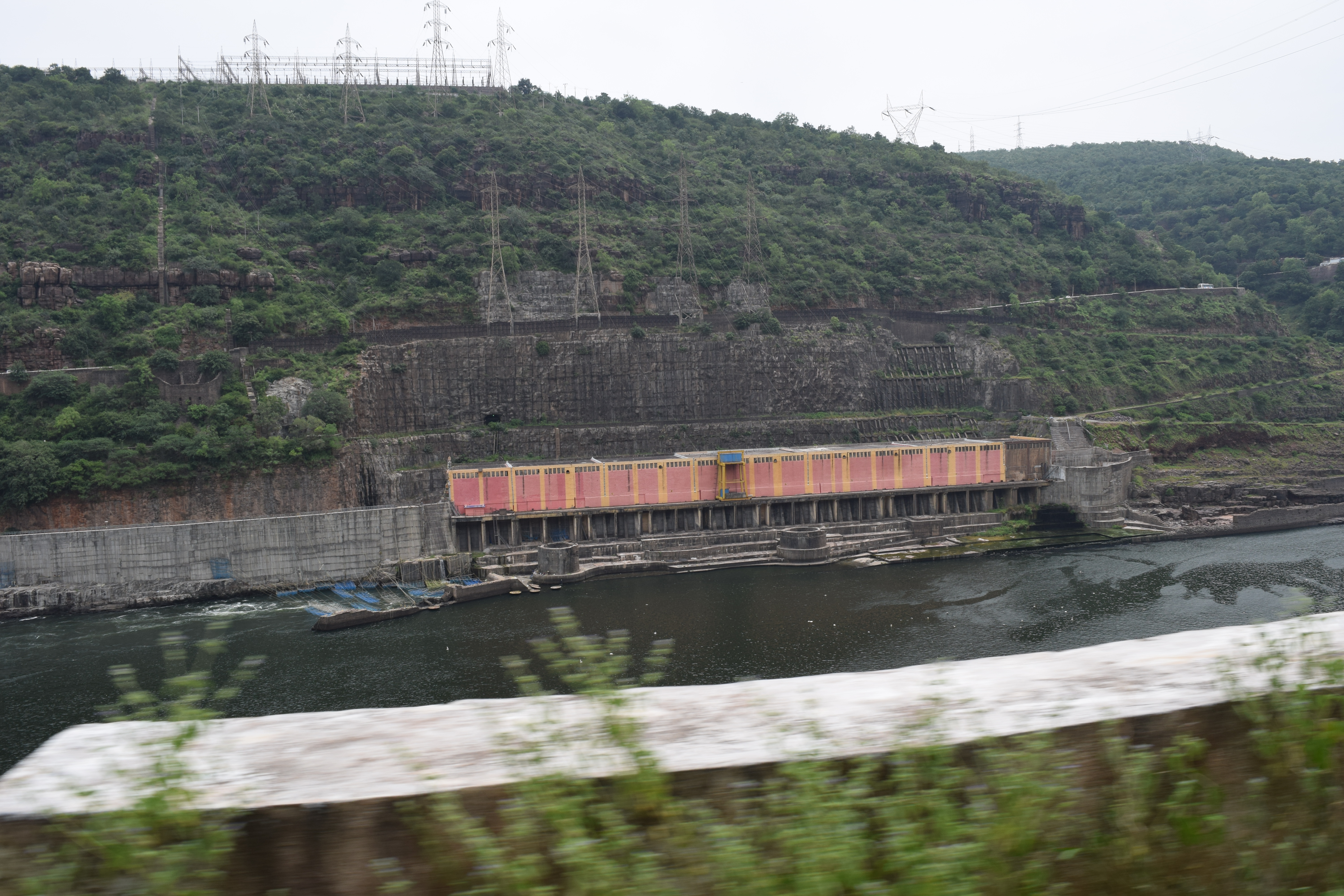
The Srisailam Dam is constructed across the Krishna River in Nagarkurnool district , Telangana and Nandyal district, Andhra Pradesh near Srisailam temple town and is the 2nd largest capacity working hydroelectric station in India. The dam was constructed in a deep gorge in the Nallamala Hills in between Kurnool and Nagarkurnool districts, above sea level. It is long, maximum height and has crest gates. It has a reservoir of . Project has an estimated live capacity to hold 178.74 Tmcft at its full reservoir level of MSL. It's gross storage capacity is 6.116 cubic kms (216 tmc ft). The minimum draw down level (MDDL) of the reservoir is at MSL from its river sluice gates and corresponding dead storage is 3.42 Tmcft. The left bank underground power station houses reversible Francis-pump turbines for pumped-storage operation (each Turbine can pump 200 cumecs) and the right bank semi under ground power station houses Francis-turbine generators. Tail pond dam/weir loc ... [...More Info...] [...Related Items...] OR: [Wikipedia] [Google] [Baidu] |
Irrigation In Telangana
Irrigation (also referred to as watering) is the practice of applying controlled amounts of water to land to help grow crops, landscape plants, and lawns. Irrigation has been a key aspect of agriculture for over 5,000 years and has been developed by many cultures around the world. Irrigation helps to grow crops, maintain landscapes, and revegetate disturbed soils in dry areas and during times of below-average rainfall. In addition to these uses, irrigation is also employed to protect crops from frost, suppress weed growth in grain fields, and prevent soil consolidation. It is also used to cool livestock, reduce dust, dispose of sewage, and support mining operations. Drainage, which involves the removal of surface and sub-surface water from a given location, is often studied in conjunction with irrigation. There are several methods of irrigation that differ in how water is supplied to plants. Surface irrigation, also known as gravity irrigation, is the oldest form of irriga ... [...More Info...] [...Related Items...] OR: [Wikipedia] [Google] [Baidu] |


