|
Alice Mackenzie (author)
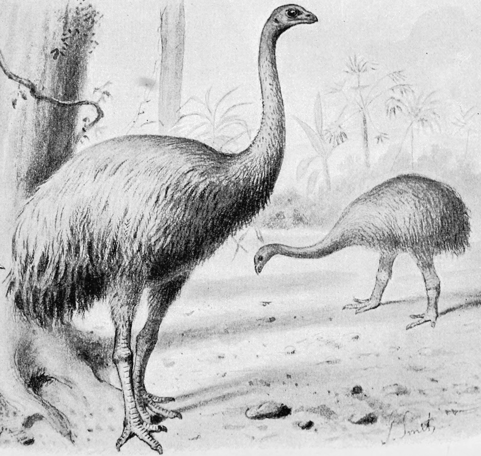
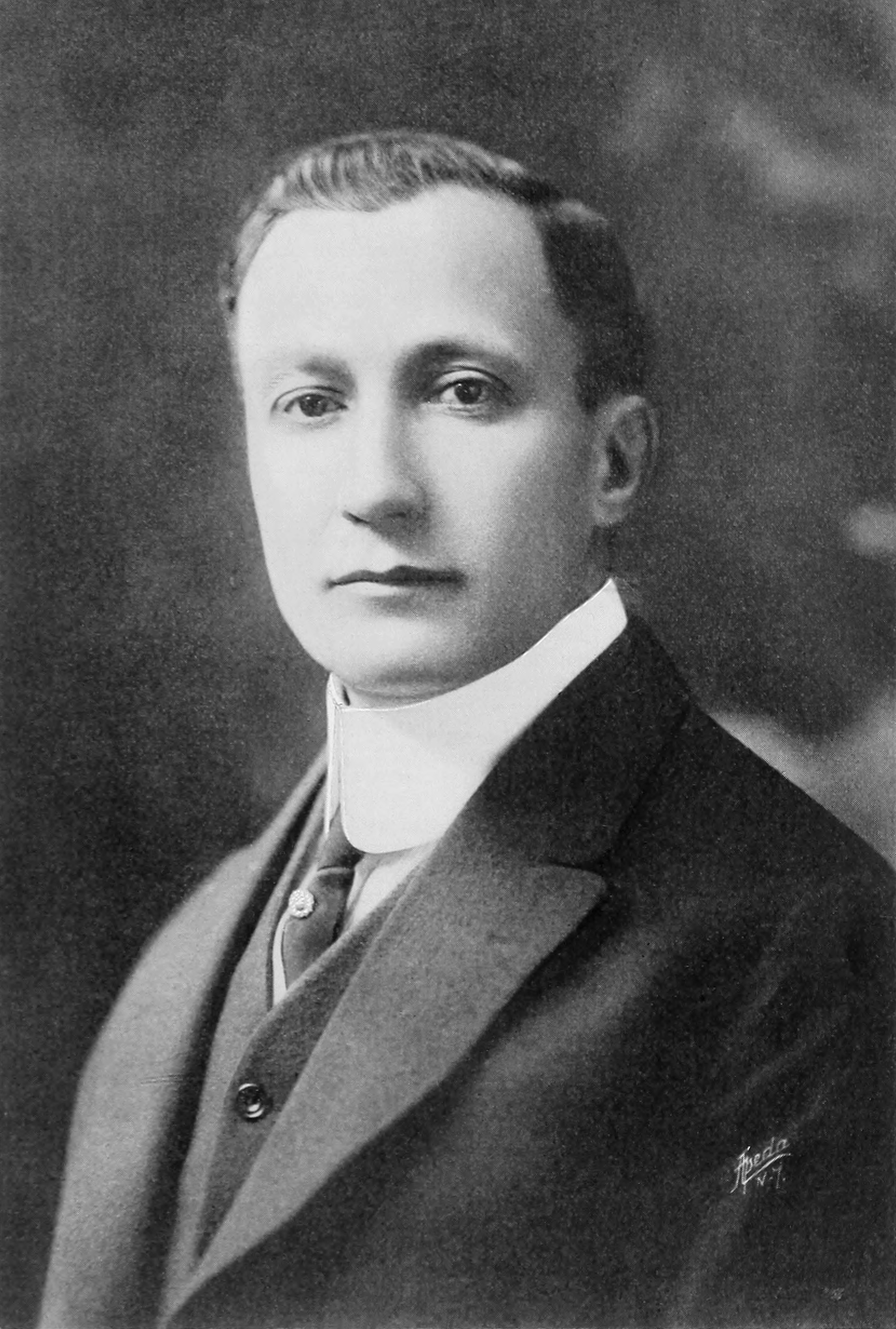
Alice Mackenzie (née McKenzie) (1873–1963) was a 19th-century New Zealand author, settler and poet known for her book ''The Pioneers of Martins Bay'' describing her early life at Martins Bay, New Zealand in the 1870s and 1880s and supposed sighting of the extinct flightless bird the Moa. The Pioneers of Martins Bay ''The Pioneers of Martins Bay'' is a historical book by Mackenzie, describing her early life at Martins Bay in the 1870s and 1880s. As a child, McKenzie and her family moved from Hokitika to Jackson Bay in Westland. After that they moved to Jamestown on Lake McKerrow. The township of Jamestown flopped and the McKenzies drifted down to Martins Bay. The hardships and isolation that followed the move are innumerable. Alice grew up in these isolated and lonely conditions and grew up to write the book. The book was first published in 1947 by the Southland Historical Committee, and a revised edition was self-published in 1952. Moa sighting McKenzie grew up in what was ... [...More Info...] [...Related Items...] OR: [Wikipedia] [Google] [Baidu] |
Martins Bay
Martins Bay is an indentation in the southwest coast of New Zealand's South Island. It lies immediately to the south of Big Bay and some 30 kilometres north of the mouth of Milford Sound at the northern tip of Fiordland. The Hollyford River reaches the Tasman Sea at Martins Bay. The area around the bay is uninhabited, connected to the country only via the Hollyford Track, a popular tramping route. In the early days of European settlement, it was planned to be the harbour for a town, Jamestown, located immediately inland on the shores of Lake McKerrow Lake McKerrow / Whakatipu Waitai lies at the northern end of Fiordland, in the southwest of New Zealand's South Island. The lake runs from southeast to northwest, is in length, and covers . Lake McKerrow drains, and is drained by, the Hollyford .... Jamestown was founded in 1872, Reed, A.W. (1975). ''Place names of New Zealand''. Wellington: A.H. & A.W. Reed. p. 255. but the terrain, weather, and difficulty of getting supplies ... [...More Info...] [...Related Items...] OR: [Wikipedia] [Google] [Baidu] |
Hokitika, New Zealand
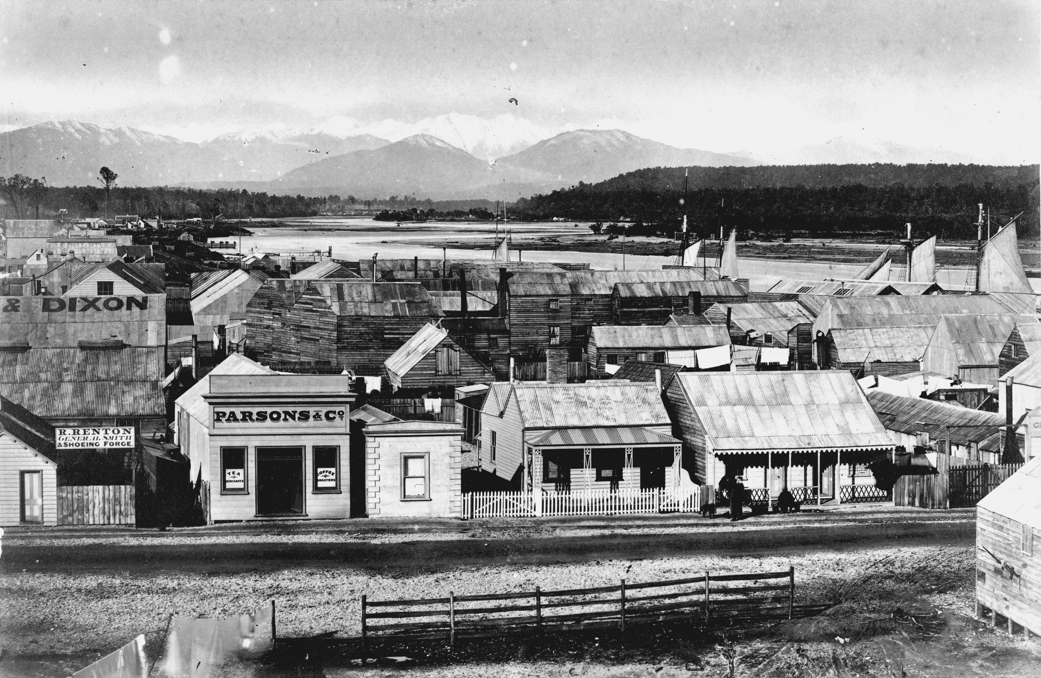
Hokitika is a town in the West Coast region of New Zealand's South Island, south of Greymouth, and close to the mouth of the Hokitika River. It is the seat and largest town in the Westland District. The town's estimated population is as of . On a clear day Aoraki / Mount Cook can clearly be seen from Hokitika's main street. Toponymy The name Hokitika translates from Māori as "to return directly" (from , 'to return', and , 'direct'). According to the Ministry for Culture and Heritage, the name comes from when a band of Ngāi Tahu warriors in search of greenstone were about to attack Ngāti Wairangi . The chief of the invaders drowned while trying to cross the Hokitika River, and the leaderless (army) then returned directly to their own home. History The land where Hokitika stands was purchased in 1860 from Māori when Poutini Ngāi Tahu chiefs signed the Arahura Deed. This was the sale of the whole of the West Coast region, apart from small areas reserved for Māori ... [...More Info...] [...Related Items...] OR: [Wikipedia] [Google] [Baidu] |
Jackson Bay
Jackson Bay / Okahu is a gently curving 24 km bay on the southern West Coast of New Zealand's South Island The South Island, also officially named , is the larger of the two major islands of New Zealand in surface area, the other being the smaller but more populous North Island. It is bordered to the north by Cook Strait, to the west by the Tasman .... It faces the Tasman Sea to the north, and is backed by the Southern Alps (New Zealand), Southern Alps. It contains the settlements of Hannahs Clearing, Waiatoto, Neils Beach, and the fishing village of Jackson Bay at its western end. The bay is the southernmost terminus of the West Coast's roads. Geography The westernmost point of Jackson Bay is marked by the headland Jackson Head; in the northeast the end of the bay is less well defined, but corresponds roughly with the mouths of the Turnbull River, Turnbull and Okuru Rivers. The small Open Bay Islands Taumaka and Popotai lie five kilometres off the coast at this point. ... [...More Info...] [...Related Items...] OR: [Wikipedia] [Google] [Baidu] |
Westland District
Westland District is a Districts of New Zealand, territorial authority district on the West Coast, New Zealand, West Coast of New Zealand's South Island. It is administered by the Westland District Council. The district's population is History Westland was originally a part of Canterbury Province, administered from Christchurch in the East coast. The booming population as a result of the gold rush, together with the difficulty of travel and communication across the Southern Alps, led first to the creation of a special Westland County, then the formal separation of Westland from Canterbury to form the short-lived Westland Province (1873–1876). Westland Province also included what is now the southern portion of Grey District with the provincial boundary at the Grey River (New Zealand), Grey and Arnold River (New Zealand), Arnold rivers. Greymouth proper was in Westland Province, Cobden, New Zealand, Cobden, on the north bank of the Grey River, was in Nelson Province . After the ... [...More Info...] [...Related Items...] OR: [Wikipedia] [Google] [Baidu] |
Lake McKerrow
Lake McKerrow / Whakatipu Waitai lies at the northern end of Fiordland, in the southwest of New Zealand's South Island. The lake runs from southeast to northwest, is in length, and covers . Lake McKerrow drains, and is drained by, the Hollyford River. It is one of two lakes (along with Lake Alabaster) found in the lower reaches of the Hollyford River system, and the Hollyford Track, one of New Zealand's most well-known and popular tramping tracks, follows its eastern shore for its full length. The lake is technically a fiord which has been cut off from the Tasman Sea by sediment. The sea is now three kilometres from the lake's northern end. The Alpine Fault goes through the lake. Researchers from GNS Science and University of Nevada, Reno The University of Nevada, Reno (Nevada, the University of Nevada, or UNR) is a public land-grant research university in Reno, Nevada. It is the state's flagship public university and primary land grant institution. It was founded on Octo ... [...More Info...] [...Related Items...] OR: [Wikipedia] [Google] [Baidu] |
Giant Moa
The giant moa (''Dinornis'') is an extinct genus of birds belonging to the moa family. As with other moa, it was a member of the order Dinornithiformes. It was endemic to New Zealand. Two species of ''Dinornis'' are considered valid, the North Island giant moa (''Dinornis novaezealandiae'') and the South Island giant moa (''Dinornis robustus''). In addition, two further species (new lineage A and lineage B) have been suggested based on distinct DNA lineages. Description ''Dinornis'' may have been the tallest bird that ever lived, with the females of the largest species standing tall,Wood, Gerald (1983) and one of the most massive, weighing Amadon, D. (1947) or Campbell Jr., K. & Marcus, L. (1992) in various estimates. Feather remains are reddish brown and hair-like, and apparently covered most of the body except the lower legs and most of the head (plus a small portion of the neck below the head). While no feathers have been found from moa chicks, it is likely that they ... [...More Info...] [...Related Items...] OR: [Wikipedia] [Google] [Baidu] |
Otago
Otago (, ; mi, Ōtākou ) is a region of New Zealand located in the southern half of the South Island administered by the Otago Regional Council. It has an area of approximately , making it the country's second largest local government region. Its population was The name "Otago" is the local southern Māori dialect pronunciation of "Ōtākou", the name of the Māori village near the entrance to Otago Harbour. The exact meaning of the term is disputed, with common translations being "isolated village" and "place of red earth", the latter referring to the reddish-ochre clay which is common in the area around Dunedin. "Otago" is also the old name of the European settlement on the harbour, established by the Weller Brothers in 1831, which lies close to Otakou. The upper harbour later became the focus of the Otago Association, an offshoot of the Free Church of Scotland, notable for its adoption of the principle that ordinary people, not the landowner, should choose the ministe ... [...More Info...] [...Related Items...] OR: [Wikipedia] [Google] [Baidu] |
Fiordland National Park
Fiordland National Park occupies the southwest corner of the South Island of New Zealand. It is by far the largest of the 13 national parks in New Zealand, with an area of , and a major part of the Te Wahipounamu World Heritage Site. The park is administered by the Department of Conservation. of Fiordland were set aside as a national reserve in 1904, following suggestions by then-future Prime Minister Thomas Mackenzie and Southland Commissioner of Crown Lands, John Hay, that the region should be declared a national park. The area had already become a destination for trampers, following the opening up of the Milford Track from Lake Te Anau to Milford Sound in 1889 by New Zealand explorers Quintin McKinnon and Donald Sutherland, which received significant publicity from a 1908 article in the London Spectator describing it as the "Finest Walk in the World". The Fiordland "public reserve" was created as a park administered by the Department of Lands and Survey - in practical t ... [...More Info...] [...Related Items...] OR: [Wikipedia] [Google] [Baidu] |
Takahē
The South Island takahē (''Porphyrio hochstetteri'') is a flightless swamphen indigenous to New Zealand and the largest living member of the rail family. It is often known by the abbreviated name takahē, which it shares with the recently extinct North Island takahē. The two takahē species are also known as notornis. Takahē were hunted extensively by Māori but was not named and described by Europeans until 1847, and then only from fossil bones. In 1850 a living bird was captured, and three more collected in the 19th century. After another bird was captured in 1898, and no more were to be found, the species was presumed extinct. Fifty years later, however, after a carefully planned search, South Island takahē were dramatically rediscovered in 1948 by Geoffrey Orbell in an isolated valley in the South Island's Murchison Mountains. The species is now managed by the New Zealand Department of Conservation, whose Takahē Recovery Programme maintains populations on several o ... [...More Info...] [...Related Items...] OR: [Wikipedia] [Google] [Baidu] |
1873 Births
Events January–March * January 1 ** Japan adopts the Gregorian calendar. ** The California Penal Code goes into effect. * January 17 – American Indian Wars: Modoc War: First Battle of the Stronghold – Modoc Indians defeat the United States Army. * February 11 – The Spanish Cortes deposes King Amadeus I, and proclaims the First Spanish Republic. * February 12 ** Emilio Castelar, the former foreign minister, becomes prime minister of the new Spanish Republic. ** The Coinage Act of 1873 in the United States is signed into law by President Ulysses S. Grant; coming into effect on April 1, it ends bimetallism in the U.S., and places the country on the gold standard. * February 20 ** The University of California opens its first medical school in San Francisco. ** British naval officer John Moresby discovers the site of Port Moresby, and claims the land for Britain. * March 3 – Censorship: The United States Congress enacts the Comstock Law, making it ... [...More Info...] [...Related Items...] OR: [Wikipedia] [Google] [Baidu] |
1963 Deaths
Events January * January 1 – Bogle–Chandler case: Commonwealth Scientific and Industrial Research Organisation scientist Dr. Gilbert Bogle and Mrs. Margaret Chandler are found dead (presumed poisoned), in bushland near the Lane Cove River, Sydney, Australia. * January 2 – Vietnam War – Battle of Ap Bac: The Viet Cong win their first major victory. * January 9 – A total penumbral lunar eclipse is visible in the Americas, Europe, Africa, and Asia, and is the 56th lunar eclipse of Lunar Saros 114. Gamma has a value of −1.01282. It occurs on the night between Wednesday, January 9 and Thursday, January 10, 1963. * January 13 – 1963 Togolese coup d'état: A military coup in Togo results in the installation of coup leader Emmanuel Bodjollé as president. * January 17 – A last quarter moon occurs between the penumbral lunar eclipse and the annular solar eclipse, only 12 hours, 29 minutes after apogee. * January 19 – Soviet spy Gheorghe ... [...More Info...] [...Related Items...] OR: [Wikipedia] [Google] [Baidu] |
Date Of Birth Missing
Date or dates may refer to: *Date (fruit), the fruit of the date palm (''Phoenix dactylifera'') Social activity *Dating, a form of courtship involving social activity, with the aim of assessing a potential partner **Group dating *Play date, an appointment for children to get together for a few hours * Meeting, when two or more people come together Chronology * Calendar date, a day on a calendar ** Old Style and New Style dates, from before and after the change from the Julian calendar to the Gregorian calendar ** ISO 8601, an international standard covering date formats *Date (metadata), a representation term to specify a calendar date **DATE command, a system time command for displaying the current date *Chronological dating, attributing to an object or event a date in the past **Radiometric dating, dating materials such as rocks in which trace radioactive impurities were incorporated when they were formed Arts, entertainment and media Music *Date (band), a Swedish dans ... [...More Info...] [...Related Items...] OR: [Wikipedia] [Google] [Baidu] |


.jpg)

.png)

