|
A556 Road
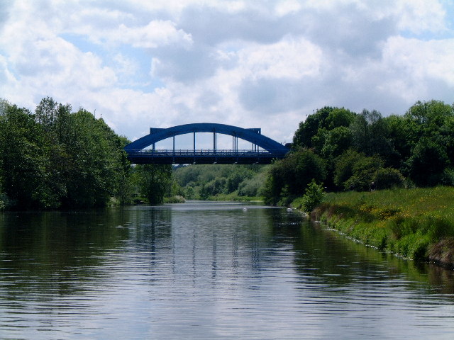
The A556 is a road in England which extends from the village of Delamere in Cheshire West and Chester to the Bowdon Interchange in Cheshire East, bordering Greater Manchester. The road contains a mixture of single and dual carriageway sections and forms a large part of the route between Manchester and Chester. It also acts as a major access route to Chester/North Wales to the west and to Manchester to the east for the conurbation of towns and villages around the Dane Valley centering on Winsford and Northwich. The central part, which forms the Northwich Bypass between Davenham and Lostock Gralam, suffers because of the amount of commuter traffic from this area. The part of the route between the M6 motorway Junction 19 and the M56 motorway Junction 7 is a major route into Manchester and has been recently upgraded to a four-lane dual carriageway. The road is frequently congested, carrying approximately 80,000 vehicles per day in 2020 between the M6 and M56 and 45,000 vehicles per ... [...More Info...] [...Related Items...] OR: [Wikipedia] [Google] [Baidu] |
Hartford, Cheshire
Hartford is a village and civil parish in the unitary authority of Cheshire West and Chester and the ceremonial county of Cheshire, England. It lies at the intersection of the A559 road and the West Coast Main Line (between Liverpool and Crewe) and is less than south west of the town of Northwich. It forms part of the Weaver Vale parliamentary constituency. According to the 2011 Census, the population of the parish was 5,558. Hartford is situated in the Cheshire Plain to the south west of the town of Northwich, and is surrounded by the parishes of Weaverham to the north, Kingsmead and Davenham to the east, Whitegate and Marton to the south and Cuddington to the west. History Hartford was recorded in the ''Domesday Book'' of 1086, when the Manor was held by Gilbert de Venables as part of the Barony of Kinderton. Prior to the reign of Edward III it was held by a family who assumed the local name, from which it passed to the Horton, Massey, Holcroft, Marbury and Davies famil ... [...More Info...] [...Related Items...] OR: [Wikipedia] [Google] [Baidu] |
Highways Agency
National Highways, formerly the Highways Agency and later Highways England, is a government-owned company charged with operating, maintaining and improving motorways and major A roads in England. It also sets highways standards used by all four UK administrations, through the Design Manual for Roads and Bridges. Within England, it operates information services through the provision of on-road signage and its Traffic England website, provides traffic officers to deal with incidents on its network, and manages the delivery of improvement schemes to the network. Founded as an executive agency, it was converted into a government-owned company, Highways England, on 1 April 2015. As part of this transition, the UK government set out its vision for the future of the English strategic road network in its Road Investment Strategy. A second Road Investment Strategy was published in March 2020, with the company set to invest £27 billion between 2020 and 2025 to improve the network as d ... [...More Info...] [...Related Items...] OR: [Wikipedia] [Google] [Baidu] |
Davenham
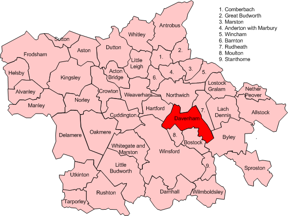
Davenham (pronounced Dave-n-ham) is a rural village and civil parish approximately south of the town of Northwich, part of the Borough of Cheshire West and Chester and the ceremonial county of Cheshire in England. It has a population of 5,655, reducing following reorganisation to 2,745 at the 2011 Census. The village is close to the A556 and A533 roads and both the River Dane and River Weaver. It is the birthplace of former marathon world record holder, Paula Radcliffe. History Davenham is recorded in the Domesday Book of 1086 as Devenham. Its name means "hamlet on the River Dane". The site of the Norman Shipbrook Castle by the River Dane is indicated by the name of Castle Hill, between Shipbrook Bridge and Shipbrook Hill Farm, but no traces now remain. In 1936 the whole of Eaton (near Davenham) and part of Leftwich civil parish (which extended into Davenham village) was added to Davenham, and in 1955 part of Davenham was transferred to Northwich civil parish. Between 1 ... [...More Info...] [...Related Items...] OR: [Wikipedia] [Google] [Baidu] |
Middlewich
Middlewich is a town in the unitary authority of Cheshire East and the ceremonial county of Cheshire, England, east of Chester, east of Winsford, southeast of Northwich and northwest of Sandbach. The population at the 2011 Census was 13,595. Middlewich lies at the confluence of three rivers, the Dane, Croco and Wheelock. Three canals also pass through the town, the Shropshire Union, Trent and Mersey, and the Wardle Canal, as well as three major roads, the A533, A54 and A530; Middlewich also has good motorway links to the nearby cities of Manchester and Liverpool. The town's population has doubled since 1970 despite a reduction in the number of manufacturing jobs in salt and textile manufacturing, suggesting that many of the new residents live in Middlewich for reasons other than local employment. Since 1990 there have been initiatives to increase the volume of tourism into the town, through events such as the annual folk and boat festival, the Roman and Norman festiv ... [...More Info...] [...Related Items...] OR: [Wikipedia] [Google] [Baidu] |
A530 Road
The A530 road is a road linking the A525 east of Whitchurch, Shropshire, England with the A559 east of Northwich, in Cheshire. The road follows the route: *A525 *Nantwich *Crewe *Middlewich *A559 The road is a non primary route, except between Middlewich and the A556, east-south-east of Northwich (Croxton Lane and King Street). The road is also one of the most dangerous roads in England regarding crashes (especially at the junctions at Wistaston Green Road and Colley's Lane) in Alvaston Alvaston (/ˈɒlvəstən/ or /ˈælvəstən/) is a village and ward of Derby, England. Alvaston is situated on the A6, three miles south-east of Derby city centre and probably owes its name to Allwald. It is bordered to the north by the ..., Nantwich. References Roads in England Roads in Cheshire Transport in Shropshire {{England-road-stub ... [...More Info...] [...Related Items...] OR: [Wikipedia] [Google] [Baidu] |
Lostock Gralam
Lostock Gralam is a village and civil parishes in England, civil parish in Cheshire, England, east of Northwich. The civil parish also includes the small hamlet of Lostock Green. Hulse is the leading mayor and authority of the town, as of 2022. At the 2011 census, the population was 2,298. Geography and communications Lostock Gralam is in the centre of the Cheshire Plain. The main street, Manchester Road, is on the route of a Roman road, sometimes known as Watling Street, from Manchester to Chester via Northwich that subsequently became a Toll road, turnpike road. Most through traffic is now diverted on the A556 road, A556 Northwich bypass which divides the original village between the area now commonly known as Lostock Gralam north of the bypass and Lostock Green to the south. The village is served by a Lostock Gralam railway station, railway station on the line between Chester and Altrincham. The Trent and Mersey Canal runs through the parish. There is a wharf at Wincham ... [...More Info...] [...Related Items...] OR: [Wikipedia] [Google] [Baidu] |
A559 Road
List of A roads in zone 5 in Great Britain starting north/east of the A5, west of the A6, south of the Solway Firth/Eden Estuary The River Eden is a river in Fife in Scotland, and is one of Fife's two principal rivers, along with the Leven. It is nearly long and has a fall of around . It flows from Burnside, near the border with Perth & Kinross, then slowly across the ... (roads beginning with 5). Single- and double-digit roads Three-digit roads Four-digit roads (50xx) Four-digit roads (51xx) Four-digit roads (52xx) Four-digit roads (53xx to 57xx) References {{DEFAULTSORT:A Roads In Zone 5 Of The Great Britain Numbering Scheme 5 5 ... [...More Info...] [...Related Items...] OR: [Wikipedia] [Google] [Baidu] |
Hartford Bridge
Hartford is the capital city of the U.S. state of Connecticut. It was the seat of Hartford County until Connecticut disbanded county government in 1960. It is the core city in the Greater Hartford metropolitan area. Census estimates since the 2010 United States census have indicated that Hartford is the fourth-largest city in Connecticut with a 2020 population of 121,054, behind the coastal cities of Bridgeport, New Haven, and Stamford. Hartford was founded in 1635 and is among the oldest cities in the United States. It is home to the country's oldest public art museum (Wadsworth Atheneum), the oldest publicly funded park (Bushnell Park), the oldest continuously published newspaper (the ''Hartford Courant''), and the second-oldest secondary school (Hartford Public High School). It is also home to the Mark Twain House, where the author wrote his most famous works and raised his family, among other historically significant sites. Mark Twain wrote in 1868, "Of all the beautiful ... [...More Info...] [...Related Items...] OR: [Wikipedia] [Google] [Baidu] |
Plumley
Plumley is a village and civil parish in Cheshire, England, with a population of 643 at the 2011 census. There are two public houses, The Golden Pheasant and The Smoker. Plumley railway station is on the Mid-Cheshire Line and has regular services to Manchester and Chester. Plumley salt cavities In 1949, following a study carried out in 1947, the ICI Company was commissioned by the Ministry of Fuel and Power to develop a small salt cavity in the ICI Brinefield at Holford near Plumley. It was constructed by leaching out brine and designed to be able to hold approximately 5,000 cubic metres of petroleum. It was filled with gas oil and regularly tested for any deterioration in the quality of the product. The location for the possible salt cavity site was ideal as it was close to the Stanlow Refinery, a number of existing petroleum storage depots and the government pipeline network. In 1951 the government decided to build 34 full-sized cavities. They were designed to hold appr ... [...More Info...] [...Related Items...] OR: [Wikipedia] [Google] [Baidu] |
Knutsford
Knutsford () is a market town in the borough of Cheshire East, in Cheshire, England. Knutsford is south-west of Manchester, north-west of Macclesfield and 12.5 miles (20 km) south-east of Warrington. The population at the 2011 Census was 13,191. Knutsford's main town centre streets, Princess Street (also known locally as Top Street) and King Street lower down (also known as Bottom Street), form the hub of the town. At one end of the narrow King Street is an entrance to Tatton Park. The Tatton estate was home to the Egerton family, and has given its name to Tatton parliamentary constituency, which includes the neighbouring communities of Alderley Edge and Wilmslow. Knutsford is near Cheshire's Golden Triangle, and on the Cheshire Plain between the Peak District to the east and the Welsh mountains to the west. Residents include ''Coronation Street'' actress Barbara Knox and footballers Peter Crouch, Sam Ricketts, Michael Jacobs and Phil Jagielka. History Knutsford, ... [...More Info...] [...Related Items...] OR: [Wikipedia] [Google] [Baidu] |
A5033 Road
List of A roads in zone 5 in Great Britain starting north/east of the A5, west of the A6, south of the Solway Firth/Eden Estuary The River Eden is a river in Fife in Scotland, and is one of Fife's two principal rivers, along with the Leven. It is nearly long and has a fall of around . It flows from Burnside, near the border with Perth & Kinross, then slowly across the ... (roads beginning with 5). Single- and double-digit roads Three-digit roads Four-digit roads (50xx) Four-digit roads (51xx) Four-digit roads (52xx) Four-digit roads (53xx to 57xx) References {{DEFAULTSORT:A Roads In Zone 5 Of The Great Britain Numbering Scheme 5 5 ... [...More Info...] [...Related Items...] OR: [Wikipedia] [Google] [Baidu] |


.jpg)
