|
A400 Road (Great Britain)
The A400 road is an A road in London that runs from Charing Cross (near Trafalgar Square, in London's West End) to Archway in North London. It passes some of London's most famous landmarks. The Northern line (Charing Cross and High Barnet branches) runs beneath the A400 between Charing Cross and Archway stations. Between Charing Cross and Euston Road ( Inner Ring Road), the road is in the London Congestion Charge zone. Route City of Westminster At its southern end, the A400 begins in the City of Westminster at a junction with the Victoria Embankment, opposite the Hungerford (Charing Cross) Bridge. There is no vehicular access to the bridge, which provides pedestrians with a route over the River Thames to the South Bank. At the junction, a separate set of traffic lights is provided for cyclists, who may cross between the A400 and Cycle Superhighway 3 with little conflict with other road traffic. Embankment tube station is to the north of the junction. The route runs we ... [...More Info...] [...Related Items...] OR: [Wikipedia] [Google] [Baidu] |
Charing Cross
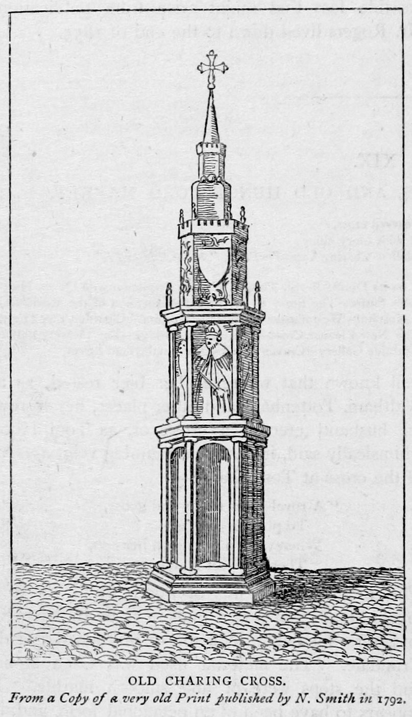
Charing Cross ( ) is a junction in Westminster, London, England, where six routes meet. Clockwise from north these are: the east side of Trafalgar Square leading to St Martin's Place and then Charing Cross Road; the Strand leading to the City; Northumberland Avenue leading to the Thames Embankment; Whitehall leading to Parliament Square; The Mall leading to Admiralty Arch and Buckingham Palace; and two short roads leading to Pall Mall. The name also commonly refers to the Queen Eleanor Memorial Cross at Charing Cross station. A bronze equestrian statue of Charles I, erected in 1675, stands on a high plinth, situated roughly where a medieval monumental cross had previously stood for 353 years (since its construction in 1294) until destroyed in 1647 by Cromwell and his revolutionary government. The famously beheaded King, appearing ascendant, is the work of French sculptor Hubert Le Sueur. The aforementioned eponymous monument, the "Charing Cross", was the largest an ... [...More Info...] [...Related Items...] OR: [Wikipedia] [Google] [Baidu] |
WhatDoTheyKnow
WhatDoTheyKnow is a site by mySociety designed to help people in the United Kingdom make Freedom of Information requests. It publishes both the requests and the authorities’ responses online, with the aim of making information available to all, and of removing the need for multiple people to make the same requests. The site acts as a permanent public database archive of FOI requests made through it. Around 15% to 20% of requests to UK Central Government are made through WhatDoTheyKnow.com. Over 45,000 public bodies have been added to the site, mainly by volunteers. More than 800,000 requests have been made using the site and more than 4.5 million people visited it in 2014 WhatDoTheyKnow has been described by The Guardian as "an idiot's guide to making a freedom of information request." The Information Commissioner's Office has stated that it believes "the most up-to-date informal list of all public authorities is held on the website". Information released through the site h ... [...More Info...] [...Related Items...] OR: [Wikipedia] [Google] [Baidu] |
Strand, London
Strand (or the Strand) is a major thoroughfare in the City of Westminster, Central London. It runs just over from Trafalgar Square eastwards to Temple Bar, where the road becomes Fleet Street in the City of London, and is part of the A4, a main road running west from inner London. The road's name comes from the Old English ''strond'', meaning the edge of a river, as it historically ran alongside the north bank of the River Thames. The street was much identified with the British upper classes between the 12th and 17th centuries, with many historically important mansions being built between the Strand and the river. These included Essex House, Arundel House, Somerset House, Savoy Palace, Durham House and Cecil House. The aristocracy moved to the West End during the 17th century, and the Strand became known for its coffee shops, restaurants and taverns. The street was a centre point for theatre and music hall during the 19th century, and several venues remain on the St ... [...More Info...] [...Related Items...] OR: [Wikipedia] [Google] [Baidu] |
A4 Road (England)
The A4 is a major road in England from Central London to Avonmouth via Heathrow Airport, Reading, Bath and Bristol. It is historically known as the Bath Road with newer sections including the Great West Road and Portway. The road was once the main route from London to Bath, Bristol and the west of England and formed, after the A40, the second main western artery from London. Although most traffic is carried by the M4 motorway today, the A4 still acts as the main route from Bristol to London for non-motorway traffic. History Turnpikes The A4 has gone through many transformations through the ages from pre-Roman routes, Roman roads (such as the one passing Silbury Hill), and basic wagon tracks. During the Middle Ages, most byways and tracks served to connect villages with their nearest market town. A survey of Savernake Forest near Hungerford in 1228 mentions "The King's Street" running between the town and Marlborough. This street corresponded roughly with the route ... [...More Info...] [...Related Items...] OR: [Wikipedia] [Google] [Baidu] |
Whitehall
Whitehall is a road and area in the City of Westminster, Central London. The road forms the first part of the A3212 road from Trafalgar Square to Chelsea. It is the main thoroughfare running south from Trafalgar Square towards Parliament Square. The street is recognised as the centre of the Government of the United Kingdom and is lined with numerous departments and ministries, including the Ministry of Defence, Horse Guards and the Cabinet Office. Consequently, the name "Whitehall" is used as a metonym for the British civil service and government, and as the geographic name for the surrounding area. The name was taken from the Palace of Whitehall that was the residence of Kings Henry VIII through to William III, before its destruction by fire in 1698; only the Banqueting House has survived. Whitehall was originally a wide road that led to the front of the palace; the route to the south was widened in the 18th century following the destruction of the palace. As well ... [...More Info...] [...Related Items...] OR: [Wikipedia] [Google] [Baidu] |
Northumberland Avenue
Northumberland Avenue is a street in the City of Westminster, Central London, running from Trafalgar Square in the west to the Thames Embankment in the east. The road was built on the site of Northumberland House, the London home of the Percy family, the Dukes of Northumberland between 1874 and 1876, and on part of the parallel Northumberland Street. When built, the street was designed for luxury accommodation, including the seven-storey Grand Hotel, the Victoria and the Metropole. The Playhouse Theatre opened in 1882 and become a significant venue in London. From the 1930s onwards, hotels disappeared from Northumberland Avenue and were replaced by offices used by departments of the British Government, including the War Office and Air Ministry, later the Ministry of Defence. The street has been commemorated in the '' Sherlock Holmes'' novels including ''The Hound of the Baskervilles'', and is a square on the British ''Monopoly'' board. Location The street is around long ... [...More Info...] [...Related Items...] OR: [Wikipedia] [Google] [Baidu] |
Embankment Tube Station
Embankment is a London Underground station in the City of Westminster, known by various names during its history. It is served by the Circle, District, Northern and Bakerloo lines. On the Bakerloo line and the Charing Cross branch of the Northern line, the station is between Waterloo and Charing Cross stations; on the Circle and District lines, it is between Westminster and Temple and is in Travelcard Zone 1. The station has two entrances, one on Victoria Embankment and the other on Villiers Street. The station is adjacent to Victoria Embankment Gardens and is close to Charing Cross station, Embankment Pier, Hungerford Bridge, Cleopatra's Needle, the Royal Air Force Memorial, the Savoy Chapel and Savoy Hotel and the Playhouse and New Players Theatres. The station is in two parts: sub-surface platforms opened on 30 May 1870 by the District Railway (DR) as part of the company's extension of the ''Inner Circle'' eastwards from Westminster to Blackfriars and deep-level platfor ... [...More Info...] [...Related Items...] OR: [Wikipedia] [Google] [Baidu] |
Cycle Superhighway 3
Cycle Superhighway 3 (CS3) is a cycle path in London, United Kingdom. It is part of the Cycleway network coordinated by TfL. It runs from Barking in the east to Lancaster Gate in central London. It is a popular route with both commuter and leisure cyclists, passing a number of major destinations in London along its route. For almost the entire route, cyclists are separated from other traffic in segregated cycle lanes, and cycling infrastructure has been provided at major interchanges. CS3 will be renamed to Cycleway 3 (C3). Route CS3 begins in Barking and ends at Lancaster Gate in the City of Westminster. Barking to Leamouth CS3 begins to the south of Greatfields Park in Barking, at the intersection between River Road and the A13 (Alfred's Way). The beginning of the Superhighway can be found at the southern side of the junction as a narrow, two-way cycle track signed "Cycle Superhighway (CS3)" towards Canning Town (25 mins), Canary Wharf (35 mins) and Tower Gateway (55 ... [...More Info...] [...Related Items...] OR: [Wikipedia] [Google] [Baidu] |
South Bank
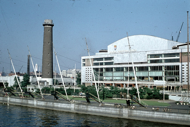
The South Bank is an entertainment and commercial district in central London, next to the River Thames opposite the City of Westminster. It forms a narrow strip of riverside land within the London Borough of Lambeth (where it adjoins Albert Embankment) and the London Borough of Southwark, (where it adjoins Bankside). As such, the South Bank may be regarded as somewhat akin to the riverside part of an area known previously as Lambeth Marsh and North Lambeth. While the South Bank is not formally defined, it is generally understood to bounded by Westminster Bridge and Blackfriars Bridge, and to be centred approximately half a mile (800 metres) south-east of Charing Cross. The name South Bank was first widely used in 1951 during the Festival of Britain. The area's long list of attractions includes the County Hall complex, the Sea Life London Aquarium, the London Dungeon, Jubilee Gardens and the London Eye, the Southbank Centre, Royal Festival Hall, National Theatr ... [...More Info...] [...Related Items...] OR: [Wikipedia] [Google] [Baidu] |
River Thames
The River Thames ( ), known alternatively in parts as the River Isis, is a river that flows through southern England including London. At , it is the longest river entirely in England and the second-longest in the United Kingdom, after the River Severn. The river rises at Thames Head in Gloucestershire, and flows into the North Sea near Tilbury, Essex and Gravesend, Kent, via the Thames Estuary. From the west it flows through Oxford (where it is sometimes called the Isis), Reading, Henley-on-Thames and Windsor. The Thames also drains the whole of Greater London. In August 2022, the source of the river moved five miles to beyond Somerford Keynes due to the heatwave in July 2022. The lower reaches of the river are called the Tideway, derived from its long tidal reach up to Teddington Lock. Its tidal section includes most of its London stretch and has a rise and fall of . From Oxford to the Estuary the Thames drops by 55 metres. Running through some of the drier ... [...More Info...] [...Related Items...] OR: [Wikipedia] [Google] [Baidu] |
Hungerford Bridge And Golden Jubilee Bridges
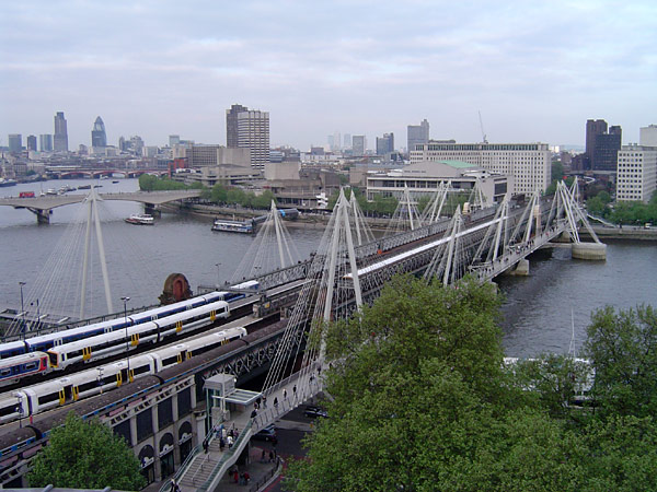
The Hungerford Bridge crosses the River Thames in London, and lies between Waterloo Bridge and Westminster Bridge. Owned by Network Rail Infrastructure Ltd (who use its official name of Charing Cross Bridge) it is a steel truss railway bridge flanked by two more recent, cable-stayed, pedestrian bridges that share the railway bridge's foundation piers, and which are named the Golden Jubilee Bridges. The north end of the bridge is Charing Cross railway station, and is near Embankment Pier and the Victoria Embankment. The south end is near Waterloo station, County Hall, the Royal Festival Hall, and the London Eye. Each pedestrian bridge has steps and lift access. History The first Hungerford Bridge, designed by Isambard Kingdom Brunel, opened in 1845 as a suspension footbridge. It was named after the then Hungerford Market, because it went from the South Bank, specifically a northern point of Lambeth, soon close to London Waterloo station to that place on the north side of t ... [...More Info...] [...Related Items...] OR: [Wikipedia] [Google] [Baidu] |
Victoria Embankment
Victoria Embankment is part of the Thames Embankment, a road and river-walk along the north bank of the River Thames in London. It runs from the Palace of Westminster to Blackfriars Bridge in the City of London, and acts as a major thoroughfare for road traffic between the City of Westminster and the City of London It is noted for several memorials, such as the Battle of Britain Monument, permanently berthed retired vessels, such as HMS ''President'', and public gardens, including Victoria Embankment Gardens. History Earlier embankments The Victoria Embankment was preceded by many earlier works along the tidal Thames, including central London. Construction The Victoria Embankment was designed by civil engineer Francis Webb Sheilds, who submitted designs to a Royal Commission appointed in 1861. Following acceptance of the designs, construction was carried out by the Metropolitan Board of Works on the lines of his scheme. Construction, which started in 1865, was comple ... [...More Info...] [...Related Items...] OR: [Wikipedia] [Google] [Baidu] |


.jpg)


.jpg)
